Parking
Start at Elephant Hill Trailhead. Access is by Elephant Hill Road, a technical road requiring a high-clearance, low-range 4WD vehicle and a permit for every vehicle.

#7 of 63 trails in Canyonlands
Canyonlands National Park, UT
A rocky climb to the pass above Chesler Park's grass and spires.
Overview
Map & elevation
Plan your hike

The highest, rockiest slopes around here are a summer buffet for grizzly bears.
Canyonlands Tour Guide
Parkwolf is a GPS audio tour guide for Canyonlands National Park. As you drive, it chimes in with what’s ahead: hidden gems, upcoming stops, history, geology, and wildlife, right through your car’s speakers.
See the Canyonlands audio tourRecorded for this trailhead
Elephant Hill and Druid Arch“You're nearing Elephant Hill Trailhead, where the hike to Druid Arch begins.”
Plays as you drive up to this trailhead in the Parkwolf Canyonlands Tour Guide.
More stories near here in the app
“Fantastic app with many points of information… It’s great to just turn on while you’re driving and it gives you an audio tour of the national Park. We love it!!!!”


Trail guide
Chesler Park Viewpoint Trail is a strenuous 5.8-mile out-and-back from Elephant Hill to a pass overlooking a basin of desert grasses and shrubs. Give it three to four hours. If the full 10.7-mile loop is more than you want, this is a better-sized day: you still get a close look at the Needles and a view across Chesler Park, but there is a hard climb and rough trail before you earn it. This is not a quick stroll to an overlook.
From Elephant Hill, the path climbs steep stone steps and ledges, then follows a sandstone bench below banded fins and rounded knobs. An early viewpoint opens south across the Needles, but the trail keeps going. After a scrubby rise and a campground junction, it squeezes between sandstone blocks into a water-carved slot, then drops over ledges and sandy slopes to Elephant Canyon wash. The Druid Arch route branches at the wash; stay on the Chesler route as it climbs a narrow canyon and reaches a scrubby bench with views toward Hell's Kitchen and the La Sal Mountains. At the base of the pinnacles, take the left-hand branch up the steep rocky slope to the pass. The longer Chesler Park Loop / Joint Trail continues beyond. Turn around at the pass unless you have planned that longer circuit.
The hard part is not just the distance. The steps, ledges, sand and uneven rock ask you to watch your footing; dropping into the wash means climbing back out on the return. The final slope to the pass is steep and rocky. The park rates the trail strenuous. It suits hikers comfortable moving over rough sandstone, not anyone looking for a gentle viewpoint path. Cairns mark routes and signs mark intersections, but carry a map and pay attention at junctions.
Near the start, the trail runs beside pinion pine, juniper and sage, with red and white-banded rock formations to the west. The slot and gorge feel more enclosed before the path opens at Elephant Canyon. After the wash, you trade sandy canyon floor for a climb through narrow rock and a more open bench. At the pass, the grass-and-scrub basin sits below you, ringed by sandstone spires, pinnacles and knobs. That contrast between open ground and the red rock is the payoff. For a photo, include one of the pass walls in the foreground so the basin does not flatten into a distant panorama.
The Needles are made of Cedar Mesa Sandstone, deposited by windblown dunes roughly 290 to 275 million years ago. Two sets of cracks cross the rock at close to right angles. Erosion widened those joints until blocks separated into the free-standing spires and toadstool shapes around Chesler Park. At the viewpoint, the geology is right around you: the pass cuts between sandstone pinnacles, while the basin below makes their scale easier to read.
Start at Elephant Hill Trailhead. Reaching it means driving Elephant Hill Road, a technical road that requires a high-clearance, low-range four-wheel-drive vehicle and a permit for every vehicle. Water is scarce in The Needles, and desert heat adds to the effort; the park recommends one liter per person per hour for this hike. Dogs are not allowed. Snow or ice can cover the trail in winter, when traction devices may be needed. Overnight camping requires a backcountry permit.
Wildlife
 48 sightingsBighorn SheepMost seen around 7 AMSighting map
 47 sightingsMule DeerMost seen around 7 AMSighting map
 12 sightingsCoyoteMost seen around 7 PMSighting map
 30 sightingsWestern RattlesnakeMost seen around 7 PMSighting map
 18 sightingsTurkey VultureMost seen around 11 AMSighting map
 18 sightingsWild TurkeyMost seen around 7 AMSighting map
Sighting maps show where each species has been reported across Canyonlands. Wildlife moves, so no sighting is guaranteed.
Keep exploring
 ChallengingDruid Arch Trail10.8 mi · 6 hr · At the trailheadA long canyon hike to a giant sandstone arch.
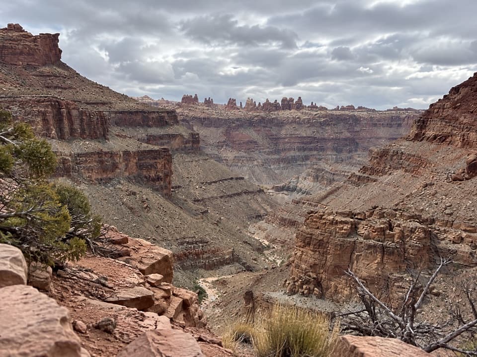 ChallengingLower Red Lake Canyon Trail18.8 mi · 14 hr · At the trailheadA strenuous backcountry descent to the Colorado and back
 ChallengingChesler Park Loop and Joint Trail10.7 mi · 6 hr · At the trailheadA spire-ringed meadow and narrow rock passages reward a full-day loop.
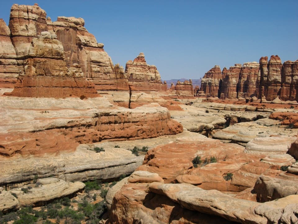 ChallengingBig Spring Canyon to Elephant Canyon Loop Trail10.5 mi · 5 hr · 1.3 mi awayTwo ladders cross a slickrock pass between Big Spring and Elephant.
 ModerateBig Spring to Wooden Shoe Canyon Loop Trail7.5 mi · 3.5 hr · 1.3 mi awayTwo canyons, one high saddle, and a rougher route between them.
 ChallengingPeekaboo Trail10.8 mi · 6 hr · 1.3 mi awayTwo ladders and high slickrock make this a serious Needles day hike.
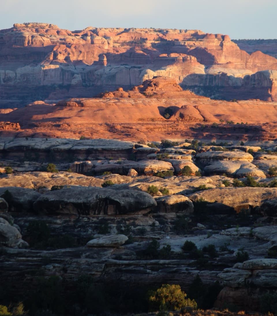 ChallengingWooden Shoe Canyon to Lost Canyon Loop Trail8.7 mi · 5.5 hr · 1.3 mi awayTwo canyon floors, slickrock climbs, and one ladder in a rugged loop.
 ModerateDevils Kitchen to Elephant Canyon Trail5.2 mi · 3.5 hr · 1.8 mi awayA remote through-hike past red needles into Elephant Canyon.
 Campground · 1.5 mi awayThe Needles CampgroundCamp among sandstone spires, with Needles hikes close at hand.
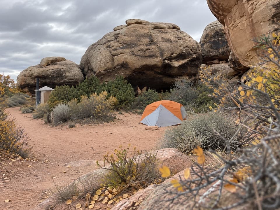 Campground · 1.9 mi awayDevils Kitchen CampgroundA four-site backcountry camp reached by the technical Elephant Hill road.
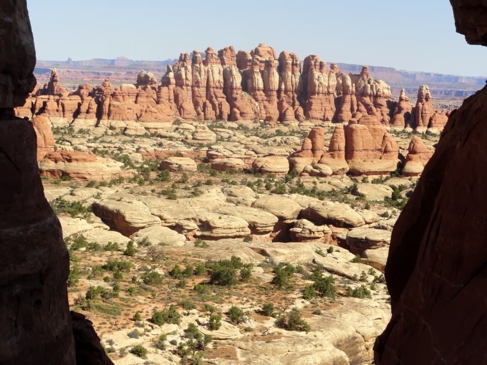 Sight · 1.9 mi awayChesler Park ViewpointA grassland basin ringed by stone needles, earned on a long hike.
 Picnic area · 2 mi awayNeedles Scenic Drive Picnic AreaA shaded stop where rain brings tiny desert creatures to life.
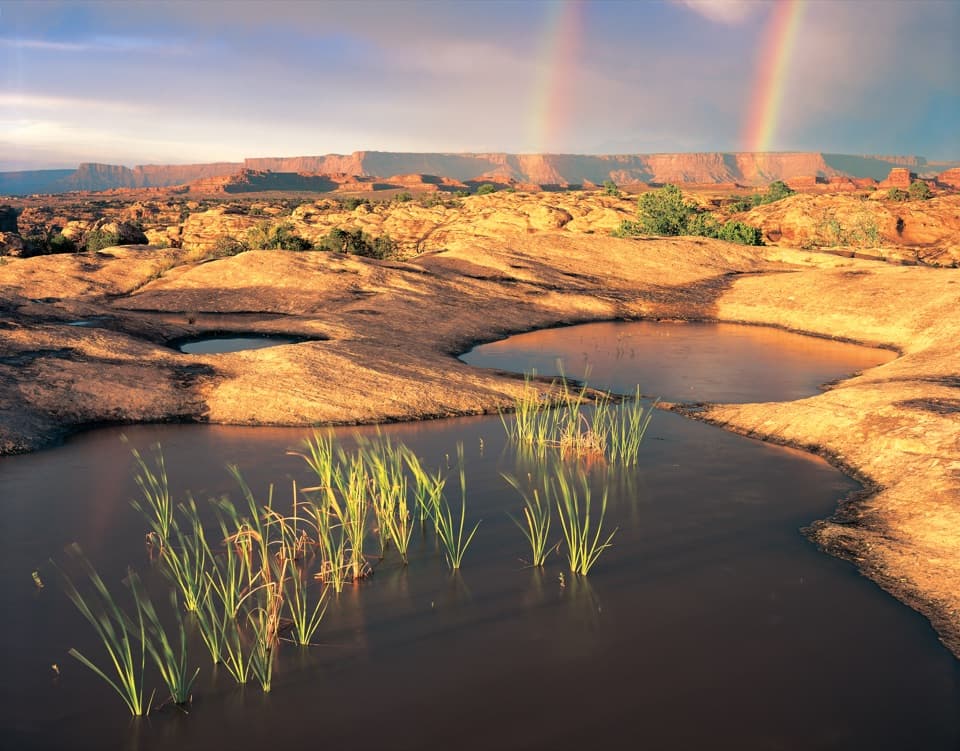 Sight · 2.3 mi awayPothole PointRain-fed pools bring a small world to life on bare sandstone.
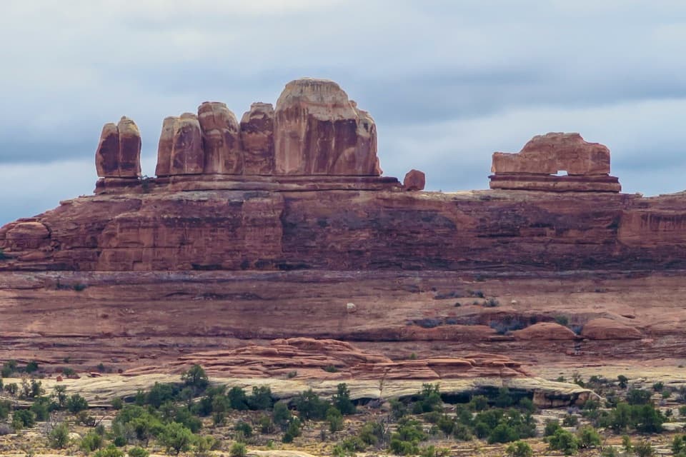 Sight · 2.6 mi awayWooden Shoe Arch OverlookA quick stop for one unmistakable shoe-shaped arch.
 Sight · 2.6 mi awayBig Spring Canyon OverlookSpires and sandstone benches line a bend in Big Spring Canyon.
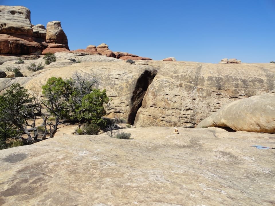 Sight · 3 mi awayThe JointA shaded quarter-mile passage through deep Cedar Mesa sandstone fractures.
Parkwolf’s Canyonlands ranking

The audio tour guide for the drive, plus offline maps, trails, and wildlife heatmaps for when the signal drops.


