Les Falaises in Cape Breton Highlands National Park

Picnic area · Cape Breton Highlands National Park

Les Falaises

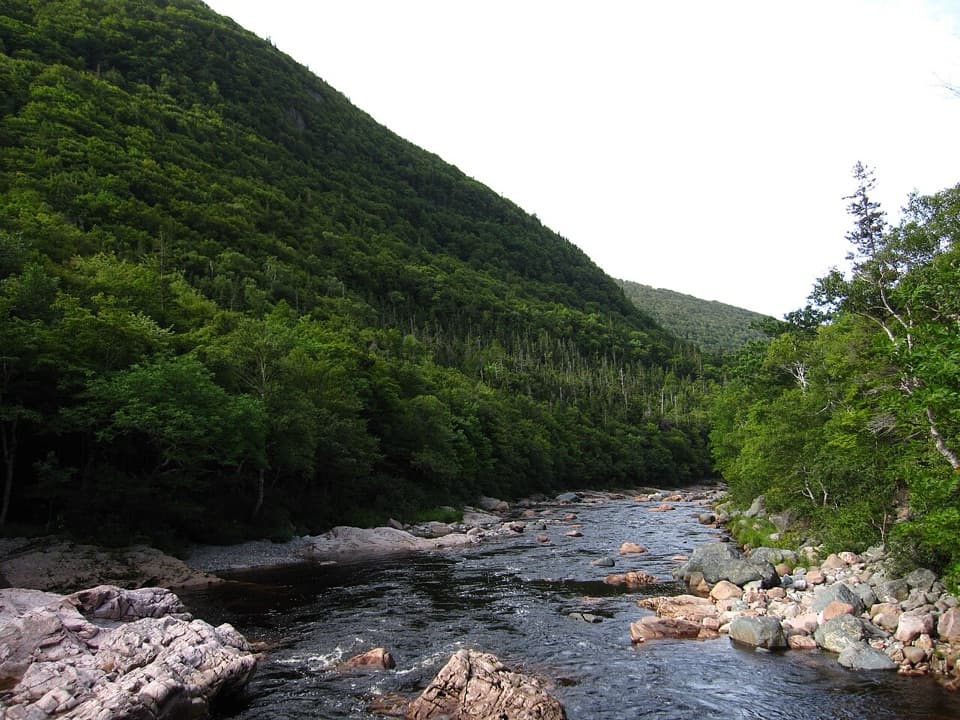
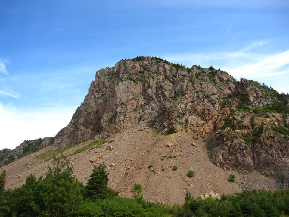
Pull in for a quick look up at La Grande Falaise.

Photo: Wikimedia Commons
Type
Picnic area
Nearest trail
0.4 km
Audio stories
6 nearby
  • Scenic viewpoint

Hear the audio tour

Les Falaises and Le Buttereau

Overview

About Les Falaises

Why stop

  • A close look up at the bare face of La Grande Falaise.

Map

Where it is

Loading the Cape Breton Highlands map
Full map
Picnic areaLes Falaises46.67408, -60.95324
Keep this map with you offline in the Parkwolf app

Plan your stop

Before you go

6 active Cape Breton Highlands alerts

  • CautionPedestrian prohibition on Cabot Trail near French LakeMentions Cabot Trail, referenced in this guidePedestrian use is prohibited at all times on the Cabot Trail between 19713 Cabot Trail (French Lake Look-Off) and 18865 Cabot Trail (Veteran’s Monument Look-Off) through October 25, 2026.Official details
  • ClosureCoyote-related area closuresMacIntosh Brook Campground and Trail, Lone Shieling, three Cabot Trail properties, and nearby pull-offs are closed because coyotes have approached people aggressively.Official details

See all 6 alerts
A park ranger sits on a dash-mounted phone, talking, as Parkwolf’s Tour Guide plays “Army Cutworm Moths: A Grizzly Bear Buffet” on Grand Loop Road below Dunraven Pass in Yellowstone
Parkwolf Tour GuideThe highest, rockiest slopes around here are a summer buffet for grizzly bears.

Cape Breton Highlands Tour Guide

Your drive to Les Falaises, narrated.

Parkwolf is a GPS audio tour guide for Cape Breton Highlands National Park. As you drive, it chimes in with what’s ahead: hidden gems, upcoming stops, history, geology, and wildlife, right through your car’s speakers.

See the Cape Breton Highlands audio tour

Recorded for this place

Les Falaises and Le Buttereau
0:00 / 0:27
“Les Falaises picnic area is coming up, beneath the bare rock face of La Grande Falaise, the Great Cliff. Stop for a close look up at the cliff without committing to a hike.”

Plays as you drive up to Les Falaises in the Parkwolf Cape Breton Highlands Tour Guide.

More stories near here in the app

  • An Island Assembled from Continents
  • Le Chemin du Buttereau
  • Chéticamp Visitor Centre
  • La Bloc Beach
  • 50 audio storiesacross Cape Breton Highlands’s roads, triggered by GPS as you drive
  • Wildlife heatmapsfor Moose, Black Bear, Bald Eagle, and 13 more
  • Works offlinemaps, 27 trails, 38 places, and audio download before you lose signal
  • CarPlay readysimple controls built for the drive
★★★★★
“Fantastic app with many points of information… It’s great to just turn on while you’re driving and it gives you an audio tour of the national Park. We love it!!!!”
JMJamesApp Store review
Download Parkwolf on the App StoreGet Parkwolf on Google Play

4.7 from 8,600+ ratings

Guide

More about Les Falaises

A short roadside stopLes Falaises is a named picnic area beside the Cabot Trail, on the Chéticamp side of Cape…

Les Falaises is a named picnic area beside the Cabot Trail, on the Chéticamp side of Cape Breton Highlands National Park. The reason to stop is the view up at La Grande Falaise, a large bare cliff rising above the road. Pull in for a short break if you’re curious about the cliff; this is a quick look, not a long outing.

La Grande Falaise above the roadLa Grande Falaise means “The Great Cliff”; it’s the landmark the picnic area looks up at.

La Grande Falaise means “The Great Cliff”; it’s the landmark the picnic area looks up at. Its full size is easier to take in from farther down the coast, while Les Falaises gives you a close view from below. For a photo, keep some of the lower slope beneath the rock face in frame instead of cropping tightly; that helps show the cliff’s scale.

Keep Le Buttereau separateNearby Le Buttereau is a separate hill and trail across the Cabot Trail.

Nearby Le Buttereau is a separate hill and trail across the Cabot Trail. Its old cart path once linked Cap Rouge and Chéticamp, and the walk passes remains of early settlers’ homes and interpretive panels. Those ruins and the wider views toward Pillar Rock and the mouth of the Chéticamp River belong to that walk, not this picnic stop.

Wildlife

Wildlife in Cape Breton Highlands

All Cape Breton Highlands wildlife maps

Sighting maps show where each species has been reported across Cape Breton Highlands. Wildlife moves, so no sighting is guaranteed.

Keep exploring

Near Les Falaises

See it all on the map

Trails nearby

More stops nearby

Parkwolf’s Cape Breton Highlands ranking

Top sights in Cape Breton Highlands

All 38 places
  1. 1Beulach Ban FallsSight
  2. 2Ingonish Beach and Freshwater LakeBeach
  3. 3Black Brook BeachBeach
  4. 4Lakie's HeadSight
  5. 5Lone ShielingSight
  6. 6Highlands LinksSight

Take Parkwolf to Cape Breton Highlands.

The audio tour guide for the drive, plus offline maps, trails, and wildlife heatmaps for when the signal drops.

4.7 from 8,600+ ratings

Download Parkwolf on the App StoreGet Parkwolf on Google Play