Augspurger Mountain Trail in Columbia River Gorge National Scenic Area

Columbia River Gorge National Scenic Area, OR · WA

Augspurger Mountain Trail

The summit is wooded; keep going to the open ridge.

Length
12.5mi
Time
9hr
Elev. change
3,251ft
Difficulty
Challenging
  • Dogs allowed
  • High point 3,524 ft
  • #26 of 111 in Columbia River Gorge

Hear the audio tour

Dog Mountain Trailhead

Overview

About Augspurger Mountain Trail

Why go

  • Four Cascade peaks from an open late-spring meadow
  • The upper route feels quieter after the shared Dog Mountain climb

Heads up

  • About 4,400 feet of gain over a 12.5-mile day
  • Wayfinding is tricky at the power-line clearing, and upper tread can overgrow

Map & elevation

The route

Loading the Columbia River Gorge map
Full map
Elevation272–3,524 ft
TrailheadDog Mountain Trailhead / Augspurger Trailhead45.69917, -121.70806
Keep this map with you offline in the Parkwolf app

Plan your hike

Before you go

Parking

Use the shared Dog Mountain Trailhead off State Route 14; Augspurger Trail 4407 starts on the left. The roughly 70-space lot fills on busy weekends; do not park along the highway. A day-use fee or accepted pass is required. Spring vehicle reservations sometimes apply, so check the current schedule.

Safety

Long, steep hike with about 4,400 feet of gain. There is no potable water at the trailhead. The power-line clearing can be confusing, summer overgrowth can obscure upper tread, and the drop from the forested summit to the viewpoint is steep.

8 active Columbia River Gorge alerts

  • ClosureEagle Creek Fire area closureDo not enter Oneonta Gorge or the specified trail sections because hazards remain following the Eagle Creek Fire.Official details
  • CautionAircraft and drone restrictions at developed recreation sitesAircraft and drone landings, drop-offs, and pickups are prohibited at six high-use developed recreation sites to protect visitor safety.Official details
See all 8 alerts
A park ranger sits on a dash-mounted phone, talking, as Parkwolf’s Tour Guide plays “Army Cutworm Moths: A Grizzly Bear Buffet” on Grand Loop Road below Dunraven Pass in Yellowstone
Parkwolf Tour GuideThe highest, rockiest slopes around here are a summer buffet for grizzly bears.

Columbia River Gorge Tour Guide

Your drive to Augspurger Mountain Trail, narrated.

Parkwolf is a GPS audio tour guide for Columbia River Gorge National Scenic Area. As you drive, it chimes in with what’s ahead: hidden gems, upcoming stops, history, geology, and wildlife, right through your car’s speakers.

Recorded for this trailhead

Dog Mountain Trailhead
0:00 / 0:26
“You're approaching Dog Mountain Trailhead, the start of a hard climb to spring wildflower meadows above the Columbia.”

Plays as you drive up to this trailhead in the Parkwolf Columbia River Gorge Tour Guide.

More stories near here in the app

  • What Mount Defiance Asks of You
  • Starvation Creek Falls
  • The Waterfall Through a Tunnel
  • A Slide Beside the Water
  • 217 audio storiesacross Columbia River Gorge’s roads, triggered by GPS as you drive
  • Wildlife heatmapsfor Bald Eagle, Black Bear, American Pika, and 13 more
  • Works offlinemaps, 111 trails, 78 places, and audio download before you lose signal
  • CarPlay readysimple controls built for the drive
★★★★★
“Fantastic app with many points of information… It’s great to just turn on while you’re driving and it gives you an audio tour of the national Park. We love it!!!!”
JMJamesApp Store review
Download Parkwolf on the App StoreGet Parkwolf on Google Play

4.7 from 8,600+ ratings

Trail guide

Hiking Augspurger Mountain Trail

A full day for the open ridgeAugspurger Mountain Trail is a 12.

Augspurger Mountain Trail is a 12.5-mile round-trip out-and-back from Dog Mountain Trailhead to an open ridge beyond the wooded 3,667-foot summit. It follows Forest Service Trail 4407 north from the shared Dog Mountain access, then turns around at the ridge viewpoint instead of continuing to the line trail's gravel-pit end. The climb totals about 4,400 feet, and a typical outing takes 8.5 to 9.5 hours. Save a full day for it: the summit itself is quiet and plain, but a short drop beyond it opens a long view of the Cascades.

Up Dog Mountain, then back downAugspurger starts on the left side of the trailhead lot; the Dog Mountain route goes right.

Augspurger starts on the left side of the trailhead lot; the Dog Mountain route goes right. The first 2.8 miles climb the west slope of Dog Mountain to the Dog-Augspurger Tie Trail junction. Keep left on Trail 4407. Trail grades run 10 to 20 percent on the steeper sections, and this first climb is no warm-up. The track moves through forest and rock scree, with old-growth pockets and occasional glimpses across the Columbia River Gorge.

After the junction, the trail drops through switchbacks into a small valley and joins an old road. You give back some elevation here before the second climb. It is a useful change of pace, but the hike is far from over; the route keeps alternating between wooded slopes and open stretches as it works toward the north ridge.

The real view is past the summitAt the 2.

At the 2.8-mile junction, keep left on Trail 4407 instead of taking the tie trail back toward Dog Mountain. Later, several old roads and paths meet near a power-line clearing; stay on 4407 through that confusing stretch. Near a second low point, look for a large old-growth Douglas-fir before the climb resumes. The upper tread comes in and out of forest, and repeated reports describe it becoming overgrown in summer.

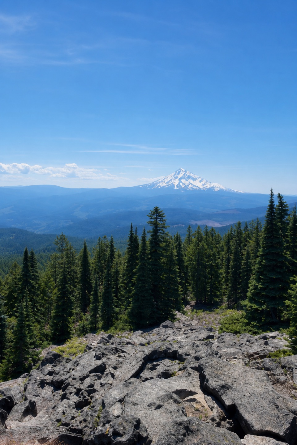
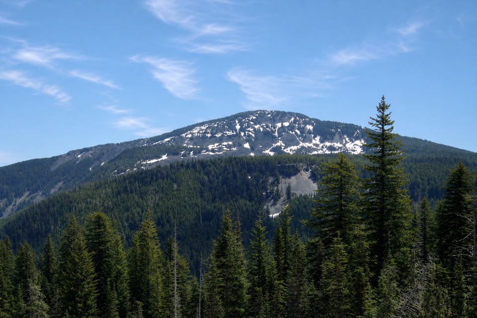
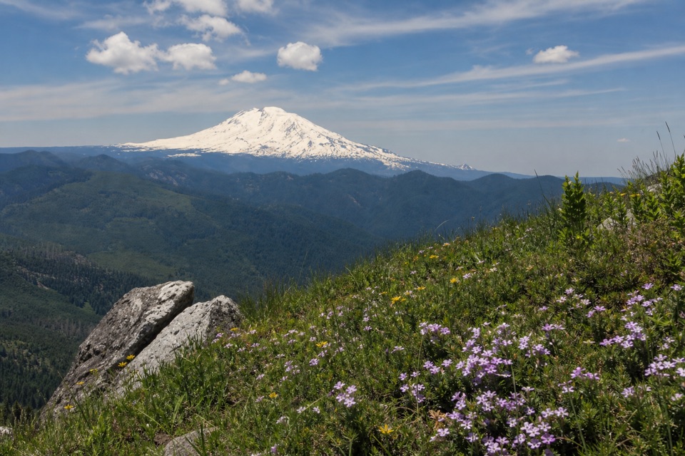
Augspurger's 3,667-foot summit is forested, so do not count on a broad panorama from the top. Keep going about 0.1 mile downhill to the open ridge. In late spring, wildflowers fill the meadow; Mount St. Helens, Mount Rainier and Mount Adams line up to the north, with Silver Star Mountain to the west. This is the payoff and the turnaround for the 12.5-mile route. For a photo, put the flowers in the foreground and the northern peaks behind them.

Access and the optional extraUse the signed Dog Mountain Trailhead off State Route 14.

Use the signed Dog Mountain Trailhead off State Route 14. Its lot holds about 70 vehicles and fills on busy weekends; roadside parking on the highway is not allowed. A day-use fee or accepted pass is required. The shared trailhead has used vehicle reservations on spring weekends, so check the current season's dates before driving. There is no potable water at the trailhead, and no refill point is identified on the route. Dogs are allowed on leash.

If you still have energy, the trail continues roughly 0.5 mile beyond the viewpoint, adding about a mile round trip and another climb and descent of roughly 300 feet. That ridge-end extension is often overgrown in summer and is not part of the distance above. Turning around at the main view keeps this demanding hike focused on its best section.

Wildlife

Wildlife in Columbia River Gorge

All Columbia River Gorge wildlife maps

Sighting maps show where each species has been reported across Columbia River Gorge. Wildlife moves, so no sighting is guaranteed.

Keep exploring

Near Augspurger Mountain Trail

See it all on the map

Trails that start nearby

Places near the trailhead

Parkwolf’s Columbia River Gorge ranking

Top-rated trails in Columbia River Gorge

All 111 trails
  1. 1Eagle Creek Trail #440 to Tunnel FallsChallenging · 11.7 mi
  2. 2Multnomah Falls Trail to the TopModerate · 2.4 mi
  3. 3Multnomah–Wahkeena Falls LoopChallenging · 4.8 mi
  4. 4Dog Mountain LoopChallenging · 6.9 mi
  5. 5Angel's Rest TrailModerate · 4.8 mi
  6. 6Cape Horn Loop TrailChallenging · 6.5 mi

Take Parkwolf to Columbia River Gorge.

The audio tour guide for the drive, plus offline maps, trails, and wildlife heatmaps for when the signal drops.

4.7 from 8,600+ ratings

Download Parkwolf on the App StoreGet Parkwolf on Google Play