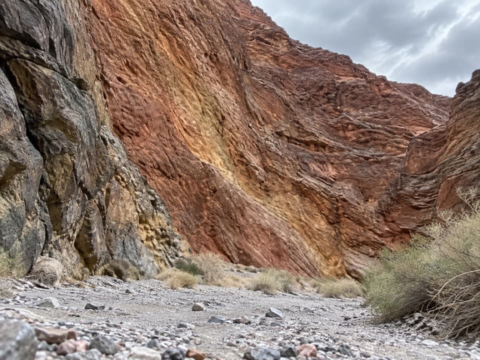
Redwall Canyon in Death Valley National Park

Death Valley National Park, CA · NV

Redwall Canyon

A long, rough fan walk ends in folded red canyon walls.

Length
5.8mi
Time
5.5hr
Elev. change
1,696ft
Difficulty
Challenging
  • No dogs
  • High point 2,093 ft

Hear the audio tour

Redwall Canyon: Beyond the Long Approach

Overview

About Redwall Canyon

Why go

  • Striking folded red walls with purple and yellow tones.
  • The chockstone pour-over gives the hike a clear turnaround.

Heads up

  • A long, loose-cobbled approach with no shade.
  • Unmarked route-finding across open bajada.
Redwall Canyon is a 5.8-mile out-and-back from the lower roadside access on Scotty's Castle Road. The route crosses an unmarked bajada, then follows a narrow canyon to a 25-foot pour-over capped by a huge chockstone. Go for the folded, brightly colored rock and a backcountry day; skip it if you want a quick canyon stroll. Allow about five to six hours for roughly 1,600 feet of climbing. This is an off-trail route, not a built path.
Parkwolf’s verdictIs the long approach for you?

Map & elevation

The route

Loading the Death Valley map
Full map
Elevation397–2,093 ft
TrailheadScotty’s Castle Road at Redwall Canyon, lower access36.83623, -117.22585
Keep this map with you offline in the Parkwolf app

Plan your hike

Before you go

Parking

Use the roadside access zone on Scotty’s Castle Road north of Titus Canyon junction; there is no marked trailhead or developed lot. The 5.8-mile figure starts at the lower end. A higher pull-off shortens the fan crossing and may make it easier, but changes the mileage.

Safety

Unmarked route across loose cobbles and small washes; the bajada has no shade and rescue in the isolated canyon would be difficult. Turn back at the 25-foot pour-over: the move above it is exposed fifth-class climbing. Pets are prohibited on trails and in designated wilderness in Death Valley.

4 active Death Valley alerts

  • ClosureRoad closures and hazardous conditionsSeveral park roads are closed or hazardous; follow closures and vehicle restrictions.Official details
  • ClosureSaline Valley Lower Springs closed after wildfireLower Springs pools at Saline Valley Warm Springs remain closed because the September 15 wildfire left safety hazards, including potential hazardous chemicals; do not enter the closed area.Official details
See all 4 alerts
A park ranger sits on a dash-mounted phone, talking, as Parkwolf’s Tour Guide plays “Army Cutworm Moths: A Grizzly Bear Buffet” on Grand Loop Road below Dunraven Pass in Yellowstone
Parkwolf Tour GuideThe highest, rockiest slopes around here are a summer buffet for grizzly bears.

Death Valley Tour Guide

Your drive to Redwall Canyon, narrated.

Parkwolf is a GPS audio tour guide for Death Valley National Park. As you drive, it chimes in with what’s ahead: hidden gems, upcoming stops, history, geology, and wildlife, right through your car’s speakers.

See the Death Valley audio tour

Recorded for this trailhead

Redwall Canyon: Beyond the Long Approach
0:00 / 0:30
“The roadside start for Redwall Canyon is coming up, for a long walk to folded red walls striped with purple and yellow.”

Plays as you drive up to this trailhead in the Parkwolf Death Valley Tour Guide.

More stories near here in the app

  • Flying With Your Fingers
  • Rhyolite's Bottle House
  • Fall Canyon: A Hike into Striped Narrows
  • The Bighorn's Second Chew
  • 228 audio storiesacross Death Valley’s roads, triggered by GPS as you drive
  • Wildlife heatmapsfor Bighorn Sheep, Desert Tortoise, Coyote, and 13 more
  • Works offlinemaps, 57 trails, 81 places, and audio download before you lose signal
  • CarPlay readysimple controls built for the drive
★★★★★
“Fantastic app with many points of information… It’s great to just turn on while you’re driving and it gives you an audio tour of the national Park. We love it!!!!”
JMJamesApp Store review
Download Parkwolf on the App StoreGet Parkwolf on Google Play

4.7 from 8,600+ ratings

Trail guide

Hiking Redwall Canyon

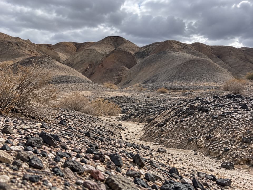
Across the fanThe first 2.2 miles climb the bajada toward the canyon mouth, gaining about 1,000 feet.

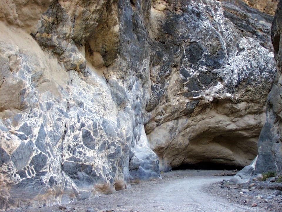
The first 2.2 miles climb the bajada toward the canyon mouth, gaining about 1,000 feet. The ground is cut by small washes and covered in loose cobbles. Ridges of older desert pavement offer firmer footing for about half the climb. The mouth can be hard to pick out from the lower start: look for the cleft between dark gray rock on the south and bright red rock on the north. A triangular dark limestone wall just inside the north side is a useful landmark.

The red wallsThe canyon gets greener than the bare fan.

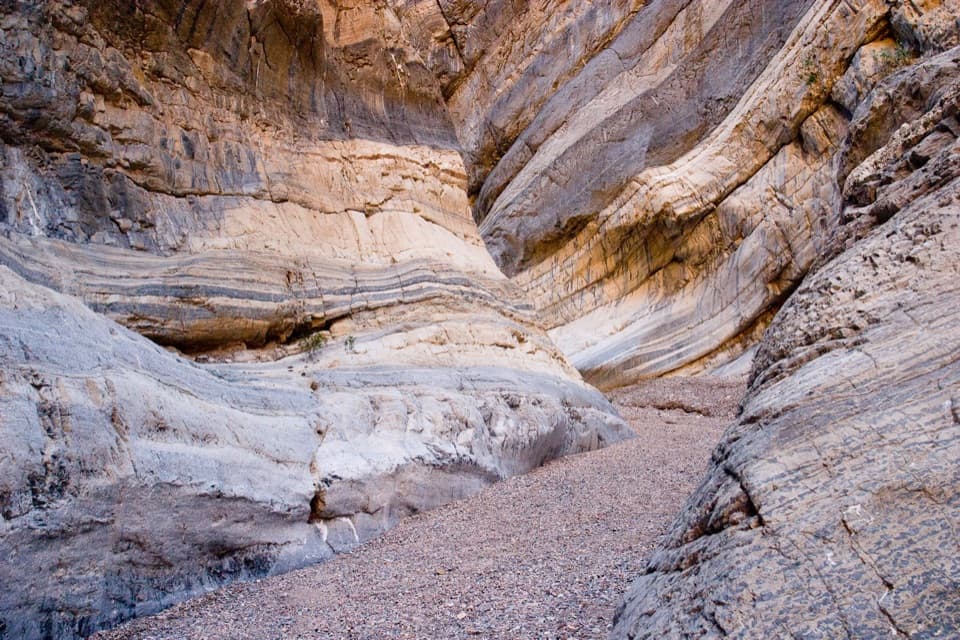
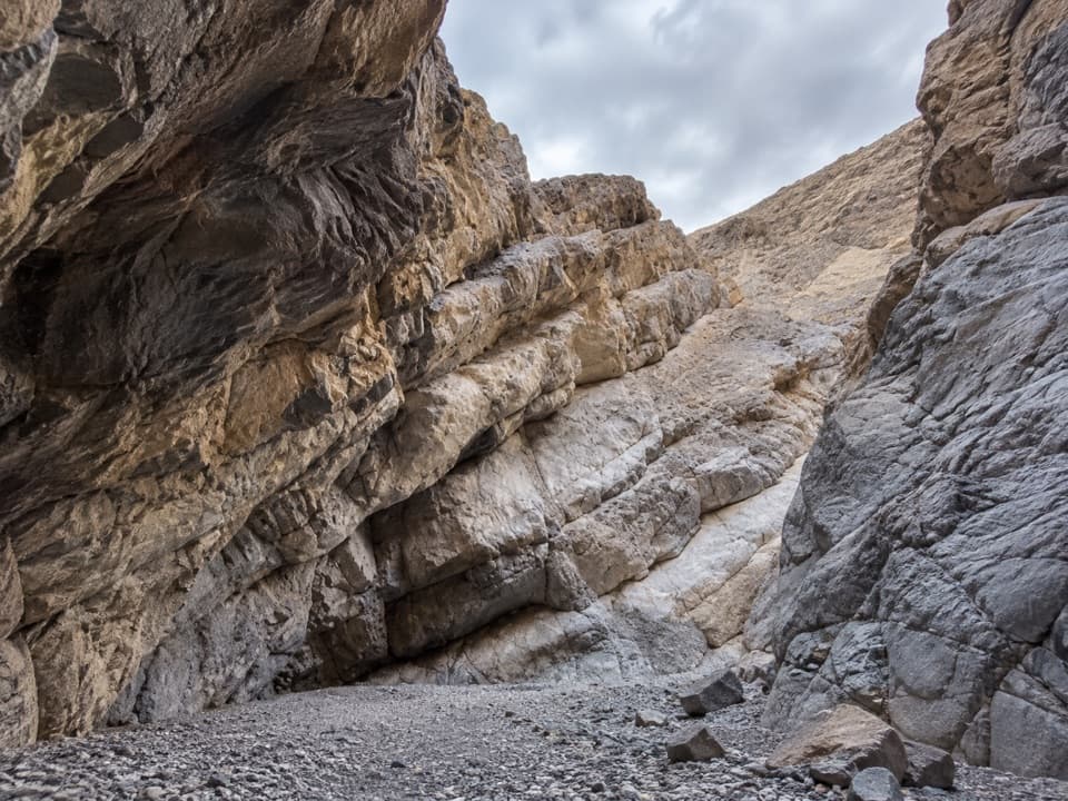
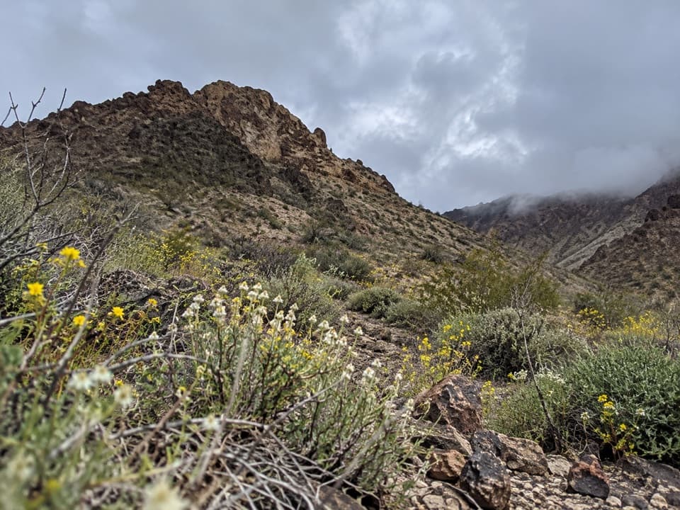
The canyon gets greener than the bare fan. Rabbitbrush, Mormon tea and coyote melon grow among the rocks. About five minutes in, the route reaches a south-side red wall striped with purple and yellow, with folded layers and erosion holes. After a short squeeze between eroded limestone buttresses, the canyon bends and opens at a smooth red wall on the north side. For a photo, keep some of the gravel wash below that first colored wall in frame; it gives the rock a sense of scale.

Turn at the pour-overThe last 0.7 mile narrows again.

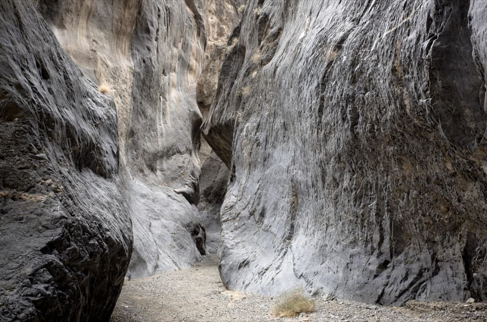
The last 0.7 mile narrows again. A short scramble reaches the 25-foot pour-over, where smooth, water-polished rock rises beneath a large chockstone. This is the turnaround for the hike described here. Climbing above it involves an exposed, off-balance fifth-class move; the technical continuation is a separate outing.

Access and rulesThere is no signed trailhead or developed lot: roadside parking runs along about 1.

There is no signed trailhead or developed lot: roadside parking runs along about 1.25 miles of Scotty's Castle Road, north of the Titus Canyon junction. The distance here starts at the lower end of that zone. A higher pull-off shortens and may ease the fan crossing, but changes the mileage. The bajada has no shade, the canyon is isolated, and rescue would be difficult. Pets aren't allowed on trails or in designated wilderness in Death Valley.
Wildlife

Wildlife in Death Valley

All Death Valley wildlife maps

Sighting maps show where each species has been reported across Death Valley. Wildlife moves, so no sighting is guaranteed.

Parkwolf’s Death Valley ranking

Top-rated trails in Death Valley

All 57 trails
  1. 1Badwater Salt FlatEasy · 1.9 mi
  2. 2Mosaic CanyonModerate · 4 mi
  3. 3Golden Canyon to Red CathedralModerate · 3 mi
  4. 4Telescope Peak TrailChallenging · 12.2 mi
  5. 5Golden Canyon Complete CircuitChallenging · 7.8 mi
  6. 6Gower Gulch LoopModerate · 4.3 mi

Take Parkwolf to Death Valley.

The audio tour guide for the drive, plus offline maps, trails, and wildlife heatmaps for when the signal drops.

4.7 from 8,600+ ratings

Download Parkwolf on the App StoreGet Parkwolf on Google Play