Franconia Ridge Trail Loop in Franconia Notch State Park

#1 of 29 trails in Franconia Notch

Franconia Notch State Park, NH

Franconia Ridge Trail Loop

A full-day loop over three exposed summits above Franconia Notch.

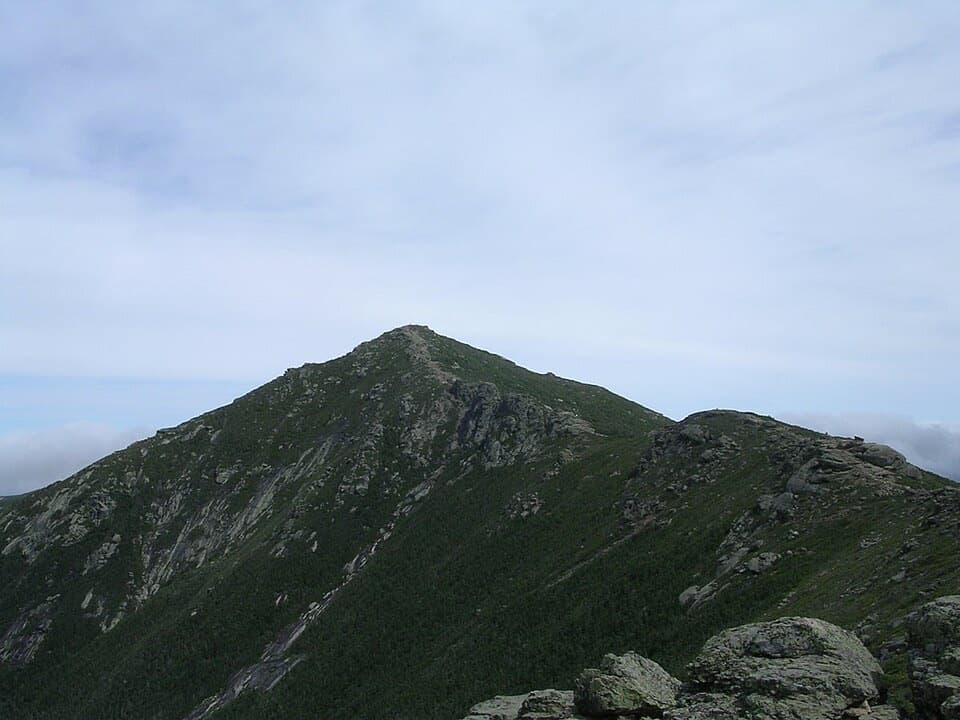
Photo: Wikimedia Commons
Length
8.1mi
Time
8.5hr
Elev. change
3,179ft
Difficulty
Challenging
  • Loop
  • Dogs allowed
  • High point 5,072 ft

Hear the audio tour

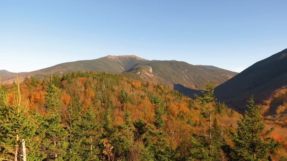
Mount Lafayette and Franconia Ridge

Overview

About Franconia Ridge Trail Loop

Why go

  • Three high summits and long above-treeline views in one circuit
  • Waterfalls on the climb and a seasonal hut on the return

Heads up

  • A full-day climb with steep, rocky footing and exposed alpine miles
  • Limited parking and little shelter once above treeline

Map & elevation

The route

Loading the Franconia Notch map
Full map
Elevation1,893–5,072 ft
TrailheadFalling Waters / Old Bridle Path Trailhead44.14023, -71.67946
Keep this map with you offline in the Parkwolf app

Plan your hike

Before you go

Parking

Start at the Falling Waters / Old Bridle Path trailhead on northbound I-93. Lafayette Place Campground on the southbound side is also an official access; use the pedestrian tunnel beneath I-93 to connect to the loop. Both areas have limited parking and fill early. Seasonal overflow parking and shuttle service from the Cannon Aerial Tramway may be offered; check the current schedule. Do not park on the highway shoulder.

Safety

The ridge is exposed to wind, cold, fog and fast-changing weather; cairns can be difficult to follow in poor visibility. Expect steep, uneven rock on the Falling Waters climb and Old Bridle Path descent. Follow the signed 2026 Falling Waters alignment around closed former sections, and stay on the alpine tread to protect fragile vegetation.

2 active Franconia Notch alerts

  • ClosureFlume Gorge Short Trail closed; seasonal closure Oct 26The Flume Gorge Short Trail/Rim Path is closed; before the seasonal closure, visitors must use the full 2-mile loop.Official details
  • ClosureCannon Mountain Aerial Tramway closed and retiredThe Cannon Mountain Aerial Tramway (Tram II) is closed and retired; do not plan on a tram ride.Official details
Franconia Notch alerts
A park ranger sits on a dash-mounted phone, talking, as Parkwolf’s Tour Guide plays “Army Cutworm Moths: A Grizzly Bear Buffet” on Grand Loop Road below Dunraven Pass in Yellowstone
Parkwolf Tour GuideThe highest, rockiest slopes around here are a summer buffet for grizzly bears.

Franconia Notch Tour Guide

Your drive to Franconia Ridge Trail Loop, narrated.

Parkwolf is a GPS audio tour guide for Franconia Notch State Park. As you drive, it chimes in with what’s ahead: hidden gems, upcoming stops, history, geology, and wildlife, right through your car’s speakers.

See the Franconia Notch audio tour

Recorded for this trailhead

Mount Lafayette and Franconia Ridge
0:00 / 0:28
“Up ahead is the trailhead for Mount Lafayette and Franconia Ridge, a demanding hike with long, open views across the White Mountains.”

Plays as you drive up to this trailhead in the Parkwolf Franconia Notch Tour Guide.

More stories near here in the app

  • Lonesome Lake and Its Shoreline Loop
  • An Old Plant in a Small Cushion
  • A Chickadee’s Hidden Food
  • Boise Rock and Its Winter Legend
  • 32 audio storiesacross Franconia Notch’s roads, triggered by GPS as you drive
  • Wildlife heatmapsfor Black Bear, Moose, Wild Turkey, and 13 more
  • Works offlinemaps, 29 trails, 33 places, and audio download before you lose signal
  • CarPlay readysimple controls built for the drive
★★★★★
“Fantastic app with many points of information… It’s great to just turn on while you’re driving and it gives you an audio tour of the national Park. We love it!!!!”
JMJamesApp Store review
Download Parkwolf on the App StoreGet Parkwolf on Google Play

4.7 from 8,600+ ratings

Trail guide

Hiking Franconia Ridge Trail Loop

The commitmentThis roughly 8.

This roughly 8.1-mile loop climbs Falling Waters Trail to Little Haystack, crosses the exposed Franconia Ridge over Mount Lincoln and Mount Lafayette, then descends Greenleaf Trail past Greenleaf Hut and returns on Old Bridle Path. It gains about 4,000 feet and is exceptionally strenuous; allow a full day, with around eight hours a realistic planning estimate before longer breaks or difficult conditions. Official sources describe it as just over eight miles, while independently mapped versions run longer because tracks and route details vary. The mapped loop follows the current official alignment.

Up Falling WatersThe first long climb stays in the forest beside streams and waterfalls, with steep, rocky…

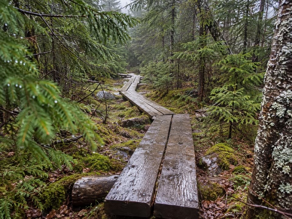
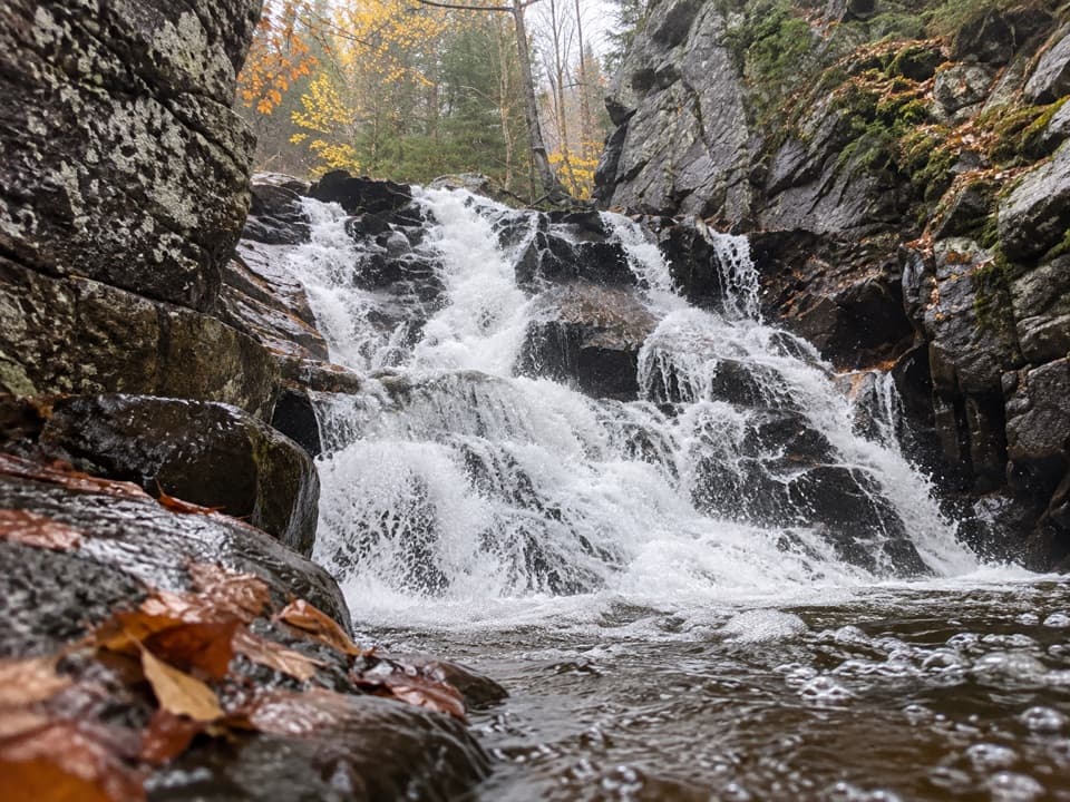
The first long climb stays in the forest beside streams and waterfalls, with steep, rocky footing on the way to the falls viewpoints. Falling Waters was realigned in 2026: follow the current signs and new trail tread, and do not use the closed former streamside sections shown on older tracks. A separate signed spur reaches the falls; it is not part of this loop’s stored line. Once the path reaches Little Haystack, it breaks out of the woods and onto the ridge.

Across Franconia RidgeFrom Little Haystack, the route follows open, rocky alpine terrain over Mount Lincoln to Mount…

From Little Haystack, the route follows open, rocky alpine terrain over Mount Lincoln to Mount Lafayette, with wide views across the Pemigewasset Wilderness, the Notch, and surrounding ranges when skies are clear. This stretch is the defining reward and the main exposure. Cairns mark the high path; fog can obscure them and make the route harder to follow. Weather on the summits can be markedly colder and windier than at the trailhead, and fog or lingering snow can occur outside winter. Check the higher-elevation forecast before choosing this hike.

Down by Greenleaf HutFrom Lafayette, descend Greenleaf Trail to Greenleaf Hut, set near the small alpine tarns…

From Lafayette, descend Greenleaf Trail to Greenleaf Hut, set near the small alpine tarns around 4,200 feet, then take Old Bridle Path back toward the trailhead. The hut is the loop’s only confirmed on-route service stop: water refills, hot drinks and bathrooms are available seasonally, while service level and day-hiker options vary. Do not count on it as an open or stocked stop without checking its operating information. Old Bridle Path is steep and rocky in places; wet, smooth rock makes the descent more demanding. Agony Ridge offers a view back toward the summits before the path drops into the forest.

Parking and accessThe northbound Falling Waters / Old Bridle Path trailhead is the route’s starting point.

The northbound Falling Waters / Old Bridle Path trailhead is the route’s starting point. Lafayette Place Campground on the southbound side is another official access, connected beneath I-93 by a pedestrian tunnel. Both trailhead areas have limited parking and can fill early. Seasonal overflow parking and a shuttle from the Cannon Aerial Tramway may be available; verify the current schedule before relying on it. Parking on the I-93 shoulder is prohibited. Pets are permitted on the hiking trails; keep dogs leashed, including at developed trailheads, and follow the state’s six-foot maximum leash rule.

A restored alpine routeThe four-trail loop was built between 1826 and 1958 and is now maintained through a partnership…

The four-trail loop was built between 1826 and 1958 and is now maintained through a partnership involving New Hampshire State Parks, the White Mountain National Forest, the Appalachian Mountain Club and other trail crews. The ridge contains one of the largest connected alpine tundra areas in the eastern United States. Its low-growing plants recover slowly after trampling, so stay on the constructed tread even where the rocks make a tempting shortcut.

Wildlife

Wildlife in Franconia Notch

All Franconia Notch wildlife maps

Sighting maps show where each species has been reported across Franconia Notch. Wildlife moves, so no sighting is guaranteed.

Keep exploring

Near Franconia Ridge Trail Loop

See it all on the map

Trails that start nearby

Places near the trailhead

Parkwolf’s Franconia Notch ranking

Top-rated trails in Franconia Notch

All 29 trails
  1. 2Flume Gorge TrailModerate · 2 mi
  2. 3Artists Bluff and Bald Mountain LoopModerate · 1.3 mi
  3. 4Lonesome Lake TrailModerate · 3 mi
  4. 5Basin Cascade TrailModerate · 2 mi
  5. 6Mount Pemigewasset TrailModerate · 3.3 mi
  6. 7Cannon Mountain via Kinsman Ridge TrailChallenging · 4.1 mi

Take Parkwolf to Franconia Notch.

The audio tour guide for the drive, plus offline maps, trails, and wildlife heatmaps for when the signal drops.

4.7 from 8,600+ ratings

Download Parkwolf on the App StoreGet Parkwolf on Google Play