Kishenehn Trail in Glacier National Park

Glacier National Park, MT

Kishenehn Trail

A remote riverside walk to an isolated historic ranger station.

Length
9.6mi
Time
5.5hr
Elev. change
272ft
Difficulty
Challenging
  • No dogs
  • High point 4,101 ft

Hear the audio tour

Kishenehn South Trailhead

Overview

About Kishenehn Trail

Why go

  • A historic ranger station gives the long walk a real destination.

Heads up

  • Two unbridged creek fords and faint markers demand careful routefinding.

Map & elevation

The route

Loading the Glacier map
Full map
Elevation3,829–4,101 ft
TrailheadKishenehn South Trailhead48.92000, -114.36851
Keep this map with you offline in the Parkwolf app

Plan your hike

Before you go

Parking

Kishenehn South Trailhead is a roadside access on Inside North Fork Road north of Polebridge. Horse rails and a stock-unloading ramp mark the start; formal parking capacity and services are not documented. Check current North Fork road access before the remote drive.

Safety

Starvation Creek and Kishenehn Creek are unbridged fords; water can be cold, fast and slippery, especially with spring runoff. After Kishenehn Creek, markers are subtle—confirm the cairn and small orange tree tag before leaving the far bank. The early route skirts a steep-sided river valley slope.

1 active Glacier alert

  • ClosureTwo Medicine Campground closed for 2026 constructionTwo Medicine Campground is closed throughout 2026 because of construction in the Two Medicine developed area.Official details
Glacier alerts
A park ranger sits on a dash-mounted phone, talking, as Parkwolf’s Tour Guide plays “Army Cutworm Moths: A Grizzly Bear Buffet” on Grand Loop Road below Dunraven Pass in Yellowstone
Parkwolf Tour GuideThe highest, rockiest slopes around here are a summer buffet for grizzly bears.

Glacier Tour Guide

Your drive to Kishenehn Trail, narrated.

Parkwolf is a GPS audio tour guide for Glacier National Park. As you drive, it chimes in with what’s ahead: hidden gems, upcoming stops, history, geology, and wildlife, right through your car’s speakers.

See the Glacier audio tour

Recorded for this trailhead

Kishenehn South Trailhead
0:00 / 0:27
“Kishenehn South Trailhead is coming up, the start of a remote walk to historic log ranger-station buildings. It's nine point six miles round trip, so allow five to six hours.”

Plays as you drive up to this trailhead in the Parkwolf Glacier Tour Guide.

More stories near here in the app

  • How Trees Record Avalanches
  • Kintla Lake
  • A Boulder Far from Home
  • The Little Case That Walks
  • 204 audio storiesacross Glacier’s roads, triggered by GPS as you drive
  • Wildlife heatmapsfor Grizzly Bear, Wolverine, Mountain Goat, and 13 more
  • Works offlinemaps, 157 trails, 91 places, and audio download before you lose signal
  • CarPlay readysimple controls built for the drive
★★★★★
“Our first time to glacier and we used the audio portion for Going to the Sun Road. Wonderful information with perfect advice of what to see and do along the road.”
PaisleyParkFanApp Store review
Download Parkwolf on the App StoreGet Parkwolf on Google Play

4.7 from 8,600+ ratings

Trail guide

Hiking Kishenehn Trail

What you’re signing up forKishenehn Trail is a remote 9.

Kishenehn Trail is a remote 9.6-mile out-and-back in Glacier’s North Fork district, from Kishenehn South Trailhead to the historic ranger-station complex, 4.8 miles each way. Allow five to six hours. There is modest overall climbing, but the long return, two unbridged creek crossings and faint markers make this a hard day. Pick it for a wild valley walk and an unusual backcountry destination, not a quick leg-stretcher.

Above the North ForkThe route starts through dense lodgepole regrowth from the 2003 Wedge Canyon Fire, then opens…

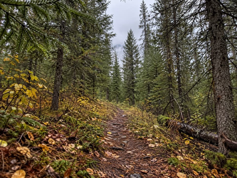
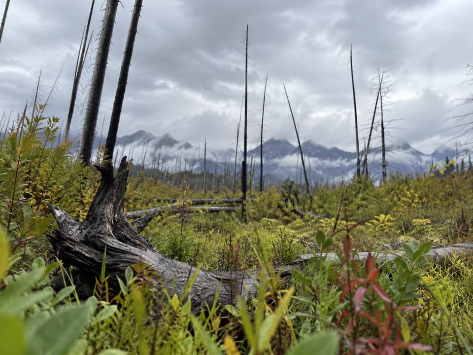
The route starts through dense lodgepole regrowth from the 2003 Wedge Canyon Fire, then opens to a steep-sided view across the North Fork Flathead River Valley. After about a mile it turns away from the river; Starvation Creek comes around mile 2.3. The path returns beside the river briefly before entering dark spruce forest. An old timber tower stands nearby, though its former use as a cable crossing is uncertain. At the early opening, leave a few standing trunks in the frame with the valley beyond to show the drop and scale.

Find the stationThe larger ford at Kishenehn Creek comes about four miles in.

The larger ford at Kishenehn Creek comes about four miles in. It can split into several channels, with slippery cobbles and current. After the far bank the route is easier to lose: look for a cairn, then the small orange marker on a tree, and continue past a beaver pond. At the junction near mile 4.7, take the left branch to the ranger station about a tenth of a mile farther on. The other branch leads into a different backcountry route.

Why there’s a station hereKishenehn Ranger Station is a cluster of historic log buildings in a forest clearing.

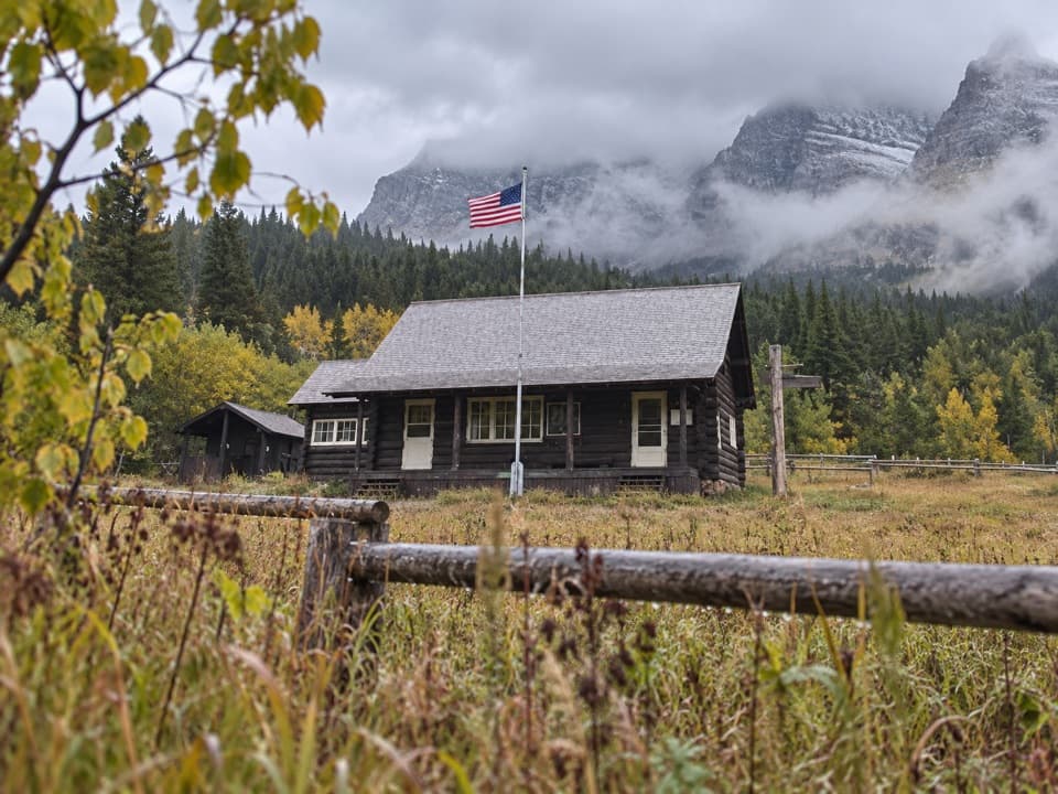
Kishenehn Ranger Station is a cluster of historic log buildings in a forest clearing. This walk follows an abandoned extension of Inside North Fork Road that reached toward the patrol station and Canadian border by 1931, as part of a proposed road loop around Glacier. The earlier rough road grew from an unsuccessful oil-prospecting push toward Kintla. Turn around at the station and retrace the same 4.8 miles.

Access and rulesReach Kishenehn South Trailhead on Inside North Fork Road north of Polebridge; horse rails and…

Reach Kishenehn South Trailhead on Inside North Fork Road north of Polebridge; horse rails and a livestock-unloading ramp mark the roadside start. Formal parking capacity and services are not documented. Pets are not permitted on park trails. Check current North Fork road access before driving this remote approach.

Wildlife

Wildlife in Glacier

All Glacier wildlife maps

Sighting maps show where each species has been reported across Glacier. Wildlife moves, so no sighting is guaranteed.

Keep exploring

Near Kishenehn Trail

See it all on the map

Trails that start nearby

Places near the trailhead

Parkwolf’s Glacier ranking

Top-rated trails in Glacier

All 157 trails
  1. 1Highline TrailChallenging · 11.8 mi
  2. 2Grinnell Glacier TrailChallenging · 10 mi
  3. 3Iceberg Lake TrailModerate · 9.6 mi
  4. 4Hidden Lake Overlook TrailModerate · 2.6 mi
  5. 5Avalanche Lake TrailModerate · 5 mi
  6. 6Trail of the CedarsEasy · 0.9 mi

Take Parkwolf to Glacier.

The audio tour guide for the drive, plus offline maps, trails, and wildlife heatmaps for when the signal drops.

4.7 from 8,600+ ratings

Download Parkwolf on the App StoreGet Parkwolf on Google Play