Bright Angel Campground in Grand Canyon National Park

Campground · Grand Canyon National Park

Bright Angel Campground

Earn a creekside night in the canyon's cottonwood shade.

Photo: Wikimedia Commons
Type
Campground
Nearest trail
0.4 mi
  • Restrooms
  • Picnic tables
  • Ranger station
Parkwolf audio tour79 stories across Grand Canyon’s roads

Overview

About Bright Angel Campground

Why stop

  • Creekside camping under cottonwoods far below the rim

Heads up

  • Permit-only access by a long hike in and out

Map

Where it is

Loading the Grand Canyon map
Full map
CampgroundBright Angel Campground36.10112, -112.09567
Keep this map with you offline in the Parkwolf app

Plan your stop

Before you go

4 active Grand Canyon alerts

  • ClosureInner Canyon and North Rim trail closuresMentions this placeDo not enter the closed trails, bridges, campgrounds, and inner-canyon areas.Official details
  • ClosureNorth Rim scenic roads closed for repairsMentions North Rim, referenced in this guideCape Royal Road and Point Imperial Road are closed from sunset October 15 through sunrise November 3, 2026. - The roads are closed to accommodate critical road repair and rehabilitation work.Official details

See all 4 alerts
A park ranger sits on a dash-mounted phone, talking, as Parkwolf’s Tour Guide plays “Army Cutworm Moths: A Grizzly Bear Buffet” on Grand Loop Road below Dunraven Pass in Yellowstone
Parkwolf Tour GuideThe highest, rockiest slopes around here are a summer buffet for grizzly bears.

Grand Canyon Tour Guide

Your drive to Bright Angel Campground, narrated.

Parkwolf is a GPS audio tour guide for Grand Canyon National Park. As you drive, it chimes in with what’s ahead: hidden gems, upcoming stops, history, geology, and wildlife, right through your car’s speakers.

See the Grand Canyon audio tour

More stories near here in the app

  • Yavapai Geology Museum
  • Mather Point and Visitor Center
  • Trailer Village’s Full-Hookup RV Sites
  • Market Plaza’s Grocery Stop
  • 79 audio storiesacross Grand Canyon’s roads, triggered by GPS as you drive
  • Wildlife heatmapsfor California Condor, Bighorn Sheep, American Bison, and 13 more
  • Works offlinemaps, 73 trails, 96 places, and audio download before you lose signal
  • CarPlay readysimple controls built for the drive
★★★★★
“Fantastic app with many points of information… It’s great to just turn on while you’re driving and it gives you an audio tour of the national Park. We love it!!!!”
JMJamesApp Store review
Download Parkwolf on the App StoreGet Parkwolf on Google Play

4.7 from 8,600+ ratings

Guide

More about Bright Angel Campground

A camp at the bottom of the canyonBright Angel Campground is a tent-oriented backcountry camp on Bright Angel Creek, half a mile…

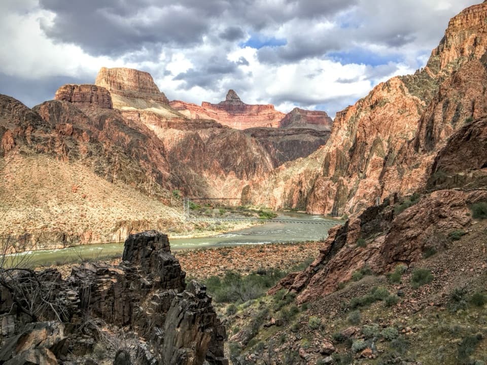
Bright Angel Campground is a tent-oriented backcountry camp on Bright Angel Creek, half a mile north of the Colorado River and less than half a mile from Phantom Ranch. The creek, cottonwood shade and the chance to sleep deep in the canyon make this a rewarding overnight. It takes a backcountry permit and a serious hike to reach; this is not a casual stop.

Choose your route before you set outFrom the South Rim, the campground is 9.

From the South Rim, the campground is 9.5 miles away; the Bright Angel Trail crosses the Silver Bridge, while the South Kaibab Trail crosses the Black Bridge. From the North Rim, it is 14 miles down the North Kaibab Trail. Plan the overnight and the climb back out as one trip. Permits allow up to two nights at a campground per hike, or four nights from November 15 through February 28.

What each site providesEvery campsite has a picnic table, pack pole and metal food-storage can.

Every campsite has a picnic table, pack pole and metal food-storage can. Store food, toiletries and plastics in the can to keep wildlife out of camp. Toilets and a ranger station are listed at the campground, but there are no showers. Potable water is normally listed here; check current service before hiking in and carry what you need for the approach.

The creek is the rewardBright Angel Creek flows through cottonwoods to its meeting with the Colorado River.

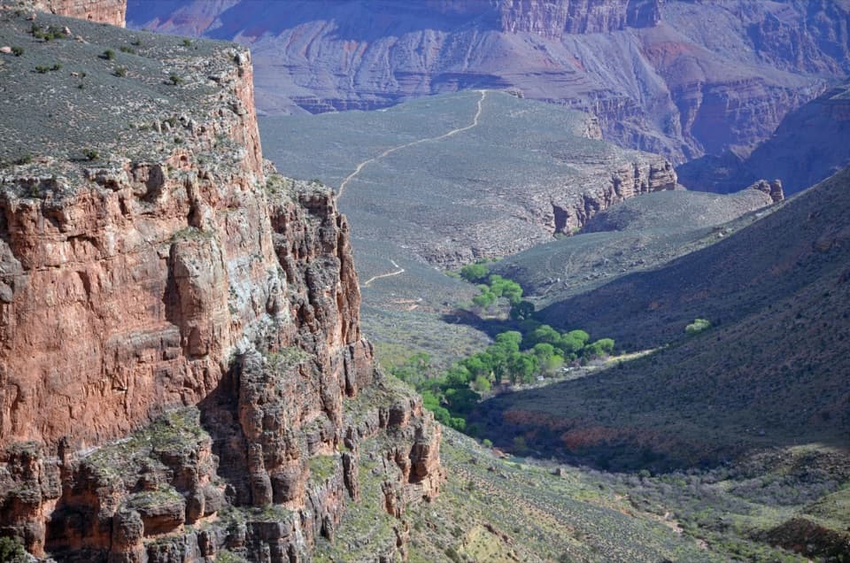
Bright Angel Creek flows through cottonwoods to its meeting with the Colorado River. Campers come to rest, wade, stargaze, fish with an Arizona license, or take day walks toward River Trail and Phantom Overlook. Phantom Ranch is nearby for snacks and meals, but meals need an advance reservation; treat it as a separate stop, not a dependable walk-in dinner. Cottonwoods shade parts of camp, though it varies by site. In summer, visitors report that the canyon heat can linger well after sunset.

A creek with a storyBright Angel Creek runs about 10 miles down Bright Angel Canyon.

Bright Angel Creek runs about 10 miles down Bright Angel Canyon. John Wesley Powell's 1869 expedition found it clear and refreshing, and the creek took the name Bright Angel. Deer, ringtail cats, gray foxes and squirrels are often seen near camp, so secure all food and toiletries. Sudden flash floods can develop in the lower canyon with little warning, even when a storm is not overhead; check the forecast and park alerts before starting down.

Wildlife

Wildlife in Grand Canyon

All Grand Canyon wildlife maps

Sighting maps show where each species has been reported across Grand Canyon. Wildlife moves, so no sighting is guaranteed.

Keep exploring

Near Bright Angel Campground

See it all on the map

Trails nearby

More stops nearby

Parkwolf’s Grand Canyon ranking

Top sights in Grand Canyon

All 96 places
  1. 1Mather PointSight
  2. 2Desert View WatchtowerSight
  3. 3Yavapai Geology MuseumSight
  4. 4Hopi PointSight
  5. 5Toroweap OverlookSight
  6. 6Point ImperialSight

Take Parkwolf to Grand Canyon.

The audio tour guide for the drive, plus offline maps, trails, and wildlife heatmaps for when the signal drops.

4.7 from 8,600+ ratings

Download Parkwolf on the App StoreGet Parkwolf on Google Play