Clear Creek (from the Colorado River) in Grand Canyon National Park

Grand Canyon National Park, AZ

Clear Creek (from the Colorado River)

A river beach, schist scramble and a waterfall that throws water sideways.

Photo: National Park Service
Length
1.4mi
Time
2hr
Elev. change
138ft
Difficulty
Moderate
  • No dogs
  • High point 2,598 ft
Parkwolf audio tour79 stories across Grand Canyon’s roads

Overview

About Clear Creek (from the Colorado River)

Why go

  • A short river hike ends at a split waterfall with a sideways flow.
  • Pink granite cuts through the canyon’s dark, ancient schist.

Heads up

  • The river entry is tricky to find and requires a ridge scramble.
  • You can reach the hike only on a Colorado River trip.

Map & elevation

The route

Loading the Grand Canyon map
Full map
Elevation2,461–2,598 ft
TrailheadColorado River right-bank landing near Clear Creek (approximate)36.08214, -112.03615
Keep this map with you offline in the Parkwolf app

Plan your hike

Before you go

Parking

There is no road trailhead or road parking. The documented start is a small boat beach on the river’s right side near mile 84.5, just before the river bends northeast; a second beach lies beyond the creek mouth. Access requires a Colorado River trip. Noncommercial river travel requires an NPS permit.

Safety

Route-finding at the river entry is difficult. Expect about 200 feet of scrambling over smooth rock, then walking through the cobbled creek bed. Pets are prohibited below the rim; service animals assisting a person with a disability are permitted under NPS rules.

4 active Grand Canyon alerts

  • CautionFlash-flood hazard near Phantom RanchMentions Phantom Ranch, referenced in this guideRiver trips passing Phantom Ranch may encounter flash flooding with little or no warning, even when storms are not visible overhead. Check today’s hiking messages and hazards before traveling.Official details
  • ClosureInner Canyon and North Rim trail closuresDo not enter the closed trails, bridges, campgrounds, and inner-canyon areas.Official details
See all 4 alerts
A park ranger sits on a dash-mounted phone, talking, as Parkwolf’s Tour Guide plays “Army Cutworm Moths: A Grizzly Bear Buffet” on Grand Loop Road below Dunraven Pass in Yellowstone
Parkwolf Tour GuideThe highest, rockiest slopes around here are a summer buffet for grizzly bears.

Grand Canyon Tour Guide

Your drive to Clear Creek (from the Colorado River), narrated.

Parkwolf is a GPS audio tour guide for Grand Canyon National Park. As you drive, it chimes in with what’s ahead: hidden gems, upcoming stops, history, geology, and wildlife, right through your car’s speakers.

See the Grand Canyon audio tour

More stories near here in the app

  • Yaki Point and South Kaibab Access
  • Range Road Picnic Area’s Pine-Shaded Tables
  • Shoshone Point’s Forest Walk
  • Pipe Creek Vista’s Shaded Walls
  • 79 audio storiesacross Grand Canyon’s roads, triggered by GPS as you drive
  • Wildlife heatmapsfor California Condor, Bighorn Sheep, American Bison, and 13 more
  • Works offlinemaps, 73 trails, 96 places, and audio download before you lose signal
  • CarPlay readysimple controls built for the drive
★★★★★
“Fantastic app with many points of information… It’s great to just turn on while you’re driving and it gives you an audio tour of the national Park. We love it!!!!”
JMJamesApp Store review
Download Parkwolf on the App StoreGet Parkwolf on Google Play

4.7 from 8,600+ ratings

Trail guide

Hiking Clear Creek (from the Colorado River)

A river-to-waterfall scrambleClear Creek (from the Colorado River) is a 1.

Clear Creek (from the Colorado River) is a 1.4-mile out-and-back to a split waterfall in a narrow inner-canyon creek. Allow about two hours. The short length hides a rough entry: you reach it only as part of a permitted Colorado River trip, then find and scramble over smooth schist ridges, gaining about 200 feet before dropping into the creek. The creek-bed stretch is mostly level cobbles, but you’ll walk through water. This is a good side hike if you’re already on the river and comfortable with route-finding, scrambling and wet feet. Pets aren’t allowed below the rim; service animals assisting a person with a disability are permitted under park rules.

The map pin and line are approximate. The commonly used boat beach isn’t precisely located in available mapping, and the line follows Clear Creek’s mapped channel from its mouth rather than showing the ridge entry. Use it to understand the creek corridor, not as directions to the beach.

Finding the creekThe hike uses the river-right side at about mile 84.5.

The hike uses the river-right side at about mile 84.5. Route-specific directions describe a small beach just before the river bends northeast, with another beach beyond the creek mouth if you miss it. From the beach, the entry crosses several smooth ridges before dropping into the creek; route-finding is part of the hike. Once you reach the channel, head upstream over cobbles. Water becomes unavoidable, so don’t expect to keep your shoes dry. This is the short river-access walk, not the longer Clear Creek Trail reached from Phantom Ranch.

The split falls and ancient rockThe lower waterfall splits around a large reddish boulder: one stream drops vertically while…

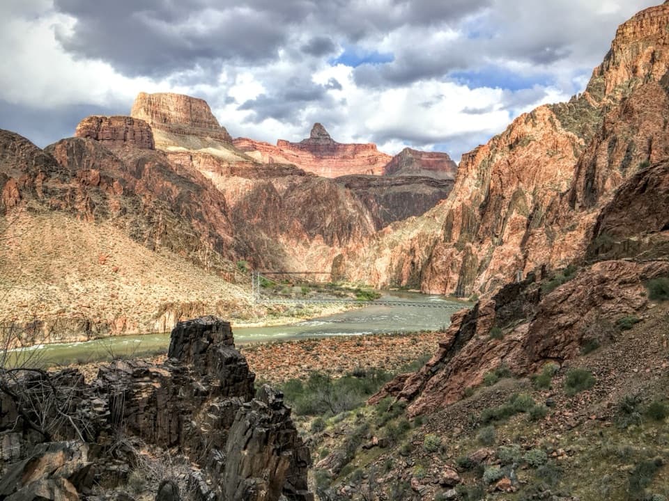
The lower waterfall splits around a large reddish boulder: one stream drops vertically while another shoots outward from a ledge into the pool. The narrow canyon walls expose dark Vishnu Schist cut by pink Zoroaster Granite, rocks nearly 1.75 billion years old. At the falls, frame the central boulder with both flows to show what makes this stop different.

Wildlife

Wildlife in Grand Canyon

All Grand Canyon wildlife maps

Sighting maps show where each species has been reported across Grand Canyon. Wildlife moves, so no sighting is guaranteed.

Keep exploring

Near Clear Creek (from the Colorado River)

See it all on the map

Trails that start nearby

Places near the trailhead

Parkwolf’s Grand Canyon ranking

Top-rated trails in Grand Canyon

All 73 trails
  1. 1Rim-to-Rim: North Kaibab to Bright AngelChallenging · 23.5 mi
  2. 2South Kaibab TrailChallenging · 6.3 mi
  3. 3Bright Angel TrailChallenging · 7.8 mi
  4. 4Rim TrailModerate · 12.8 mi
  5. 5Rim-to-Rim: South Kaibab to North KaibabChallenging · 21 mi
  6. 6Cape Royal TrailEasy · 0.8 mi

Take Parkwolf to Grand Canyon.

The audio tour guide for the drive, plus offline maps, trails, and wildlife heatmaps for when the signal drops.

4.7 from 8,600+ ratings

Download Parkwolf on the App StoreGet Parkwolf on Google Play