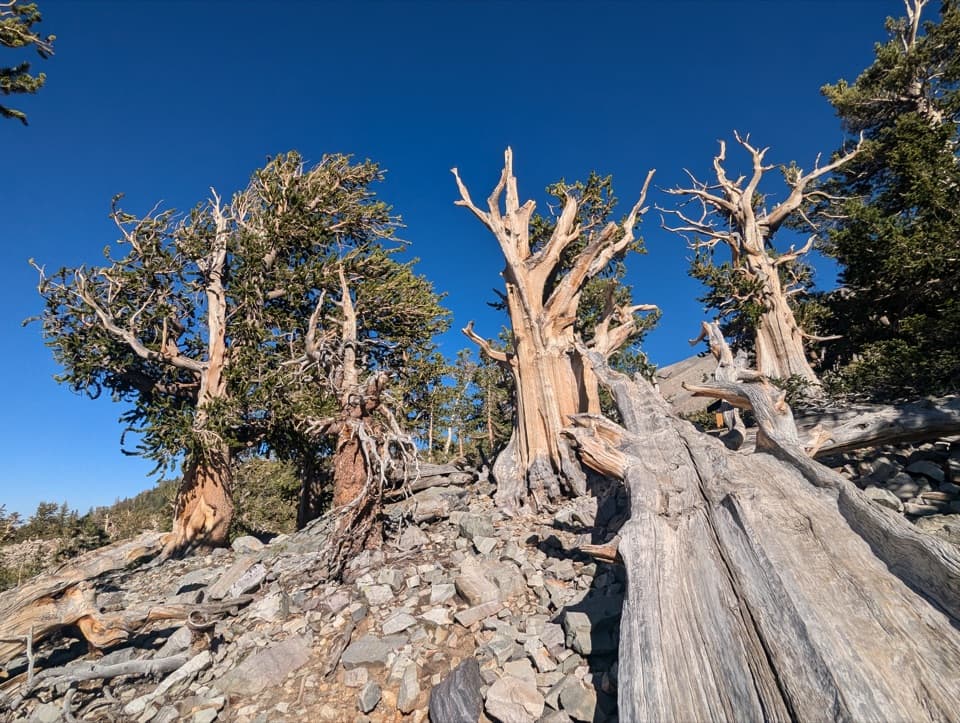
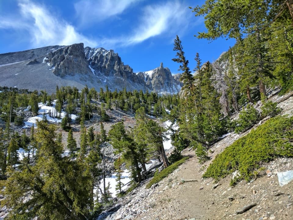
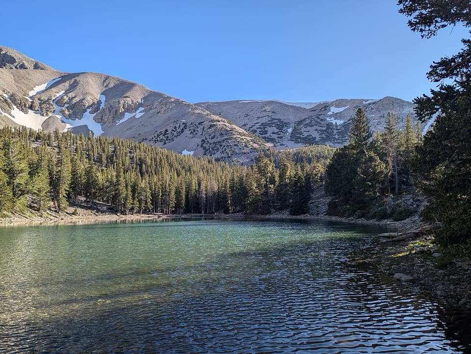
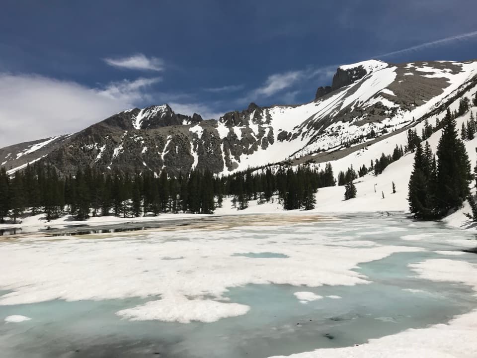
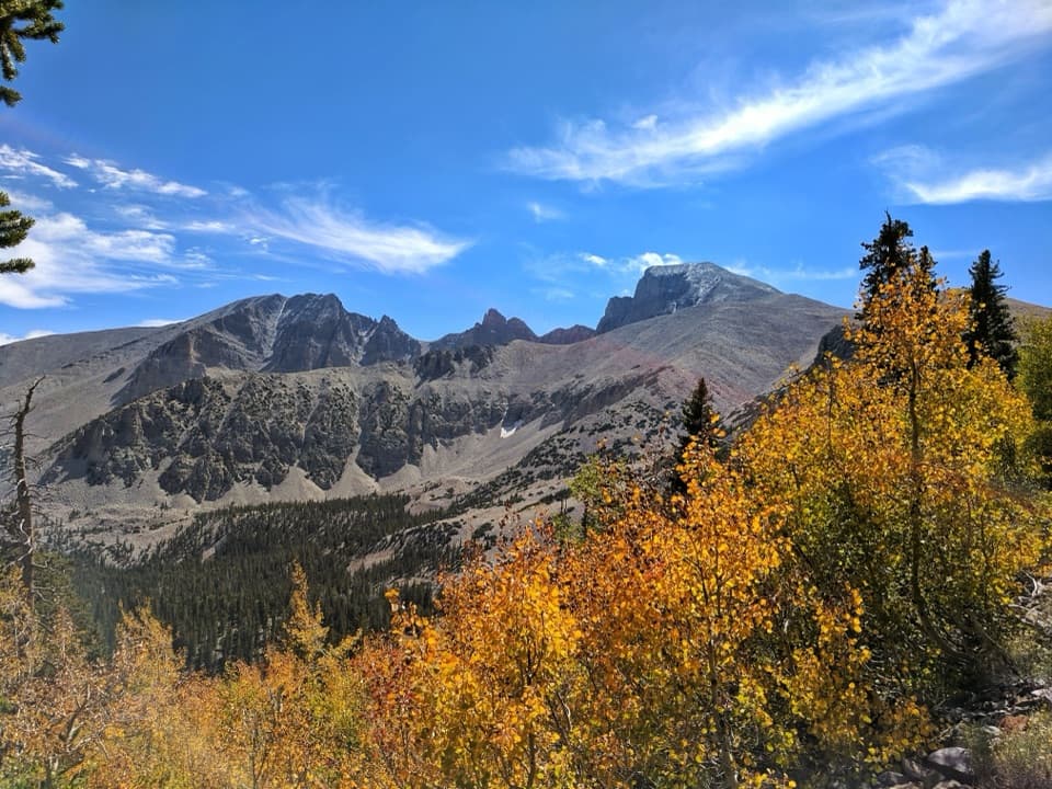
Baker Lake in Great Basin National Park

Sight · Great Basin National Park

Baker Lake

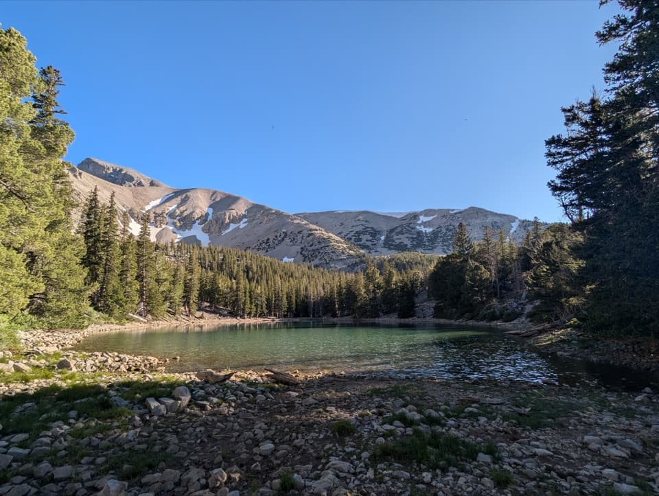
A high cirque lake at the end of a strenuous full-day climb.

Photo: National Park Service
Type
Sight
Nearest trail
3.6 mi
  • Trailhead
  • Parking
  • Restrooms

Hear the audio tour

Baker Creek Trailhead: Lake or Meadow Loop

Overview

About Baker Lake

Why stop

  • A high alpine lake in a distinctive glacial basin.

Heads up

  • A strenuous, time-consuming hike with snow often lingering at the shore.

Map

Where it is

Loading the Great Basin map
Full map
SightBaker Lake38.95754, -114.30959
Keep this map with you offline in the Parkwolf app

Plan your stop

Before you go

3 active Great Basin alerts

  • ClosureWheeler Peak Scenic Drive closed at Mather OverlookWheeler Peak Scenic Drive is closed at Mather Overlook because of incoming inclement weather and the seasonal winter closure. Check current park road conditions before traveling.Official details
  • CautionNo potable water in park campgroundsNo water is available in any Great Basin National Park campground; bring drinking water for camping.Official details

See all 3 alerts
A park ranger sits on a dash-mounted phone, talking, as Parkwolf’s Tour Guide plays “Army Cutworm Moths: A Grizzly Bear Buffet” on Grand Loop Road below Dunraven Pass in Yellowstone
Parkwolf Tour GuideThe highest, rockiest slopes around here are a summer buffet for grizzly bears.

Great Basin Tour Guide

Your drive to Baker Lake, narrated.

Parkwolf is a GPS audio tour guide for Great Basin National Park. As you drive, it chimes in with what’s ahead: hidden gems, upcoming stops, history, geology, and wildlife, right through your car’s speakers.

See the Great Basin audio tour

Recorded for this place

Baker Creek Trailhead: Lake or Meadow Loop
0:00 / 0:26
“You're nearing Baker Creek Trailhead, the start of the long climb to Baker Lake. The lake sits in a rocky bowl beneath Baker and Pyramid peaks, with snow often lingering along the shore.”

Plays as you drive up to Baker Lake in the Parkwolf Great Basin Tour Guide.

More stories near here in the app

  • Bristlecone Trailhead: The Grove Walk
  • Baker Creek Campground: Choose Your Setting
  • Snake Creek: Johnson Lake and the Old Mine
  • Wheeler Peak Summit Trailhead: A Full Hiking Day
  • 36 audio storiesacross Great Basin’s roads, triggered by GPS as you drive
  • Wildlife heatmapsfor Elk, Mule Deer, Wild Turkey, and 13 more
  • Works offlinemaps, 29 trails, 29 places, and audio download before you lose signal
  • CarPlay readysimple controls built for the drive
★★★★★
“Fantastic app with many points of information… It’s great to just turn on while you’re driving and it gives you an audio tour of the national Park. We love it!!!!”
JMJamesApp Store review
Download Parkwolf on the App StoreGet Parkwolf on Google Play

4.7 from 8,600+ ratings

Guide

More about Baker Lake

A high lake with a long approachBaker Lake is one of Great Basin's largest mountain lakes, at about 10,620 feet in a glacial…

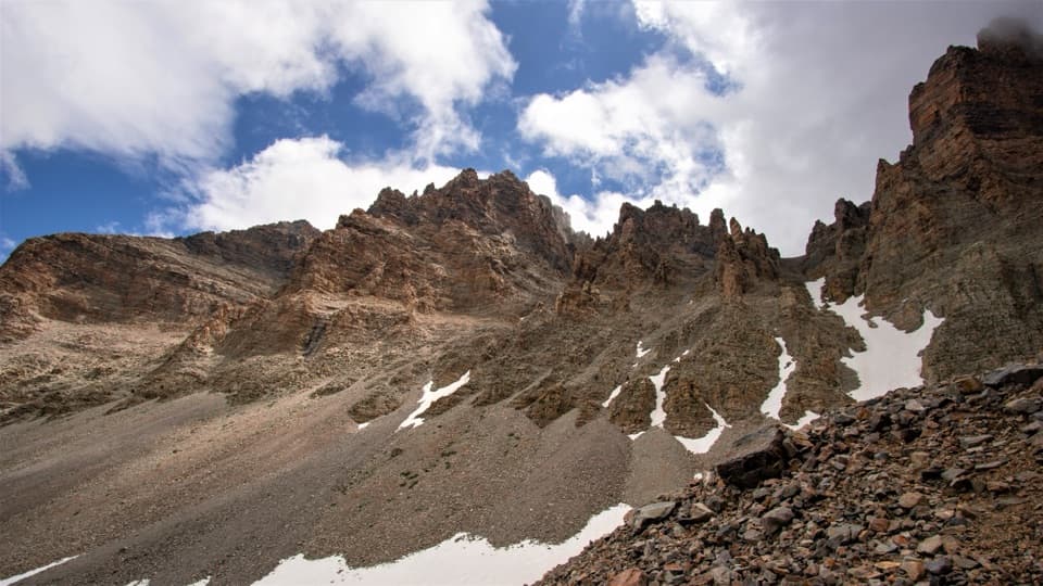
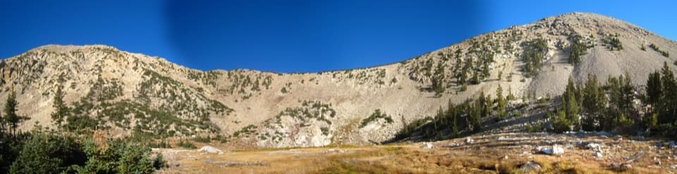
Baker Lake is one of Great Basin's largest mountain lakes, at about 10,620 feet in a glacial cirque at the head of Baker Creek. Conifers, steep talus and rocky peaks frame the water, and snow often lingers along the shore. The payoff is a quiet alpine basin; the cost is a strenuous full-day hike, not a quick stop off the scenic drive.

Budget the climbThe route starts at Baker Creek Trailhead and climbs from about 8,020 feet.

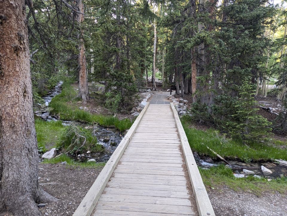
The route starts at Baker Creek Trailhead and climbs from about 8,020 feet. The posted round trip is 10.4 miles with 2,610 feet of gain and a 5-to-10-hour estimate. Other track measurements run longer, so leave a generous day. The trail climbs through sagebrush, aspen and pine before the lake opens beyond the trees; switchbacks soften the grade but do not make this an easy walk. The rocky route is not accessible.

A lake shaped by snowBaker and Johnson Lakes sit in glacial cirques.

Baker and Johnson Lakes sit in glacial cirques. Baker's water level rises with spring snowmelt and usually falls through late summer and fall, so the shoreline can change with the year's snowpack. Look for the contrast between the forested shore and broad scree slopes around the bowl.

Native trout returnIntroduced trout were removed in a 2021 treatment, and native Bonneville Cutthroat Trout were…

Introduced trout were removed in a 2021 treatment, and native Bonneville Cutthroat Trout were reintroduced. Native Bonneville Cutthroat Trout were reintroduced by 2024. Before the work, researchers mapped the lake floor and checked fish habitat; hauling equipment into this remote basin was part of the effort to protect a native fish in cold, high-country water.

Plan the trailhead and waterDrive gravel Baker Creek Road to Baker Creek Trailhead.

Drive gravel Baker Creek Road to Baker Creek Trailhead. The road can close intermittently in winter and spring. Designated parking and a pit toilet are at the trailhead, but there is no potable water along Baker Creek Road; fill up before turning onto it and carry enough for a long climb. Pets are not allowed on park trails. Overnight stays along the Baker/Johnson Creek Loop require a free backcountry permit from a visitor center.

Frame the cirqueAt the shore, include the water with the rocky cirque and conifers rather than filling the…

At the shore, include the water with the rocky cirque and conifers rather than filling the frame with lake surface; that gives the small lake its scale. Snow patches on the talus are a common part of the scene, though their amount and the visible shoreline shift with the year's snowpack.

Wildlife

Wildlife in Great Basin

All Great Basin wildlife maps

Sighting maps show where each species has been reported across Great Basin. Wildlife moves, so no sighting is guaranteed.

Keep exploring

Near Baker Lake

See it all on the map

Trails nearby

More stops nearby

Parkwolf’s Great Basin ranking

Top sights in Great Basin

All 29 places
  1. 1Lehman CavesSight
  2. 2Wheeler Peak Bristlecone GroveSight
  3. 3Wheeler PeakSight
  4. 4Mather OverlookSight
  5. 5Wheeler Peak OverlookSight
  6. 6Astronomy AmphitheaterSight

Take Parkwolf to Great Basin.

The audio tour guide for the drive, plus offline maps, trails, and wildlife heatmaps for when the signal drops.

4.7 from 8,600+ ratings

Download Parkwolf on the App StoreGet Parkwolf on Google Play