Milanesia Gate to Moonlight Head Walk in Great Ocean Road

Great Ocean Road, VIC

Milanesia Gate to Moonlight Head Walk

A rugged coast walk where the tide decides whether you can start.

Photo: Wikimedia Commons
Length
11.9km
Time
5hr
Elev. change
152m
Difficulty
Challenging
  • No dogs
  • High point 173 m
  • #41 of 109 in Great Ocean Road

Hear the audio tour

Why a Fantail Follows You

Overview

About Milanesia Gate to Moonlight Head Walk

Why go

  • A wild beach crossing and long views over the Southern Ocean
  • A varied one-way walk from beach to forested clifftops

Heads up

  • The creek and beach crossing depends on tide and sea conditions
  • One-way transport and uncertain gate parking need planning
Milanesia Gate to Moonlight Head is an 11.9 km (7.4 mi) one-way section of the Great Ocean Walk, from the Milanesia Beach Access Gate to the Moonlight Head car park. Allow about five hours. It is not a level coastal stroll: you descend to the beach, wade the mouth of Milanesia Creek, cross sand beneath cliffs, climb a long flight of wooden stairs, then follow a rolling route through coastal forest and over clifftops toward Ryans Den. The isolation and changing ocean views are the reward; the tide-dependent start makes it a poor choice for a rigid schedule. Arrange a ride at both ends before setting out.
Parkwolf’s verdictIs this the walk for you?

Map & elevation

The route

Loading the Great Ocean Road map
Full map
Elevation21–173 m
TrailheadMilanesia Beach Access Gate-38.74384, 143.32328
Keep this map with you offline in the Parkwolf app

Plan your hike

Before you go

Parking

This is a one-way walk from Milanesia Beach Access Gate to the Moonlight Head car park. Arrange a drop-off, pickup or shuttle. Confirm visitor parking and vehicle access at the gate before leaving a car; the setup there is not clear from available information.

Safety

The 300 m Milanesia beach section and creek mouth can be cut off by high tide, rough swell or high creek water. Attempt the crossing only at low tide, in calm sea and low-water conditions; be prepared to wait or turn back. The rough descent can be slippery after rain, and the track is steep and undulating. Phone coverage is intermittent.

7 active Great Ocean Road alerts

  • ClosureLorne-area walking trails closed after flood and storm damageSeveral walking trails near Lorne remain closed; do not enter closed tracks. - Phantom Falls Walk is temporarily closed because flood and storm damage affected the trail and structures.Official details
  • ClosureWye Road closed after storm and flood damageWye Road is closed until further notice for road maintenance and repairs following storm and flood damage; do not use the road. Check current Great Otway National Park conditions before travelling.Official details
See all 7 alerts
A park ranger sits on a dash-mounted phone, talking, as Parkwolf’s Tour Guide plays “Army Cutworm Moths: A Grizzly Bear Buffet” on Grand Loop Road below Dunraven Pass in Yellowstone
Parkwolf Tour GuideThe highest, rockiest slopes around here are a summer buffet for grizzly bears.

Great Ocean Road Tour Guide

Your drive to Milanesia Gate to Moonlight Head Walk, narrated.

Parkwolf is a GPS audio tour guide for Great Ocean Road. As you drive, it chimes in with what’s ahead: hidden gems, upcoming stops, history, geology, and wildlife, right through your car’s speakers.

See the Great Ocean Road audio tour

Recorded for this area

Why a Fantail Follows You
0:00 / 0:28
“If a little grey bird follows you along a forest path, it may be after the insects your footsteps disturb. Grey fantails often do this, darting out to catch prey in mid-air.”

Plays on the road 1.8 km from the trailhead in the Parkwolf Great Ocean Road Tour Guide.

More stories near here in the app

  • An Ash Forest’s Restart
  • The Ingredients of Sea Foam
  • Blanket Leaf's Woolly Underside
  • How the Otways Catch Rain
  • 181 audio storiesacross Great Ocean Road’s roads, triggered by GPS as you drive
  • Wildlife heatmapsfor Koala, Kangaroo, Little Penguin, and 13 more
  • Works offlinemaps, 109 trails, 99 places, and audio download before you lose signal
  • CarPlay readysimple controls built for the drive
★★★★★
“Fantastic app with many points of information… It’s great to just turn on while you’re driving and it gives you an audio tour of the national Park. We love it!!!!”
JMJamesApp Store review
Download Parkwolf on the App StoreGet Parkwolf on Google Play

4.7 from 8,600+ ratings

Trail guide

Hiking Milanesia Gate to Moonlight Head Walk

The tide decides the startFrom the gate, a rough track drops through bush to Milanesia Beach and can be slippery after…

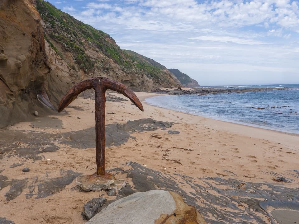
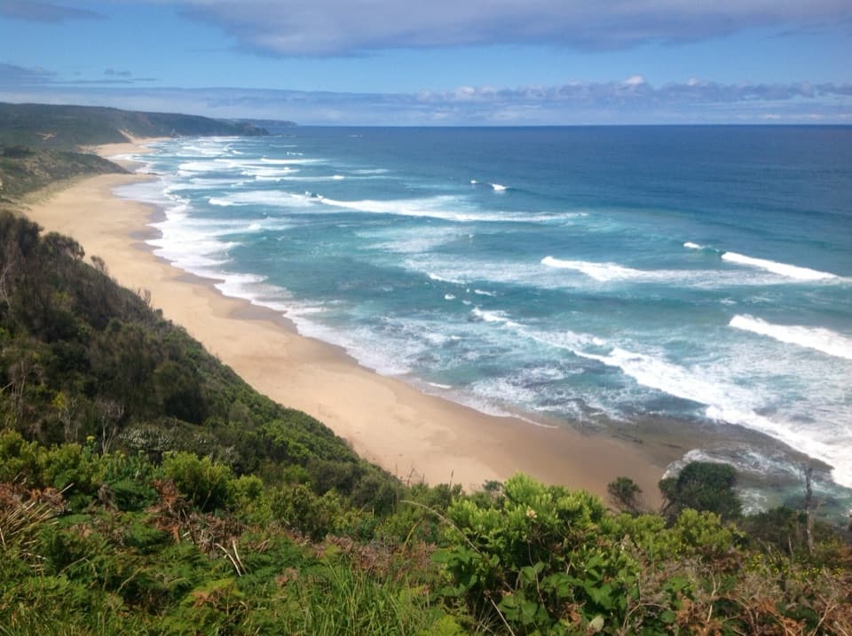
From the gate, a rough track drops through bush to Milanesia Beach and can be slippery after rain. The beach crossing is about 300 m beneath a cliff line, and the creek mouth must be waded. This section can become unsafe or impassable with a high tide, rough swell, or high creek water. Use local tide times, go only with a low tide, calm sea and low water, and be ready to wait or turn back if conditions change. The cliffs leave no easy bypass. For a photo of Milanesia's curve and the coastal cliffs, stay on safe high ground above the beach rather than lingering beneath the cliff line.

Climbing to Ryans DenAfter the sand, a long wooden stairway climbs to the clifftops.

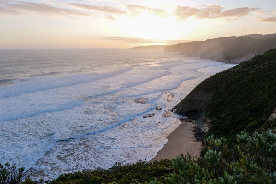
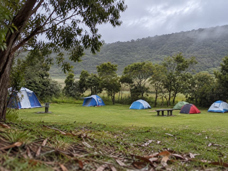
After the sand, a long wooden stairway climbs to the clifftops. The route then keeps rising and dipping through coastal forest and along high sea cliffs, so expect repeated climbs rather than a flat coast path. Ryans Den is a remote hike-in campsite on a ridge and a natural midpoint. Its outlook opens across the Southern Ocean; on a clear day, the view can reach back toward Cape Otway Lightstation. Treat the camp as a rest point, not a supply stop: carry your own food and enough water for the full walk.

The final clifftopsWest of Ryans Den, the Great Ocean Walk continues across Cape Volney and more forested…

West of Ryans Den, the Great Ocean Walk continues across Cape Volney and more forested clifftops to Moonlight Head. The repeated ups and downs make the distance feel longer than a flat beach walk, but the scenery shifts between sheltered forest and open coast. Moonlight Head is the finish of this mapped section. The Gables is a separate nearby lookout, not an extension to add to the route unless you deliberately plan an extra stop.

Why distances differSome descriptions measure about 10.

Some descriptions measure about 10.4 km from Milanesia Creek on the beach, which omits the descent from the gate. A gate-based itinerary gives 12.5 km, while the continuous mapped line from the gate to the Moonlight Head access measures 11.9 km (7.4 mi). The difference reflects start points and rounded route measurements, not an extra loop. All three figures describe a one-way walk.

Plan for a one-way walkA return by foot would be about 24 km and require the beach crossing twice, so arrange a…

A return by foot would be about 24 km and require the beach crossing twice, so arrange a drop-off, pickup or shuttle. Confirm vehicle access and parking at the Milanesia gate before leaving a car; the parking setup at the gate is not clear from the available information. There is no dependable food or water resupply on this remote section, phone coverage is intermittent, and dogs are not permitted in the national park.

Wildlife

Wildlife in Great Ocean Road

All Great Ocean Road wildlife maps

Sighting maps show where each species has been reported across Great Ocean Road. Wildlife moves, so no sighting is guaranteed.

Keep exploring

Near Milanesia Gate to Moonlight Head Walk

See it all on the map

Trails that start nearby

Places near the trailhead

Parkwolf’s Great Ocean Road ranking

Top-rated trails in Great Ocean Road

All 109 trails
  1. 1Great Ocean WalkChallenging · 100 km
  2. 2Maits Rest Rainforest WalkEasy · 0.8 km
  3. 3Triplet Falls WalkModerate · 2 km
  4. 4Hopetoun Falls WalkModerate · 0.8 km
  5. 5Erskine Falls WalkModerate · 0.7 km
  6. 6Surf Coast WalkChallenging · 41.5 km

Take Parkwolf to Great Ocean Road.

The audio tour guide for the drive, plus offline maps, trails, and wildlife heatmaps for when the signal drops.

4.7 from 8,600+ ratings

Download Parkwolf on the App StoreGet Parkwolf on Google Play