Grapeyard Ridge Trail in Great Smoky Mountains National Park

Great Smoky Mountains National Park, TN · NC

Grapeyard Ridge Trail

Five creek crossings and a rusting engine tucked in the woods.

Length
7.5mi
Time
5.5hr
Elev. change
1,211ft
Difficulty
Moderate
  • No dogs
  • High point 3,009 ft
  • #77 of 197 in Great Smoky Mountains

Hear the audio tour

Grapeyard Ridge Trailhead

Overview

About Grapeyard Ridge Trail

Why go

  • The steam-engine wreck is a distinctive historic stop on the route.
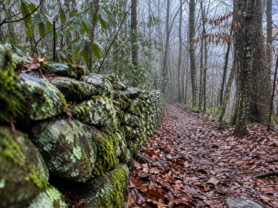
  • Five Rhododendron Creek crossings and rhododendron tunnels give the walk a clear sense of place.

Heads up

  • Five unbridged creek crossings can be difficult after rain.
  • The full point-to-point route needs a vehicle shuttle and confirmed end parking.

Map & elevation

The route

Loading the Great Smoky Mountains map
Full map
Elevation1,798–3,009 ft
TrailheadGrapeyard Ridge Trailhead (Greenbrier Road)35.70764, -83.38281
Keep this map with you offline in the Parkwolf app

Plan your hike

Before you go

Parking

Start at the small roadside Grapeyard Ridge Trailhead parking area on Greenbrier Road, just before the bridge toward the Ramsey Cascades and Porters Creek trailheads. The road becomes gravel after turning into Greenbrier. A parking tag is required for vehicles parked more than 15 minutes. The through-hike ends on the one-way Roaring Fork Motor Nature Trail; arrange a second vehicle and confirm a legal place to leave it at that end.

Safety

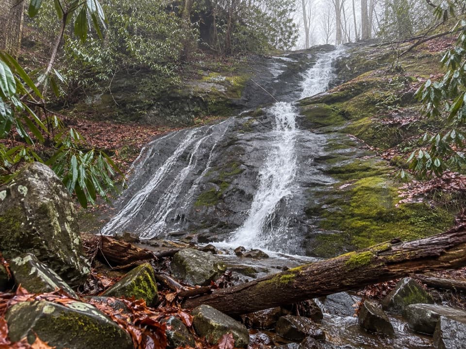
Rhododendron Creek crosses the trail five times without footbridges. After rain, water can rise and rocks or logs can be slippery; do not attempt a crossing that is unsafe.

7 active Great Smoky Mountains alerts

  • ClosureHurricane Helene trail damage and backcountry restrictionsHurricane Helene damage has restricted backcountry trail access; avoid damaged crossings and observe trail-specific limits.Official details
  • CautionBear-related trail, campsite, and road restrictionsBear activity has closed trails, a shelter, and campsites and restricted pedestrian access on Cherokee Orchard Road; stay out of closed areas and follow vehicle-only rules.Official details
See all 7 alerts
A park ranger sits on a dash-mounted phone, talking, as Parkwolf’s Tour Guide plays “Army Cutworm Moths: A Grizzly Bear Buffet” on Grand Loop Road below Dunraven Pass in Yellowstone
Parkwolf Tour GuideThe highest, rockiest slopes around here are a summer buffet for grizzly bears.

Great Smoky Mountains Tour Guide

Your drive to Grapeyard Ridge Trail, narrated.

Parkwolf is a GPS audio tour guide for Great Smoky Mountains National Park. As you drive, it chimes in with what’s ahead: hidden gems, upcoming stops, history, geology, and wildlife, right through your car’s speakers.

See the Great Smoky Mountains audio tour

Recorded for this trailhead

Grapeyard Ridge Trailhead
0:00 / 0:25
“Grapeyard Ridge Trailhead is ahead, for a roughly six-mile return hike to a steam-engine wreck.”

Plays as you drive up to this trailhead in the Parkwolf Great Smoky Mountains Tour Guide.

More stories near here in the app

  • Greenbrier Picnic Area
  • Porters Creek and Fern Branch Falls
  • Ramsey Cascades Trailhead
  • Water Written in Quartz
  • 200 audio storiesacross Great Smoky Mountains’s roads, triggered by GPS as you drive
  • Wildlife heatmapsfor Black Bear, Elk, Bald Eagle, and 13 more
  • Works offlinemaps, 197 trails, 137 places, and audio download before you lose signal
  • CarPlay readysimple controls built for the drive
★★★★★
“Fantastic app with many points of information… It’s great to just turn on while you’re driving and it gives you an audio tour of the national Park. We love it!!!!”
JMJamesApp Store review
Download Parkwolf on the App StoreGet Parkwolf on Google Play

4.7 from 8,600+ ratings

Trail guide

Hiking Grapeyard Ridge Trail

The through-hikeGrapeyard Ridge Trail is a 7.

Grapeyard Ridge Trail is a 7.5-mile point-to-point hike from Greenbrier Road west to the Roaring Fork Motor Nature Trail. It drops into Rhododendron Creek, climbs to the ridge, reaches the old engine wreck in Injun Creek, then continues to the road. Allow about 5½ hours of hiking, plus time for the shuttle. The full route needs two vehicles; Roaring Fork is one-way, so confirm where you can legally leave a car at the western end before setting out. If you have one vehicle, the shorter choice is to hike to the wreck and back for about 5.8–6 miles round-trip. A parking tag is required if your vehicle stays in the park more than 15 minutes.

A climb, then five creek crossingsThe trail climbs about 270 feet in its first two-thirds of a mile, then drops toward…

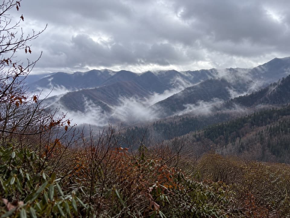
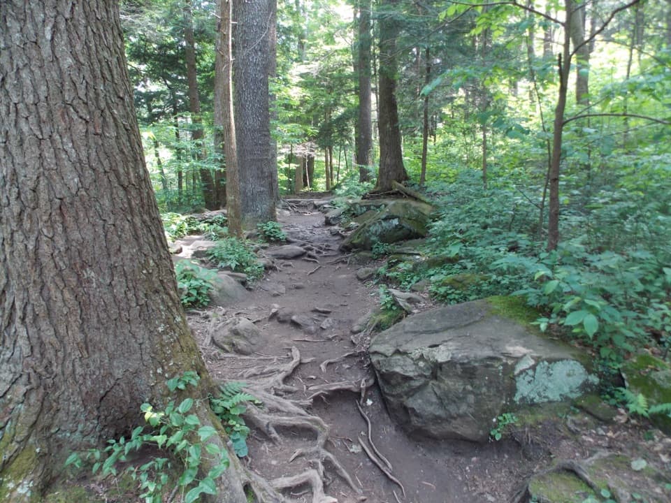
The trail climbs about 270 feet in its first two-thirds of a mile, then drops toward Rhododendron Creek. In leaf-off months, the climb opens views toward Mount Chapman, Mount Sequoia, Charlies Bunion, and Mount LeConte; foliage hides much of that skyline later in the year. The tread crosses the creek five times in roughly 1.2 miles, with no footbridges. After rain, water can be high and the rocks or logs used to cross can be slippery, so be ready to turn back if the crossings are unsafe.

The engine in Injun CreekAt about 2.

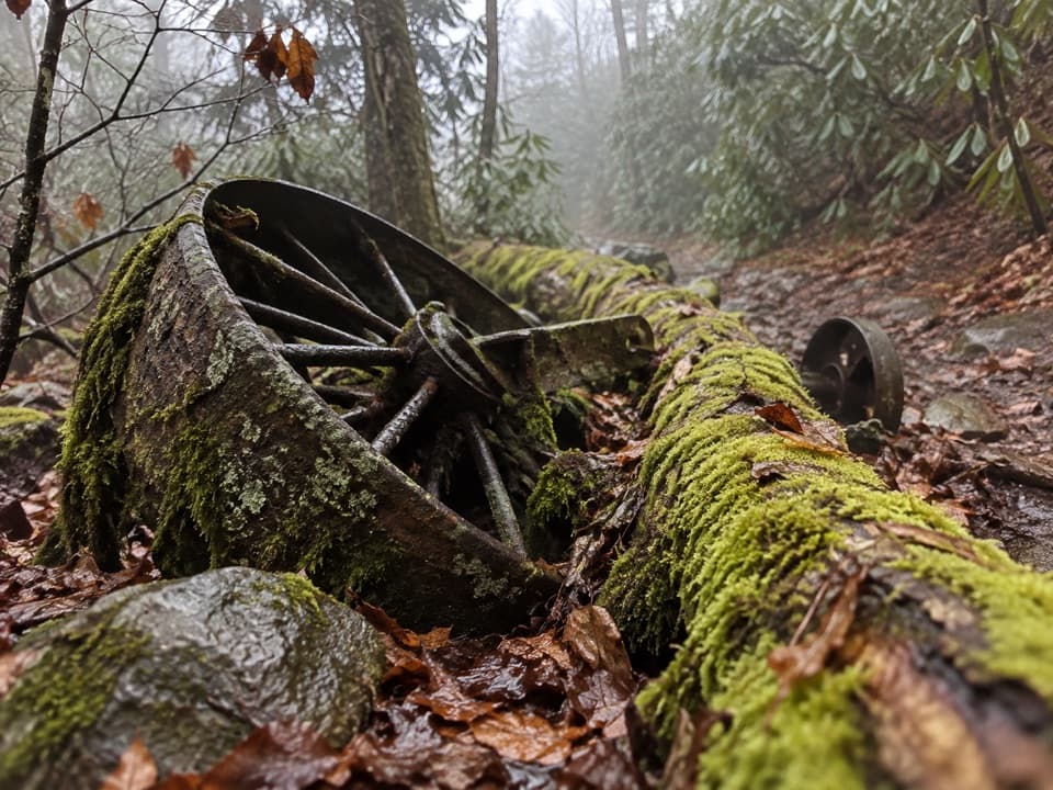
At about 2.1 miles, the route leaves Rhododendron Creek and climbs through rhododendron tunnels to James Gap, around mile 2.85. It then descends to Injun Creek, where the remains of a Nichols & Shepard steam traction engine lie in the creek. The machine came here in the 1920s to saw lumber for Greenbrier School. On its return trip, it overturned at a switchback and fell into the creek; some parts were salvaged, while the rest stayed behind. This is the main historic stop and a natural turnaround for the shorter hike.

The valley before the trailThe creek valley holds old homestead sites from the Big Laurel community.

The creek valley holds old homestead sites from the Big Laurel community. William and Middleton Whaley arrived around 1800, and the stream now called Rhododendron Creek was once known as Laurel Creek. The route follows this settled valley before climbing onto the ridge.

Continue west to Roaring ForkFor the full one-way hike, continue past the engine to the trail's western end at the Roaring…

For the full one-way hike, continue past the engine to the trail's western end at the Roaring Fork Motor Nature Trail. That extra section is what turns the popular engine walk into a through-hike; plan the vehicle pickup before you start.

Wildlife

Wildlife in Great Smoky Mountains

All Great Smoky Mountains wildlife maps

Sighting maps show where each species has been reported across Great Smoky Mountains. Wildlife moves, so no sighting is guaranteed.

Keep exploring

Near Grapeyard Ridge Trail

See it all on the map

Trails that start nearby

Places near the trailhead

Parkwolf’s Great Smoky Mountains ranking

Top-rated trails in Great Smoky Mountains

All 197 trails
  1. 1Mount Le Conte via Alum Cave TrailChallenging · 10 mi
  2. 2Charlies Bunion via Appalachian TrailModerate · 8 mi
  3. 3Alum Cave Trail to Alum Cave BluffsModerate · 4.6 mi
  4. 4Ramsey Cascades TrailChallenging · 8 mi
  5. 5Mount Cammerer TrailChallenging · 11.1 mi
  6. 6Gregory Ridge TrailChallenging · 11.4 mi

Take Parkwolf to Great Smoky Mountains.

The audio tour guide for the drive, plus offline maps, trails, and wildlife heatmaps for when the signal drops.

4.7 from 8,600+ ratings

Download Parkwolf on the App StoreGet Parkwolf on Google Play