Bush Mountain–Blue Ridge Loop in Guadalupe Mountains National Park

Guadalupe Mountains National Park, TX

Bush Mountain–Blue Ridge Loop

A full-day ridge loop crosses Texas’s second-highest summit.

Photo: Wikimedia Commons
Length
16.2mi
Time
10.5hr
Elev. change
2,513ft
Difficulty
Challenging
  • Loop
  • No dogs
  • High point 8,376 ft

Hear the audio tour

Pine Springs: The Guadalupe Peak Climb

Overview

About Bush Mountain–Blue Ridge Loop

Why go

  • Crosses Texas’s second-highest peak and the Blue Ridge crest
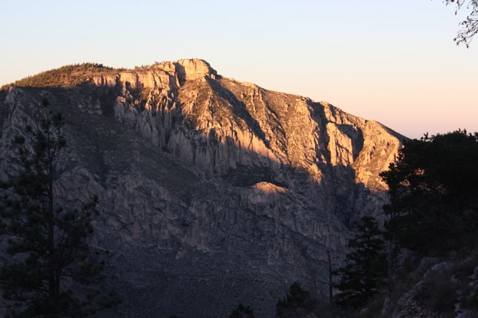
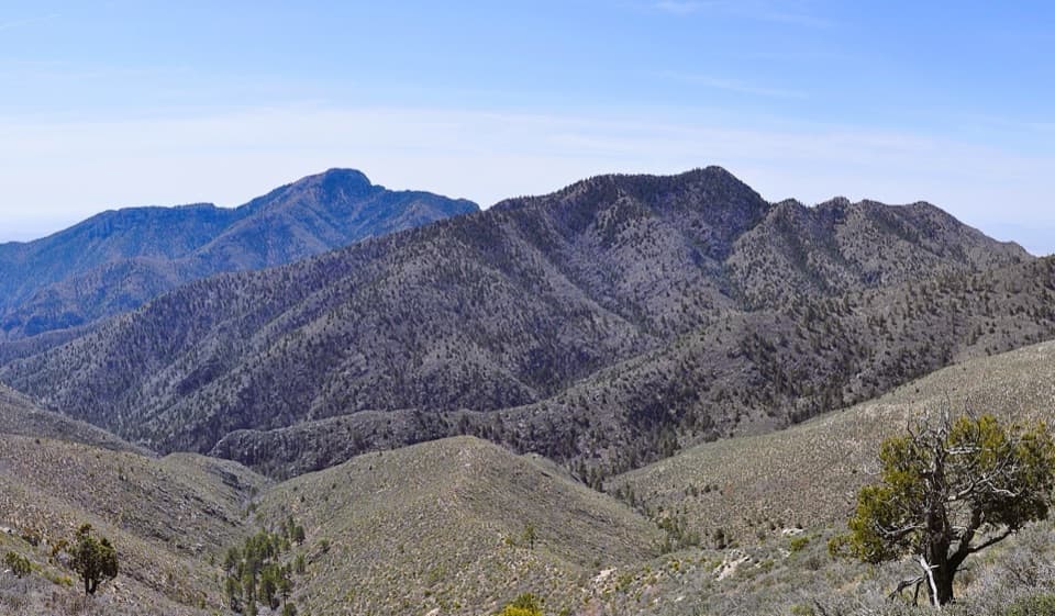
  • High-country woodland and a dramatic western escarpment view

Heads up

  • A hard full day with the Pine Springs approach walked twice
  • No water source along the route
The Bush Mountain–Blue Ridge Loop is a 16.2-mile circuit from Pine Springs over the summit of Bush Mountain, back by Blue Ridge and Tejas. It climbs north on Tejas to Pine Top, crosses the high ridge on Bush Mountain Trail, then turns east on Blue Ridge and returns to Pine Springs on Tejas. The 3.7-mile Pine Springs–Pine Top approach is walked twice, so the total includes that shared ground on the way up and down. Published estimates for this loop range from about 15.9 to 17 miles; the map here follows the connected trails and measures 16.2. Plan on 10 to 12 hours with breaks. This is a hard, remote, full-day hike for people who want the climb as much as the views.
Parkwolf’s verdictIs this the full-day loop for you?

Map & elevation

The route

Loading the Guadalupe Mountains map
Full map
Elevation5,863–8,376 ft
TrailheadPine Springs Trailhead31.89641, -104.82787
Keep this map with you offline in the Parkwolf app

Plan your hike

Before you go

Parking

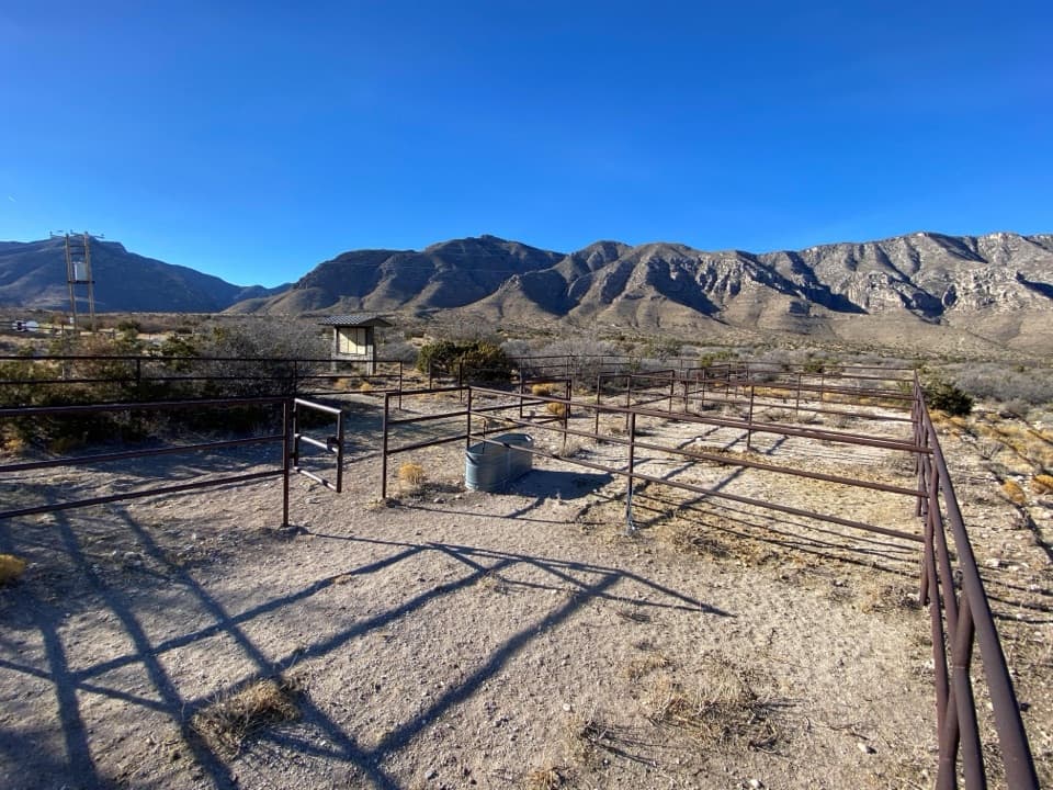
Start at Pine Springs Trailhead at the end of Pine Springs Access Road, beside the campground. The trailhead has flush restrooms and picnic tables and often fills first on busy weekends. The visitor-center parking area connects through the campground if you need the alternate lot.


Safety

A remote, strenuous wilderness loop with sustained climbing and no water source; carry all water and a detailed topographic map. Day-hiking groups larger than 20 need a special use permit. Overnight wilderness camping requires a backcountry permit.

1 active Guadalupe Mountains alert

  • CautionDevil’s Hall wash dangerous when wetThe Devil’s Hall hike is strenuous, and its wash section is dangerous when wet or if water is present. - The wash requires rock scrambling.Official details
Guadalupe Mountains alerts
A park ranger sits on a dash-mounted phone, talking, as Parkwolf’s Tour Guide plays “Army Cutworm Moths: A Grizzly Bear Buffet” on Grand Loop Road below Dunraven Pass in Yellowstone
Parkwolf Tour GuideThe highest, rockiest slopes around here are a summer buffet for grizzly bears.

Guadalupe Mountains Tour Guide

Your drive to Bush Mountain–Blue Ridge Loop, narrated.

Parkwolf is a GPS audio tour guide for Guadalupe Mountains National Park. As you drive, it chimes in with what’s ahead: hidden gems, upcoming stops, history, geology, and wildlife, right through your car’s speakers.

Recorded for this area

Pine Springs: The Guadalupe Peak Climb
0:00 / 0:24
“You're nearing Pine Springs Trailhead, where the climb to Guadalupe Peak begins.”

Plays on the road 0.2 mi from the trailhead in the Parkwolf Guadalupe Mountains Tour Guide.

More stories near here in the app

  • Pine Springs Visitor Center and the Pinery
  • The Tree with Alligator Bark
  • Why an Airline Marked the Summit
  • Frijole Ranch: An Orchard Fed by Springs
  • 22 audio storiesacross Guadalupe Mountains’s roads, triggered by GPS as you drive
  • Wildlife heatmapsfor Aoudad, Mule Deer, Wild Turkey, and 13 more
  • Works offlinemaps, 32 trails, 34 places, and audio download before you lose signal
  • CarPlay readysimple controls built for the drive
★★★★★
“Fantastic app with many points of information… It’s great to just turn on while you’re driving and it gives you an audio tour of the national Park. We love it!!!!”
JMJamesApp Store review
Download Parkwolf on the App StoreGet Parkwolf on Google Play

4.7 from 8,600+ ratings

Trail guide

Hiking Bush Mountain–Blue Ridge Loop

Climb out of Pine SpringsTejas leaves the trailhead and steadily climbs out of Pine Springs Canyon for about 3.

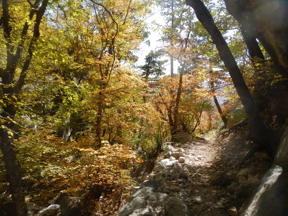
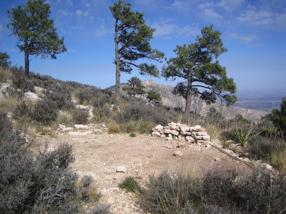
Tejas leaves the trailhead and steadily climbs out of Pine Springs Canyon for about 3.7 miles to Pine Top. This is not a gentle warm-up: you gain the high country early, and the way back down is the same trail. Above the canyon, the scenery shifts toward a cooler-looking mix of pine, oak, juniper and Douglas fir. At Pine Top, turn onto Bush Mountain Trail for the southern loop; continuing north on Tejas heads toward other high-country routes.

Cross Bush MountainBush Mountain Trail crosses the summit at 8,631 feet, the second-highest peak in Texas.

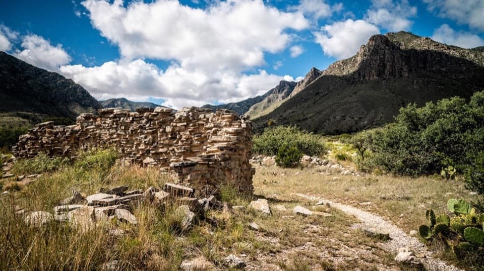
Bush Mountain Trail crosses the summit at 8,631 feet, the second-highest peak in Texas. The Bush Mountain Wilderness Campground sits just below the summit, a useful landmark on this remote stretch, not a water stop. The trail works across high ridges and woodland before meeting Blue Ridge in a grassy meadow by the western escarpment. Take the junction east onto Blue Ridge here; following Bush Mountain Trail north beyond it is a different route toward Dog Canyon.

Take Blue Ridge back eastBlue Ridge connects Bush Mountain Trail to Tejas in about two miles.

Blue Ridge connects Bush Mountain Trail to Tejas in about two miles. It climbs steeply toward its crest when walked westbound, then levels near Blue Ridge Campground; on this loop you're heading east, so the crest comes first and the steeper descent follows. The west-side meadow is the route's big open payoff, with the cliffs and broad country below the escarpment. Give yourself a pause there, and include some of the ridge in a photo so the view has scale.

Return on TejasAt the eastern Blue Ridge junction, turn south on Tejas. It's about 2.

At the eastern Blue Ridge junction, turn south on Tejas. It's about 2.6 miles back to Pine Top through high-country woods and drainages, then 3.7 miles down the same approach to Pine Springs. Keep an eye on the junctions and carry a detailed topographic map; this is designated wilderness, and the National Park Service says detailed maps are a must for planning here. Treat it as a full-day commitment and leave enough daylight for the climb, junctions and breaks.

Bring your own supportThere is no water source along this itinerary, so carry everything you'll need for the full day.

There is no water source along this itinerary, so carry everything you'll need for the full day. The trailhead has flush restrooms and picnic tables, but there is no food service on the loop. Pets aren't allowed on this route. Day-hiking groups larger than 20 need a special use permit, and overnight wilderness camping requires a backcountry permit. Pine Springs Trailhead is at the end of Pine Springs Access Road beside the campground; its area often fills first on busy weekends, and the visitor-center lot connects back through the campground if you need the alternate parking area.

Why the high country is differentThis ridge is a striking change from the desert below.

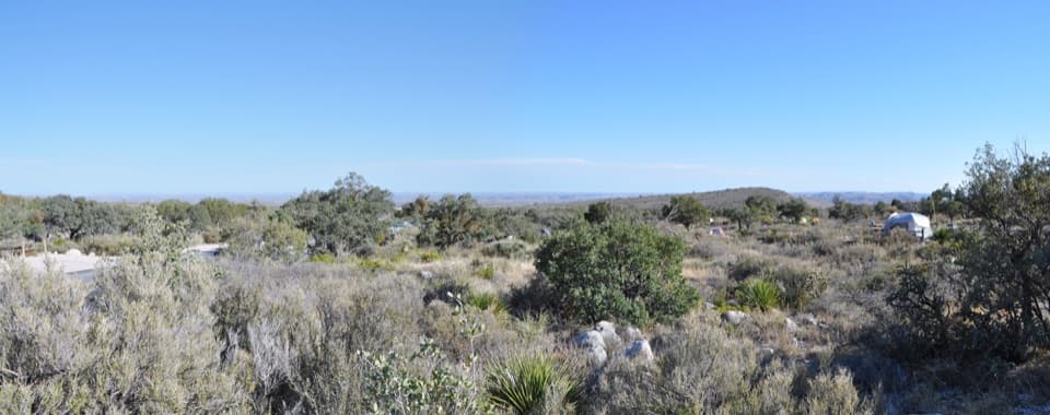
This ridge is a striking change from the desert below. The Guadalupe Mountains formed as an ancient reef, and the higher, cooler slopes hold a mix of conifers and oaks that feels far from the dry country around Pine Springs. The loop gives you that transition twice: first as Tejas climbs into the woods, then from above as the Blue Ridge escarpment opens onto the park's western side.

Wildlife

Wildlife in Guadalupe Mountains

All Guadalupe Mountains wildlife maps

Sighting maps show where each species has been reported across Guadalupe Mountains. Wildlife moves, so no sighting is guaranteed.

Keep exploring

Near Bush Mountain–Blue Ridge Loop

See it all on the map

Trails that start nearby

Places near the trailhead

Parkwolf’s Guadalupe Mountains ranking

Top-rated trails in Guadalupe Mountains

All 32 trails
  1. 1Guadalupe Peak TrailChallenging · 8.4 mi
  2. 2The Grotto and Hunter Line ShackModerate · 7 mi
  3. 3McKittrick Canyon Trail to The NotchChallenging · 9 mi
  4. 4Hunter Peak LoopChallenging · 8.7 mi
  5. 5Devil's Hall TrailChallenging · 4.2 mi
  6. 6Smith Spring Trail LoopModerate · 2.3 mi

Take Parkwolf to Guadalupe Mountains.

The audio tour guide for the drive, plus offline maps, trails, and wildlife heatmaps for when the signal drops.

4.7 from 8,600+ ratings

Download Parkwolf on the App StoreGet Parkwolf on Google Play