Supply Trail in Haleakalā National Park

Haleakalā National Park, HI

Supply Trail

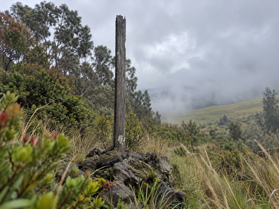
A steady shrubland climb to the Halemauʻu Trail junction

Photo: Wikimedia Commons
Length
4.6mi
Time
2.8hr
Elev. change
951ft
Difficulty
Moderate
  • No dogs
  • High point 7,726 ft

Hear the audio tour

Hosmer Grove

Overview

About Supply Trail

Why go

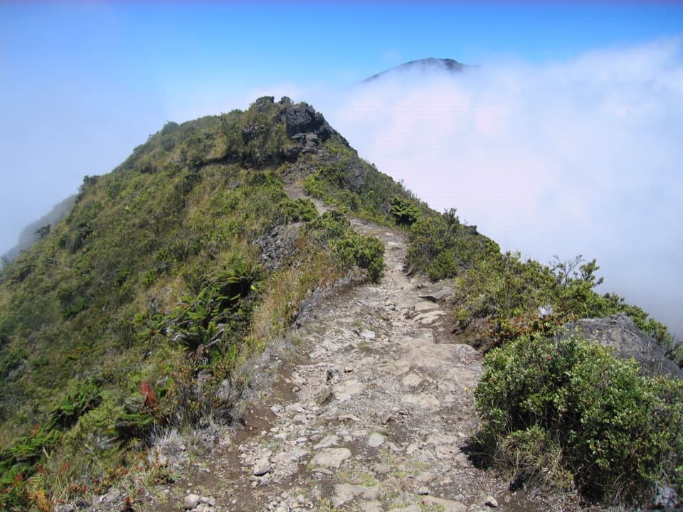
  • A gradual climb through native high-elevation shrubland
  • The rain catchment gives the route a useful midpoint landmark

Heads up

  • The full walk is uphill on the way out and retraces the same trail
  • Cloud can make the shrubland feel repetitive

Map & elevation

The route

Loading the Haleakalā map
Full map
Elevation6,775–7,726 ft
TrailheadSupply Trail access off Hosmer Grove Access Road20.76798, -156.24056
Keep this map with you offline in the Parkwolf app

Plan your hike

Before you go

Parking

Supply Trail parking is directly off Hosmer Grove Access Road, just past the park entrance station on the first road to the left. Parking is described as limited; the exact pullout and space count are not marked on the NPS map, so look for the Supply Trail access rather than the separate Hosmer Grove Loop.


Safety

Expect rocky footing and several stream crossings on a steady high-elevation climb. Stay on marked trail to protect fragile native plants. NPS limits hiking groups to 12 and prohibits pets on trails; pack animals are allowed on Supply Trail.

2 active Haleakalā alerts

  • CautionCrater Road lane closures near Haleakalā National ParkMentions National Park, referenced in this guideExpect single-lane closures on Crater Road (Route 378) from Monday, October 12, through Friday, October 16.Official details
  • ClosureSwimming prohibited at ʻOheʻo PoolsDo not enter or swim in the Pools of ʻOheʻo in the Kīpahulu District. - Entry is prohibited because of a number of safety concerns; view the pools safely from the Kūloa Point Trail instead.Official details
Haleakalā alerts
A park ranger sits on a dash-mounted phone, talking, as Parkwolf’s Tour Guide plays “Army Cutworm Moths: A Grizzly Bear Buffet” on Grand Loop Road below Dunraven Pass in Yellowstone
Parkwolf Tour GuideThe highest, rockiest slopes around here are a summer buffet for grizzly bears.

Haleakalā Tour Guide

Your drive to Supply Trail, narrated.

Parkwolf is a GPS audio tour guide for Haleakalā National Park. As you drive, it chimes in with what’s ahead: hidden gems, upcoming stops, history, geology, and wildlife, right through your car’s speakers.

Recorded for this trailhead

Hosmer Grove
0:00 / 0:33
“You're coming up on the access road to Hosmer Grove, a good stop for native birds and a short forest walk. The roughly half-mile loop takes about thirty minutes, longer if you linger at the birdwatching station.”

Plays as you drive up to this trailhead in the Parkwolf Haleakalā Tour Guide.

More stories near here in the app

  • Why Forest Birds Need Cool Air
  • A Tree That Starts on Lava
  • A Bat in the Trees
  • Why Clouds Stop Climbing
  • 25 audio storiesacross Haleakalā’s roads, triggered by GPS as you drive
  • Wildlife heatmapsfor Hawaiian Goose, Hawaiian Short-eared Owl, Green Sea Turtle, and 12 more
  • Works offlinemaps, 17 trails, 32 places, and audio download before you lose signal
  • CarPlay readysimple controls built for the drive
★★★★★
“Fantastic app with many points of information… It’s great to just turn on while you’re driving and it gives you an audio tour of the national Park. We love it!!!!”
JMJamesApp Store review
Download Parkwolf on the App StoreGet Parkwolf on Google Play

4.7 from 8,600+ ratings

Trail guide

Hiking Supply Trail

What the walk isSupply Trail is a 4.

Supply Trail is a 4.6-mile out-and-back from its roadside access off Hosmer Grove Access Road to the Halemauʻu Trail junction. The National Park Service maps the trail corridor at about 2.3 miles one way and reports 975 feet of elevation change for the full return walk. Expect a mostly gradual climb through native high-elevation shrubland, then the same route back. Allow about 2½ to 3 hours; it’s a steady outing, not a quick loop.

The climbThe route starts on a short service road that narrows into a rocky path.

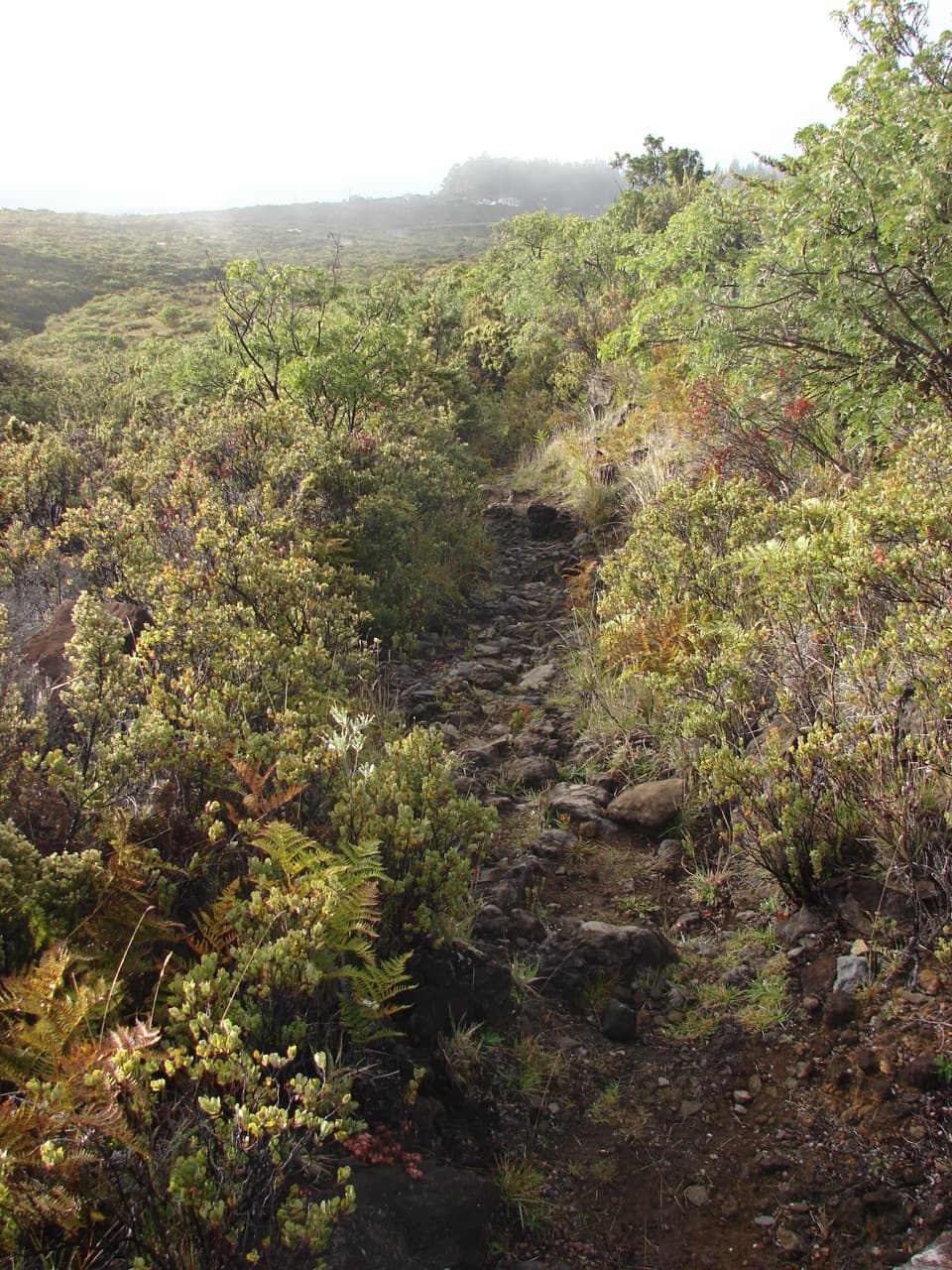
The route starts on a short service road that narrows into a rocky path. The climb continues for most of the way, with several stream crossings and a crossing of the service road that serves the rain catchment. The footing is uneven, so the gradual grade can still ask for your attention. You return downhill on the same corridor.

A useful landmarkThe large rain catchment sits just off the trail and begins to come into view around 1.3 miles.

The large rain catchment sits just off the trail and begins to come into view around 1.3 miles. It’s a useful checkpoint on the climb and on the way back. The surrounding shrubland can look similar when cloud settles in; keep following the marked tread instead of cutting across the fragile plants.

Native shrublandThis is a chance to see the summit area beyond the crater’s cinder slopes: low native shrubs,…

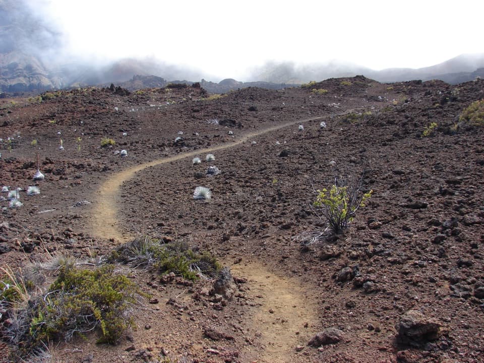
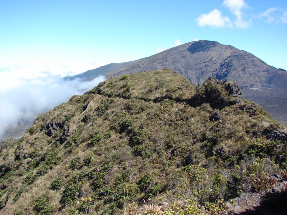
This is a chance to see the summit area beyond the crater’s cinder slopes: low native shrubs, ʻŌhiʻa lehua and māmane, with nohoanu among the flowering plants. The National Park Service notes that this shrubland supports plants important to nēnē and other endangered species. When ʻŌhiʻa crowns are in flower, native birds may be feeding in the trees; take a minute to look before you move on.

Add the overlook if you want itThe Supply Trail ends at the Halemauʻu junction, which is the distance stored here.

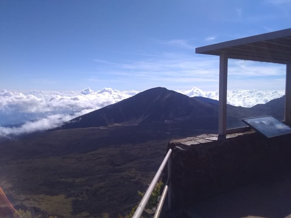
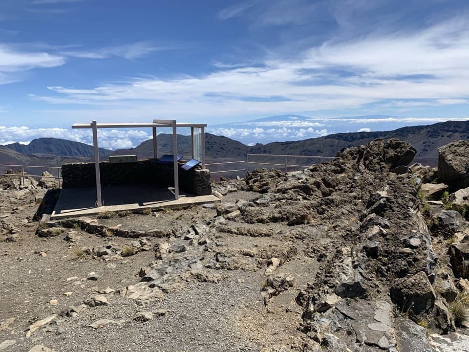
The Supply Trail ends at the Halemauʻu junction, which is the distance stored here. A route account places Halemauʻu Overlook about 0.2 mile farther along Halemauʻu Trail. Going there and back to the junction adds roughly 0.4 mile before you return on Supply Trail; it’s a worthwhile add-on if you want a crater view, but it’s a different endpoint from the base hike.

Access and rulesThe Supply Trail access is on Hosmer Grove Access Road, just past the entrance station on the…

The Supply Trail access is on Hosmer Grove Access Road, just past the entrance station on the first road to the left. Parking there is described as limited, and the NPS map does not mark the exact pullout, so confirm the signed access before you leave the car. This is not the separate Hosmer Grove Loop. Stay on marked trails, keep hiking groups to 12 or fewer, and leave pets behind; pack animals are permitted on Supply Trail. There’s no food, gas or supplies available in the park.

Wildlife

Wildlife in Haleakalā

All Haleakalā wildlife maps

Sighting maps show where each species has been reported across Haleakalā. Wildlife moves, so no sighting is guaranteed.

Keep exploring

Near Supply Trail

See it all on the map

Trails that start nearby

Places near the trailhead

Parkwolf’s Haleakalā ranking

Top-rated trails in Haleakalā

All 17 trails
  1. 1Pīpīwai TrailModerate · 4 mi
  2. 2Keoneheʻeheʻe (Sliding Sands) TrailChallenging · 7.8 mi
  3. 3Keoneheʻeheʻe to Halemauʻu TrailChallenging · 11 mi
  4. 4Halemauʻu TrailModerate · 2.7 mi
  5. 5Silversword Loop via Halemauʻu TrailChallenging · 10 mi
  6. 6Pā Kaʻoao TrailEasy · 0.4 mi

Take Parkwolf to Haleakalā.

The audio tour guide for the drive, plus offline maps, trails, and wildlife heatmaps for when the signal drops.

4.7 from 8,600+ ratings

Download Parkwolf on the App StoreGet Parkwolf on Google Play