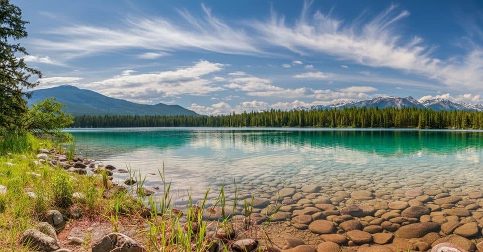
Lake Annette Loop in Jasper National Park

Jasper National Park, AB

Lake Annette Loop

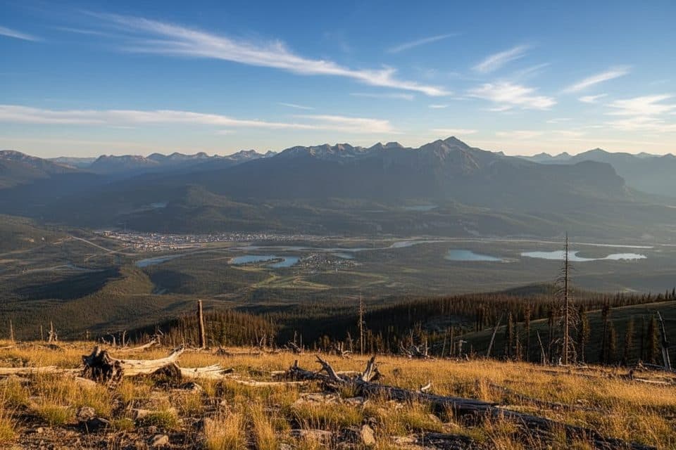
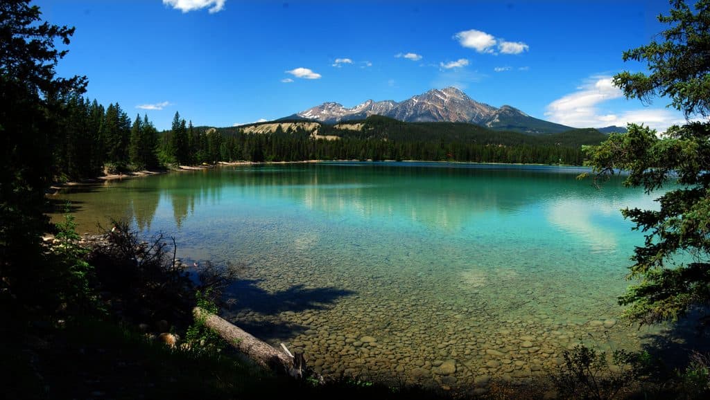
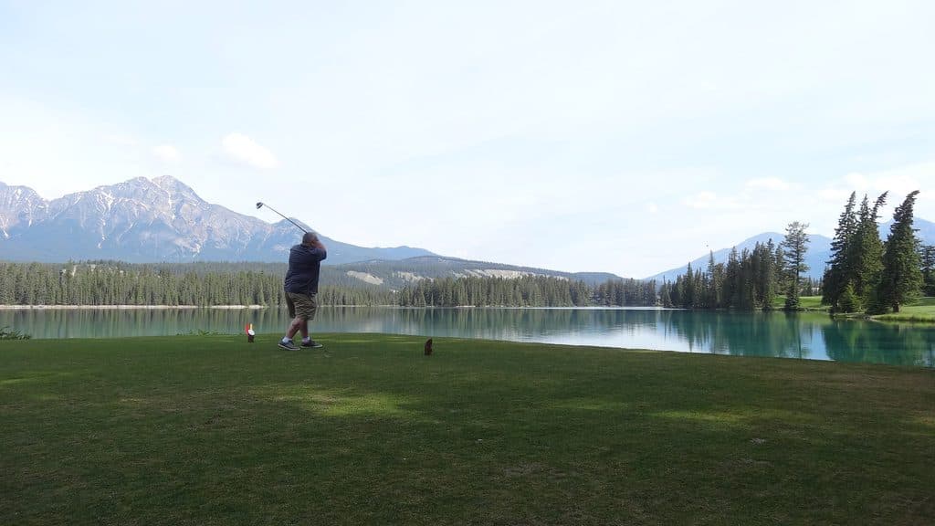
A paved, easy loop for clear water, mountain views, and a beach

Length
2.4km
Time
1.3hr
Elev. change
13m
Difficulty
Easy
  • Loop
  • No dogs
  • High point 1,036 m

Hear the audio tour

Lake Edith: Jasper's Quieter, Warmer Beach

Overview

About Lake Annette Loop

Why go

  • Wheelchair- and stroller-friendly paved shoreline loop
  • Interpretive signs explain the surrounding scenery
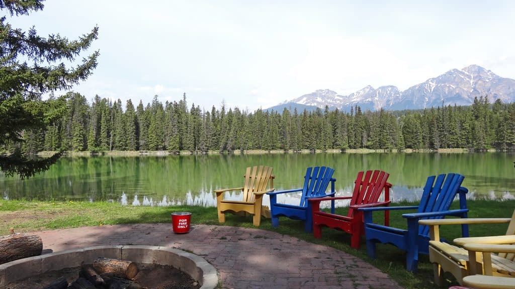
  • Picnic tables, fire rings, playground, and beach at the day-use area

Heads up

  • Beach crowds can fill the parking area on warm days
  • Bicycles and dogs are not allowed on the beach and trail area
  • Limited challenge if you want a strenuous hike

Map & elevation

The route

Loading the Jasper map
Full map
Elevation1,023–1,036 m
TrailheadAnnette Loop Trailhead52.90514, -118.04261
Keep this map with you offline in the Parkwolf app

Plan your hike

Before you go

Parking

From Jasper, take Highway 16 east for 1.9 km, turn right onto Maligne Road, angle right onto Lodge Road, then turn left at the Lake Annette sign. Keep right at major intersections to reach the western Lake Annette picnic-area parking lot; the trail begins on the right side of the lot. Arrive early on warm days because beach parking can fill.

Safety

The beach and trail area are popular, and parking can fill on warm days. Bicycles are not allowed on Trail 4d. Lake Annette beach is dog-free; use the designated dog areas instead.

8 active Jasper alerts

  • ClosureWildfire-impacted areas and facilities closedStay out of closed wildfire-impacted areas and facilities in Jasper National Park; closures protect public safety after the 2024 wildfire and remain in effect while recovery and safety work continues.Official details
  • Closure93A (Wabasso Road) no through travel during roadworkFrom mid-October to early November 2026, plan for 93A (Wabasso Road) to be accessible from the south entrance only; no through travel is expected during roadwork.Official details
See all 8 alerts
A park ranger sits on a dash-mounted phone, talking, as Parkwolf’s Tour Guide plays “Army Cutworm Moths: A Grizzly Bear Buffet” on Grand Loop Road below Dunraven Pass in Yellowstone
Parkwolf Tour GuideThe highest, rockiest slopes around here are a summer buffet for grizzly bears.

Jasper Tour Guide

Your drive to Lake Annette Loop, narrated.

Parkwolf is a GPS audio tour guide for Jasper National Park. As you drive, it chimes in with what’s ahead: hidden gems, upcoming stops, history, geology, and wildlife, right through your car’s speakers.

See the Jasper audio tour

Recorded for this trailhead

Lake Edith: Jasper's Quieter, Warmer Beach
Listen
“You're nearing the turnoff for Lake Edith and Lake Annette. While Annette gets most of the attention, many people prefer Lake Edith, especially for a swim.”

Plays as you drive up to this trailhead in the Parkwolf Jasper Tour Guide.

More stories near here in the app

  • Lake Annette Beach and Trail
  • Edith Lake: A Quiet Swim and Historic Cabins
  • Kettle Lakes: Annette and Edith
  • Mildred Lake's Winter Skating Loop
  • 157 audio storiesacross Jasper’s roads, triggered by GPS as you drive
  • Wildlife heatmapsfor Grizzly Bear, Caribou, Gray Wolf, and 13 more
  • Works offlinemaps, 91 trails, 129 places, and audio download before you lose signal
  • CarPlay readysimple controls built for the drive
★★★★★
“Fantastic app with many points of information… It’s great to just turn on while you’re driving and it gives you an audio tour of the national Park. We love it!!!!”
JMJamesApp Store review
Download Parkwolf on the App StoreGet Parkwolf on Google Play

4.7 from 8,600+ ratings

Trail guide

Hiking Lake Annette Loop

Keep it easyIf you want a low-effort way to see Lake Annette, this is a good choice. The 2.

If you want a low-effort way to see Lake Annette, this is a good choice. The 2.4 km paved loop stays beside the turquoise water and mountain views. It is an easy walk with no meaningful elevation gain; allow 1 to 1.5 hours if you stop for the scenery and signs.

Follow the shorelineTrail 4d is a short interpretive loop, so the route is simple once you leave the picnic area.

Trail 4d is a short interpretive loop, so the route is simple once you leave the picnic area. The signs are set at wheelchair height and point out the surrounding landscape. For photos, include the shoreline or beach in the foreground with the mountains behind it - the water gives your phone a strong sense of color and scale.

Start at the right lotDrive east from Jasper on Highway 16, turn onto Maligne Road, angle right onto Lodge Road, then…

Drive east from Jasper on Highway 16, turn onto Maligne Road, angle right onto Lodge Road, then follow signs for Lake Annette. Keep right at major intersections to reach the western picnic-area parking lot. The trail starts on the right side of the lot. Warm days can fill the beach parking early.

Useful limitsThe paved loop is wheelchair and stroller friendly, and accessible toilets, picnic tables, fire…

The paved loop is wheelchair and stroller friendly, and accessible toilets, picnic tables, fire rings, a playground, and the beach are nearby. Bicycles are not allowed, and the beach is dog-free; use the designated dog areas instead.

Wildlife

Wildlife in Jasper

All Jasper wildlife maps

Sighting maps show where each species has been reported across Jasper. Wildlife moves, so no sighting is guaranteed.

Keep exploring

Near Lake Annette Loop

See it all on the map

Trails that start nearby

Places near the trailhead

Parkwolf’s Jasper ranking

Top-rated trails in Jasper

All 91 trails
  1. 1Skyline TrailChallenging · 44.1 km
  2. 2Maligne CanyonModerate · 3.7 km
  3. 3Cavell MeadowsModerate · 8.4 km
  4. 4Sulphur SkylineChallenging · 8.9 km
  5. 5Athabasca Falls LoopEasy · 0.8 km
  6. 6Indian RidgeChallenging · 8.9 km

Take Parkwolf to Jasper.

The audio tour guide for the drive, plus offline maps, trails, and wildlife heatmaps for when the signal drops.

4.7 from 8,600+ ratings

Download Parkwolf on the App StoreGet Parkwolf on Google Play