Maligne Canyon in Jasper National Park

#2 of 91 trails in Jasper

Jasper National Park, AB

Maligne Canyon

Point-to-point gorge walk from Jasper’s upper bridges to Sixth Bridge

Photo: Wikimedia Commons
Length
3.7km
Time
1.5hr
Elev. change
131m
Difficulty
Moderate
  • No dogs
  • High point 1,152 m

Hear the audio tour

Maligne Canyon's Deep Gorge and Waterfalls

Overview

About Maligne Canyon

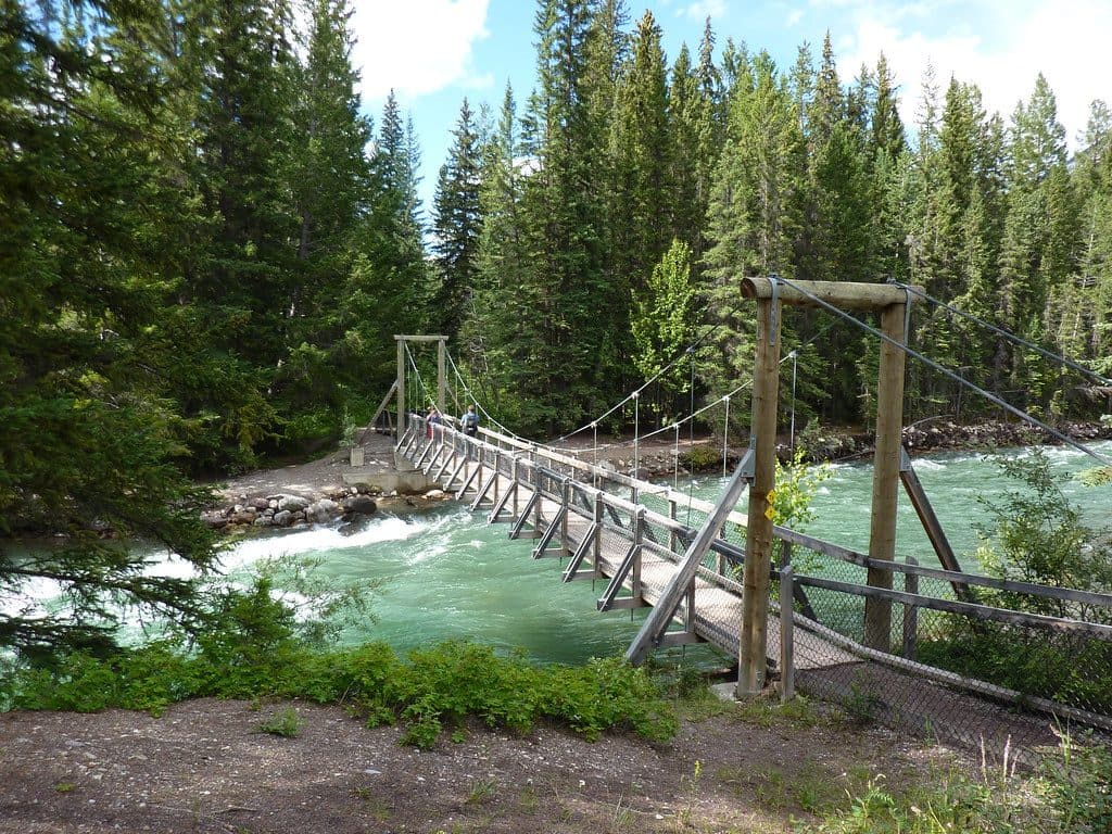
Maligne Canyon is Jasper’s signature gorge walk, following the Maligne River from the upper trailhead by the First and Second Bridges to Sixth Bridge. This point-to-point route is about 3.7 km (2.3 miles) one way and takes roughly 1.5 hours for a steady hike, with frequent stops and stairs. It descends through a narrow limestone canyon with waterfalls, potholes, fossils, lush rock walls, karst springs, and numbered bridges along the way.

Start at the upper Maligne Canyon parking area by the First and Second Bridges. The upper section has paved, railed viewpoints and frequent stairs; farther down, the route becomes packed dirt and gravel as it follows the river toward the lower bridges. The mapped route ends at Sixth Bridge, so arrange a shuttle or second vehicle if you want to hike one way. Without a shuttle, plan for the 7.5 km (4.6-mile) return to the upper lot and a substantial uphill climb; the route loses roughly 130 m net to Sixth Bridge.

Parks Canada lists cycling as permitted on trail 7/7g, but dogs and horses are not permitted. Follow posted segment restrictions and stay on the marked route. This is an especially rewarding walk for geology and photography, but the canyon edge, stairs, and bridges demand attention. Conditions and access can change seasonally, so check Parks Canada advisories before setting out.

Why go

  • Deep limestone gorge with waterfalls, potholes, fossils, and karst springs
  • Numbered bridges and interpretive geology make the route easy to follow

Heads up

  • Point-to-point route requires a shuttle or a 7.5 km return to the upper lot
  • Frequent stairs, slick canyon sections, and a steep uphill return

Map & elevation

The route

Loading the Jasper map
Full map
Elevation1,021–1,152 m
TrailheadMaligne Canyon Upper Trailhead (First and Second Bridges)52.92091, -117.99950
Keep this map with you offline in the Parkwolf app

Plan your hike

Before you go

Parking

Start at the upper Maligne Canyon parking area by the First and Second Bridges. A one-way hike needs a shuttle or second vehicle at Sixth Bridge; the lower Fifth- and Sixth-Bridge access points are alternate starts, not the start of this mapped route. Check Parks Canada notices for current parking and access information.

Safety

Stay on marked trails and behind railings; canyon edges, bridges, and wet or icy stairs are hazardous. Dogs and horses are not permitted on trail 7/7g. If hiking one way to Sixth Bridge, arrange transport or plan the full uphill return. Check Parks Canada advisories for seasonal access changes and closures.

8 active Jasper alerts

  • ClosureWildfire-impacted areas and facilities closedMentions this trailStay out of closed wildfire-impacted areas and facilities in Jasper National Park; closures protect public safety after the 2024 wildfire and remain in effect while recovery and safety work continues.Official details
  • ClosureMaligne River watercraft closureMentions Maligne River, referenced in this guideDo not use, enter or travel by watercraft on the Maligne River between Maligne Lake and Medicine Lake; the closure protects Harlequin Ducks from human disturbance.Official details
See all 8 alerts
A park ranger sits on a dash-mounted phone, talking, as Parkwolf’s Tour Guide plays “Army Cutworm Moths: A Grizzly Bear Buffet” on Grand Loop Road below Dunraven Pass in Yellowstone
Parkwolf Tour GuideThe highest, rockiest slopes around here are a summer buffet for grizzly bears.

Jasper Tour Guide

Your drive to Maligne Canyon, narrated.

Parkwolf is a GPS audio tour guide for Jasper National Park. As you drive, it chimes in with what’s ahead: hidden gems, upcoming stops, history, geology, and wildlife, right through your car’s speakers.

See the Jasper audio tour

Recorded for this trailhead

Maligne Canyon's Deep Gorge and Waterfalls
Listen
“You're headed towards Maligne Canyon, the deepest canyon in Jasper National Park. It's a narrow limestone gorge that plunges more than 50 meters.”

Plays as you drive up to this trailhead in the Parkwolf Jasper Tour Guide.

More stories near here in the app

  • Mount Tekarra Viewpoint and Maligne Lookout
  • Skyline Trailhead: A World-Famous Trek and a Day Hike
  • Fifth Bridge: A Quieter Way into Maligne Canyon
  • The Overlanders of 1862
  • 157 audio storiesacross Jasper’s roads, triggered by GPS as you drive
  • Wildlife heatmapsfor Grizzly Bear, Caribou, Gray Wolf, and 13 more
  • Works offlinemaps, 91 trails, 129 places, and audio download before you lose signal
  • CarPlay readysimple controls built for the drive
★★★★★
“Fantastic app with many points of information… It’s great to just turn on while you’re driving and it gives you an audio tour of the national Park. We love it!!!!”
JMJamesApp Store review
Download Parkwolf on the App StoreGet Parkwolf on Google Play

4.7 from 8,600+ ratings

Wildlife

Wildlife in Jasper

All Jasper wildlife maps

Sighting maps show where each species has been reported across Jasper. Wildlife moves, so no sighting is guaranteed.

Keep exploring

Near Maligne Canyon

See it all on the map

Trails that start nearby

Places near the trailhead

Parkwolf’s Jasper ranking

Top-rated trails in Jasper

All 91 trails
  1. 1Skyline TrailChallenging · 44.1 km
  2. 3Cavell MeadowsModerate · 8.4 km
  3. 4Sulphur SkylineChallenging · 8.9 km
  4. 5Athabasca Falls LoopEasy · 0.8 km
  5. 6Indian RidgeChallenging · 8.9 km
  6. 7Wilcox Pass TrailModerate · 9.3 km

Take Parkwolf to Jasper.

The audio tour guide for the drive, plus offline maps, trails, and wildlife heatmaps for when the signal drops.

4.7 from 8,600+ ratings

Download Parkwolf on the App StoreGet Parkwolf on Google Play