Moderate

Tekarra Lookout via Signal

High, windy Skyline finale with big views and a long fire-road exit
Tekarra Lookout via Signal, Jasper National Park
Distance8.7 mi
Typical time4 hr
DifficultyModerate
PetsNot allowed

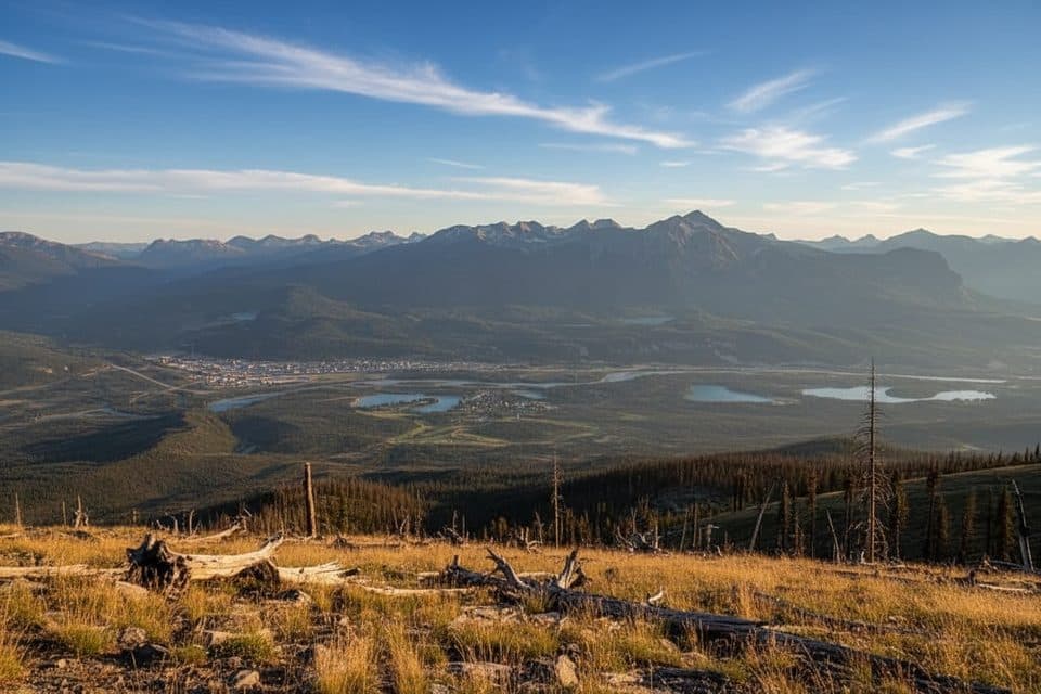
This route rides the high country of the Skyline Trail between Tekarra and Signal before dropping all the way to the valley on the Signal Mountain Fire Road. Expect a classic Jasper combo: forested approach, broad alpine meadows, and long, open ridgelines with wide‑angle views of the Athabasca River valley and peaks like Mount Tekarra, Signal Mountain, Grisette, The Watchtower, and Centre Mountain.

For planning, the Tekarra-to-Signal section itself runs roughly 5–6 km between the two backcountry campgrounds, then continues about 8.5 km down the Signal Mountain Fire Road to the parking area—about 8.7 miles total one way from Tekarra Campground to the Signal trailhead. Many hikers are finishing a multi‑day Skyline here; others day‑hike onto the ridge from the Signal side and turn around when the views peak. Be warned: that final fire road descent is long and can feel monotonous after the alpine high point.

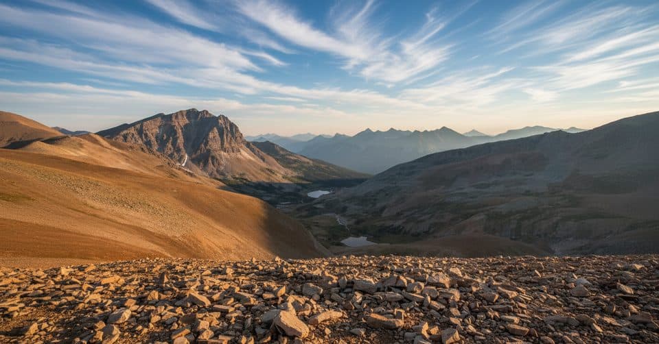
Above treeline, you’ll get sustained alpine travel—one of the Skyline’s calling cards—with summer wildflowers splashing color across meadows after rains. The terrain is glaciated sedimentary rock of the Maligne Range: broad, wind‑scoured ridges and rocky slopes that are gorgeous but fully exposed to weather.

Logistics matter. Backcountry sites at Tekarra and Signal must be reserved well in advance if you’re backpacking. Many hikers stage a vehicle at the Signal trailhead or arrange a shuttle for a point‑to‑point Skyline trip. This corridor is in critical woodland caribou habitat and is strictly no‑dogs. It’s also bear country—carry spray and know how to use it.

Tips: If you’re here as a day hiker from the Signal side, consider turning around at the ridge or adding the easy Signal Mountain side detour for extra views rather than committing to the full campground‑to‑trailhead push. Navigation is straightforward in clear weather, but fog or early/late‑season snow can hide the path; a map/GPS is wise.

Best time to hike: July through September, when snow has mostly melted and wildflowers are in bloom. Even in midsummer, expect fast‑moving storms, strong wind, and chilly temps on the ridges. Start early for calmer winds, clearer views, and room on the ridge before the day warms and crowds arrive from either end.

Pros

  • Long, above‑treeline ridge walking without any technical scrambling
  • Easy optional detour to Signal Mountain from the corridor for extra views

Cons

  • Lengthy, monotonous descent on the Signal Mountain Fire Road
  • Strict no‑dogs policy due to caribou habitat

Parking

Park at the Signal trailhead at the base of the Signal Mountain Fire Road; many hikers stage a car here when finishing the Skyline via Signal.

Caution

Highly exposed above treeline with rapid weather shifts; long descent can hammer knees. Navigation can be tricky in fog or fresh snow. Bear country—carry spray. No dogs due to caribou habitat; enforcement is strict.

The Parkwolf tour guide sitting on a phone mounted in a car

Parkwolf Tour Guide

Like a tour guide in your car.

Bring Jasper trail research into the car, with offline maps and stories that play as you drive.Download Parkwolf on the App Store