Jasper National Park, AB

Bighorn Alley

Easy, mostly flat town-to-lakes connector with valley views and wildlife

Length
4.3km
Time
1.5hr
Elev. change
44m
Difficulty
Easy
  • Dogs allowed
  • High point 1,067 m

Hear the audio tour

Connaught Drive Shopping and Dining

Overview

About Bighorn Alley

Bighorn Alley is Jasper’s easy, mostly flat connector between the northeast end of the Jasper Discovery Trail and the Lake Annette/Lake Edith area. The point-to-point route is about 2.7 miles (4.3 km) one way, with roughly 33 m of gentle elevation gain—plan on 1–2 hours one way at a relaxed pace.

Start at the town-side end of the Jasper Discovery Trail and follow Bighorn Alley north through montane forest, open meadows, and the Athabasca Valley. The route crosses the Athabasca River at Moberly Bridge, including a crossing of Highway 16, then continues east toward the Lake Edith and Lake Annette access area. The lake beaches and picnic areas make a natural destination or lunch stop. This is a one-way route rather than a loop, so return by retracing the corridor or arrange transportation from the far end.

Scenery stays wide: mountains frame the valley, mixed conifers line the corridor, and birdlife and other wildlife are common. Bighorn sheep and elk are possible, along with deer and woodpeckers; keep a respectful distance and bring binoculars if you like to linger. Wayfinding is generally straightforward, with bear-symbol trail signs and connections to the Jasper Discovery Trail and the surrounding lakes-area paths.

This is not a remote wilderness ramble—you’ll share it with locals and visitors, especially in summer—but that’s part of its charm. The trail is permitted for hiking and biking and is an easy way to reach the lakes without driving. The natural dirt tread has occasional roots and is not wheelchair-accessible. Spring through fall brings green forest, wildflowers, and active wildlife; winter can also work for an easy snowy walk, but expect ice or snow and shorter daylight.

Use the signed access and be prepared for a Highway 16 crossing at Moberly Bridge. If you want more solitude, choose early mornings or shoulder seasons, or choose a more remote trail elsewhere in the park.


Why go

  • Easy, scenic one-way access to the Lake Annette and Lake Edith area
  • Athabasca Valley views with frequent opportunities for wildlife viewing

Heads up

  • One-way route; returning requires retracing the corridor or arranging transport
  • Highway 16 crossing at Moberly Bridge requires extra caution
  • Popular near town and not a solitude hike

Map & elevation

The route

Loading the Jasper map
Full map
Elevation1,023–1,067 m
TrailheadNortheast end of Jasper Discovery Trail (town-side access)52.89202, -118.07542
Keep this map with you offline in the Parkwolf app

Plan your hike

Before you go

Parking

Use public parking near the northeast end of the Jasper Discovery Trail in Jasper townsite, then join the signed Bighorn Alley route. Lake-side access is also possible near Lake Annette and Lake Edith, but the visitor experience represented here starts from the town side.

Safety

The route crosses Highway 16 at Moberly Bridge; use the designated crossing and watch traffic. Give wildlife plenty of space. The natural tread has roots, and winter travel can bring ice, snow, and short daylight.

8 active Jasper alerts

  • ClosureWildfire-impacted areas and facilities closedStay out of closed wildfire-impacted areas and facilities in Jasper National Park; closures protect public safety after the 2024 wildfire and remain in effect while recovery and safety work continues.Official details
  • Closure93A (Wabasso Road) no through travel during roadworkFrom mid-October to early November 2026, plan for 93A (Wabasso Road) to be accessible from the south entrance only; no through travel is expected during roadwork.Official details
See all 8 alerts
A park ranger sits on a dash-mounted phone, talking, as Parkwolf’s Tour Guide plays “Army Cutworm Moths: A Grizzly Bear Buffet” on Grand Loop Road below Dunraven Pass in Yellowstone
Parkwolf Tour GuideThe highest, rockiest slopes around here are a summer buffet for grizzly bears.

Jasper Tour Guide

Your drive to Bighorn Alley, narrated.

Parkwolf is a GPS audio tour guide for Jasper National Park. As you drive, it chimes in with what’s ahead: hidden gems, upcoming stops, history, geology, and wildlife, right through your car’s speakers.

See the Jasper audio tour

Recorded for this area

Connaught Drive Shopping and Dining
Listen
“You're now on Connaught Drive, the main street running through Jasper. This section is the core of the town's activity, packed with restaurants, hotels, and gift shops.”

Plays on the road 0.4 km from the trailhead in the Parkwolf Jasper Tour Guide.

More stories near here in the app

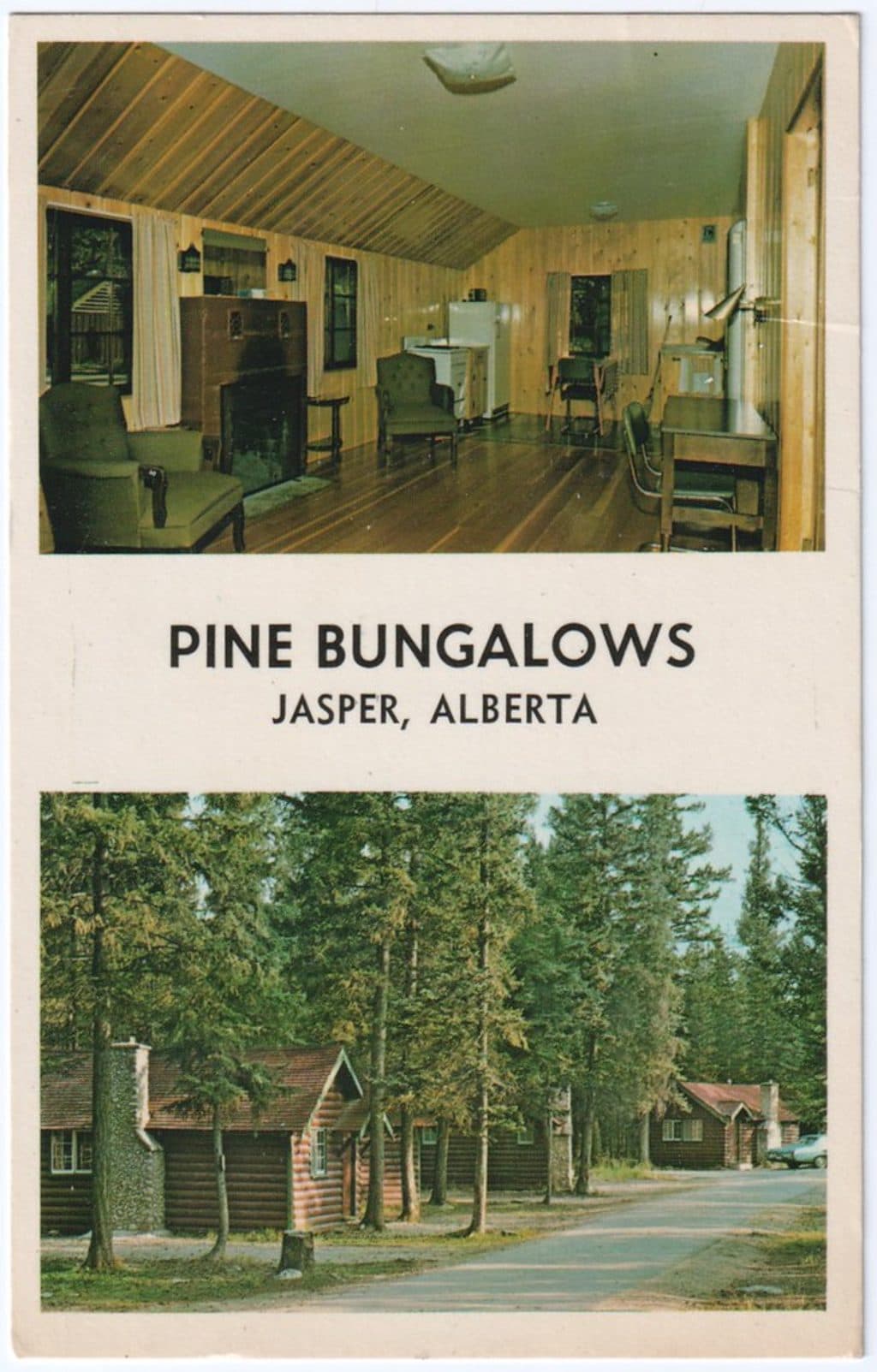
  • Pine Bungalows: A Riverside Escape
  • Mildred Lake's Winter Skating Loop
  • Jasper Gas and EV Charging Hub
  • Cottonwood Slough: A Peaceful Wetland Walk
  • 157 audio storiesacross Jasper’s roads, triggered by GPS as you drive
  • Wildlife heatmapsfor Grizzly Bear, Caribou, Gray Wolf, and 13 more
  • Works offlinemaps, 91 trails, 129 places, and audio download before you lose signal
  • CarPlay readysimple controls built for the drive
★★★★★
“Fantastic app with many points of information… It’s great to just turn on while you’re driving and it gives you an audio tour of the national Park. We love it!!!!”
JMJamesApp Store review
Download Parkwolf on the App StoreGet Parkwolf on Google Play

4.7 from 8,600+ ratings

Wildlife

Wildlife in Jasper

All Jasper wildlife maps

Sighting maps show where each species has been reported across Jasper. Wildlife moves, so no sighting is guaranteed.

Keep exploring

Near Bighorn Alley

See it all on the map

Trails that start nearby

Places near the trailhead

Parkwolf’s Jasper ranking

Top-rated trails in Jasper

All 91 trails
  1. 1Skyline TrailChallenging · 44.1 km
  2. 2Maligne CanyonModerate · 3.7 km
  3. 3Cavell MeadowsModerate · 8.4 km
  4. 4Sulphur SkylineChallenging · 8.9 km
  5. 5Athabasca Falls LoopEasy · 0.8 km
  6. 6Indian RidgeChallenging · 8.9 km

Take Parkwolf to Jasper.

The audio tour guide for the drive, plus offline maps, trails, and wildlife heatmaps for when the signal drops.

4.7 from 8,600+ ratings

Download Parkwolf on the App StoreGet Parkwolf on Google Play