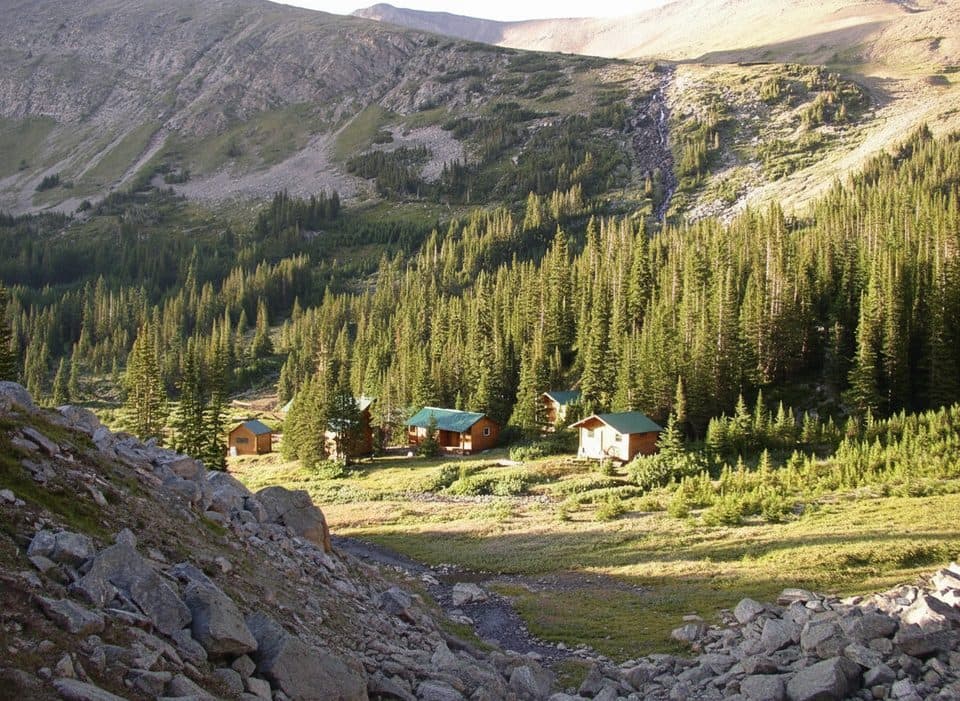
Jasper National Park, AB

Moab Lake Trail

A quiet, moderate road walk to a Moab Lake viewpoint via the Whirlpool valley

Length
15.1km
Time
4hr
Elev. change
124m
Difficulty
Moderate
  • No dogs
  • High point 1,257 m

Hear the audio tour

Where Rivers Meet: The Whirlpool–Athabasca Confluence

Overview

About Moab Lake Trail

Moab Lake Trail is a 15.2 km (9.4 mi) out-and-back route from the Whirlpool Cross-country Ski Hub to the Moab Lake viewpoint in Jasper National Park. It follows the broad, unpaved Moab Lake Road through the Whirlpool valley; the physical line stored here is the 7.6 km one-way corridor, without duplicating the return. Allow about 4 hours on foot, with extra time for stops or winter travel.

Why go

  • Quiet Whirlpool valley route with river views and a red-chair viewpoint
  • Broad, straightforward corridor that is groomed for cross-country skiing in winter
  • Peaceful Moab Lake destination with a clear 7.6 km one-way route

Heads up

  • The 15.2 km return distance is a long outing for a broad road corridor
  • The final roughly 4 km climbs more steadily than the opening section
  • Seasonal road access and winter grooming can change how the route is experienced

Map & elevation

The route

Loading the Jasper map
Full map
Elevation1,133–1,257 m
TrailheadWhirlpool Cross-country Ski Hub52.72523, -117.92850
Keep this map with you offline in the Parkwolf app

Plan your hike

Before you go

Parking

Park at the Whirlpool Cross-country Ski Hub / Whirlpool River road access off Highway 93A. Parks Canada notes two parking areas near the start of the groomed trail. The 15.2 km return distance assumes starting here; do not count on driving Moab Lake Road when seasonal motor-vehicle restrictions apply.

Safety

Carry bear spray and make noise in wildlife habitat. The final roughly 4 km are more steadily uphill. Dogs are prohibited on trails and in sensitive habitats where Parks Canada restrictions apply. Verify seasonal road access and winter grooming before setting out.
8 active Jasper alerts

  • ClosureWildfire-impacted areas and facilities closedStay out of closed wildfire-impacted areas and facilities in Jasper National Park; closures protect public safety after the 2024 wildfire and remain in effect while recovery and safety work continues.Official details
  • Closure93A (Wabasso Road) no through travel during roadworkFrom mid-October to early November 2026, plan for 93A (Wabasso Road) to be accessible from the south entrance only; no through travel is expected during roadwork.Official details
See all 8 alerts
A park ranger sits on a dash-mounted phone, talking, as Parkwolf’s Tour Guide plays “Army Cutworm Moths: A Grizzly Bear Buffet” on Grand Loop Road below Dunraven Pass in Yellowstone
Parkwolf Tour GuideThe highest, rockiest slopes around here are a summer buffet for grizzly bears.

Jasper Tour Guide

Your drive to Moab Lake Trail, narrated.

Parkwolf is a GPS audio tour guide for Jasper National Park. As you drive, it chimes in with what’s ahead: hidden gems, upcoming stops, history, geology, and wildlife, right through your car’s speakers.

See the Jasper audio tour

Recorded for this area

Where Rivers Meet: The Whirlpool–Athabasca Confluence
Listen
“Right here, the silty Whirlpool River pours into the clearer Athabasca. You can often see a distinct seam where the two meet, running side-by-side for hundreds of meters before they finally mix.”

Plays on the road 1.5 km from the trailhead in the Parkwolf Jasper Tour Guide.

More stories near here in the app

  • Driving the River’s Staircase
  • Athabasca Pass: The Fur Trade’s Hidden Highway
  • Why the Whirlpool River Whirls
  • Wabasso: The Hare and the Lynx
  • 157 audio storiesacross Jasper’s roads, triggered by GPS as you drive
  • Wildlife heatmapsfor Grizzly Bear, Caribou, Gray Wolf, and 13 more
  • Works offlinemaps, 91 trails, 129 places, and audio download before you lose signal
  • CarPlay readysimple controls built for the drive
★★★★★
“Fantastic app with many points of information… It’s great to just turn on while you’re driving and it gives you an audio tour of the national Park. We love it!!!!”
JMJamesApp Store review
Download Parkwolf on the App StoreGet Parkwolf on Google Play

4.7 from 8,600+ ratings

Trail guide

Hiking Moab Lake Trail

Trail snapshotStart at the Whirlpool Cross-country Ski Hub off Highway 93A and follow Moab Lake Road to the…

Start at the Whirlpool Cross-country Ski Hub off Highway 93A and follow Moab Lake Road to the end of the groomed route at the Moab Lake viewpoint. Parks Canada describes the first roughly 3.4 km as gentle, including the red chairs and Whirlpool River viewpoint; the final roughly 4 km has more substantial climbing to the Moab Lake viewpoint. This is a moderate outing because of its length and the steadier final climb, even though the route is broad and nontechnical.

Scenery and feelThe route is a quiet valley outing rather than an alpine summit hike.

The route is a quiet valley outing rather than an alpine summit hike. Expect forest, glimpses of the Whirlpool River, the red-chair viewpoint, and a peaceful destination near Moab Lake. The broad road corridor is easy to follow, but the distance makes this a full outing.

Access and route conventionParks Canada's winter information says the groomed trail begins on Highway 93A and that two…

Parks Canada's winter information says the groomed trail begins on Highway 93A and that two parking areas provide short classic-trail access to the start. Moab Lake Road has seasonal motor-vehicle restrictions; confirm the current road status before driving it. The 15.2 km return distance assumes walking from the Whirlpool hub and does not include a drive partway along the road.

Tips and safetyCarry bear spray and make noise in this wildlife habitat.

Carry bear spray and make noise in this wildlife habitat. The final 4 km are more steadily uphill than the opening section. Dogs are prohibited on trails and in sensitive habitats where Parks Canada restrictions apply, so check the current park rules before bringing a pet. Winter grooming and the usable route vary by season; check Parks Canada's current trail and road information before setting out.

FishingMoab Lake is a fishing destination; a Parks Canada fishing permit is required for anglers.

Moab Lake is a fishing destination; a Parks Canada fishing permit is required for anglers.

Wildlife

Wildlife in Jasper

All Jasper wildlife maps

Sighting maps show where each species has been reported across Jasper. Wildlife moves, so no sighting is guaranteed.

Keep exploring

Near Moab Lake Trail

See it all on the map

Trails that start nearby

Places near the trailhead

Parkwolf’s Jasper ranking

Top-rated trails in Jasper

All 91 trails
  1. 1Skyline TrailChallenging · 44.1 km
  2. 2Maligne CanyonModerate · 3.7 km
  3. 3Cavell MeadowsModerate · 8.4 km
  4. 4Sulphur SkylineChallenging · 8.9 km
  5. 5Athabasca Falls LoopEasy · 0.8 km
  6. 6Indian RidgeChallenging · 8.9 km

Take Parkwolf to Jasper.

The audio tour guide for the drive, plus offline maps, trails, and wildlife heatmaps for when the signal drops.

4.7 from 8,600+ ratings

Download Parkwolf on the App StoreGet Parkwolf on Google Play