Parking
Small pullout/parking area off Highway 93 (Icefields Parkway), about 25–30 km south of Jasper. The highway sign has been removed, so use GPS or your odometer; washroom facilities are at the trailhead, not at the lake.
Jasper National Park, AB
Short Horseshoe Lake lollipop with clear water, shoreline views, and cliff-top viewpoints
Overview
Horseshoe Lake Circuit is a short lollipop route off the Icefields Parkway in Jasper National Park. From the small pullout, the path reaches the lake, visits the shoreline loop and cliff-view spur, and returns to the same pullout. The complete visitor route mapped here is about 1.5 km (0.9 mi) and typically takes about 25–30 minutes, with little elevation change.
The route passes through forest before opening to clear blue water, rocky shoreline, small footbridges, and multiple viewpoints. It includes a short spur toward cliff-top views as well as a loop beside the lake. Expect uneven bedrock, slick rock near the water, and sections where the path is less obvious; use care at junctions and stay on the established route.
Horseshoe Lake is a scenic picnic and swimming stop, but the water is deep and very cold. Cliff jumping is dangerous and is not recommended by Parks Canada. The lake has no washrooms or garbage bins, so use facilities at the trailhead and pack out everything you bring. Dogs should remain on leash, and children need close supervision around exposed cliffs and slippery rocks.
The trailhead is an easy-to-miss pullout on Highway 93, roughly 25–30 km south of Jasper. The former highway sign has been removed, so use GPS or your odometer. Limited cell service is possible in this remote roadside stop.
Map & elevation
Plan your hike

The highest, rockiest slopes around here are a summer buffet for grizzly bears.
Jasper Tour Guide
Parkwolf is a GPS audio tour guide for Jasper National Park. As you drive, it chimes in with what’s ahead: hidden gems, upcoming stops, history, geology, and wildlife, right through your car’s speakers.
See the Jasper audio tourRecorded for this area
Horseshoe Lake: A Hidden Gem“Keep an eye out for the turnoff to Horseshoe Lake; it's a small, unsigned gravel lot right off the parkway. This spot is a local favorite, a compact lake surrounded by cliffs with shockingly clear, turquoise water.”
Plays on the road 0.4 km from the trailhead in the Parkwolf Jasper Tour Guide.
More stories near here in the app
“Fantastic app with many points of information… It’s great to just turn on while you’re driving and it gives you an audio tour of the national Park. We love it!!!!”


Wildlife
 174 sightingsGrizzly BearMost seen around 8 PMSighting map
 43 sightingsCaribouMost seen around 7 AMSighting map
 40 sightingsGray WolfMost seen around 6 AMSighting map
 12 sightingsCanada LynxMost seen around 8 PMSighting map
 315 sightingsMooseMost seen around 6 AMSighting map
 1,028 sightingsElkMost seen around 7 AMSighting map
Sighting maps show where each species has been reported across Jasper. Wildlife moves, so no sighting is guaranteed.
Keep exploring
 EasyAthabasca Falls Loop0.8 km · 45 min · 3.4 km awayEasy, developed out-and-back to Jasper’s most powerful waterfall and canyonModerateMoab Lake Trail15.1 km · 4 hr · 5.3 km awayA quiet, moderate road walk to a Moab Lake viewpoint via the Whirlpool valleyModerateLeach Lake Trail15.4 km · 4.5 hr · 5.3 km awayWinter route to Leach Lake with Mount Hardisty and Mount Kerkeslin views.ChallengingFryatt Valley Trail43.9 km · 16 hr · 5.6 km awayDramatic backcountry journey to Fryatt Lake, the headwall, and Sydney Vallance HutModerateWhirlpool River Trail13.4 km · 4.5 hr · 6.5 km awayHistoric Whirlpool River valley out-and-back to a riverside campgroundChallengingAthabasca Pass Trail48.4 km · 4 days · 6.5 km awayHistoric 48.5 km one-way backcountry route up the Whirlpool River valley to Athabasca Pass
 ChallengingGeraldine Lakes Trail12.4 km · 6 hr · 8.1 km awayRugged lakes-and-waterfalls climb to a backcountry campground beneath Jasper’s big peaks.
 EasyWabasso Lake6.8 km · 2.5 hr · 11.2 km awayGentle forest walk on Trail 9 to a quiet, marsh-edged lake.
 Sight · 0.4 km awayHorseshoe LakeCliff-ringed turquoise lake just off the Parkway
 Sight · 3.6 km awayAthabasca FallsRoaring glacier-fed falls squeezed into a narrow quartzite canyon
 Lodging · 3.9 km awayHI Athabasca FallsRustic hostel steps from Athabasca Falls with a cozy cookhouse
 Campground · 6.8 km awayMt Kerkeslin CampgroundQuiet, riverside first‑come campground on the Icefields Parkway
 Scenic pullout · 8.8 km awayGoats and Glaciers ViewpointQuick goat-spotting pullout with glacier and river valley views
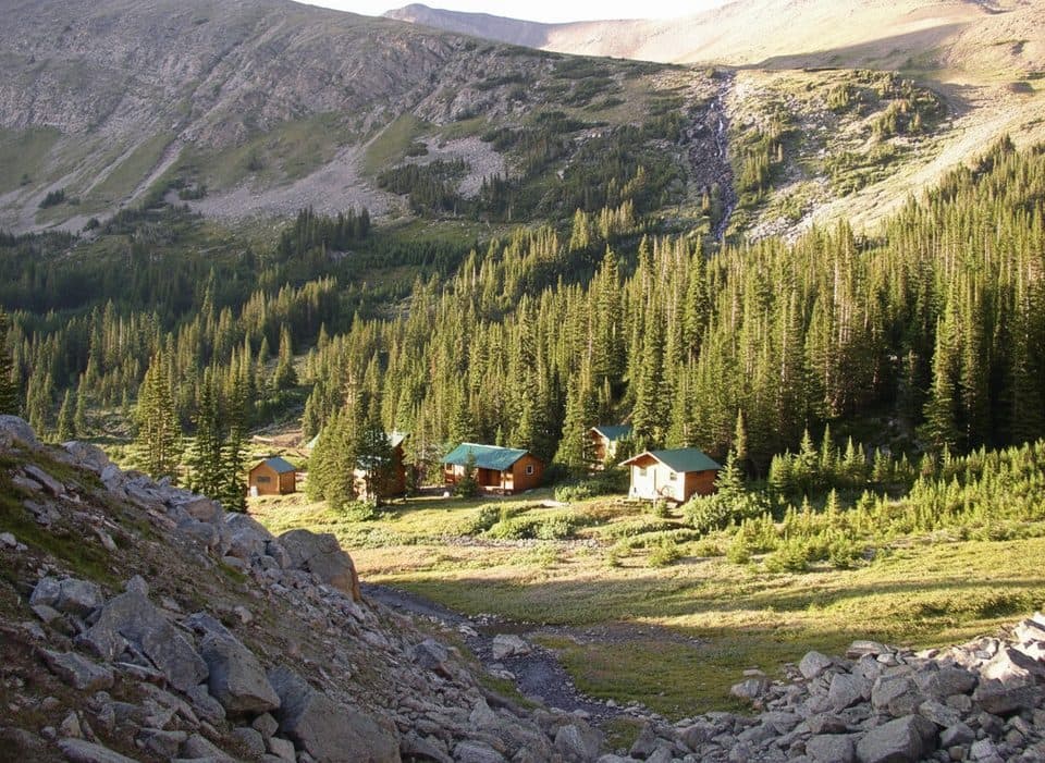 Lodging · 10.1 km awayShovel Pass LodgeHistoric, hike-in lodge with meals on the Skyline Trail
 Sight · 10.9 km awayCurator LakeRemote blue alpine lake below The Notch on the Skyline Trail
 Campground · 11 km awayWabasso CampgroundRiverside basecamp with spacious sites and modern bathrooms, no showers
Parkwolf’s Jasper ranking

The audio tour guide for the drive, plus offline maps, trails, and wildlife heatmaps for when the signal drops.




