Lucky Boy Loop in Joshua Tree National Park

Joshua Tree National Park, CA

Lucky Boy Loop

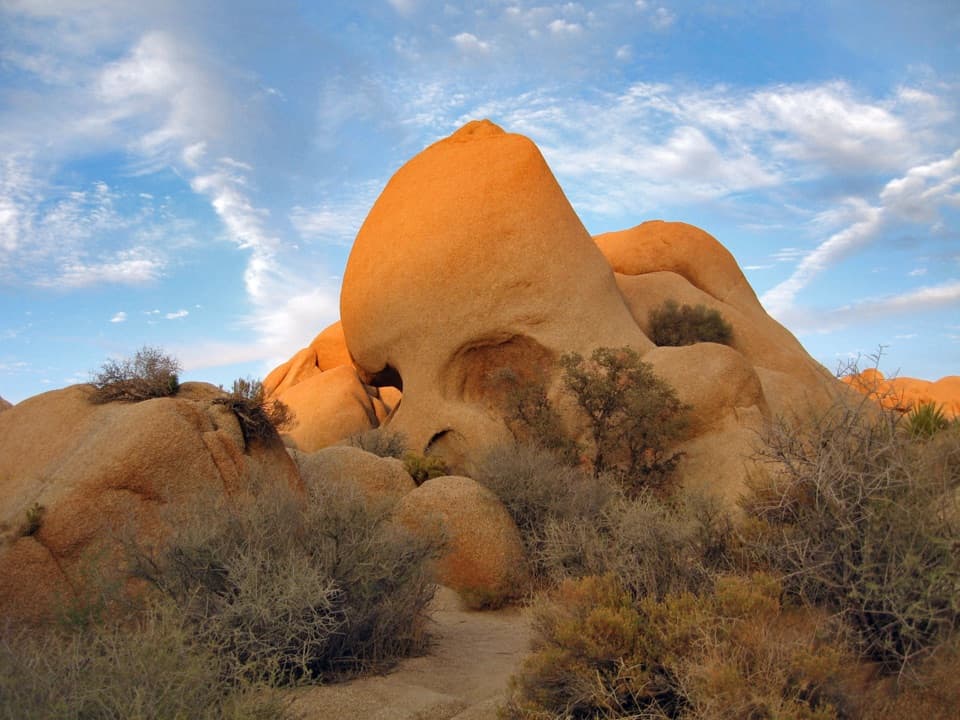
Desert views, old mine remains, and a final road stretch.

Photo: National Park Service
Length
3.3mi
Time
2.3hr
Elev. change
138ft
Difficulty
Easy
  • Loop
  • No dogs
  • High point 4,524 ft

Hear the audio tour

Lucky Boy Loop: Mine Remains and Desert Wildlife

Overview

About Lucky Boy Loop

Why go

  • Rock formations and Elton Mine give the circuit distinct stops.

Heads up

  • Little shade and a dirt-road finish with passing vehicles.

Map & elevation

The route

Loading the Joshua Tree map
Full map
Elevation4,386–4,524 ft
TrailheadLucky Boy Loop Trailhead34.01784, -116.08254
Keep this map with you offline in the Parkwolf app

Plan your hike

Before you go

Parking

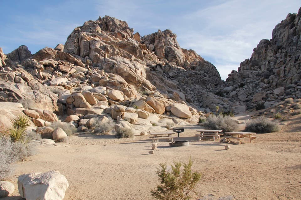
From Park Boulevard about five miles west of Pinto Basin Road, turn north onto Desert Queen Mine Road, opposite Geology Tour Road. Drive less than a mile on dirt and use the small right-side pullout with the trail sign. A vault or composting toilet is listed at the trailhead; a park entrance pass is required.

Safety

The open route has little shade, and the park advises against hiking it in summer heat; carry adequate water and sun protection. The final half-mile follows dirt Desert Queen Mine Road, where vehicles may pass. Stay outside the fenced, covered mine shafts. Pets are prohibited on hiking trails.

5 active Joshua Tree alerts

  • ClosureGeology Tour Road closed by floodingMentions Geology Tour Road, referenced in this guideGeology Tour Road is temporarily closed because flooding followed a significant amount of rain in the park; do not drive the road while it is closed. Check current park conditions before visiting.Official details
  • ClosureOasis of Mara Trail closed past the OasisThe Oasis of Mara Trail is closed past the Oasis due to a heavy flooding event; do not continue beyond the Oasis. Check current park conditions before visiting.Official details
See all 5 alerts
A park ranger sits on a dash-mounted phone, talking, as Parkwolf’s Tour Guide plays “Army Cutworm Moths: A Grizzly Bear Buffet” on Grand Loop Road below Dunraven Pass in Yellowstone
Parkwolf Tour GuideThe highest, rockiest slopes around here are a summer buffet for grizzly bears.

Joshua Tree Tour Guide

Your drive to Lucky Boy Loop, narrated.

Parkwolf is a GPS audio tour guide for Joshua Tree National Park. As you drive, it chimes in with what’s ahead: hidden gems, upcoming stops, history, geology, and wildlife, right through your car’s speakers.

See the Joshua Tree audio tour

Recorded for this trailhead

Lucky Boy Loop: Mine Remains and Desert Wildlife
0:00 / 0:24
“You're nearing the Lucky Boy trail access, for a desert walk past rock formations and the remains of Elton Mine.”

Plays as you drive up to this trailhead in the Parkwolf Joshua Tree Tour Guide.

More stories near here in the app

  • Desert Queen Mine from Pine City Trailhead
  • The Rock Inside the Crack
  • The Toad’s Borrowed Pool
  • Farming on a Few Wet Years
  • 89 audio storiesacross Joshua Tree’s roads, triggered by GPS as you drive
  • Wildlife heatmapsfor Bighorn Sheep, Golden Eagle, Desert Tortoise, and 13 more
  • Works offlinemaps, 60 trails, 64 places, and audio download before you lose signal
  • CarPlay readysimple controls built for the drive
★★★★★
“Fantastic app with many points of information… It’s great to just turn on while you’re driving and it gives you an audio tour of the national Park. We love it!!!!”
JMJamesApp Store review
Download Parkwolf on the App StoreGet Parkwolf on Google Play

4.7 from 8,600+ ratings

Trail guide

Hiking Lucky Boy Loop

What the loop coversLucky Boy Loop is a 3.

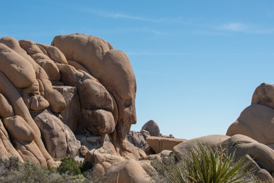
Lucky Boy Loop is a 3.25-mile circuit through Joshua Tree’s open desert, with rock formations, vista points and the remains of Elton Mine. The route gains about 555 feet and ends with roughly half a mile on dirt Desert Queen Mine Road. Allow two to three hours with a stop at the mine. The mapped line measures about 3.1 miles; published totals differ a little, so plan for the full circuit.

Take the loop at the forkAbout a mile from the trailhead, follow the signed left branch to stay on the loop.

About a mile from the trailhead, follow the signed left branch to stay on the loop. The straight branch continues to Lucky Boy Vista, a separate out-and-back, and is not part of this circuit. The loop returns to the parking area along the dirt road, where passing vehicles may be present.

What the walk feels likeThe opening path is sandy and fairly smooth, winding among Joshua trees, yucca, cactus and…

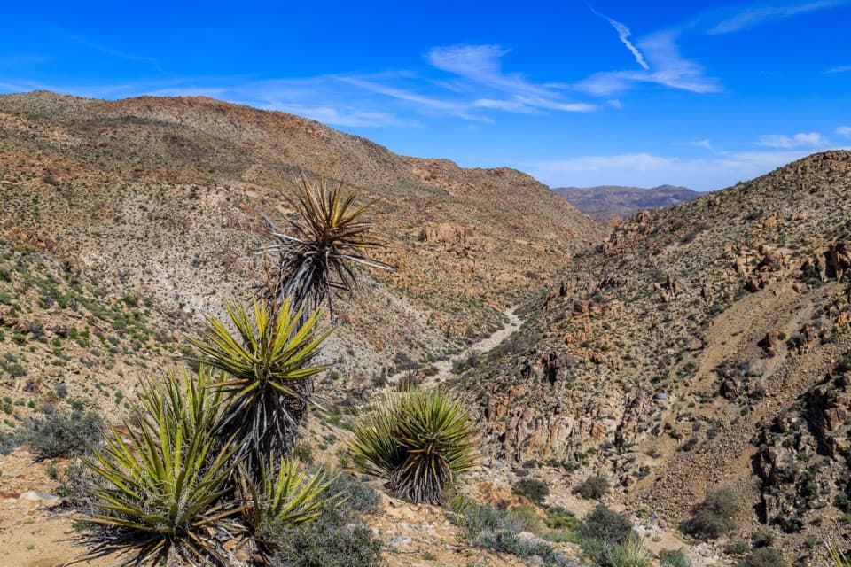
The opening path is sandy and fairly smooth, winding among Joshua trees, yucca, cactus and scattered boulders. The scenery stays open, with little shade; the heat matters more than the grade on a hot day. The park advises against this hike in summer heat, so choose a cooler season or a cool part of the day.

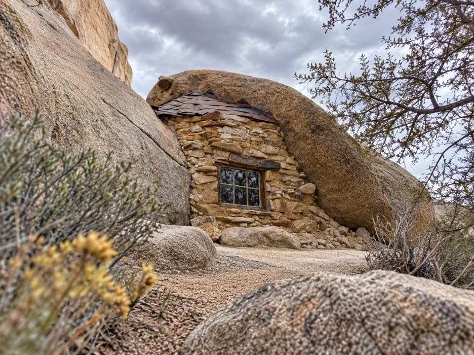
Elton MineShortly after the junction, look for the mine remains beside the trail.

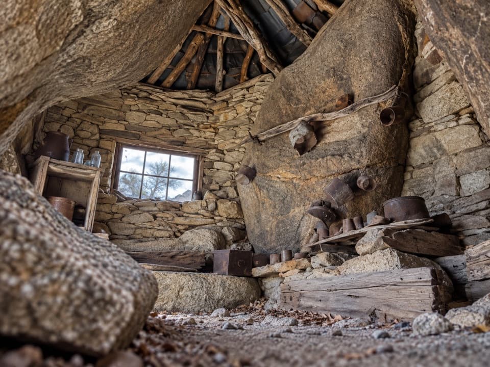
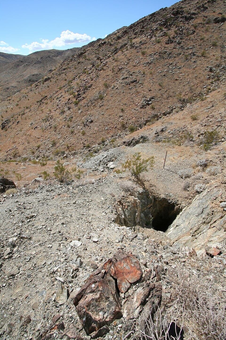
Shortly after the junction, look for the mine remains beside the trail. This is an old working site, not a restored mine: the visible features are fenced and covered shafts, with scattered rusted metal. Stay outside the barriers and do not approach the openings.

Desert wildlifeScrub jays use the pinyon pines, and lizards and cottontails may appear along the route.

Scrub jays use the pinyon pines, and lizards and cottontails may appear along the route. Desert tortoises are possible but never something to count on; spring wildflowers can be part of the scene when they feed. Watch from the trail and leave wildlife room.

A shorter walkFor a shorter outing, Lucky Boy Vista is about a 2.5-mile round trip from the same pullout.

For a shorter outing, Lucky Boy Vista is about a 2.5-mile round trip from the same pullout. Continue straight at the fork and return by the same path; that walk reaches the named overlook but skips the loop’s return route.

Wildlife

Wildlife in Joshua Tree

All Joshua Tree wildlife maps

Sighting maps show where each species has been reported across Joshua Tree. Wildlife moves, so no sighting is guaranteed.

Keep exploring

Near Lucky Boy Loop

See it all on the map

Trails that start nearby

Places near the trailhead

Parkwolf’s Joshua Tree ranking

Top-rated trails in Joshua Tree

All 60 trails
  1. 1Hidden Valley Nature TrailEasy · 1 mi
  2. 2Barker Dam Nature TrailEasy · 1.3 mi
  3. 3Ryan Mountain TrailChallenging · 3 mi
  4. 4Fortynine Palms Oasis TrailChallenging · 3 mi
  5. 5Lost Palms Oasis TrailChallenging · 7.5 mi
  6. 6Arch Rock TrailEasy · 1.3 mi

Take Parkwolf to Joshua Tree.

The audio tour guide for the drive, plus offline maps, trails, and wildlife heatmaps for when the signal drops.

4.7 from 8,600+ ratings

Download Parkwolf on the App StoreGet Parkwolf on Google Play