Parking
Start at the Split Rock picnic area; parking is beside the trailhead and namesake boulder. The site has picnic tables and a restroom.
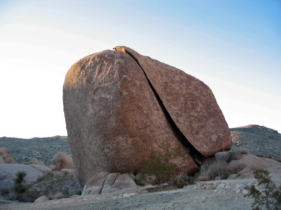
Joshua Tree National Park, CA
A short boulder loop with a Face Rock detour worth the turn.
Overview
Map & elevation
Plan your hike

The highest, rockiest slopes around here are a summer buffet for grizzly bears.
Joshua Tree Tour Guide
Parkwolf is a GPS audio tour guide for Joshua Tree National Park. As you drive, it chimes in with what’s ahead: hidden gems, upcoming stops, history, geology, and wildlife, right through your car’s speakers.
See the Joshua Tree audio tourRecorded for this trailhead
Split Rock: A Short Stop or Longer Loop“You're approaching Split Rock, where you can see the deep cleft dividing a huge granite boulder right beside the picnic area. Stop for a look or a picnic without committing to a hike.”
Plays as you drive up to this trailhead in the Parkwolf Joshua Tree Tour Guide.
More stories near here in the app
“Fantastic app with many points of information… It’s great to just turn on while you’re driving and it gives you an audio tour of the national Park. We love it!!!!”


Trail guide
Split Rock Loop Trail is a 2.5-mile circuit from the Split Rock picnic area, winding among granite boulders and across desert washes. The total includes the out-and-back visit to Face Rock. Allow about 1.5 to 2.5 hours. It stays in boulder country rather than climbing to a summit, so the draw is the changing rock shapes and the close-up desert scenery. The trail is short, but not always obvious underfoot: washes and branching social paths can make the loop hard to follow.
The walk starts beside the namesake Split Rock, then heads north into open desert. Around the first third of a mile, it passes a junction with Eagle Cliff Mine Trail; climbers' paths branch into the rocks here, so stay with the marked route. Farther along, the loop crosses a wash and follows the western edge of a jumble of granite formations. The footing shifts between sand, rock and worn trail. Where the tread fades in a wash, check your offline map before taking a tempting side path.
At roughly the halfway point, a signed spur leaves the loop for Face Rock, a cliff profile that looks like a face. Walk out to the rock, then return the way you came. The nearby footpath continues toward the separate Skull Rock trail network; that continuation is not part of this loop. Route descriptions differ on whether the spur is extra mileage, but the park's 2.5-mile figure already includes the safe trip to Face Rock.
After rejoining the circuit, the trail crosses open ground and reaches a small canyon with tall pinyon pines before winding back to the picnic area. The change from exposed boulder field to the tucked-in pines is one of the walk's quieter pleasures.
There is little to no shade, and the desert heat builds quickly. Cooler months are more comfortable; avoid hiking in summer heat and carry enough water for the whole outing. Trail markers can be difficult to pick out where washes meet social paths, so save a map for offline use and keep checking it at junctions. Dogs are not permitted on the park's hiking trails.
The Split Rock picnic area is the trailhead, with auto parking, picnic tables and a restroom. Bring your own food and water; no on-route food stop is described. The namesake boulder is right at the start, so you can see the deep split even if you are not hiking the whole loop.
The route passes a series of rounded, fractured granite forms, including the named Split Rock and the face-like cliff at Face Rock. A distinct formation called the Tulip also rises above the boulder field. At Face Rock, frame the profile with some of the surrounding boulders so the scale and its resemblance are easier to see.
Wildlife
 129 sightingsBighorn SheepMost seen around 6 PMSighting map
 15 sightingsGolden EagleMost seen around 10 AMSighting map
 413 sightingsDesert TortoiseMost seen around 8 AMSighting map
 275 sightingsCoyoteMost seen around 6 AMSighting map
 47 sightingsBobcatMost seen around 6 PMSighting map
 32 sightingsMule DeerMost seen around 6 AMSighting map
Sighting maps show where each species has been reported across Joshua Tree. Wildlife moves, so no sighting is guaranteed.
Keep exploring
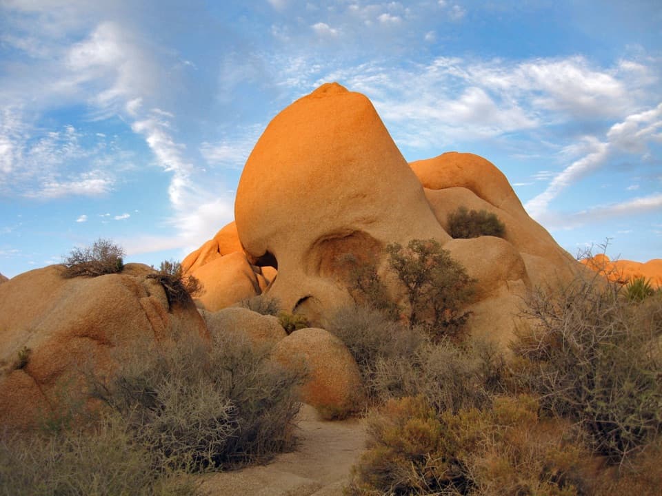 EasySkull Rock Nature Trail1.8 mi · 1.5 hr · 0.8 mi awayA short loop to a skull-shaped granite formation
 EasyDiscovery Trail0.7 mi · 36 min · 0.8 mi awayA short loop through washes, rock slots, and a desert overlook.
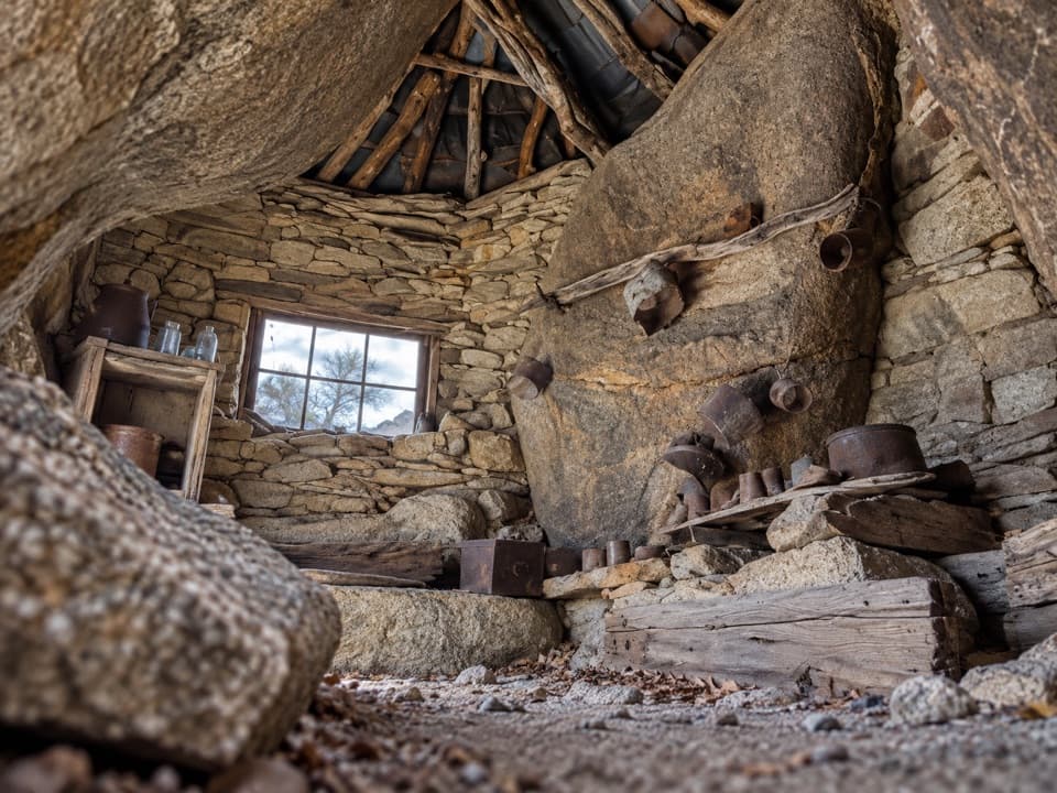 ChallengingEagle Cliff Mine Trail3.5 mi · 3 hr · 1.6 mi awayA hidden cabin in boulders, reached by a faint desert route
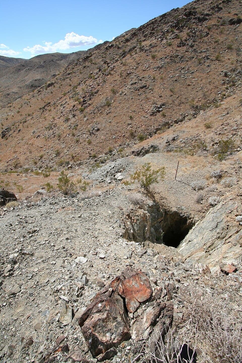 EasyDesert Queen Mine Trail1.5 mi · 1.3 hr · 1.6 mi awayOld mine gear rewards a short desert walk; stay outside the gates.
 EasyPine City Trail4 mi · 2.5 hr · 1.6 mi awayA desert walk to pinyons tucked among granite boulders.
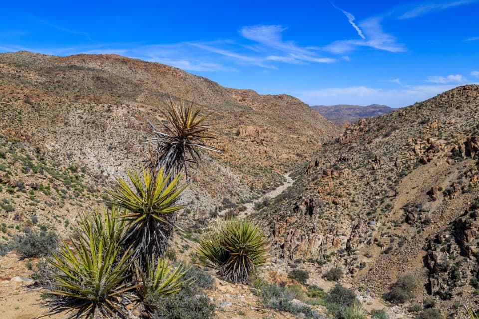 EasyLucky Boy Vista Trail2.5 mi · 1.5 hr · 1.6 mi awayAn easy desert walk to mine remains and a wide valley overlook.
 EasyLucky Boy Loop3.3 mi · 2.3 hr · 1.6 mi awayDesert views, old mine remains, and a final road stretch.
 EasyArch Rock Trail1.3 mi · 1 hr · 2.3 mi awayA short sandy walk ends at a sculpted granite arch.Sight · At the trailheadSplit RockThe namesake boulder sits at the start of a 2.5-mile desert loop.
 Picnic area · 0.7 mi awayLive Oak Picnic AreaPicnic tables, boulders to scramble, and a curious old oak.
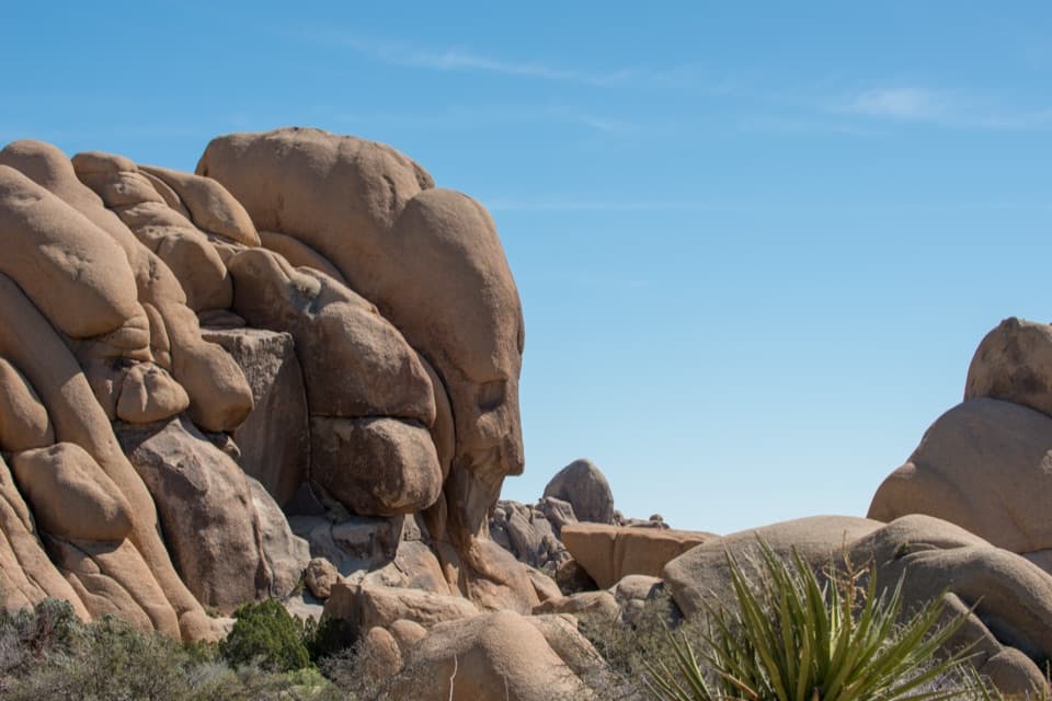 Sight · 0.7 mi awayFace RockA face in the rocks rewards a short spur detour.Sight · 0.8 mi awaySkull RockA skull-shaped granite boulder makes a memorable roadside pause.
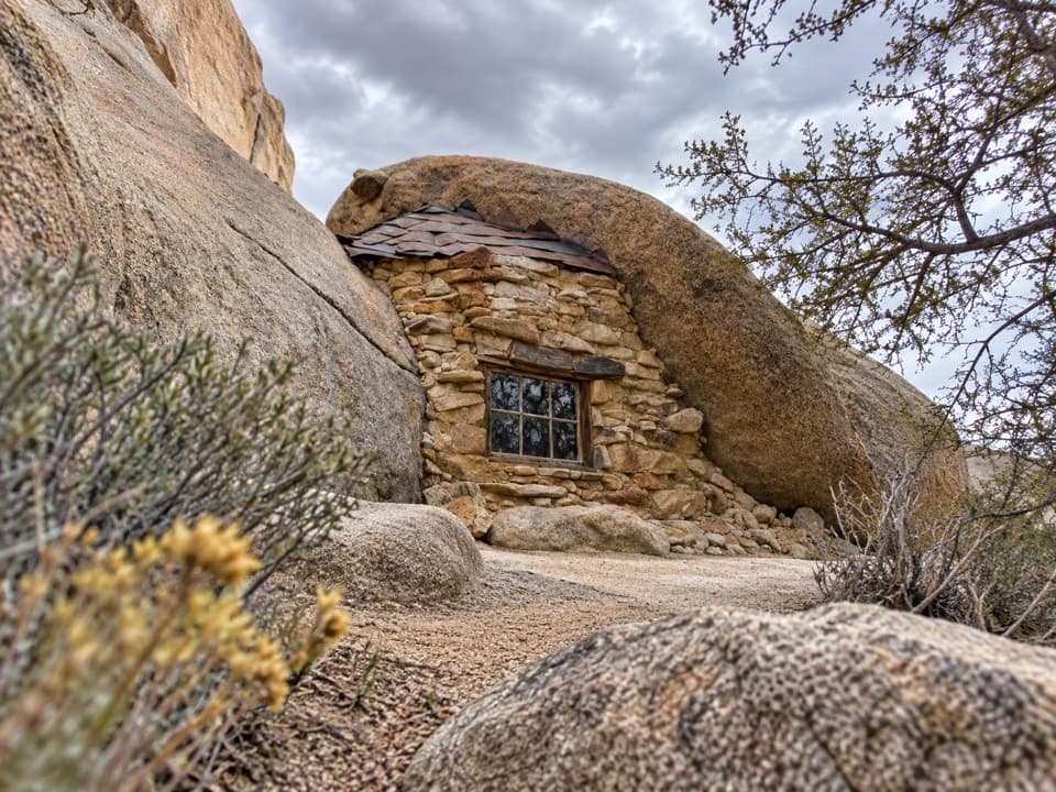 Sight · 1 mi awayEagle Cliff Mine and Boulder HouseA miner’s stone cabin tucked into a narrow boulder cleft.
 Campground · 1.3 mi awayJumbo Rocks CampgroundA campsite in a maze of boulders, with stars overhead after dark.
 Sight · 1.3 mi awayDesert Queen MineWalk a short loop past ore bins, old shafts and mining debris.
 Campground · 2.2 mi awayBelle CampgroundEighteen simple sites tucked among Joshua trees and granite boulders.
Parkwolf’s Joshua Tree ranking

The audio tour guide for the drive, plus offline maps, trails, and wildlife heatmaps for when the signal drops.




