Arch Rock Trail in Joshua Tree National Park

#6 of 60 trails in Joshua Tree

Joshua Tree National Park, CA

Arch Rock Trail

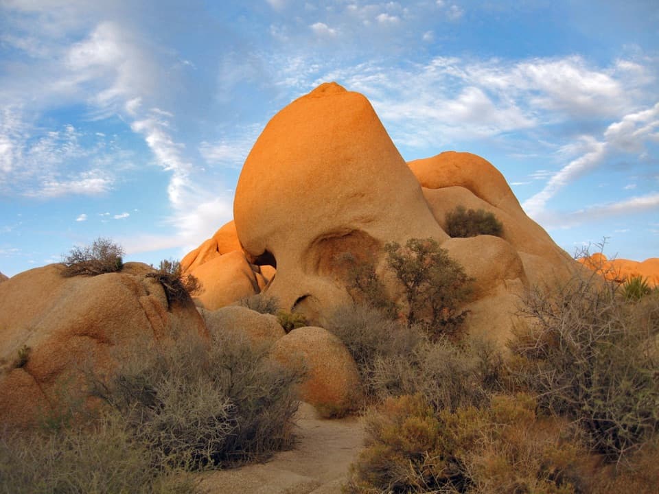
A short sandy walk ends at a sculpted granite arch.

Photo: Wikimedia Commons
Length
1.3mi
Time
1hr
Elev. change
92ft
Difficulty
Easy
  • Loop
  • No dogs
  • High point 3,917 ft

Hear the audio tour

Arch Rock from Twin Tanks

Overview

About Arch Rock Trail

Why go

  • A memorable granite arch and smaller formations are close to the trailhead.
  • The short loop adds a geology walk without a long climb.

Heads up

  • The sandy approach and uneven rocks take more effort than the mileage suggests.
  • No shade, water or cell service; summer timing matters.

Map & elevation

The route

Loading the Joshua Tree map
Full map
Elevation3,825–3,917 ft
TrailheadArch Rock and Twin Tanks Trailhead33.98946, -116.02296
Keep this map with you offline in the Parkwolf app

Plan your hike

Before you go

Parking

Start at the Twin Tanks / Arch Rock Trailhead parking lot along Pinto Basin Road, about a mile south of Belle Campground. The lot has a restroom and hiker register; parking can be difficult on busy days. Use the marked road crossing on the route.

Best time to go

There is no shade, running water or cell service along this route. Carry water from the start and have an offline map ready; a few turns among the rocks can be less obvious than the short distance suggests. Summer heat is the serious hazard here: park guidance advises against hiking between 10 a.m. and 5 p.m. in summer, and recommends starting early. Dogs are not allowed on this trail; the park’s pet exception is the paved Oasis of Mara walk.

Safety

No shade, running water or cell service. Summer heat is dangerous; avoid hiking from 10 a.m. to 5 p.m. in summer and carry water. Use the marked crossing at Pinto Basin Road, and have an offline map for the boulder junctions.

5 active Joshua Tree alerts

  • ClosureOasis of Mara Trail closed past the OasisThe Oasis of Mara Trail is closed past the Oasis due to a heavy flooding event; do not continue beyond the Oasis. Check current park conditions before visiting.Official details
  • ClosureSR 62 and US 95 closed by floodingFlooding has closed portions of SR 62 and US 95; avoid the closed segments.Official details
See all 5 alerts
A park ranger sits on a dash-mounted phone, talking, as Parkwolf’s Tour Guide plays “Army Cutworm Moths: A Grizzly Bear Buffet” on Grand Loop Road below Dunraven Pass in Yellowstone
Parkwolf Tour GuideThe highest, rockiest slopes around here are a summer buffet for grizzly bears.

Joshua Tree Tour Guide

Your drive to Arch Rock Trail, narrated.

Parkwolf is a GPS audio tour guide for Joshua Tree National Park. As you drive, it chimes in with what’s ahead: hidden gems, upcoming stops, history, geology, and wildlife, right through your car’s speakers.

See the Joshua Tree audio tour

Recorded for this trailhead

Arch Rock from Twin Tanks
0:00 / 0:22
“You're nearing the Twin Tanks trailhead for Arch Rock, a stone span tucked among rounded granite boulders.”

Plays as you drive up to this trailhead in the Parkwolf Joshua Tree Tour Guide.

More stories near here in the app

  • White Tank: A Small Camp Beside Arch Rock
  • Belle Campground: Small and Simple
  • The Chuckwalla’s Inflatable Escape
  • The Iguana in the Midday Heat
  • 89 audio storiesacross Joshua Tree’s roads, triggered by GPS as you drive
  • Wildlife heatmapsfor Bighorn Sheep, Golden Eagle, Desert Tortoise, and 13 more
  • Works offlinemaps, 60 trails, 64 places, and audio download before you lose signal
  • CarPlay readysimple controls built for the drive
★★★★★
“Fantastic app with many points of information… It’s great to just turn on while you’re driving and it gives you an audio tour of the national Park. We love it!!!!”
JMJamesApp Store review
Download Parkwolf on the App StoreGet Parkwolf on Google Play

4.7 from 8,600+ ratings

Trail guide

Hiking Arch Rock Trail

A quick walk with a proper destinationArch Rock Trail is a lollipop walk from Twin Tanks to a small loop through rounded granite…

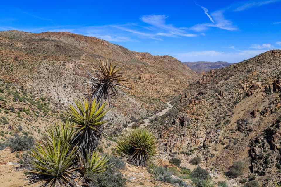
Arch Rock Trail is a lollipop walk from Twin Tanks to a small loop through rounded granite boulders, with the arch itself as the payoff. Published estimates range from 1.3 to 1.4 miles round trip; allow about an hour either way. You walk a sandy approach, explore the rocky loop, then retrace the same approach to the lot. It is an easy outing for a short desert walk, but the rocks make it feel more like a hike than a flat roadside stop.

Follow the signs, then take the loop counterclockwiseFrom the Twin Tanks trailhead, the route heads across open desert, briefly follows the…

From the Twin Tanks trailhead, the route heads across open desert, briefly follows the California Riding and Hiking Trail, and crosses Pinto Basin Road at the marked crossing before turning toward Arch Rock. Keep an eye out for the Arch Rock signs at the junction; the longer route continues beyond the turn. When you reach the short loop, walk it counterclockwise. That direction makes the arch easier to spot, roughly a tenth of a mile into the loop. The loop reconnects with the approach, which you follow back to the same parking lot.


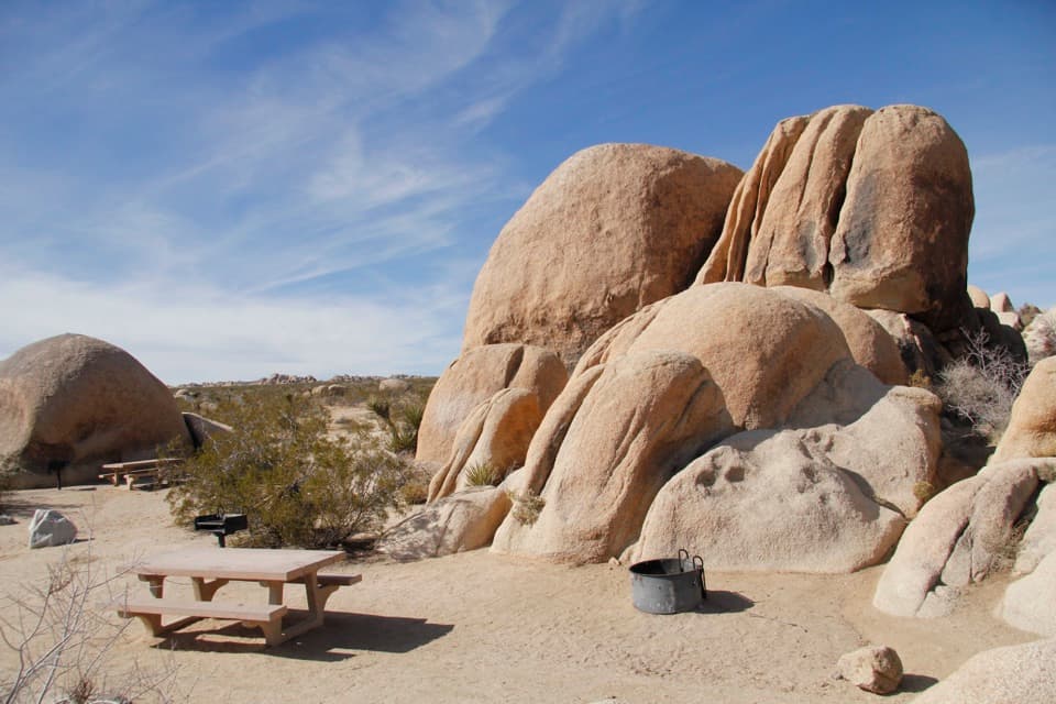
Spend time with the rockArch Rock is a broad granite span, about 30 feet across, tucked among other rounded formations.

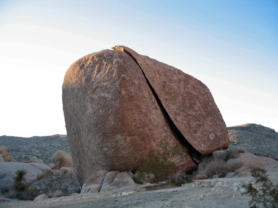
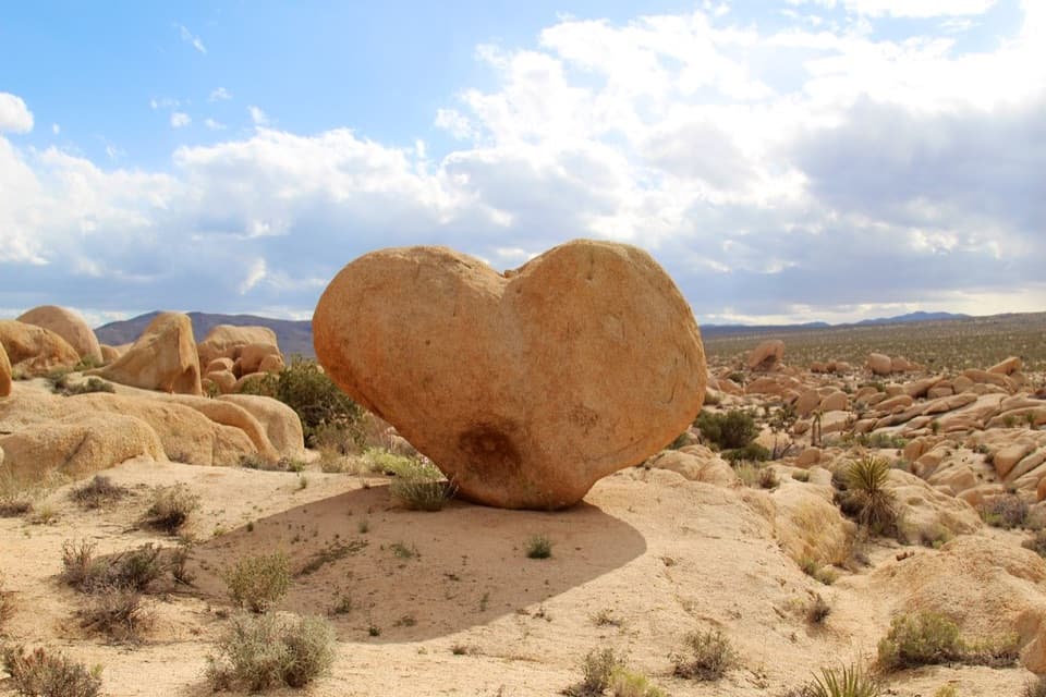
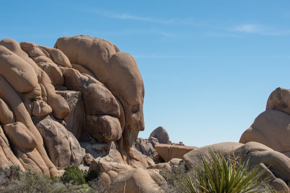
Arch Rock is a broad granite span, about 30 feet across, tucked among other rounded formations. The loop has geology wayside signs that help make sense of the boulder field, and Whale Rock is another formation you can see from the route. A short side detour leads toward Heart Rock, but that is extra wandering beyond the route mapped here. If you want a photograph, a side view shows the arch’s shape better than standing directly beneath it; a few steps off the path take you below the span if the rocks feel comfortable underfoot.

Sand first, then uneven graniteThe approach is mostly sand.

The approach is mostly sand. Around the loop the ground shifts between deep sand, hard-packed dirt and uneven rock, with some narrow sections, so take your time when choosing a line through the boulders. The climb is modest; the main effort is the soft footing and picking out the route in the rock field. This is not a boardwalk or a smooth, step-free path. The optional few steps below the arch are rougher than the main trail and are easy to skip.

Parking and the practical detailsStart at the Twin Tanks / Arch Rock Trailhead parking lot along Pinto Basin Road, about a mile…

Start at the Twin Tanks / Arch Rock Trailhead parking lot along Pinto Basin Road, about a mile south of Belle Campground. It has parking, a restroom and a hiker register. Parking can be difficult on busy days, so arriving early is useful. There is no food or running water at the trailhead or along the walk. A separate, shorter route begins inside White Tank Campground and reaches the same rock; that is a different access option, not this Twin Tanks hike.

Wildlife

Wildlife in Joshua Tree

All Joshua Tree wildlife maps

Sighting maps show where each species has been reported across Joshua Tree. Wildlife moves, so no sighting is guaranteed.

Keep exploring

Near Arch Rock Trail

See it all on the map

Trails that start nearby

Places near the trailhead

Parkwolf’s Joshua Tree ranking

Top-rated trails in Joshua Tree

All 60 trails
  1. 1Hidden Valley Nature TrailEasy · 1 mi
  2. 2Barker Dam Nature TrailEasy · 1.3 mi
  3. 3Ryan Mountain TrailChallenging · 3 mi
  4. 4Fortynine Palms Oasis TrailChallenging · 3 mi
  5. 5Lost Palms Oasis TrailChallenging · 7.5 mi
  6. 7Lost Horse Mine TrailModerate · 4 mi

Take Parkwolf to Joshua Tree.

The audio tour guide for the drive, plus offline maps, trails, and wildlife heatmaps for when the signal drops.

4.7 from 8,600+ ratings

Download Parkwolf on the App StoreGet Parkwolf on Google Play