Scout Scar in Lake District National Park

Lake District National Park, EN

Scout Scar

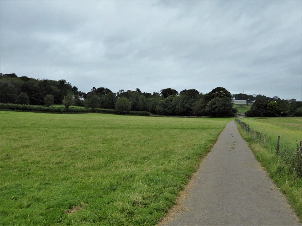
Short steep climb to a limestone rim with wide fell views

Photo: Wikimedia Commons
Length
1.8km
Time
30min
Elevation
Flat
Difficulty
Moderate
  • Dogs allowed
  • High point 222 m
  • #118 of 265 in Lake District

Hear the audio tour

Scout Scar: A Short Walk to the Fells View

Overview

About Scout Scar

Why go

  • Wide views after a short walk
  • Clear route to a limestone escarpment

Heads up

  • One steep 1:5 climb
  • Unprotected edge and no facilities
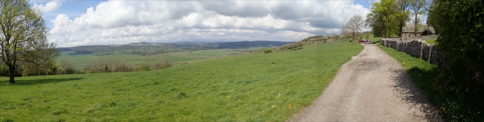
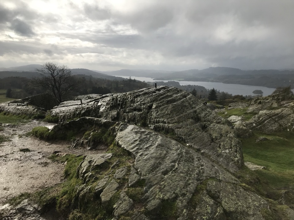
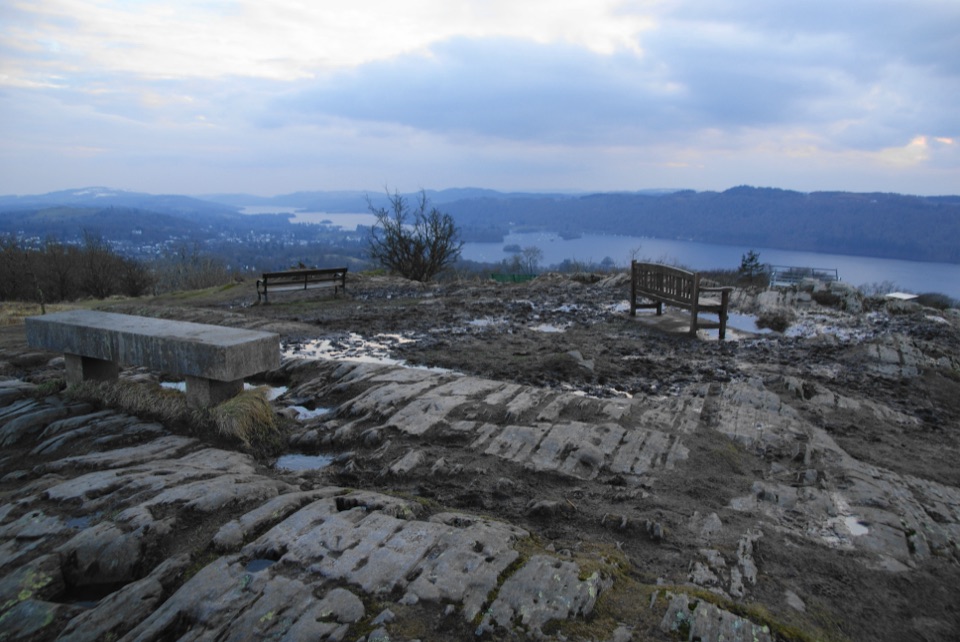
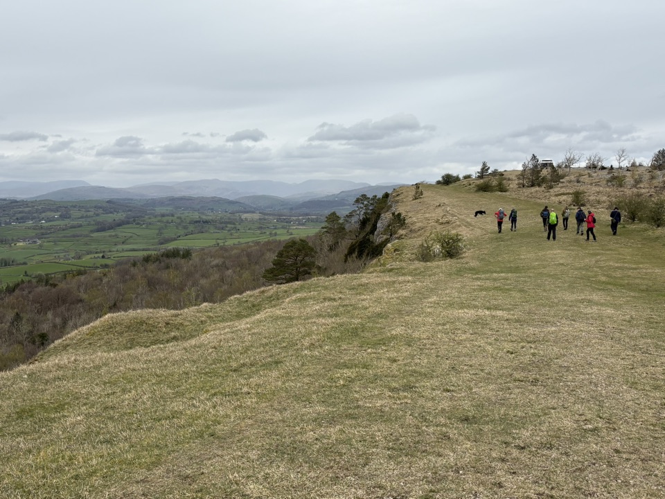
Open views stretch across the Lyth Valley to Coniston Old Man, Bowfell and the Langdale Pikes.
Parkwolf’s verdictThe payoff

Map & elevation

The route

Loading the Lake District map
Full map
Elevation217–222 m
TrailheadScout Scar Car Park54.32458, -2.78776
Keep this map with you offline in the Parkwolf app

Plan your hike

Before you go

Parking

Use Scout Scar Car Park on Underbarrow Road. From Kendal Town Hall, take Allhallows Lane and continue about 2.5 km. After the sharp right-hand bend, the car park is on the right as the road starts downhill. There are no facilities on the route.


Safety

The opening climb is a rough 1:5 gradient for over 100 m. Cross the road carefully, and keep children and dogs well back from the steep, unprotected western edge. Dogs must be controlled around livestock and kept on a lead no longer than 2 m from 1 March to 31 July on open access land.

8 active Lake District alerts

  • ClosureChapel Stile footpath closed for retaining-wall riskPart of Footpath 543030 between Chapel Stile and Baysbrown campsite is closed because a retaining wall beside the path could collapse and material it supports could fall across the footpath.Official details
  • ClosureStanley Ghyll Lower Falls footpath closed for rockfallThe section of Footpath 408037 leading towards Stanley Ghyll Lower Falls is closed because severe rockfall damage has made the path unstable and further rockfall remains a danger.Official details
See all 8 alerts
A park ranger sits on a dash-mounted phone, talking, as Parkwolf’s Tour Guide plays “Army Cutworm Moths: A Grizzly Bear Buffet” on Grand Loop Road below Dunraven Pass in Yellowstone
Parkwolf Tour GuideThe highest, rockiest slopes around here are a summer buffet for grizzly bears.

Lake District Tour Guide

Your drive to Scout Scar, narrated.

Parkwolf is a GPS audio tour guide for Lake District National Park. As you drive, it chimes in with what’s ahead: hidden gems, upcoming stops, history, geology, and wildlife, right through your car’s speakers.

Recorded for this trailhead

Scout Scar: A Short Walk to the Fells View
0:00 / 0:52
“You're coming up on Scout Scar, where a short climb opens up a wide view across the Lyth Valley to the high fells.”

Plays as you drive up to this trailhead in the Parkwolf Lake District Tour Guide.

More stories near here in the app

  • Kendal Mint Cake Goes to Everest
  • The Lakes' Volcanic Past
  • Helsington: Local Faces Among the Angels
  • Pipistrelles: Hunting by Echo
  • 298 audio storiesacross Lake District’s roads, triggered by GPS as you drive
  • Wildlife heatmapsfor Red Deer, Eurasian Otter, Osprey, and 13 more
  • Works offlinemaps, 265 trails, 89 places, and audio download before you lose signal
  • CarPlay readysimple controls built for the drive
★★★★★
“Fantastic app with many points of information… It’s great to just turn on while you’re driving and it gives you an audio tour of the national Park. We love it!!!!”
JMJamesApp Store review
Download Parkwolf on the App StoreGet Parkwolf on Google Play

4.7 from 8,600+ ratings

Trail guide

Hiking Scout Scar

The short versionAn out-and-back walk of 900 m each way, 1.8 km (1.

An out-and-back walk of 900 m each way, 1.8 km (1.12 mi) round trip, with about half an hour of walking. Short, but rated challenging for the climb.

How it unfoldsFrom Scout Scar Car Park, take the path right and down to the road, then cross carefully and go…

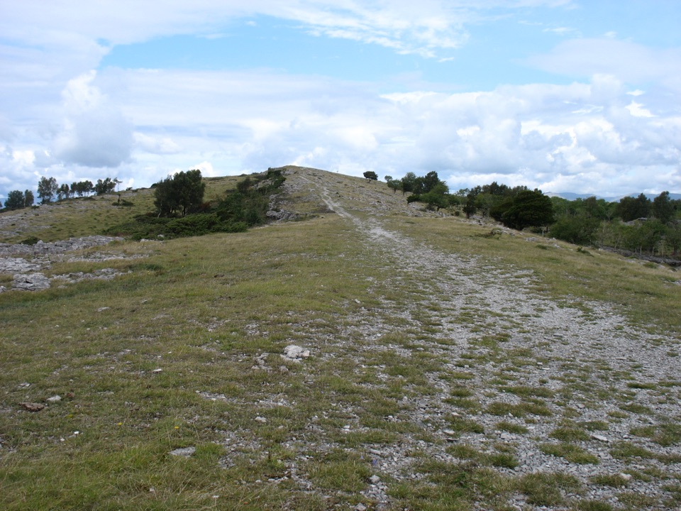
From Scout Scar Car Park, take the path right and down to the road, then cross carefully and go through the wooden gate. A rough path rises steeply at roughly 1:5 for over 100 m, with two resting places along the way. The gradient eases where a surfaced path bends left, and a natural surface carries on for about 300 m past and below the Mushroom viewpoint. Turn around there and retrace the same route.

Underfoot and along the edgeThis is a limestone escarpment with open grassland and limestone pavement, so expect limestone…

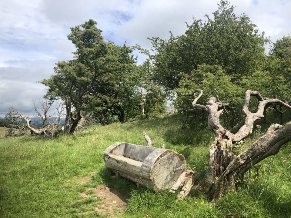
This is a limestone escarpment with open grassland and limestone pavement, so expect limestone footing and some uneven natural surface beyond the surfaced section. The western edge is steep and unprotected, so keep children and dogs well back from the drop.

DogsDogs are welcome.

Dogs are welcome. Under open access rules, keep them on a lead of 2 m or less from 1 March to 31 July to protect ground-nesting birds, and under close control around livestock. It is a popular route with local walkers and dog walkers.

Access and parkingPark at Scout Scar Car Park (LA8 8HB, grid SD 488924).

Park at Scout Scar Car Park (LA8 8HB, grid SD 488924). There are no facilities and no direct public transport. Mobility scooters must be class 2 or 3, and the two rest places are not accessible to wheelchairs or mobility scooters. The steep initial rise is the main barrier.

If you want moreLonger walks over Scout Scar and Cunswick Scar start from the same area and are separate routes…

Longer walks over Scout Scar and Cunswick Scar start from the same area and are separate routes with their own distances and effort, rather than extensions of this one.

Wildlife

Wildlife in Lake District

All Lake District wildlife maps

Sighting maps show where each species has been reported across Lake District. Wildlife moves, so no sighting is guaranteed.

Keep exploring

Near Scout Scar

See it all on the map

Trails that start nearby

Places near the trailhead

Parkwolf’s Lake District ranking

Top-rated trails in Lake District

All 265 trails
  1. 1Scafell Pike via Hollow Stones from WasdaleChallenging · 9 km
  2. 2Helvellyn via Striding Edge and Swirral EdgeChallenging · 12.4 km
  3. 3CatbellsModerate · 6.6 km
  4. 4The Old Man of ConistonChallenging · 9 km
  5. 5Buttermere CircularEasy · 7.6 km
  6. 6The Fairfield HorseshoeChallenging · 17.2 km

Take Parkwolf to Lake District.

The audio tour guide for the drive, plus offline maps, trails, and wildlife heatmaps for when the signal drops.

4.7 from 8,600+ ratings

Download Parkwolf on the App StoreGet Parkwolf on Google Play