Swirls Trail, Thirlmere in Lake District National Park

Lake District National Park, EN

Swirls Trail, Thirlmere

A short accessible path to a quiet Thirlmere viewpoint

Photo: Wikimedia Commons
Length
1.4km
Time
1hr
Elev. change
14m
Difficulty
Easy
  • Dogs allowed
  • High point 225 m

Hear the audio tour

Thirlmere and Swirls: Viewpoint or Mountain Day

Overview

About Swirls Trail, Thirlmere

Why go

  • Reservoir views on a short accessible route
  • Clear destination with firm surfaced sections

Heads up

  • Parking is popular with Helvellyn walkers
  • The route is not fully level and ends before rougher ground
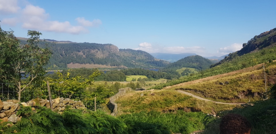
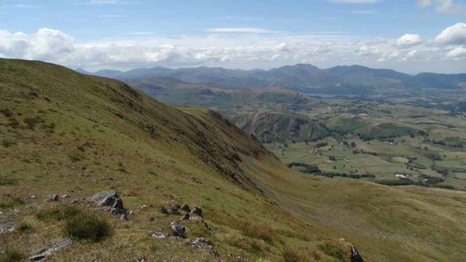
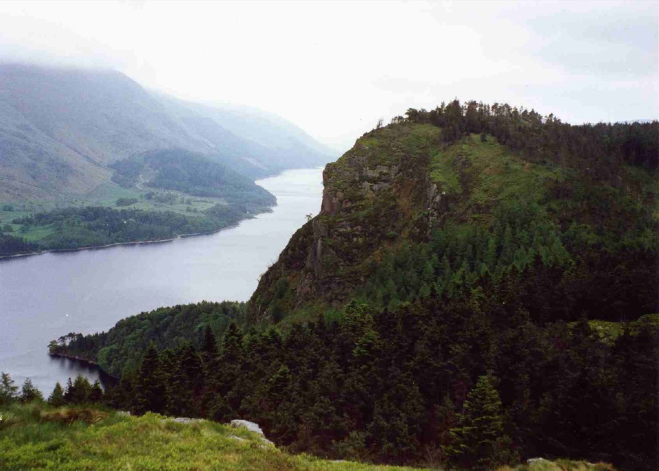
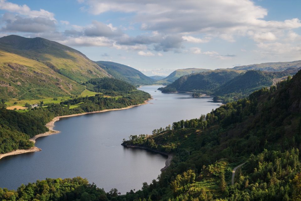
The path trades a little access friction for a good view across the reservoir. Thirlmere sits in a narrow mountain corridor, with wooded slopes below High Tove, High Seat, and Bleaberry Fell. The water-supply landscape has a human history too: the reservoir replaced two smaller waters and a hamlet when the valley was flooded in the late Victorian period. Early or late light gives the water and surrounding fells more shape, while the woodland section adds shade on brighter days.
Parkwolf’s verdictThe payoff

Map & elevation

The route

Loading the Lake District map
Full map
Elevation211–225 m
TrailheadSwirls Trail, Thirlmere54.54279, -3.05784
Keep this map with you offline in the Parkwolf app

Plan your hike

Before you go

Parking

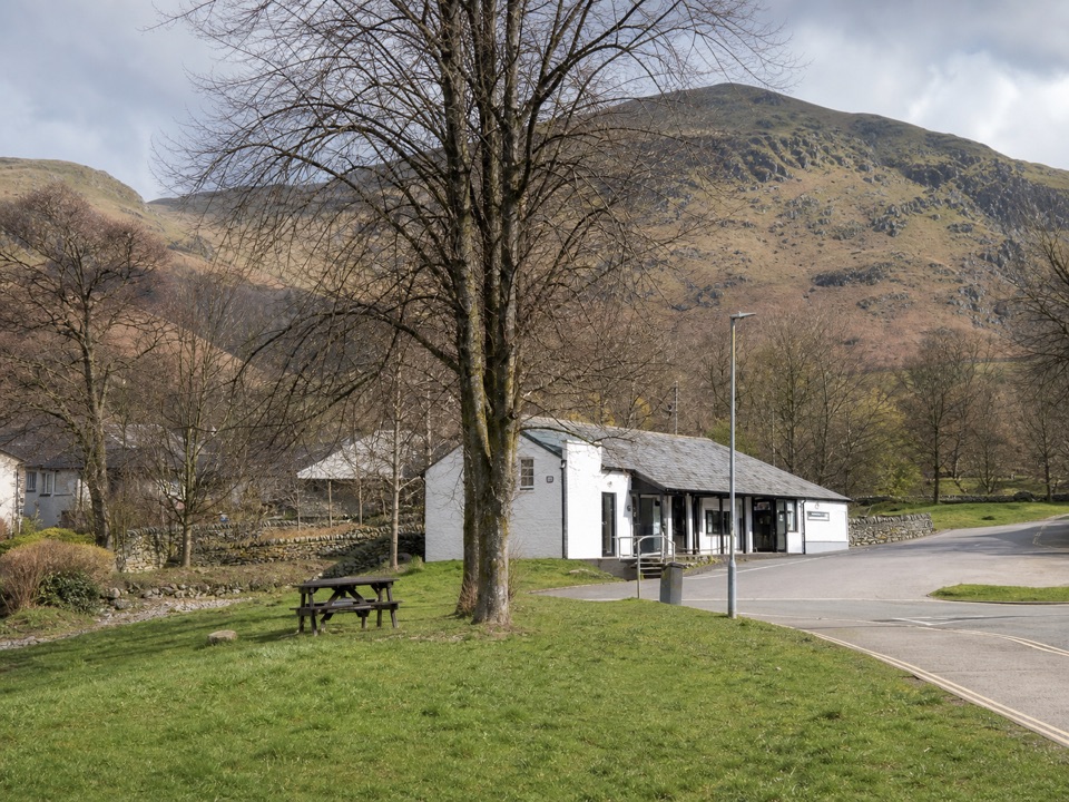
Use the main Swirls car park off the A591, on the southbound side near CA12 4TN. The National Park describes approximately 60 spaces, pay-and-display parking, and accessible toilet facilities. It is a popular Helvellyn starting point, so space is limited at busy times. Do not substitute the nearby northbound Station Coppice car park or stop on the A591. Toilets at the reservoir sites are closed in winter.


Safety

Use the A591 underpass rather than crossing the live road. The rolled-stone ramp includes a short 1:9 gradient, and the woodland path undulates. Class 2 or 3 mobility scooters are required. Surfaces can be wet and slippery after rain. Keep dogs close or on a short lead around livestock and wildlife; the reservoir edge beyond the accessible viewpoint is not part of this route.

8 active Lake District alerts

  • ClosureChapel Stile footpath closed for retaining-wall riskPart of Footpath 543030 between Chapel Stile and Baysbrown campsite is closed because a retaining wall beside the path could collapse and material it supports could fall across the footpath.Official details
  • ClosureStanley Ghyll Lower Falls footpath closed for rockfallThe section of Footpath 408037 leading towards Stanley Ghyll Lower Falls is closed because severe rockfall damage has made the path unstable and further rockfall remains a danger.Official details
See all 8 alerts
A park ranger sits on a dash-mounted phone, talking, as Parkwolf’s Tour Guide plays “Army Cutworm Moths: A Grizzly Bear Buffet” on Grand Loop Road below Dunraven Pass in Yellowstone
Parkwolf Tour GuideThe highest, rockiest slopes around here are a summer buffet for grizzly bears.

Lake District Tour Guide

Your drive to Swirls Trail, Thirlmere, narrated.

Parkwolf is a GPS audio tour guide for Lake District National Park. As you drive, it chimes in with what’s ahead: hidden gems, upcoming stops, history, geology, and wildlife, right through your car’s speakers.

Recorded for this trailhead

Thirlmere and Swirls: Viewpoint or Mountain Day
0:00 / 1:16
“Up ahead is Swirls, beside Thirlmere, where you can choose a short reservoir walk or a full mountain day on Helvellyn. For a break from driving, I'd take the Swirls Trail to the picnic bench overlooking the water.”

Plays as you drive up to this trailhead in the Parkwolf Lake District Tour Guide.

More stories near here in the app

  • Armboth: High Tove and the Rocky Tops
  • Stanah: Sticks Pass and the Dodds
  • Raven Crag: Thirlmere from Above
  • Legburthwaite: High Rigg Ridge and Valley
  • 298 audio storiesacross Lake District’s roads, triggered by GPS as you drive
  • Wildlife heatmapsfor Red Deer, Eurasian Otter, Osprey, and 13 more
  • Works offlinemaps, 265 trails, 89 places, and audio download before you lose signal
  • CarPlay readysimple controls built for the drive
★★★★★
“Fantastic app with many points of information… It’s great to just turn on while you’re driving and it gives you an audio tour of the national Park. We love it!!!!”
JMJamesApp Store review
Download Parkwolf on the App StoreGet Parkwolf on Google Play

4.7 from 8,600+ ratings

Trail guide

Hiking Swirls Trail, Thirlmere

The routeThis is a 0.

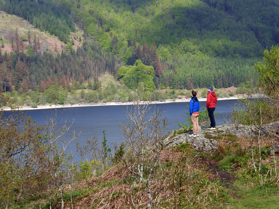
This is a 0.9-mile out-and-back from Swirls car park, with the stored distance representing the complete return trip. The mapped line follows the physical route once. Start through the large field gate or accessible wicket gate, take the stone-surfaced track downhill, then turn uphill toward the A591 underpass. Beyond the underpass, follow the signed path through Station Coppice to an accessible picnic bench overlooking Thirlmere. The accessible route ends at the bench; the rougher footpath beyond is a different proposition.

Surface and effortThis is a short, low-effort walk rather than a level promenade.

This is a short, low-effort walk rather than a level promenade. The route uses firm stone and tarmac near the start, a rolled-stone ramp with one short 1:9 gradient, and a well-surfaced woodland path that undulates gently. It is graded for many visitors, including some mobility-scooter users, but class 2 or 3 mobility scooters are required. Allow about 1 hour at an easy pace with time at the viewpoint.

Planning and comparisonSwirls is also a major starting point for Helvellyn, so the car park can feel much busier than…

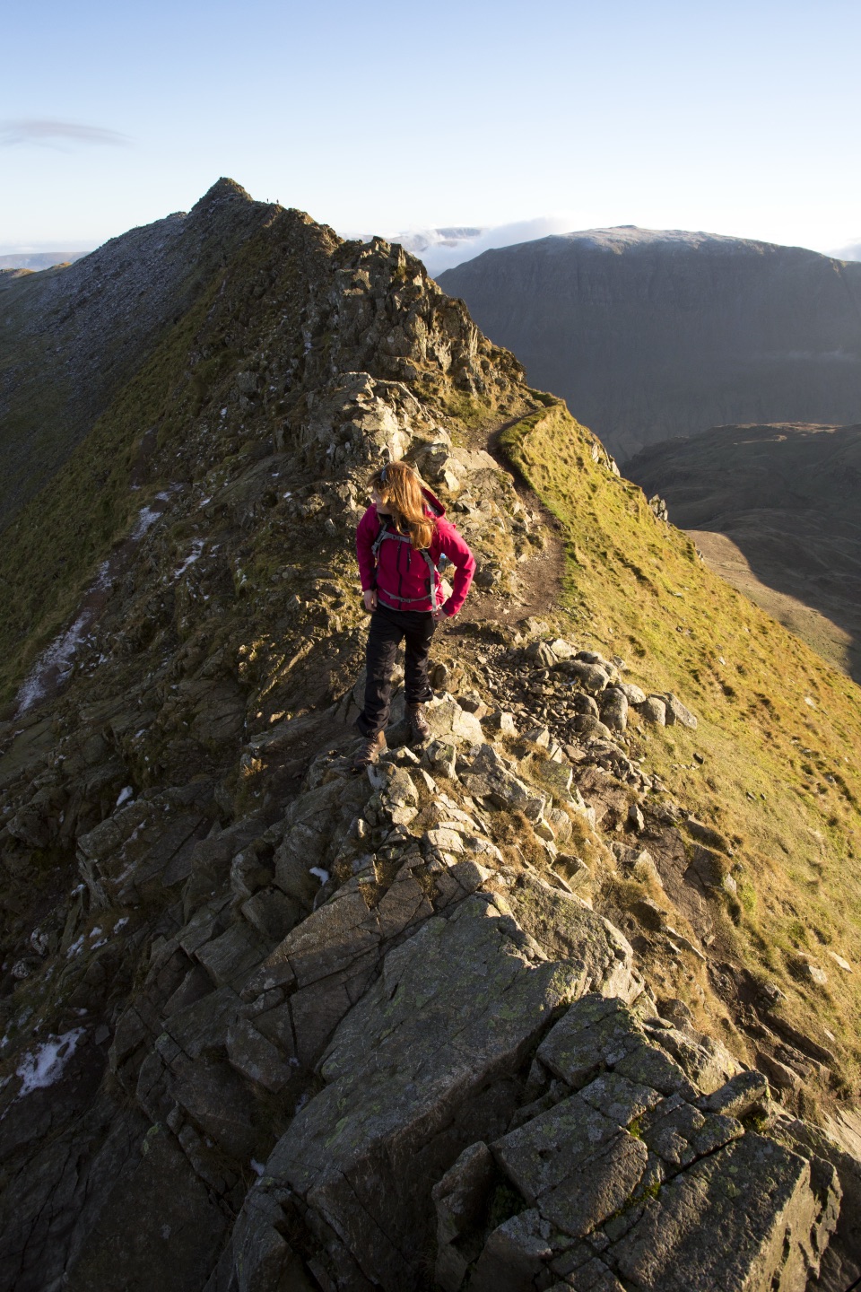
Swirls is also a major starting point for Helvellyn, so the car park can feel much busier than this short trail itself. This route suits a quick reservoir view, a pushchair-compatible outing on the firmer sections, or a mobility-scooter trip within the stated limits. If you want a summit day, Helvellyn from Swirls is nearby but much longer, steeper, rougher, and exposed. Dogs may use this route, but keep them close or on a short lead around livestock and wildlife.

Wildlife

Wildlife in Lake District

All Lake District wildlife maps

Sighting maps show where each species has been reported across Lake District. Wildlife moves, so no sighting is guaranteed.

Keep exploring

Near Swirls Trail, Thirlmere

See it all on the map

Trails that start nearby

Places near the trailhead

Parkwolf’s Lake District ranking

Top-rated trails in Lake District

All 265 trails
  1. 1Scafell Pike via Hollow Stones from WasdaleChallenging · 9 km
  2. 2Helvellyn via Striding Edge and Swirral EdgeChallenging · 12.4 km
  3. 3CatbellsModerate · 6.6 km
  4. 4The Old Man of ConistonChallenging · 9 km
  5. 5Buttermere CircularEasy · 7.6 km
  6. 6The Fairfield HorseshoeChallenging · 17.2 km

Take Parkwolf to Lake District.

The audio tour guide for the drive, plus offline maps, trails, and wildlife heatmaps for when the signal drops.

4.7 from 8,600+ ratings

Download Parkwolf on the App StoreGet Parkwolf on Google Play