Parking
Use the marked Valley Woods Road parking area for the loop. The lot is small; the preserve map permits roadside parking when it is full, as long as you do not block neighboring driveways.
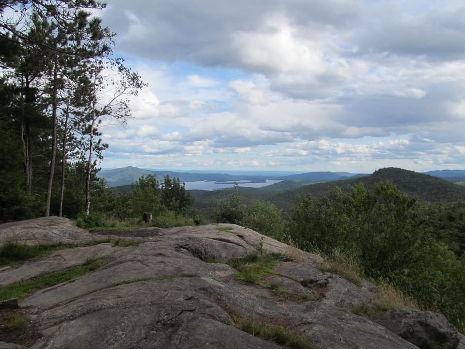
#10 of 67 trails in Lake George
Lake George NY, NY
Two summits, a Lake George panorama, and a rough ridge between them.
Overview
Map & elevation
Plan your hike

The highest, rockiest slopes around here are a summer buffet for grizzly bears.
Lake George Tour Guide
Parkwolf is a GPS audio tour guide for Lake George NY. As you drive, it chimes in with what’s ahead: hidden gems, upcoming stops, history, geology, and wildlife, right through your car’s speakers.
See the Lake George audio tourRecorded for this trailhead
Cat and Thomas Mountains from Valley Woods Road“You're nearing the Valley Woods Road trailhead for Cat and Thomas Mountains. Cat gives you the wider sweep of Lake George and the Adirondacks, but allow about four hours for the six point eight mile round trip.”
Plays as you drive up to this trailhead in the Parkwolf Lake George Tour Guide.
More stories near here in the app
“Fantastic app with many points of information… It’s great to just turn on while you’re driving and it gives you an audio tour of the national Park. We love it!!!!”


Trail guide
Cat and Thomas Mountains Loop is a 7.2-mile lollipop route from Valley Woods Road that links the Thomas and Cat summits before returning on a different trail. It takes about five hours and makes a hard half-day: the approach is manageable, but the long, rocky ridge between the peaks is what earns the extra effort. The preserve is open to the public from dawn to dusk year-round. Do this one if you want both Lake George viewpoints in one outing. It is a lollipop loop: the first stretch near the trailhead is shared, and the Cat summit spur is briefly retraced.
From the Valley Woods Road lot, follow the Blue Trail along a wide, fairly level old roadbed to the junction with the Yellow Trail. Turn toward Thomas. That trail climbs more steadily to a clearing and overlook by the old cabin site, where the view opens over the southern part of Lake George. The clearing is the practical summit stop for this route.
Continue along the yellow-marked ridge toward Cat, then take the short Blue Trail spur to the summit. Come back to that junction and follow Blue downhill to Valley Woods Road. Read the map at the lower intersections: a wrong turn can send you toward the separate Edgecomb Pond access instead of back to your car.
The connecting trail is rougher than either approach, with repeated short climbs across rocky knobs, ledges and rooty tread. Views appear through occasional openings, but the path stays mostly in the woods between the two summits. Wet rock can be slick, and route-finding takes more attention where marked trails meet. The steep, rough middle section is the part that takes the most care.
Thomas gives you a broad view across the southern lake. Cat opens wider, with Lake George, its Narrows islands and a long sweep of Adirondack peaks in view. This is the place to stop for the panorama: frame the lake and islands together rather than pointing straight at a single peak.
The Lake George Land Conservancy acquired the preserve in 2003 and sold it to New York State in 2013, bringing it into the Adirondack Forest Preserve. Thomas's overlook is beside the site of a one-room cabin built by a former owner to attract hunters. Its present condition is unclear, but the cabin story explains why the clearing is there.
For a shorter outing, turn around at Thomas: the Valley Woods approach is 1.4 miles each way, or about 2.8 miles round trip. You still get the Lake George overlook and skip the harder ridge traverse. The full loop is the better choice when you specifically want both summit views and have time for the rougher middle section.
Wildlife
 34 sightingsWhite-tailed DeerMost seen around 5 PMSighting map
 26 sightingsTimber RattlesnakeMost seen around 6 PMSighting map
 22 sightingsOspreyMost seen around 7 AMSighting map
 60 sightingsLoonMost seen around 6 AMSighting map
 33 sightingsPorcupineMost seen around 7 PMSighting map
 84 sightingsGreat Blue HeronMost seen around 6 AMSighting map
Sighting maps show where each species has been reported across Lake George. Wildlife moves, so no sighting is guaranteed.
Keep exploring
 ModerateCat Mountain Trail from Valley Woods Road6.8 mi · 4 hr · At the trailheadA long forest road gives way to a rocky Lake George summit.
 ModerateThomas Mountain Trail3 mi · 2 hr · At the trailheadA broad forest road leads to a rocky Lake George overlook.
 ModerateCat Mountain Trail from Edgecomb Pond4.5 mi · 3.5 hr · 2 mi awayA pond-side climb to open rock and broad Lake George views
 EasyUp Yonda Farm Base Loop Trail0.5 mi · 25 min · 2.6 mi awayA half-mile farm loop with a self-guided nature focus.
 ModerateUp Yonda Farm Field Traverse Trail0.5 mi · 30 min · 2.7 mi awayA short grassy climb to an open view of Lake George's Narrows.
 EasyUp Yonda Farm Sugar Trail0.3 mi · 15 min · 2.7 mi awayA short sugarbush walk links the Sugar House and seasonal StoryWalk.
 ModerateUp Yonda Farm Upper Loop1.3 mi · 1.5 hr · 2.7 mi awayA grassy climb to a Lake George Narrows view
 ModerateGodwin Preserve Yellow Trail1.2 mi · 45 min · 2.8 mi awayA short climb to wetlands, forested ridges and a Lake George glimpse.
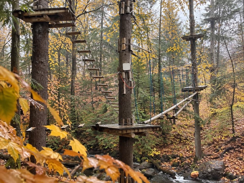 Sight · 1.6 mi awayAdirondack Extreme Adventure CourseClimb, swing, and zip through a forest full of obstacles.
 Visitor center · 2.7 mi awayUp Yonda Farm Environmental Education CenterHands-on nature exhibits pair with a short climb to a lake view.
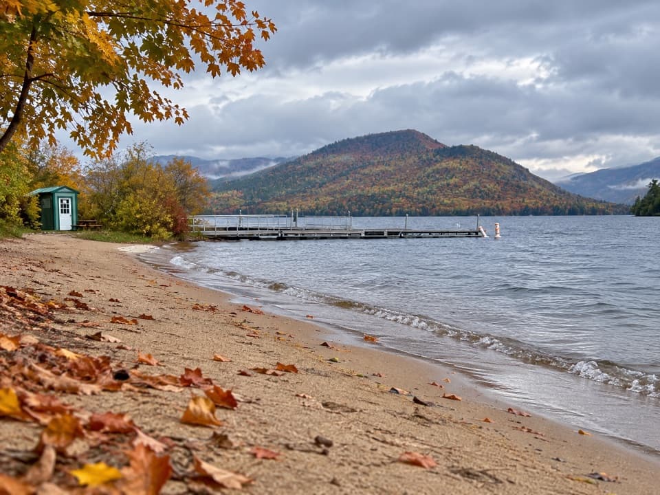 Beach · 3.5 mi awayVeteran’s Memorial Park BeachA compact beach pairs mountain views with easy family play.
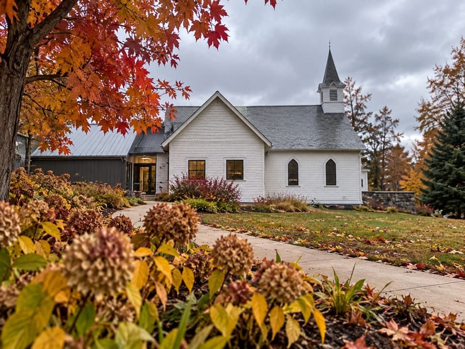 Sight · 3.9 mi awayThe Bolton MuseumA former church traces the story of a classic Adirondack resort
 Beach · 3.9 mi awayRogers Memorial Park and BeachLake George swimming, picnic space, and a pier in the village.
 Lodging · 4.1 mi awayThe Sagamore ResortA historic hotel on a private island reached by causeway.
 Restaurant · 4.2 mi awayThe Algonquin RestaurantDockside dining pairs the Fish Point with wide lake views.
 Sight · 4.3 mi awayThe SembrichOpera history inside a soprano’s former teaching studio.
Parkwolf’s Lake George ranking

The audio tour guide for the drive, plus offline maps, trails, and wildlife heatmaps for when the signal drops.




