Tolmer Falls in Litchfield National Park

#5 of 15 sights in Litchfield

Sight · Litchfield National Park

Tolmer Falls

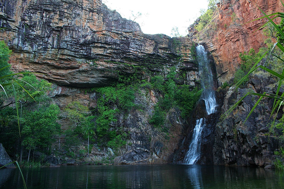
Twin escarpments, one deep plunge pool, and a short sealed path

Photo: Wikimedia Commons
Type
Sight
Nearest trail
0.4 km
Audio stories
9 nearby
  • Parking
  • Restrooms
  • Scenic viewpoint
  • Picnic tables

Hear the audio tour

Tolmer Falls

Overview

About Tolmer Falls

Why stop

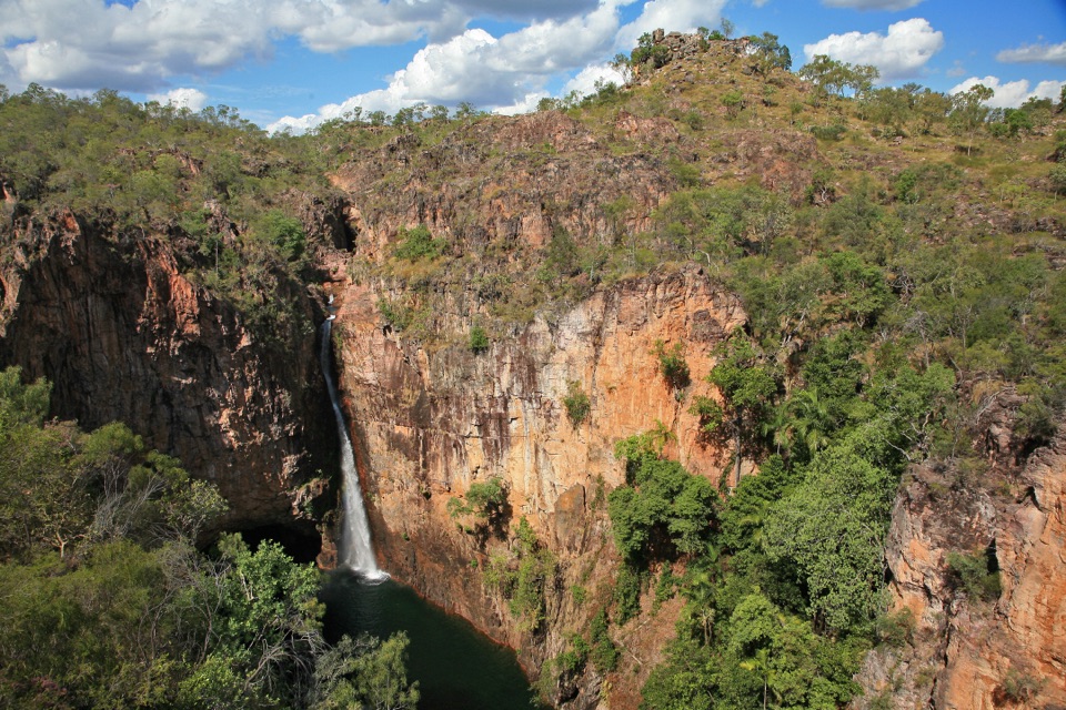
  • Dramatic waterfall framed by a red sandstone gorge

Heads up

  • Swimming is not allowed at the falls
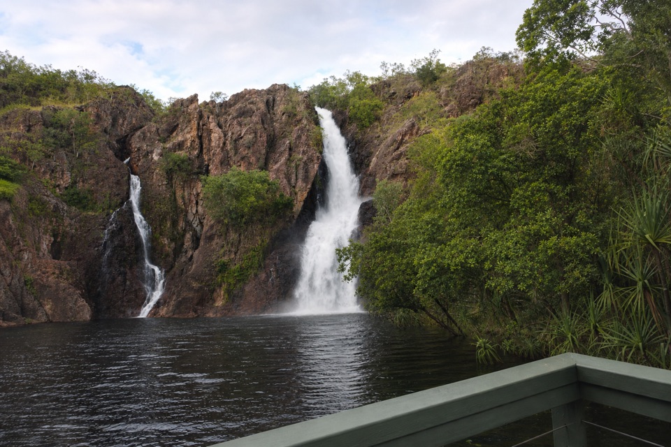
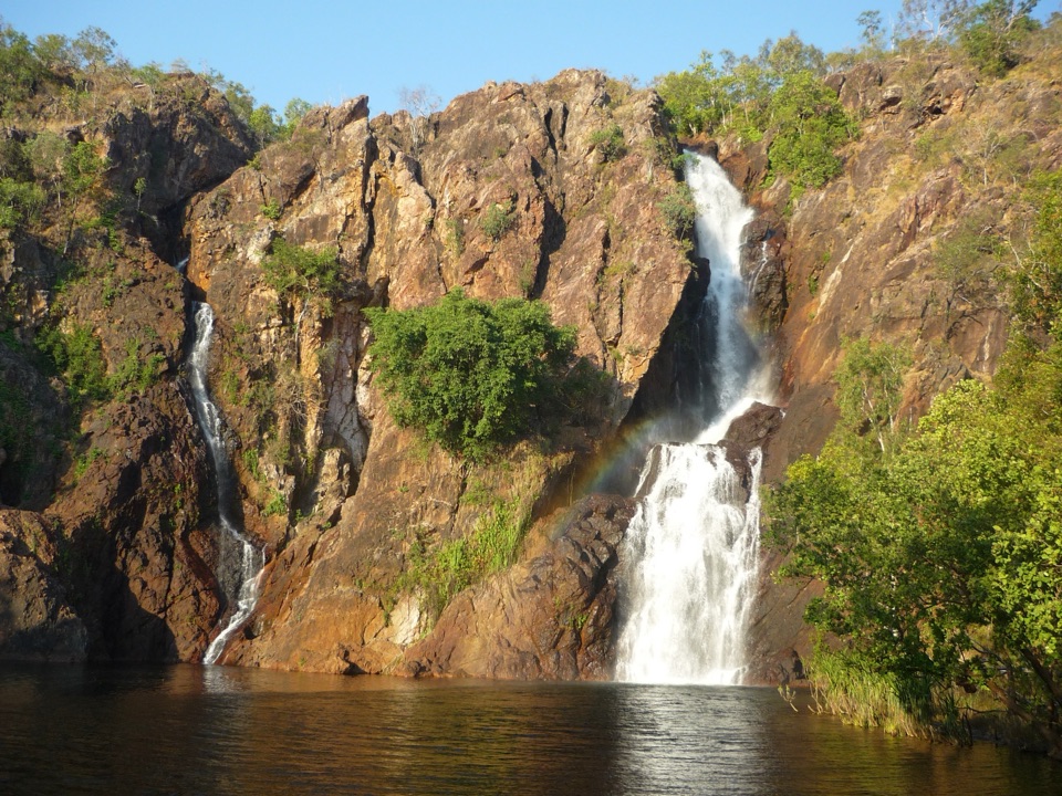
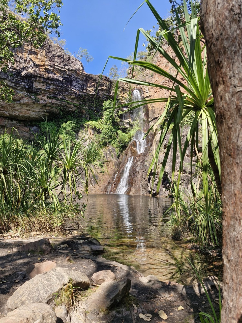
Tolmer Falls drops over two high escarpments into a deep plunge pool set below the cliff line, and the payoff comes fast. From the parking area it is a 400 m walk on a sealed path to the viewing platform and decks, where the falls and the surrounding sandstone country open up in one wide view. It is one of the quickest big-scenery stops in the area, which makes it easy to fit alongside other sites in the park.
Parkwolf’s verdictWhy stop here

Map

Where it is

Loading the Litchfield map
Full map
SightTolmer Falls-13.20557, 130.71507
Keep this map with you offline in the Parkwolf app

Plan your stop

Before you go

Best time to go

Water flow is strongest in the wet season, when the two-tier drop is at its most dramatic. Earlier and later in the day generally gives softer light on the escarpment for photos. Because conditions and access can change with the seasons, check current park information before you drive out.


Getting there and access

  • The falls sit near the park's western boundary and are reached by sealed road.
  • Park at the signed Tolmer Falls parking area, then follow the short sealed pathway to the lookout.
  • The viewing platform is described as accessible to people of all abilities. The longer loop walk is not.

3 active Litchfield alerts

  • CautionReynolds River Track: deep water crossingsThe Reynolds River Track is open to 4WDs only, but rough conditions and water crossings about 500–600 mm deep require care.Official details
  • ClosureTabletop Track closedThe Tabletop Track is closed because an Excess Heat Warning is in effect and there is no accessible drinking water. - Permit access only; do not plan an unpermitted walk on the track.Official details
See all 3 alerts
A park ranger sits on a dash-mounted phone, talking, as Parkwolf’s Tour Guide plays “Army Cutworm Moths: A Grizzly Bear Buffet” on Grand Loop Road below Dunraven Pass in Yellowstone
Parkwolf Tour GuideThe highest, rockiest slopes around here are a summer buffet for grizzly bears.

Litchfield Tour Guide

Your drive to Tolmer Falls, narrated.

Parkwolf is a GPS audio tour guide for Litchfield National Park. As you drive, it chimes in with what’s ahead: hidden gems, upcoming stops, history, geology, and wildlife, right through your car’s speakers.

Recorded for this place

Tolmer Falls
0:00 / 0:31
“You're nearing Tolmer Falls, where water drops over two sandstone escarpments into a pool far below the lookout.”

Plays as you drive up to Tolmer Falls in the Parkwolf Litchfield Tour Guide.

More stories near here in the app

  • Greenant Creek and Tjaetaba Falls
  • The Ants That Sew Leaves
  • Tolmer's Hidden Bat Colony
  • From Ore to Tin
  • 68 audio storiesacross Litchfield’s roads, triggered by GPS as you drive
  • Works offlinemaps, 17 trails, 31 places, and audio download before you lose signal
  • CarPlay readysimple controls built for the drive
★★★★★
“Fantastic app with many points of information… It’s great to just turn on while you’re driving and it gives you an audio tour of the national Park. We love it!!!!”
JMJamesApp Store review
Download Parkwolf on the App StoreGet Parkwolf on Google Play

4.7 from 8,600+ ratings

Guide

More about Tolmer Falls

Walk optionsShort version: 400 m each way on the sealed path to the viewing platform and back.
  • Short version: 400 m each way on the sealed path to the viewing platform and back.
  • Tolmer Falls loop: 1.6 km return, about 45 minutes, Grade 3 moderate. It works as a pleasant alternative route back to the car park from the lookout, running through typical Top End sandstone country and along Tolmer Creek. Expect rocky sections in parts, so wear proper footwear.
Rules worth knowing before you arriveSwimming is not allowed here, and neither is camping.

Swimming is not allowed here, and neither is camping. This is a look-and-photograph stop rather than a swimming hole, so plan your swim at one of the park's designated swimming sites and treat Tolmer Falls as a lookout visit. If you want a longer stay in the park, book accommodation or camping elsewhere.

Facilities and planningPublic toilets, picnic shelters and tables, and viewing points are provided at the Tolmer Falls…
  • Public toilets, picnic shelters and tables, and viewing points are provided at the Tolmer Falls visitor area, so it suits a short break or a packed lunch.
  • Visitors to the Northern Territory need an NT Parks Visitor Pass, so sort that out before you set off rather than at the trailhead.
A note on the nameThe falls were named by explorer Frederick Henry Litchfield in honour of Alexander Tolmer, a…

The falls were named by explorer Frederick Henry Litchfield in honour of Alexander Tolmer, a colleague of his late father in the South Australia Police.

Keep exploring

Near Tolmer Falls

See it all on the map

Trails nearby

More stops nearby

Parkwolf’s Litchfield ranking

Top sights in Litchfield

All 31 places
  1. 1Wangi FallsSight
  2. 2Florence FallsSight
  3. 3Buley RockholeSight
  4. 4Magnetic Termite MoundsSight
  5. 6The Lost CitySight
  6. 7Tjaynera Falls (Sandy Creek Falls)Sight

Take Parkwolf to Litchfield.

The audio tour guide for the drive, plus offline maps, trails, and wildlife heatmaps for when the signal drops.

4.7 from 8,600+ ratings

Download Parkwolf on the App StoreGet Parkwolf on Google Play