Parking
Drive 25 km (about 30 minutes) from Glenorchy along partly unsealed Routeburn Road to Routeburn Shelter and its road-end car park.

#10 of 50 trails in Mount Aspiring
Mount Aspiring National Park, OT · WC
Two waterfalls and a high hut make the long climb worthwhile.
Overview
Map & elevation
Plan your hike

The highest, rockiest slopes around here are a summer buffet for grizzly bears.
Mount Aspiring Tour Guide
Parkwolf is a GPS audio tour guide for Mount Aspiring National Park. As you drive, it chimes in with what’s ahead: hidden gems, upcoming stops, history, geology, and wildlife, right through your car’s speakers.
See the Mount Aspiring audio tourRecorded for this trailhead
Routeburn Shelter: Choose Your Walk“You're coming up on Routeburn Shelter, where you can explore without tackling the full Great Walk. For a short stop, choose the Nature Walk, a forest-and-river loop taking forty minutes to an hour.”
Plays as you drive up to this trailhead in the Parkwolf Mount Aspiring Tour Guide.
More stories near here in the app
“Fantastic app with many points of information… It’s great to just turn on while you’re driving and it gives you an audio tour of the national Park. We love it!!!!”


Trail guide
The Routeburn Falls Hut Day Walk follows the first 9.8 km of the Routeburn Track from Routeburn Shelter to Routeburn Falls Hut and the nearby cascade, then returns the same way. The complete outing is 19.6 km (12.2 miles) round trip. It is a full-day walk for people who want the Falls and a high valley view without crossing the whole Great Walk. Allow 5–8 hours; around seven is a fair plan with breaks and time at the huts. The way out climbs steadily and the way back retraces it, so the commitment does not end at the flats.
The walk starts over the swing bridge at Routeburn Shelter and follows the Route Burn through beech forest. It begins gently, then climbs past Sugarloaf Stream and Bridal Veil Waterfall before continuing above the gorge. Another swing bridge opens onto the grassy Routeburn Flats, a wide break in the forest with the river winding through the valley. After the enclosed river path, the open grass and mountain sides make a welcome change before the last climb.
Routeburn Flats Hut is about 7.5 km from the Shelter, and the huts and campsite sit on the first stage of the route. A short access spur reaches the hut from the main track, so the mapped itinerary takes it out and back before continuing to Falls Hut. It is a sensible turnaround if the longer climb would make the day too much: you still get the river, swing bridges, Bridal Veil Waterfall and open flats, but miss the higher bushline and Routeburn Falls. The valley path has some rises; the “Flats” name does not make this a flat walk.
From Routeburn Flats Hut, the final 2.3 km takes 1–1.5 hours one way and climbs steadily through beech forest. The trees keep the path enclosed for much of the ascent, then gaps open toward the Humboldt Mountains and back over the Routeburn valley. This is the harder stretch, so take the uphill timing seriously and save enough for the return descent. The Shelter-to-Falls walk is timed at 3–4 hours one way; that fits the 5–8 hour return range when you stop at the huts.
Routeburn Falls Hut sits near the bushline, beside the Routeburn Falls cascade. The waterfall is close to the track, with views down the Route Burn valley toward the Humboldt Mountains. The cascade is especially impressive after heavy rain. The high, open valley view and the falls are the best subjects to spend time on here; include a surrounding slope in a waterfall photo to give the water some scale. The hut has 48 bunks, but it is an overnight stop rather than a place to buy lunch. Food is not sold along the route, and the hut’s water is untreated and must be boiled.
The route is described as intermediate and well marked, but the long return distance and steady climb make it a demanding day. Some sections are rough and can be muddy or slippery; poor weather can make the walk challenging even during the main walking season. Snow and ice can be hazardous near the beginning or end of the November–April Great Walk season, so check conditions before heading up. If you plan to stay overnight at Falls Hut during the Great Walk season, book ahead. Dogs are not allowed, and there is no food service along the track.
Wildlife
 60 sightingsKeaMost seen around 5 PMSighting map
 112 sightingsRockwrenMost seen around 8 AMSighting map
 26 sightingsYellowheadMost seen around 8 AMSighting map
 13 sightingsTūīMost seen around 7 AMSighting map
 27 sightingsBellbirdMost seen around 7 AMSighting map
 35 sightingsRiflemanMost seen around 8 AMSighting map
Sighting maps show where each species has been reported across Mount Aspiring. Wildlife moves, so no sighting is guaranteed.
Keep exploring
 ChallengingRouteburn Track33.1 km · 13.5 hr · At the trailheadWaterfalls, alpine wetlands and a 1,255 m pass in one crossing.
 ChallengingTarahaka Whakatipu (Harris Saddle)25.4 km · 10.5 hr · At the trailheadA long alpine day ends at a shelter above Lake Harris.
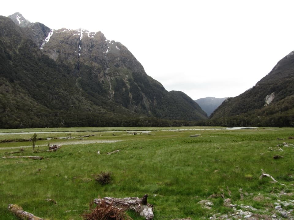 ModerateRouteburn Flats Track15 km · 4 hr · At the trailheadFollow an 1870s bridle path to open valley flats.
 ChallengingSugarloaf Pass Track8 km · 6 hr · At the trailheadA hard climb to a broad pass above two valleys.
 ChallengingRouteburn North Branch Track21.7 km · 8.5 hr · At the trailheadA long valley walk with rough tread and Humboldt mountain views.
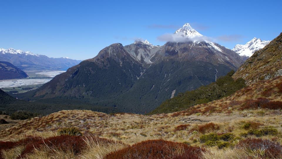 ChallengingSugarloaf/Rockburn Track16.9 km · 9.5 hr · At the trailheadAn advanced full-day traverse over Sugarloaf Saddle to Lake Sylvan.
 EasyRouteburn Nature Walk3.1 km · 48 min · At the trailheadA short loop through red beech forest to Sugarloaf Stream.
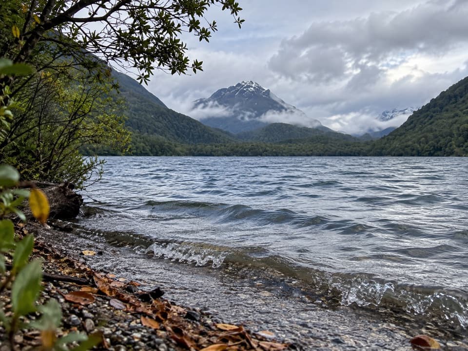 ModerateLake Sylvan–Rockburn Track14.5 km · 5 hr · 2.9 km awayA long forest tramp pays off at Rockburn’s blue pools.
 Campground · 2.9 km awaySylvan CampsiteA simple riverside base for Lake Sylvan and the Routeburn
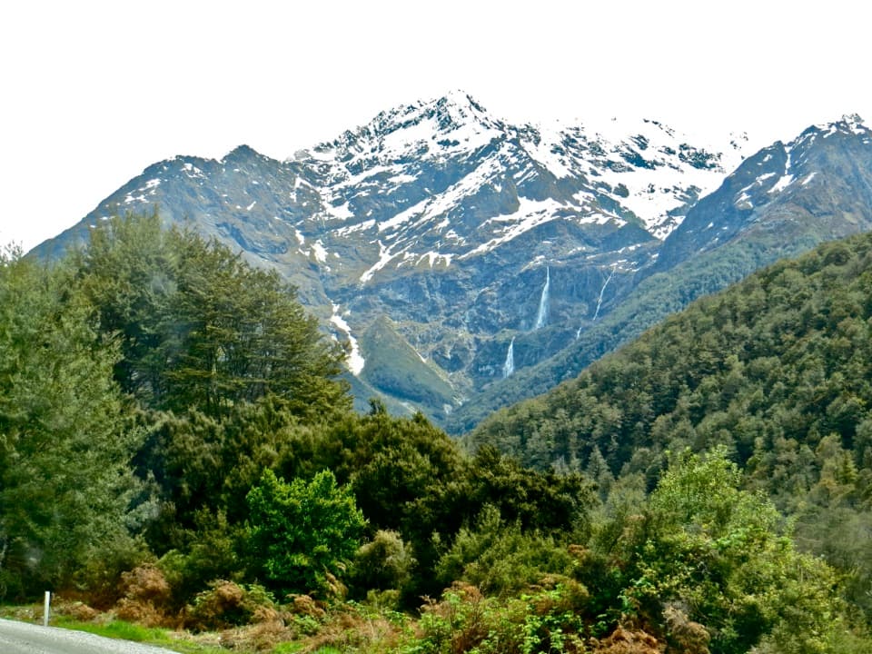 Sight · 3 km awayBridal Veil FallsA 57-metre fall framed by the Routeburn's forest and snowy peaks.
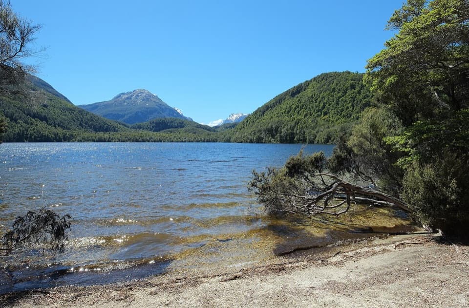 Sight · 3.6 km awayLake SylvanA gentle forest walk ends at a lake with a mountain view.
 Lodging · 5.1 km awayRouteburn Flats HutA good first night on the Routeburn, with the valley opening wide.
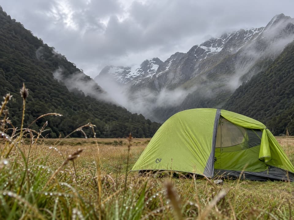 Campground · 5.2 km awayRouteburn Flats CampsiteA 15-site walk-in camp on the Routeburn's open grassy flats.
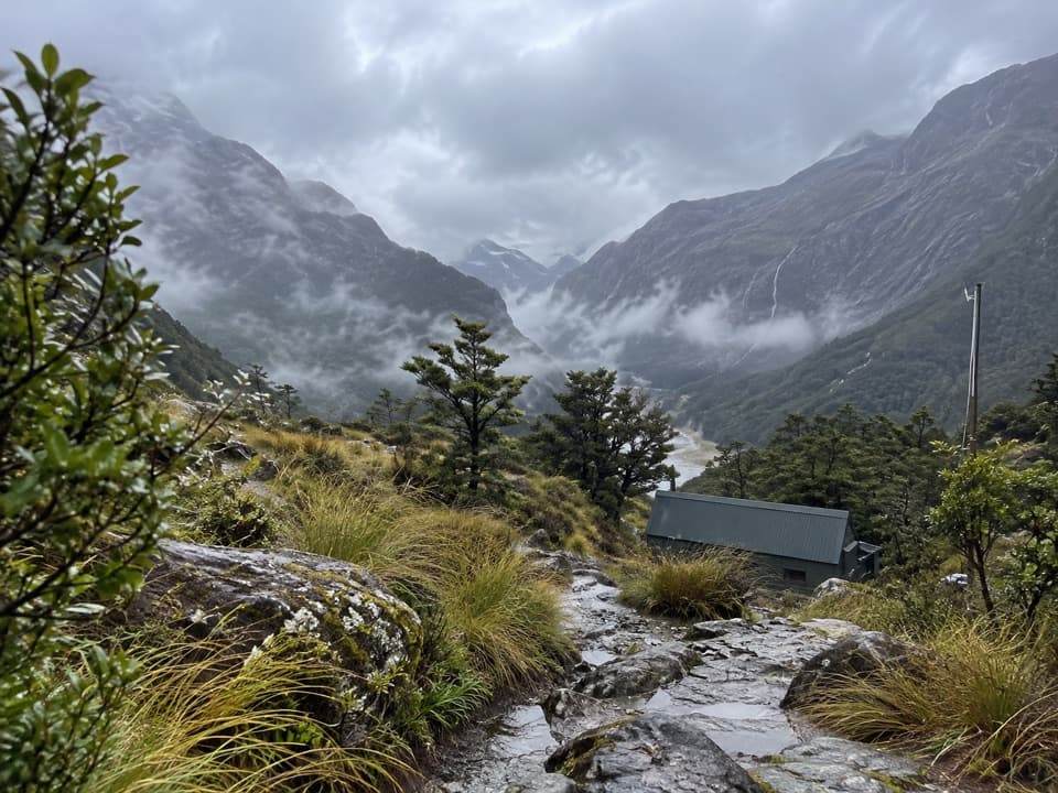 Lodging · 6.3 km awayRouteburn Falls HutSleep at the bushline with the falls close by.
 Sight · 6.3 km awayRouteburn FallsA 9.8 km walk to a cascade at the bushline.
 Sight · 8.1 km awayLake HarrisA wide lake view built into the Routeburn’s high alpine crossing.
Parkwolf’s Mount Aspiring ranking

The audio tour guide for the drive, plus offline maps, trails, and wildlife heatmaps for when the signal drops.




