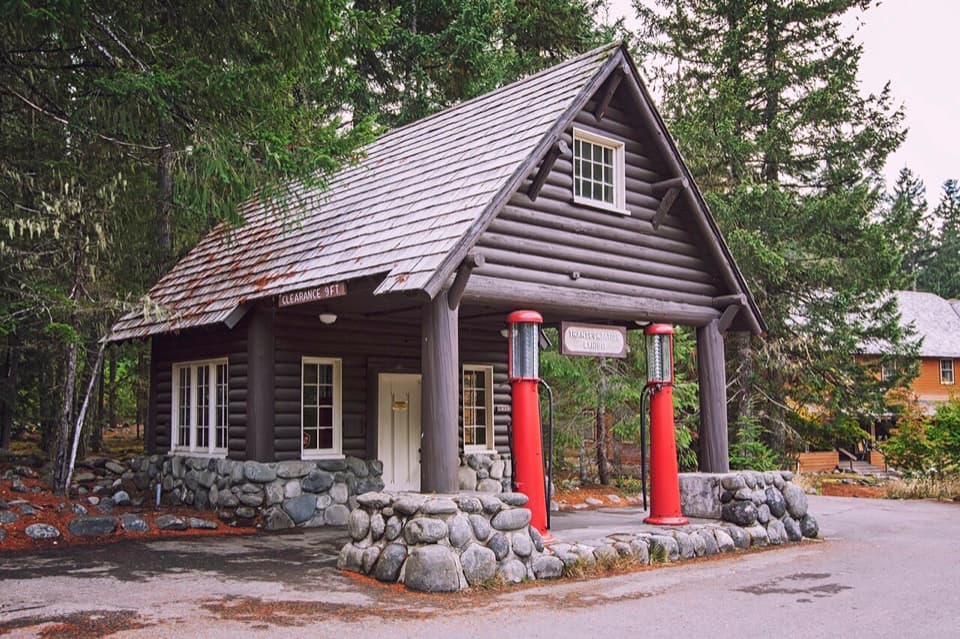
Longmire Transportation Exhibit in Mount Rainier National Park

Sight · Mount Rainier National Park

Longmire Transportation Exhibit

Road history told inside a landmark gas station

Photo: Wikimedia Commons
Type
Sight
Nearest trail
Right here
Audio stories
5 nearby
  • Exhibit
  • Parking

Hear the audio tour

Longmire: A Museum, Mineral Springs and a Meal

Overview

About Longmire Transportation Exhibit

Why stop

  • Connects Indigenous routes, rail travel, and early car access to today’s park roads.

Heads up

  • A small, reading-focused stop without a trail or mountain view.

Map

Where it is

Loading the Mount Rainier map
Full map
SightLongmire Transportation Exhibit46.74968, -121.81283
Keep this map with you offline in the Parkwolf app

Plan your stop

Before you go

7 active Mount Rainier alerts

  • ClosureWildfire closures in the northern parkGrand Park 2 and Wonderland Complex fire closures affect trails, backcountry camps, and Sunrise access; stay out of closed areas.Official details
  • ClosureSR 165 bridge closed: no public access to Carbon River or Mowich LakeThe SR 165 Carbon River/Fairfax Bridge is closed to vehicles, bicycles, and pedestrians; there is no public access or alternate route to Carbon River or Mowich Lake.Official details

See all 7 alerts
A park ranger sits on a dash-mounted phone, talking, as Parkwolf’s Tour Guide plays “Army Cutworm Moths: A Grizzly Bear Buffet” on Grand Loop Road below Dunraven Pass in Yellowstone
Parkwolf Tour GuideThe highest, rockiest slopes around here are a summer buffet for grizzly bears.

Mount Rainier Tour Guide

Your drive to Longmire Transportation Exhibit, narrated.

Parkwolf is a GPS audio tour guide for Mount Rainier National Park. As you drive, it chimes in with what’s ahead: hidden gems, upcoming stops, history, geology, and wildlife, right through your car’s speakers.

See the Mount Rainier audio tour

Recorded for this place

Longmire: A Museum, Mineral Springs and a Meal
0:00 / 0:39
“You're nearing Longmire, the historic village that became park headquarters in eighteen ninety-nine.”

Plays as you drive up to Longmire Transportation Exhibit in the Parkwolf Mount Rainier Tour Guide.

More stories near here in the app

  • Fay Fuller’s Mountain Murmurs
  • Why Iron Mike Runs Rusty
  • Cougar Rock: A Picnic or a Waterfall Walk
  • Twin Firs: A Short Walk Among Old Trees
  • 77 audio storiesacross Mount Rainier’s roads, triggered by GPS as you drive
  • Wildlife heatmapsfor Mountain Goat, Black Bear, Wolverine, and 13 more
  • Works offlinemaps, 99 trails, 87 places, and audio download before you lose signal
  • CarPlay readysimple controls built for the drive
★★★★★
“Fantastic app with many points of information… It’s great to just turn on while you’re driving and it gives you an audio tour of the national Park. We love it!!!!”
JMJamesApp Store review
Download Parkwolf on the App StoreGet Parkwolf on Google Play

4.7 from 8,600+ ratings

Guide

More about Longmire Transportation Exhibit

A small exhibit with a big road storyThis is a five-panel indoor exhibit inside the historic Longmire Service Station, a small…

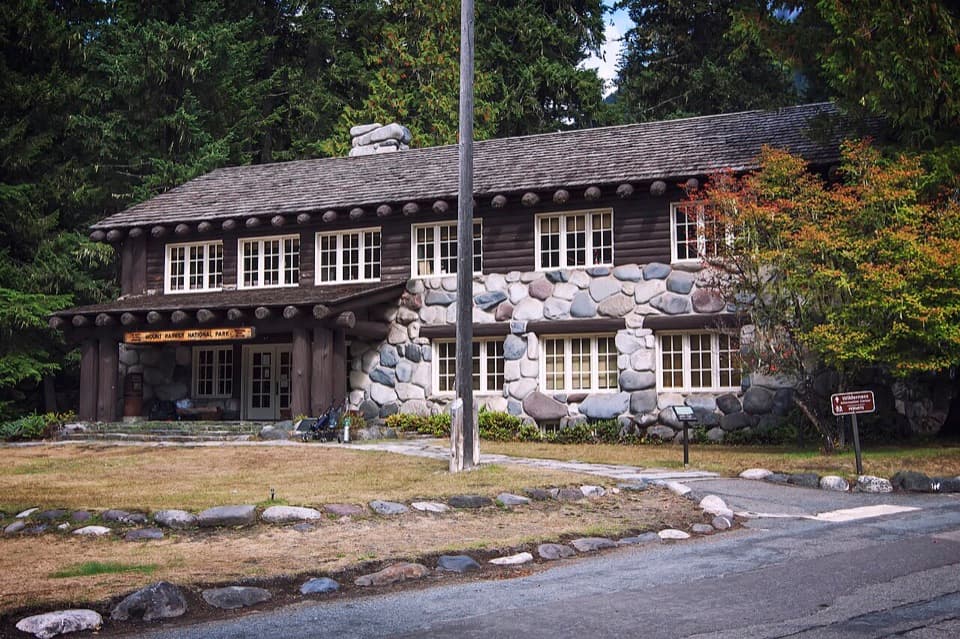
This is a five-panel indoor exhibit inside the historic Longmire Service Station, a small log-and-stone building built as a gas station in 1929. The panels follow how people reached Mount Rainier, from Indigenous routes to modern roads. If you’re already in Longmire and like local history, it’s a worthwhile short stop; if your time is tight and you’d rather be outside, it’s easy to skip.

Pair it with LongmireThe station is beside the National Park Inn, 6.5 miles east of the Nisqually Entrance.

The station is beside the National Park Inn, 6.5 miles east of the Nisqually Entrance. Parking serves the station, which is designated wheelchair accessible, though details of the route through the exhibit are not spelled out. The exhibit is open when the Longmire Museum is open, so check the museum’s hours before making this your reason for the stop.

Trails before the highwayThe first panels trace Indigenous routes used for generations by ancestors of the Nisqually,…

The first panels trace Indigenous routes used for generations by ancestors of the Nisqually, Cowlitz, Squaxin Island, Yakama, Puyallup, and Muckleshoot peoples for gathering, hunting, and trade. James Longmire cut a rough trail to the mineral springs in 1884; by 1893, his family and five Nisqually people had opened a wagon toll road to Longmire Springs.

From train to touring carThe Tacoma Eastern Railroad reached Ashford in 1904, six miles west of the entrance, and…

The Tacoma Eastern Railroad reached Ashford in 1904, six miles west of the entrance, and visitors continued to Longmire by horse-drawn carriage. Mount Rainier was one of two national parks to experiment with car access in 1907. Engineer Eugene Ricksecker surveyed the Nisqually–Longmire–Paradise route in 1903, laying out gentle grades and curves that followed the land; the park’s road and bridge system was built between 1920 and 1957.

A station built around the roadThe 1929 station had a sheltered pump bay beside a sales and information office, and its…

The 1929 station had a sheltered pump bay beside a sales and information office, and its log-and-local-rock design is part of the stop’s appeal. The building is a National Historic Landmark. The final panels bring the story forward to road impacts, using the 2006 flood and sediment carried by glacier-fed rivers to show how water can threaten access.

Wildlife

Wildlife in Mount Rainier

All Mount Rainier wildlife maps

Sighting maps show where each species has been reported across Mount Rainier. Wildlife moves, so no sighting is guaranteed.

Keep exploring

Near Longmire Transportation Exhibit

See it all on the map

Trails nearby

More stops nearby

Parkwolf’s Mount Rainier ranking

Top sights in Mount Rainier

All 87 places
  1. 1Reflection LakesSight
  2. 2Myrtle FallsSight
  3. 3Panorama PointSight
  4. 4Narada FallsSight
  5. 5Tipsoo LakeSight
  6. 6Sunrise Point OverlookSight

Take Parkwolf to Mount Rainier.

The audio tour guide for the drive, plus offline maps, trails, and wildlife heatmaps for when the signal drops.

4.7 from 8,600+ ratings

Download Parkwolf on the App StoreGet Parkwolf on Google Play