Grand Park via Lake Eleanor in Mount Rainier National Park

Mount Rainier National Park, WA

Grand Park via Lake Eleanor

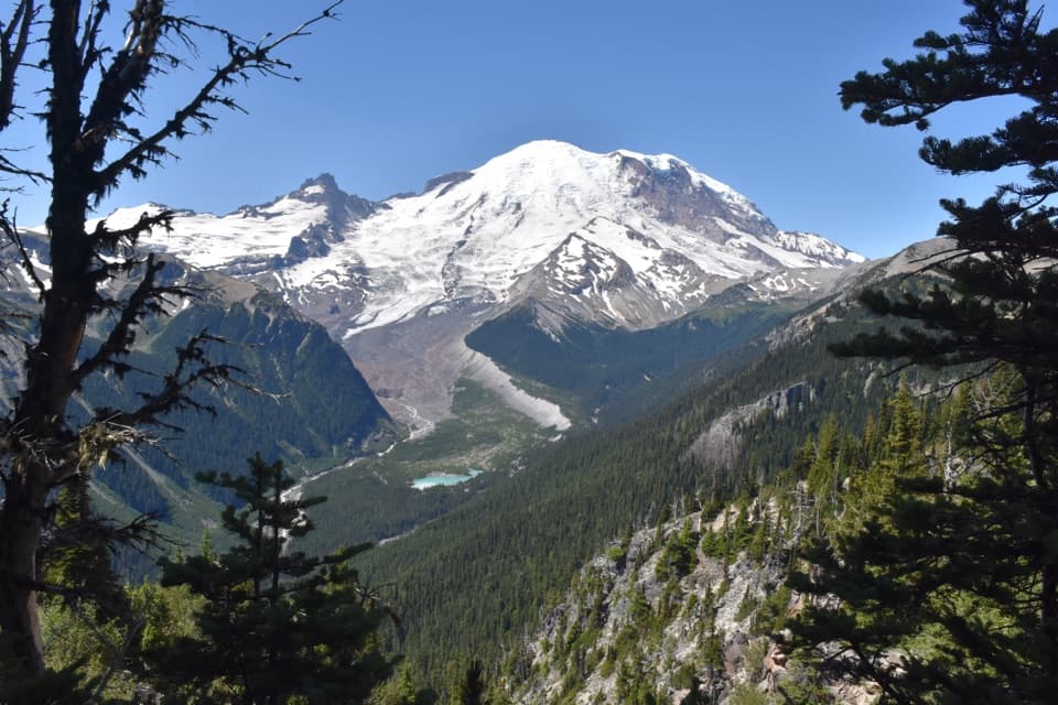
Lake Eleanor leads to a wide, Rainier-backed alpine meadow.

Photo: Wikimedia Commons
Length
8.2mi
Time
5hr
Elev. change
1,066ft
Difficulty
Moderate
  • No dogs
  • High point 5,682 ft
  • #25 of 99 in Mount Rainier
Parkwolf audio tour77 stories across Mount Rainier’s roads

Overview

About Grand Park via Lake Eleanor

Why go

  • Grand Park opens into a long meadow with Mount Rainier views.
  • Lake Eleanor gives the forest approach a scenic pause before the main climb.

Heads up

  • Eight miles of walking and several climbs make this a full day out.
  • Forest Road 73 is a long, rough drive, and summer mosquitoes can be intense.

Map & elevation

The route

Loading the Mount Rainier map
Full map
Elevation4,616–5,682 ft
TrailheadEleanor Creek crossing on Forest Road 7346.99630, -121.64130
Keep this map with you offline in the Parkwolf app

Plan your hike

Before you go

Parking

Start at the signed Eleanor Creek crossing on Forest Road 73. A small lot sits about 150 feet beyond the trailhead, with roadside parking nearby; leave room for traffic to pass. The approach is long, rough and potholed, so save directions before driving in.

Best time to go

The meadows are the trail’s signature, with visitors reporting lupines, avalanche lilies, paintbrush and other seasonal blooms. Expect the flower show to vary from year to year and across the long open stretch. Mosquitoes can be intense around Lake Eleanor and the meadows in summer, so bring repellent and clothes that cover your arms and legs. Later in the season, visitors report fewer bugs and fewer flowers.

Safety

Summer mosquitoes can be intense near Lake Eleanor and the open meadows. No potable-water source or food service was found along the route; treat any water you collect. There is no toilet at the trailhead. Pets are prohibited on park trails; service animals are exempt.

7 active Mount Rainier alerts

  • ClosureWildfire closures in the northern parkGrand Park 2 and Wonderland Complex fire closures affect trails, backcountry camps, and Sunrise access; stay out of closed areas.Official details
  • ClosureSR 165 bridge closed: no public access to Carbon River or Mowich LakeThe SR 165 Carbon River/Fairfax Bridge is closed to vehicles, bicycles, and pedestrians; there is no public access or alternate route to Carbon River or Mowich Lake.Official details
See all 7 alerts
A park ranger sits on a dash-mounted phone, talking, as Parkwolf’s Tour Guide plays “Army Cutworm Moths: A Grizzly Bear Buffet” on Grand Loop Road below Dunraven Pass in Yellowstone
Parkwolf Tour GuideThe highest, rockiest slopes around here are a summer buffet for grizzly bears.

Mount Rainier Tour Guide

Your drive to Grand Park via Lake Eleanor, narrated.

Parkwolf is a GPS audio tour guide for Mount Rainier National Park. As you drive, it chimes in with what’s ahead: hidden gems, upcoming stops, history, geology, and wildlife, right through your car’s speakers.

See the Mount Rainier audio tour

More stories near here in the app

  • The Summit That Collapsed
  • Sunrise: Walk to Emmons Vista
  • Sunrise Road White River View: Rainier's Crater Rim
  • The Layers Beneath the Snow
  • 77 audio storiesacross Mount Rainier’s roads, triggered by GPS as you drive
  • Wildlife heatmapsfor Mountain Goat, Black Bear, Wolverine, and 13 more
  • Works offlinemaps, 99 trails, 87 places, and audio download before you lose signal
  • CarPlay readysimple controls built for the drive
★★★★★
“Fantastic app with many points of information… It’s great to just turn on while you’re driving and it gives you an audio tour of the national Park. We love it!!!!”
JMJamesApp Store review
Download Parkwolf on the App StoreGet Parkwolf on Google Play

4.7 from 8,600+ ratings

Trail guide

Hiking Grand Park via Lake Eleanor

The side entrance to Grand ParkGrand Park via Lake Eleanor is an 8.

Grand Park via Lake Eleanor is an 8.2-mile out-and-back with about 1,460 feet of climbing, from Forest Road 73 through forest and a lakeside basin to the broad, high meadow below Mount Rainier. Allow about five hours for the junction turnaround. The climbing comes in stages, with Lake Eleanor and smaller clearings along the way. This Lake Eleanor approach is shorter and easier than reaching Grand Park from Sunrise.

The mapped route continues across the meadow to the Lake Eleanor Trail’s junction with the Northern Loop Trail, then returns on the same path. The extra Northern Loop walk to the West Fork White River viewpoint is optional and is not included in that distance. If you want a shorter outing, turning around when the route first opens into Grand Park makes it about 6.4 miles round trip.

From Eleanor Creek to the lakeStart at the signed crossing of Eleanor Creek on Forest Road 73.

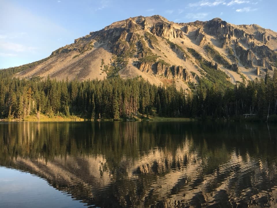
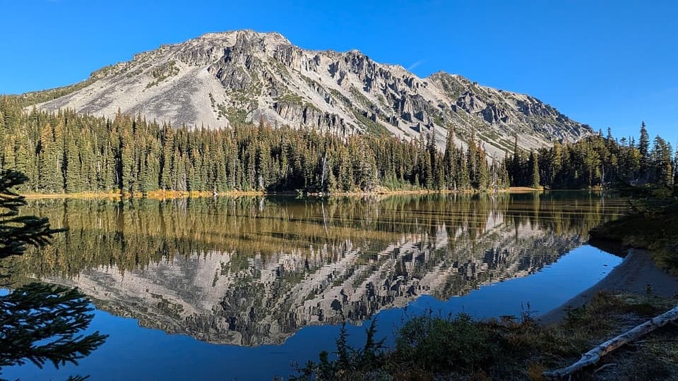
Start at the signed crossing of Eleanor Creek on Forest Road 73. The trail follows the creek, enters mixed forest, and climbs at a moderate grade. It crosses into Mount Rainier National Park within the first tenth of a mile and reaches Lake Eleanor just under a mile from the road. A few established campsites sit near the water, but there is no toilet at the trailhead, and no food or drinking-water service was found along the route.

The climb outBeyond the lake, the path briefly climbs, then drops about 150 feet to a smaller open meadow…

Beyond the lake, the path briefly climbs, then drops about 150 feet to a smaller open meadow where Mount Rainier first comes into view. The trail climbs again through hemlock and fir. Short stretches through clearings break up the work, and each opening gets wider than the last. The hills are not technical, but you gain and lose ground more than once before the main meadow, so save enough energy for the return climbs.

Crossing Grand ParkThe forest finally gives way to a broad, mostly level alpine meadow around 5,600 feet.

The forest finally gives way to a broad, mostly level alpine meadow around 5,600 feet. Grand Park runs on for more than a mile, with open grassland, scattered trees and Rainier rising beyond it. Keep going across the meadow to the Northern Loop junction for the full route; the junction is a natural turnaround, not the start of a separate Sunrise hike. The path’s repeated climbs are the main work, so leave enough in your legs for the return. From the junction, the optional side trip toward the West Fork White River viewpoint adds roughly four-tenths of a mile each way.

This is the place to slow down. From the open high ground, let the path or a strip of meadow flowers fill the foreground so the mountain does not look detached from the landscape. Spring and summer can bring broad wildflower displays; the exact show changes with snowmelt and timing.

Road, parking and rulesThe trailhead is just outside the park boundary on Forest Road 73.

The trailhead is just outside the park boundary on Forest Road 73. There is a small parking lot about 150 feet beyond the trailhead and roadside parking; leave room for vehicles to pass. The road is long, rough and potholed, so save directions before the drive and do not expect reliable cell service. There is no toilet at the start. A wilderness permit is required for overnight camping at Lake Eleanor. Pets are not allowed on Mount Rainier trails; service animals are the exception.

Wildlife

Wildlife in Mount Rainier

All Mount Rainier wildlife maps

Sighting maps show where each species has been reported across Mount Rainier. Wildlife moves, so no sighting is guaranteed.

Keep exploring

Near Grand Park via Lake Eleanor

See it all on the map

Trails that start nearby

Places near the trailhead

Parkwolf’s Mount Rainier ranking

Top-rated trails in Mount Rainier

All 99 trails
  1. 1Wonderland TrailChallenging · 93 mi
  2. 2Skyline Trail LoopChallenging · 5.5 mi
  3. 3Mount Fremont Lookout TrailModerate · 5.6 mi
  4. 4Burroughs Mountain TrailModerate · 6.2 mi
  5. 5Summerland TrailModerate · 8.4 mi
  6. 6Naches Peak Loop TrailModerate · 3.5 mi

Take Parkwolf to Mount Rainier.

The audio tour guide for the drive, plus offline maps, trails, and wildlife heatmaps for when the signal drops.

4.7 from 8,600+ ratings

Download Parkwolf on the App StoreGet Parkwolf on Google Play