Mount Fremont Fire Lookout in Mount Rainier National Park

#9 of 61 sights in Mount Rainier

Sight · Mount Rainier National Park

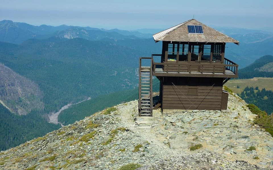
Mount Fremont Fire Lookout

A long ridge hike to a 1934 wooden fire lookout.

Photo: Wikimedia Commons
Type
Sight
Nearest trail
1.9 mi
  • Trailhead
  • Parking
  • Restrooms
  • Scenic viewpoint

Hear the audio tour

Sunrise: Walk to Emmons Vista

Overview

About Mount Fremont Fire Lookout

Why stop

  • Wide views reach Rainier, Grand Park and the surrounding ranges.
  • Marmots are often spotted around the high ridge.

Heads up

  • Exposed, rocky footing and a narrow final ridge make it demanding.

Map

Where it is

Loading the Mount Rainier map
Full map
SightMount Fremont Fire Lookout46.93404, -121.67574
Keep this map with you offline in the Parkwolf app

Plan your stop

Before you go

7 active Mount Rainier alerts

  • ClosureWildfire closures in the northern parkGrand Park 2 and Wonderland Complex fire closures affect trails, backcountry camps, and Sunrise access; stay out of closed areas.Official details
  • ClosureSR 165 bridge closed: no public access to Carbon River or Mowich LakeThe SR 165 Carbon River/Fairfax Bridge is closed to vehicles, bicycles, and pedestrians; there is no public access or alternate route to Carbon River or Mowich Lake.Official details
See all 7 alerts
A park ranger sits on a dash-mounted phone, talking, as Parkwolf’s Tour Guide plays “Army Cutworm Moths: A Grizzly Bear Buffet” on Grand Loop Road below Dunraven Pass in Yellowstone
Parkwolf Tour GuideThe highest, rockiest slopes around here are a summer buffet for grizzly bears.

Mount Rainier Tour Guide

Your drive to Mount Fremont Fire Lookout, narrated.

Parkwolf is a GPS audio tour guide for Mount Rainier National Park. As you drive, it chimes in with what’s ahead: hidden gems, upcoming stops, history, geology, and wildlife, right through your car’s speakers.

See the Mount Rainier audio tour

Recorded for this place

Sunrise: Walk to Emmons Vista
0:00 / 0:37
“Sunrise is ahead, with the visitor center and day lodge at sixty-four hundred feet. For a short visit, I'd take the half-mile round trip to Emmons Vista and continue past the first overlook to the second.”

Plays as you drive up to Mount Fremont Fire Lookout in the Parkwolf Mount Rainier Tour Guide.

More stories near here in the app

  • White River: The Campground and Patrol Cabin
  • Sunrise Road White River View: Rainier's Crater Rim
  • Beargrass Has No Seven-Year Clock
  • A Pika's Winter Haypile
  • 77 audio storiesacross Mount Rainier’s roads, triggered by GPS as you drive
  • Wildlife heatmapsfor Mountain Goat, Black Bear, Wolverine, and 13 more
  • Works offlinemaps, 99 trails, 87 places, and audio download before you lose signal
  • CarPlay readysimple controls built for the drive
★★★★★
“Fantastic app with many points of information… It’s great to just turn on while you’re driving and it gives you an audio tour of the national Park. We love it!!!!”
JMJamesApp Store review
Download Parkwolf on the App StoreGet Parkwolf on Google Play

4.7 from 8,600+ ratings

Guide

More about Mount Fremont Fire Lookout

What you are hiking toMount Fremont Fire Lookout is a two-story wooden fire tower on an exposed ridge above Sunrise,…

Mount Fremont Fire Lookout is a two-story wooden fire tower on an exposed ridge above Sunrise, at 7,181 feet. It is the highest of Mount Rainier’s four remaining fire lookouts. The payoff is a historic structure on a high, open skyline, reached by a real mountain walk rather than a roadside stop. The standard route is 5.6 miles round trip, about 900 feet of gain and roughly three hours from Sunrise.

Climbing past Frozen LakeStart at the north side of the Sunrise parking area and climb to Sourdough Ridge.

Start at the north side of the Sunrise parking area and climb to Sourdough Ridge. The trail continues past Frozen Lake, then follows the ridge’s west side for 1.3 miles to the lookout. The first climb is moderate, but the final stretch is rockier and narrower, with little shade. NPS measures about 900 feet of gain for the full route; the last 1.3 miles still calls for steady footing at high elevation.

Making the high walk workSun and wind have nowhere to hide on this ridge, and the summit can feel much colder than the…

Sun and wind have nowhere to hide on this ridge, and the summit can feel much colder than the trailhead. Bring water, sun protection and a warm, windproof layer; use sturdy shoes for the loose rocky finish. Treat any water you collect, and remember that pets are not allowed on park trails. Sunrise has public restrooms and a large parking area. The visitor center’s exhibits and the Day Lodge’s food service and shop are seasonal, all back at the trailhead rather than on the hike. For a dawn or late-day outing, carry a headlamp for the rocky walk back.

A firewatch post, not an indoor visitBuilt in 1934, the wooden lookout gave firewatchers a high vantage to spot smoke and lightning…

Built in 1934, the wooden lookout gave firewatchers a high vantage to spot smoke and lightning and report fires by telephone. A windstorm blew off its roof soon after it was built. After World War II, aircraft became the main way to spot fires, though the park’s lookouts remain equipped and are still used occasionally. Visitors can walk around the tower and look through its windows; the interior is not open to hikers.

The view from the ridgeOn clear days, Mount Rainier and the Cascade Range command the view, with the Olympic Mountains…

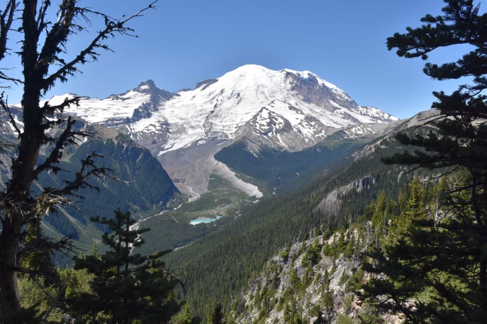
On clear days, Mount Rainier and the Cascade Range command the view, with the Olympic Mountains visible farther away. Grand Park’s broad meadows lie to the north, with Redstone Peak, Skyscraper Mountain and Berkeley Park among the surrounding landmarks. For a photo of the tower, step back on the rocky ridge until you can frame its roof and outside stairs against the open slope; from the lookout, widen the view to include Rainier or Grand Park.

The Sunrise meadowsThe high meadows around Sunrise are known as Yakima Park and were used by Yakama people for…

The high meadows around Sunrise are known as Yakima Park and were used by Yakama people for summer hunting and gathering for thousands of years. That history belongs to the wider landscape crossed on the approach; the fire lookout came much later.

Wildlife

Wildlife in Mount Rainier

All Mount Rainier wildlife maps

Sighting maps show where each species has been reported across Mount Rainier. Wildlife moves, so no sighting is guaranteed.

Keep exploring

Near Mount Fremont Fire Lookout

See it all on the map

Trails nearby

More stops nearby

Parkwolf’s Mount Rainier ranking

Top sights in Mount Rainier

All 87 places
  1. 1Reflection LakesSight
  2. 2Myrtle FallsSight
  3. 3Panorama PointSight
  4. 4Narada FallsSight
  5. 5Tipsoo LakeSight
  6. 6Sunrise Point OverlookSight

Take Parkwolf to Mount Rainier.

The audio tour guide for the drive, plus offline maps, trails, and wildlife heatmaps for when the signal drops.

4.7 from 8,600+ ratings

Download Parkwolf on the App StoreGet Parkwolf on Google Play