Sunrise Visitor Center in Mount Rainier National Park

Visitor center · Mount Rainier National Park

Sunrise Visitor Center

A historic alpine trail hub with glacier exhibits and Rainier views.

Photo: National Park Service
Type
Visitor center
Nearest trail
Right here
Audio stories
4 nearby
  • Exhibit
  • Parking
  • Restrooms

Hear the audio tour

Sunrise: Walk to Emmons Vista

Overview

About Sunrise Visitor Center

Why stop

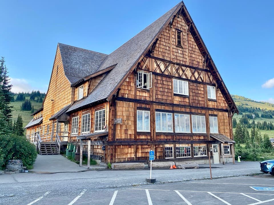
  • Historic log architecture with Mount Rainier behind the buildings.
  • Exhibits, ranger help and a wide choice of nearby trails in one stop.

Heads up

  • The visitor center itself operates for only a short summer season.

Map

Where it is

Loading the Mount Rainier map
Full map
Visitor centerSunrise Visitor Center46.91446, -121.64341
Keep this map with you offline in the Parkwolf app

Plan your stop

Before you go

Best time to go

The center normally opens from early July to early September and closes in winter. Sunrise Road usually opens in late June or early July, then closes in late September or early October as weather changes. The developed area is about 14 miles northwest of the Sunrise-White River turnoff on State Route 410 and about 60 miles northeast of Nisqually Entrance. Check current road and facility status before setting out.

7 active Mount Rainier alerts

  • ClosureWildfire closures in the northern parkGrand Park 2 and Wonderland Complex fire closures affect trails, backcountry camps, and Sunrise access; stay out of closed areas.Official details
  • ClosureSR 165 bridge closed: no public access to Carbon River or Mowich LakeThe SR 165 Carbon River/Fairfax Bridge is closed to vehicles, bicycles, and pedestrians; there is no public access or alternate route to Carbon River or Mowich Lake.Official details
See all 7 alerts
A park ranger sits on a dash-mounted phone, talking, as Parkwolf’s Tour Guide plays “Army Cutworm Moths: A Grizzly Bear Buffet” on Grand Loop Road below Dunraven Pass in Yellowstone
Parkwolf Tour GuideThe highest, rockiest slopes around here are a summer buffet for grizzly bears.

Mount Rainier Tour Guide

Your drive to Sunrise Visitor Center, narrated.

Parkwolf is a GPS audio tour guide for Mount Rainier National Park. As you drive, it chimes in with what’s ahead: hidden gems, upcoming stops, history, geology, and wildlife, right through your car’s speakers.

See the Mount Rainier audio tour

Recorded for this place

Sunrise: Walk to Emmons Vista
0:00 / 0:37
“Sunrise is ahead, with the visitor center and day lodge at sixty-four hundred feet. For a short visit, I'd take the half-mile round trip to Emmons Vista and continue past the first overlook to the second.”

Plays as you drive up to Sunrise Visitor Center in the Parkwolf Mount Rainier Tour Guide.

More stories near here in the app

  • White River: The Campground and Patrol Cabin
  • Sunrise Road White River View: Rainier's Crater Rim
  • Beargrass Has No Seven-Year Clock
  • A Pika's Winter Haypile
  • 77 audio storiesacross Mount Rainier’s roads, triggered by GPS as you drive
  • Wildlife heatmapsfor Mountain Goat, Black Bear, Wolverine, and 13 more
  • Works offlinemaps, 99 trails, 87 places, and audio download before you lose signal
  • CarPlay readysimple controls built for the drive
★★★★★
“Fantastic app with many points of information… It’s great to just turn on while you’re driving and it gives you an audio tour of the national Park. We love it!!!!”
JMJamesApp Store review
Download Parkwolf on the App StoreGet Parkwolf on Google Play

4.7 from 8,600+ ratings

Guide

More about Sunrise Visitor Center

Start hereSunrise Visitor Center is a two-story log building at 6,400 feet on Mount Rainier's northeast…

Sunrise Visitor Center is a two-story log building at 6,400 feet on Mount Rainier's northeast side. Its exhibits cover the volcano, glaciers, subalpine meadow plants and animals, and Indigenous connections to the area. Rangers can help you choose from a large trail network, so this is a useful first stop if you plan to spend time at Sunrise.

Pick a walkFrom the Sunrise area, walks range from the 1.5-mile Sunrise Nature Trail loop to the 5.

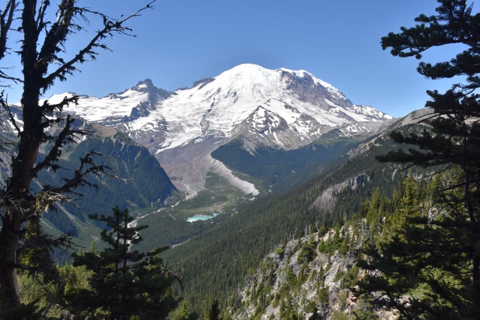
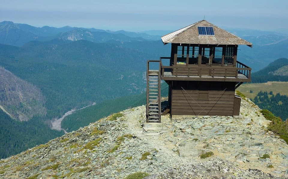
From the Sunrise area, walks range from the 1.5-mile Sunrise Nature Trail loop to the 5.6-mile Mount Fremont Lookout trail. For Emmons Glacier, follow the Sunrise Rim Trail from the south side of the parking area to two overlooks; the Emmons Vista route is listed at one mile. Sunrise Point is the place for broad views across Mount Rainier, Sunrise Lake and the Cascade volcanoes.

Give the area timeSunrise is the park's second most-visited location, with the views and trail network drawing…

Sunrise is the park's second most-visited location, with the views and trail network drawing visitors through the short summer season. Some visitors report busy parking and a longer walk from the car when the plaza fills, so arrive early if an easier parking spot matters to you. Stay on the paths through the subalpine meadows; the plants are easily damaged.

Food nearbyThe Sunrise Day Lodge is a separate building across the plaza.

The Sunrise Day Lodge is a separate building across the plaza. It offers seasonal food service and a gift shop, and restrooms are nearby in the developed area. The center itself is mainly for exhibits, ranger help and trail planning.

Yakima Park before the visitor centerThe meadows here were a summer gathering and hunting place for Yakama people long before the…

The meadows here were a summer gathering and hunting place for Yakama people long before the area was developed for park tourism. Park exhibits interpret those Indigenous connections alongside the landscape's plants, wildlife and glaciers.

A planned mountain villageThe historic Sunrise area, also called Yakima Park, was developed between 1929 and 1944 to…

The historic Sunrise area, also called Yakima Park, was developed between 1929 and 1944 to bring visitors to the park's east side. The visitor center was built in 1943. Two blockhouses, the center and a stockade fence form the Yakima Park Stockade Group, whose rustic design draws on early Pacific Northwest outposts.

The lodge and the viewsPlans for a much larger resort were cut back after the 1929 stock-market crash.

Plans for a much larger resort were cut back after the 1929 stock-market crash. The separate Sunrise Day Lodge was the only planned lodge wing completed; it served as a cafeteria and support building for more than 200 tourist cabins, later sold and removed during World War II. For a photo of the historic center, frame the log buildings with Mount Rainier behind them; on a clear day, the mountain and Emmons Glacier give the old complex its high-country setting.

Wildlife

Wildlife in Mount Rainier

All Mount Rainier wildlife maps

Sighting maps show where each species has been reported across Mount Rainier. Wildlife moves, so no sighting is guaranteed.

Keep exploring

Near Sunrise Visitor Center

See it all on the map

Trails nearby

More stops nearby

Parkwolf’s Mount Rainier ranking

Top sights in Mount Rainier

All 87 places
  1. 1Reflection LakesSight
  2. 2Myrtle FallsSight
  3. 3Panorama PointSight
  4. 4Narada FallsSight
  5. 5Tipsoo LakeSight
  6. 6Sunrise Point OverlookSight

Take Parkwolf to Mount Rainier.

The audio tour guide for the drive, plus offline maps, trails, and wildlife heatmaps for when the signal drops.

4.7 from 8,600+ ratings

Download Parkwolf on the App StoreGet Parkwolf on Google Play