Travers Valley Track to Upper Travers Hut in Nelson Lakes National Park

Nelson Lakes National Park, TM

Travers Valley Track to Upper Travers Hut

A demanding valley approach to Upper Travers Hut.

Length
20.9km
Time
8hr
Elev. change
687m
Difficulty
Challenging
  • No dogs
  • High point 1,311 m
  • #27 of 57 in Nelson Lakes
Parkwolf audio tour26 stories across Nelson Lakes’s roads

Overview

About Travers Valley Track to Upper Travers Hut

Why go

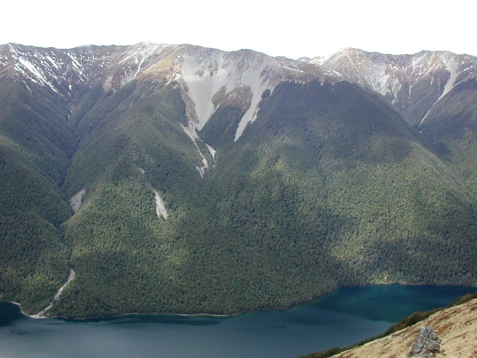
  • Grassy river flats and forested terraces open into a high tussock basin below Mount Travers.
  • A signed side trip reaches the 20 m Travers Falls.

Heads up

  • A long, remote one-way route with no road access at the upper hut.
  • Water-taxi or extra on-foot access and a return or continuation must be planned.

Map & elevation

The route

Loading the Nelson Lakes map
Full map
Elevation624–1,311 m
TrailheadLakehead Hut, Lake Rotoiti-41.87567, 172.82191
Keep this map with you offline in the Parkwolf app

Plan your hike

Before you go

Parking

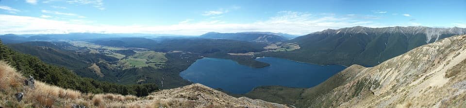
Arrange a water taxi to the Lakehead Hut jetty at the head of Lake Rotoiti; Lakehead Hut is about a 15-minute walk beyond it. Walking in from Kerr Bay at St Arnaud adds 10.4 km and about three hours. No road pickup is available at Upper Travers Hut.

Safety

Several stream crossings can become unsafe after heavy rain. Hut and stream water is untreated and must be boiled or treated. Book huts in advance.

3 active Nelson Lakes alerts

  • ClosureRotoroa Route permanently closedThe Rotoroa Route is permanently closed along the eastern side of Lake Rotoroa between Rotoroa village and Sabine Hut.Official details
  • CautionUnbridged stream between Sabine and D’Urville hutsThe bridge on the track between Sabine Hut and D’Urville Hut has been removed; trampers must cross an unbridged stream at GR E1571366 N5359831.Official details
See all 3 alerts
A park ranger sits on a dash-mounted phone, talking, as Parkwolf’s Tour Guide plays “Army Cutworm Moths: A Grizzly Bear Buffet” on Grand Loop Road below Dunraven Pass in Yellowstone
Parkwolf Tour GuideThe highest, rockiest slopes around here are a summer buffet for grizzly bears.

Nelson Lakes Tour Guide

Your drive to Travers Valley Track to Upper Travers Hut, narrated.

Parkwolf is a GPS audio tour guide for Nelson Lakes National Park. As you drive, it chimes in with what’s ahead: hidden gems, upcoming stops, history, geology, and wildlife, right through your car’s speakers.

More stories near here in the app

  • Mount Robert: Views on Foot
  • Lakeside Track to Whisky Falls
  • Kerr Bay and Lake Rotoiti
  • Nelson Lakes Visitor Centre
  • 26 audio storiesacross Nelson Lakes’s roads, triggered by GPS as you drive
  • Wildlife heatmapsfor New Zealand Falcon, Weka, Kererū, and 13 more
  • Works offlinemaps, 57 trails, 47 places, and audio download before you lose signal
  • CarPlay readysimple controls built for the drive
★★★★★
“Fantastic app with many points of information… It’s great to just turn on while you’re driving and it gives you an audio tour of the national Park. We love it!!!!”
JMJamesApp Store review
Download Parkwolf on the App StoreGet Parkwolf on Google Play

4.7 from 8,600+ ratings

Trail guide

Hiking Travers Valley Track to Upper Travers Hut

What this route coversTravers Valley Track to Upper Travers Hut is a 20.

Travers Valley Track to Upper Travers Hut is a 20.9 km one-way approach from Lakehead Hut through John Tait Hut to the upper valley. It follows river flats and forested terraces before climbing to a tussock basin below Mount Travers. This is one leg of the wider Travers–Sabine network, not a loop: this route stops at Upper Travers Hut and leaves out both the same-way return and the alpine crossing of Travers Saddle. Plan your continuation or return before starting. The published stage times add to 7.5 hours; allow a full day on foot, especially with an overnight pack and stops.

Get to Lakehead HutThe usual access is a water taxi to the jetty at the head of Lake Rotoiti, then about 15…

The usual access is a water taxi to the jetty at the head of Lake Rotoiti, then about 15 minutes on foot to Lakehead Hut, where the published distance begins. Walking in from Kerr Bay at St Arnaud adds 10.4 km and about three hours before you reach the hut. Upper Travers Hut has no road pickup, so a return along the valley or a booked continuation over the saddle needs its own plan. Huts must be booked, and there is no food service along the route; carry what you need for the backcountry stages.

Through the lower valleyFrom Lakehead Hut the route follows the Travers River flats through forest and grassy clearings…

From Lakehead Hut the route follows the Travers River flats through forest and grassy clearings left from the valley’s farming days. After about an hour and a half of easier walking, a swing bridge takes you across the river to its west bank. The valley narrows, then alternates between forested terraces and open flats. Mount Travers first appears near Hopeless Creek. Cross another swing bridge there; the route then climbs away from the river, eases past small creeks, and reaches John Tait Hut in a small clearing.

John Tait Hut’s storyJohn Tait, president of the Nelson Tramping Club from 1948, wanted a shelter in the valley…

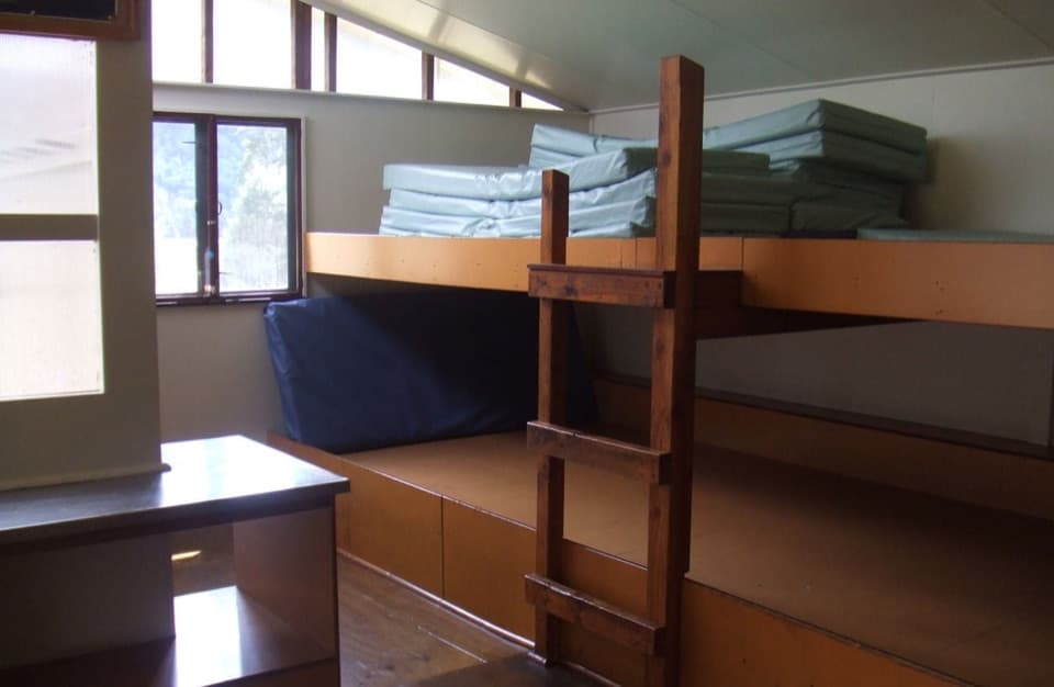
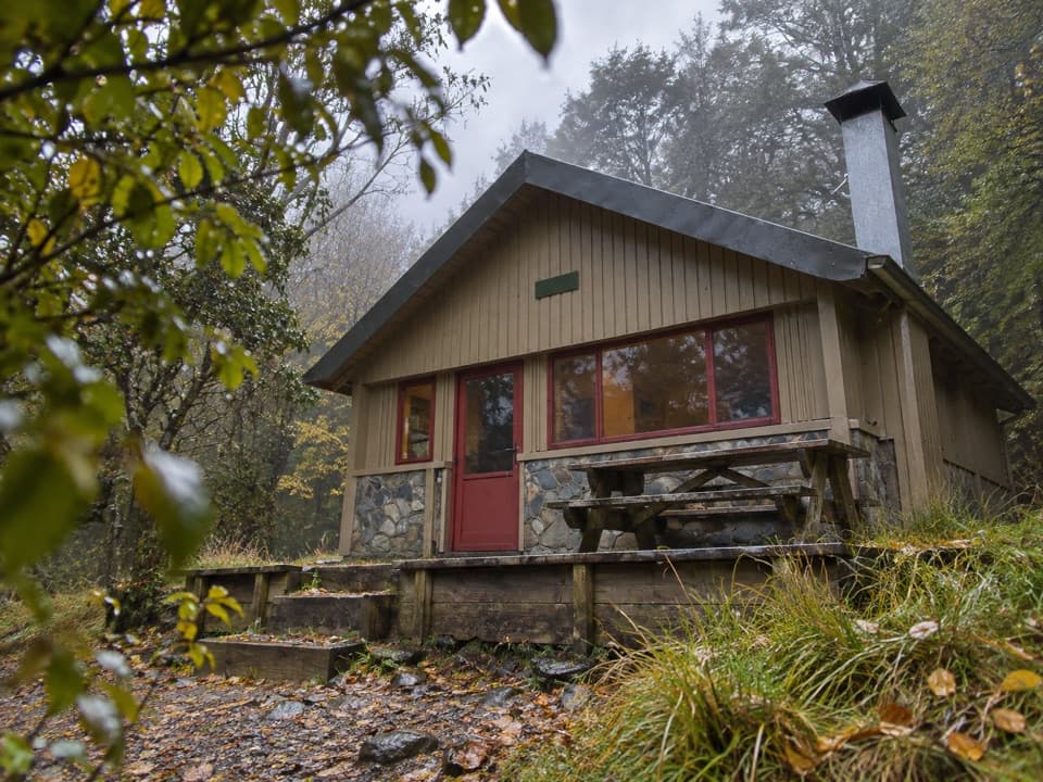
John Tait, president of the Nelson Tramping Club from 1948, wanted a shelter in the valley after climbing Mount Travers with his family. Volunteers assembled the first hut in a Nelson backyard, then carried its materials to the head of the lake; it opened at Easter in 1951. The hut you’ll use now is a replacement, but the valley still gives you the quiet clearing and mountain setting that made this a natural overnight stop. Book it if you want to split the long approach here.

Falls and the upper basinBeyond John Tait, the track climbs steeply above the river gorge at Cupola Creek, then eases…

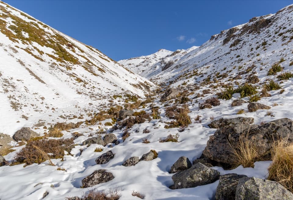
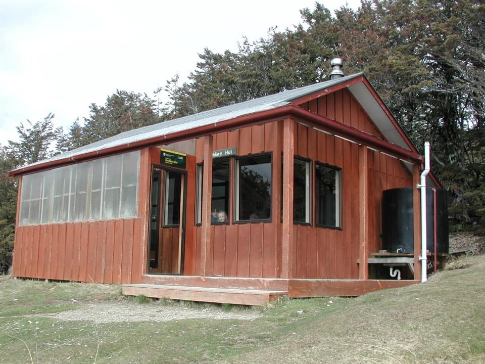
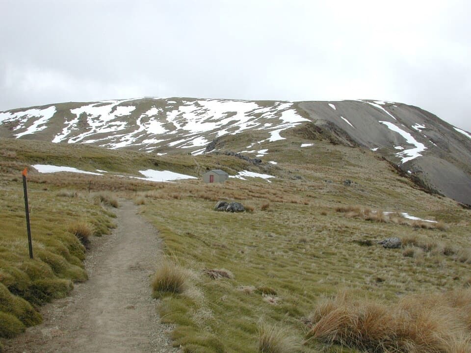
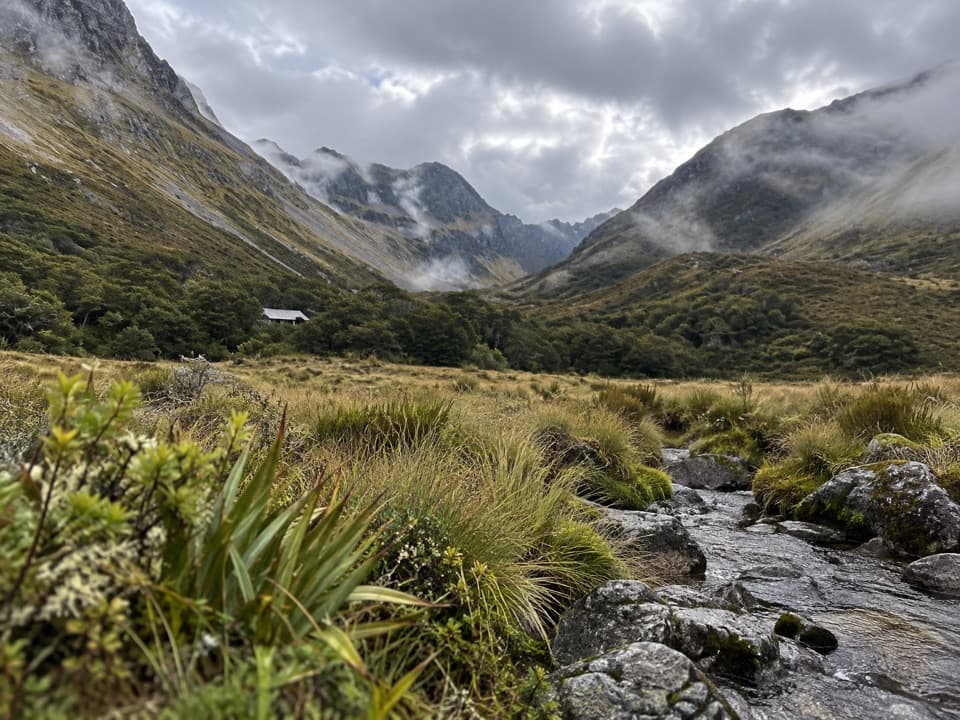
Beyond John Tait, the track climbs steeply above the river gorge at Cupola Creek, then eases across several scree slopes and a short bridge over the Travers River. A signed spur leads to Travers Falls, a 20 m cascade dropping into a deep bowl. Back on the main track, the forest gets shorter and occasional views open toward the surrounding mountains. The route finally levels onto a broad tussock flat, where Upper Travers Hut sits beneath Mount Travers’s east face. That hut-and-valley view is the route’s defining payoff; keep some of the tussock foreground in a photo to show the scale.

Effort and conditionsThis is a remote tramping route with a long distance between road access and the upper hut.

This is a remote tramping route with a long distance between road access and the upper hut. The crossings are bridged in places, but streams can be unsafe after heavy rain. Hut and stream water is untreated, so boil or treat it. Book Lakehead, John Tait and Upper Travers huts before relying on them, and leave dogs at home. If you want a shorter section, Lakehead Hut to John Tait is 14.2 km one way; that still needs a clear plan to turn around or continue, since it is not a loop. The route in this guide ends before Travers Saddle, whose alpine continuation is a separate trip.

Wildlife

Wildlife in Nelson Lakes

All Nelson Lakes wildlife maps

Sighting maps show where each species has been reported across Nelson Lakes. Wildlife moves, so no sighting is guaranteed.

Keep exploring

Near Travers Valley Track to Upper Travers Hut

See it all on the map

Trails that start nearby

Places near the trailhead

Parkwolf’s Nelson Lakes ranking

Top-rated trails in Nelson Lakes

All 57 trails
  1. 1Mount Robert CircuitChallenging · 9 km
  2. 2Angelus Hut via Pinchgut Track and Robert Ridge RouteChallenging · 12.2 km
  3. 3St Arnaud Range TrackChallenging · 10 km
  4. 4Rotomairewhenua/Blue Lake TrackChallenging · 15.4 km
  5. 5Travers-Sabine CircuitChallenging · 80 km
  6. 6Lake Rotoiti CircuitChallenging · 23.4 km

Take Parkwolf to Nelson Lakes.

The audio tour guide for the drive, plus offline maps, trails, and wildlife heatmaps for when the signal drops.

4.7 from 8,600+ ratings

Download Parkwolf on the App StoreGet Parkwolf on Google Play