Upper Travers Hut in Nelson Lakes National Park

Lodging · Nelson Lakes National Park

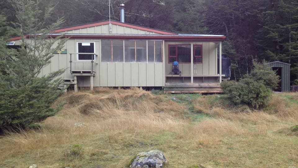
Upper Travers Hut

Sleep below Mount Travers on this demanding multi-day circuit.

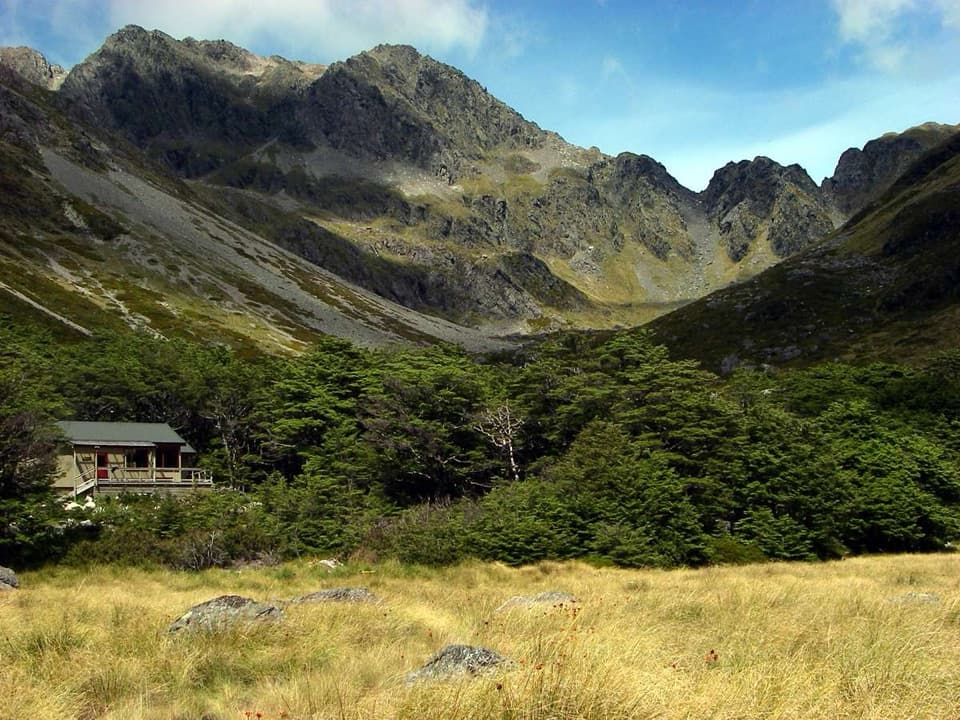
Photo: Don's Maps freely usable image permission
Type
Lodging
Nearest trail
Right here
  • Restrooms
Parkwolf audio tour26 stories across Nelson Lakes’s roads

Overview

About Upper Travers Hut

Why stop

  • An open high-alpine setting beneath Mount Travers.
  • Travers Falls is a short detour on the approach.

Heads up

  • Remote, strenuous access; bring all food and supplies.

Map

Where it is

Loading the Nelson Lakes map
Full map
LodgingUpper Travers Hut-42.02036, 172.74993
Keep this map with you offline in the Parkwolf app

Plan your stop

Before you go

3 active Nelson Lakes alerts

  • InfoSevere-weather damage lengthens West Sabine–Sabine sectionMentions West Sabine, referenced in this guideAllow 6 hours to walk the West Sabine Hut–Sabine Hut section of the Travers–Sabine Circuit; damage from severe-weather events has lengthened the track time.Official details
  • ClosureRotoroa Route permanently closedThe Rotoroa Route is permanently closed along the eastern side of Lake Rotoroa between Rotoroa village and Sabine Hut.Official details

See all 3 alerts
A park ranger sits on a dash-mounted phone, talking, as Parkwolf’s Tour Guide plays “Army Cutworm Moths: A Grizzly Bear Buffet” on Grand Loop Road below Dunraven Pass in Yellowstone
Parkwolf Tour GuideThe highest, rockiest slopes around here are a summer buffet for grizzly bears.

Nelson Lakes Tour Guide

Your drive to Upper Travers Hut, narrated.

Parkwolf is a GPS audio tour guide for Nelson Lakes National Park. As you drive, it chimes in with what’s ahead: hidden gems, upcoming stops, history, geology, and wildlife, right through your car’s speakers.

  • 26 audio storiesacross Nelson Lakes’s roads, triggered by GPS as you drive
  • Wildlife heatmapsfor New Zealand Falcon, Weka, Kererū, and 13 more
  • Works offlinemaps, 57 trails, 47 places, and audio download before you lose signal
  • CarPlay readysimple controls built for the drive
★★★★★
“Fantastic app with many points of information… It’s great to just turn on while you’re driving and it gives you an audio tour of the national Park. We love it!!!!”
JMJamesApp Store review
Download Parkwolf on the App StoreGet Parkwolf on Google Play

4.7 from 8,600+ ratings

Guide

More about Upper Travers Hut

A proper backcountry overnight stopUpper Travers Hut is a 24-bunk serviced hut on a broad tussock flat below the east face of…

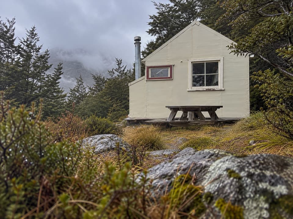
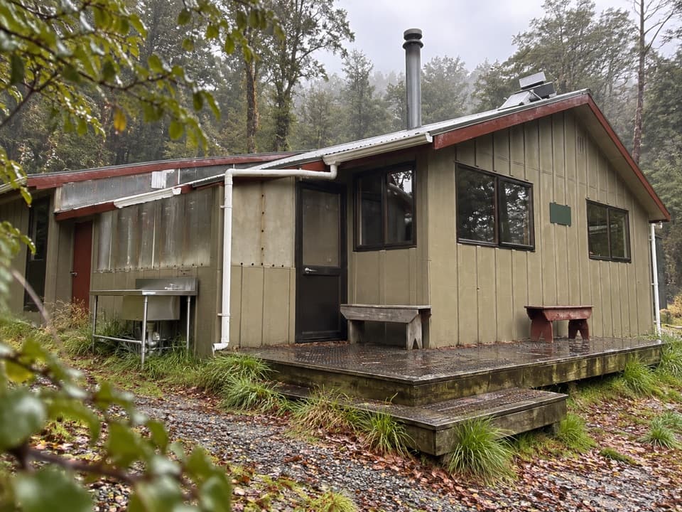
Upper Travers Hut is a 24-bunk serviced hut on a broad tussock flat below the east face of Mount Travers. It is an overnight stop on the 80 km Travers-Sabine Circuit, an advanced tramping route that usually takes four to seven days. From John Tait Hut, allow about three hours to reach it; this is a backcountry approach, not a walk in from a road. Book a bunk before setting out.

The walk inThe track climbs through the narrow chasm at Cupola Creek, with a signed short detour to…

The track climbs through the narrow chasm at Cupola Creek, with a signed short detour to Travers Falls, a 20 m cascade dropping into a deep basin. Beyond the falls, the route passes stunted forest before opening onto the tussock flat and the hut beneath Mount Travers’s rough east face. Step back on the open flat and frame the hut with the mountain behind it; that puts the scale of the basin into the picture.

Bring your own provisionsThe hut has bunks and mattresses, toilets, and an untreated water supply.

The hut has bunks and mattresses, toilets, and an untreated water supply. Bring all your food: there is no meal service, and the water needs boiling or other treatment before drinking. It is a sheltered place to stop in a remote valley, but not a stocked lodge or a trailhead facility.

Continuing over the saddleThe route onward to West Sabine Hut takes six to nine hours, depending on conditions.

The route onward to West Sabine Hut takes six to nine hours, depending on conditions. Travers Saddle rises about 450 m above Upper Travers and takes roughly an hour and a half to climb. It is an exposed alpine crossing: ice axes and crampons can be needed in winter and well into spring, snow may linger, and the saddle can freeze at any time of year. Treat the crossing as a serious mountain leg, not an easy walk after a night indoors.

The hut was moved out of dangerThe present hut was built in 2004 to replace an older Upper Travers Hut that stood in an…

The present hut was built in 2004 to replace an older Upper Travers Hut that stood in an avalanche path. That makes the open flat below the mountain more than a scenic setting: it is also the reason the current building sits where it does.

Wildlife

Wildlife in Nelson Lakes

All Nelson Lakes wildlife maps

Sighting maps show where each species has been reported across Nelson Lakes. Wildlife moves, so no sighting is guaranteed.

Parkwolf’s Nelson Lakes ranking

Top sights in Nelson Lakes

All 47 places
  1. 1Lake Rotoiti – Kerr Bay and JettySight
  2. 2Rotomairewhenua / Blue LakeSight
  3. 3Lake Rotoroa – Foreshore and JettySight
  4. 4Rotomaninitua / Lake AngelusSight
  5. 5Rotopōhueroa / Lake ConstanceSight
  6. 6Whisky FallsSight

Take Parkwolf to Nelson Lakes.

The audio tour guide for the drive, plus offline maps, trails, and wildlife heatmaps for when the signal drops.

4.7 from 8,600+ ratings

Download Parkwolf on the App StoreGet Parkwolf on Google Play