Copper Ridge Trail in North Cascades National Park

North Cascades National Park, WA

Copper Ridge Trail

Seven open ridge miles reward a demanding wilderness approach.

Length
13.9mi
Time
11hr
Elev. change
3,871ft
Difficulty
Challenging
  • No dogs
  • High point 6,198 ft
  • #13 of 88 in North Cascades
Parkwolf audio tour83 stories across North Cascades’s roads

Overview

About Copper Ridge Trail

Why go

  • Seven miles of open subalpine meadows with wide North Cascades views
  • Designated ridge camps have toilets and food-storage lockers

Heads up

  • Remote one-way segment with a five-mile approach from the parking area
  • Steep descent, scarce ridge water and braided river fords

Map & elevation

The route

Loading the North Cascades map
Full map
Elevation2,326–6,198 ft
TrailheadBoundary Camp (Copper Ridge junction)48.88782, -121.52390
Keep this map with you offline in the Parkwolf app

Plan your hike

Before you go

Parking

Hannegan Pass Trailhead at the end of Hannegan Road (USFS Road 32); the route start at Boundary Camp is about five miles farther on foot. The lot holds about 30 vehicles plus roadside shoulder parking. A Northwest Forest Pass or America the Beautiful pass is required.

Safety

Steep snow can persist into July and may require an ice axe. The exposed ridge is hot and dry in summer with limited water. The Chilliwack River ford is only for low water, and the trail is easy to lose among braided channels. Stay on durable tread around fragile meadows.

7 active North Cascades alerts

  • ClosureWildfire closures and Stehekin fire advisoryWildfire-related closures remain in effect; stay out of all closed trails, camps, and areas.Official details
  • CautionCampfires banned across the park complexCampfires and other ash-producing fires are banned throughout the North Cascades National Park Service Complex.Official details
See all 7 alerts
A park ranger sits on a dash-mounted phone, talking, as Parkwolf’s Tour Guide plays “Army Cutworm Moths: A Grizzly Bear Buffet” on Grand Loop Road below Dunraven Pass in Yellowstone
Parkwolf Tour GuideThe highest, rockiest slopes around here are a summer buffet for grizzly bears.

North Cascades Tour Guide

Your drive to Copper Ridge Trail, narrated.

Parkwolf is a GPS audio tour guide for North Cascades National Park. As you drive, it chimes in with what’s ahead: hidden gems, upcoming stops, history, geology, and wildlife, right through your car’s speakers.

See the North Cascades audio tour
  • 83 audio storiesacross North Cascades’s roads, triggered by GPS as you drive
  • Wildlife heatmapsfor Mountain Goat, Black Bear, Mule Deer, and 10 more
  • Works offlinemaps, 88 trails, 76 places, and audio download before you lose signal
  • CarPlay readysimple controls built for the drive
★★★★★
“Fantastic app with many points of information… It’s great to just turn on while you’re driving and it gives you an audio tour of the national Park. We love it!!!!”
JMJamesApp Store review
Download Parkwolf on the App StoreGet Parkwolf on Google Play

4.7 from 8,600+ ratings

Trail guide

Hiking Copper Ridge Trail

A remote ridge traverseCopper Ridge Trail is a point-to-point backcountry leg from Boundary Camp to Indian Creek Camp,…

Copper Ridge Trail is a point-to-point backcountry leg from Boundary Camp to Indian Creek Camp, listed at 13.9 miles one way. It climbs steeply onto a high ridge, crosses about seven miles of open subalpine meadows with long mountain views, then drops into the Chilliwack River valley and its braided channels. This is not a stand-alone car hike: Boundary Camp is five miles beyond Hannegan Pass Trailhead, and Indian Creek Camp has no road access. Most visitors fold it into a multi-day wilderness loop, returning through the valley on the Chilliwack River Trail. The 13.9-mile figure includes the short valley leg from the Copper Ridge junction to Indian Creek Camp.

Reach Boundary Camp firstThe stored route begins at the fork near Boundary Camp, not at the parking area.

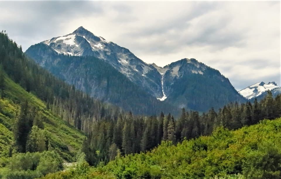
The stored route begins at the fork near Boundary Camp, not at the parking area. From Hannegan Pass Trailhead, the approach climbs through silver fir and avalanche openings to Hannegan Pass, with Ruth Mountain in view, then descends through forest and talus to the Chilliwack headwaters. Allow about five miles each way just to reach Boundary Camp. The Copper Ridge branch turns uphill there; plan the full return route or an overnight itinerary before starting.

Climb into open countryFrom Boundary Camp the Copper Ridge path climbs hard, then opens into roughly seven miles of…

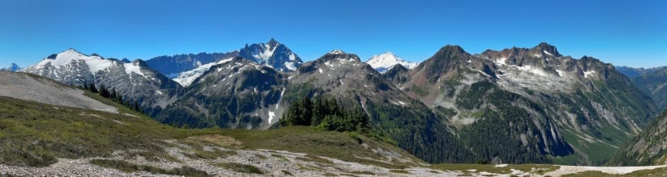
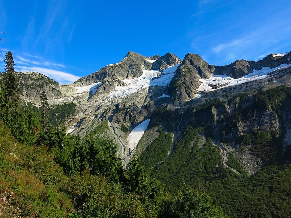
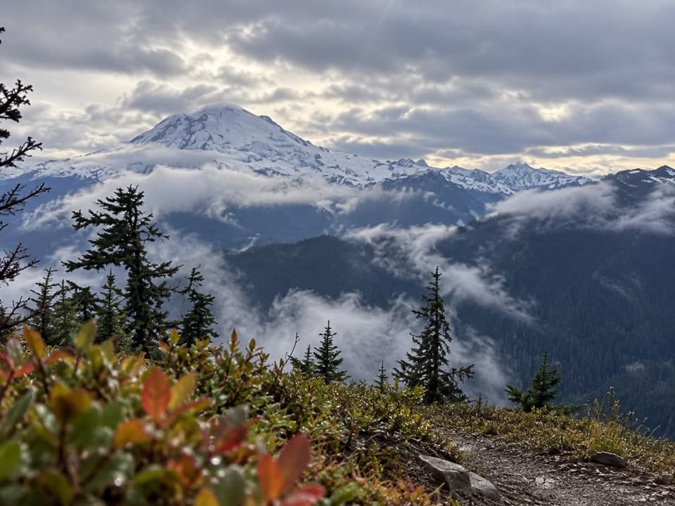
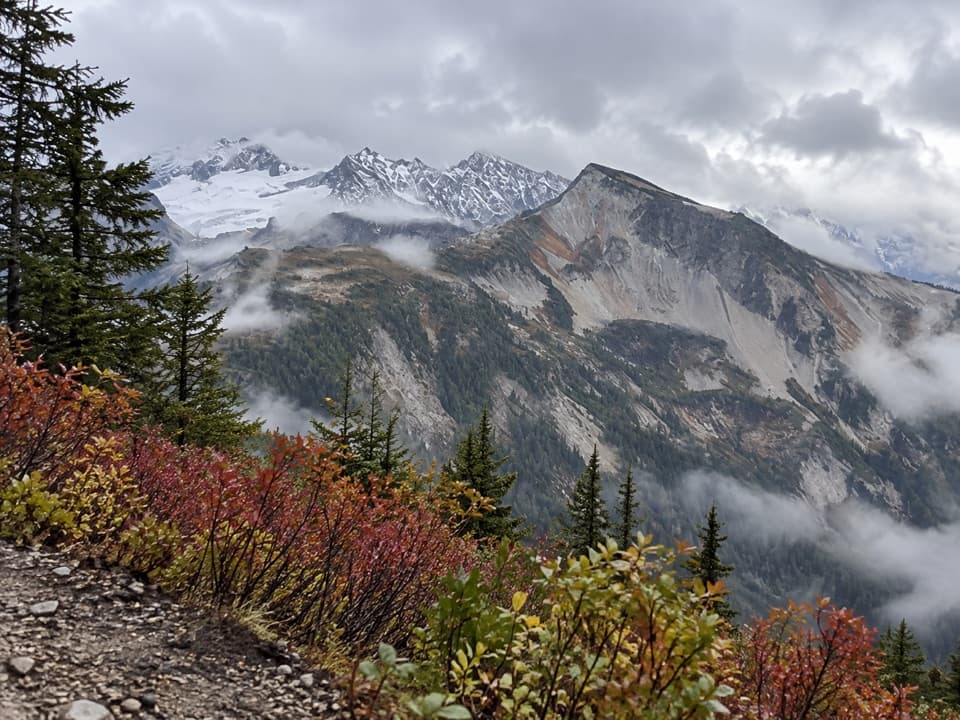
From Boundary Camp the Copper Ridge path climbs hard, then opens into roughly seven miles of subalpine meadow. The ridge rises and dips past Silesia, Egg Lake and Copper Lake rather than following a level crest. Brush and blueberry growth can narrow the tread in places. On clear days, look for Mount Shuksan and Mount Baker in the surrounding range; leave a strip of trail or meadow in the foreground for scale. Stay on the main path and durable ground around the lakes: fragile vegetation is recovering from past damage.

The lookout and waterCopper Mountain Lookout sits near the high point, about 6,260 feet.

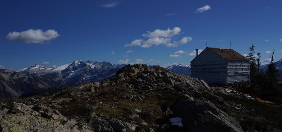
Copper Mountain Lookout sits near the high point, about 6,260 feet. Treat the building as a landmark, not an assured open shelter; current access to it has not been established. The ridge is hot and dry in summer, and water is sparse. Carry enough for the climb and do not count on small seasonal streams. Silesia, Egg Lake and Copper Lake are designated camps with composting toilets and food-storage lockers.

A steep drop and two fordsAfter Copper Lake the trail loses about 2,400 feet in five miles into the Chilliwack valley.

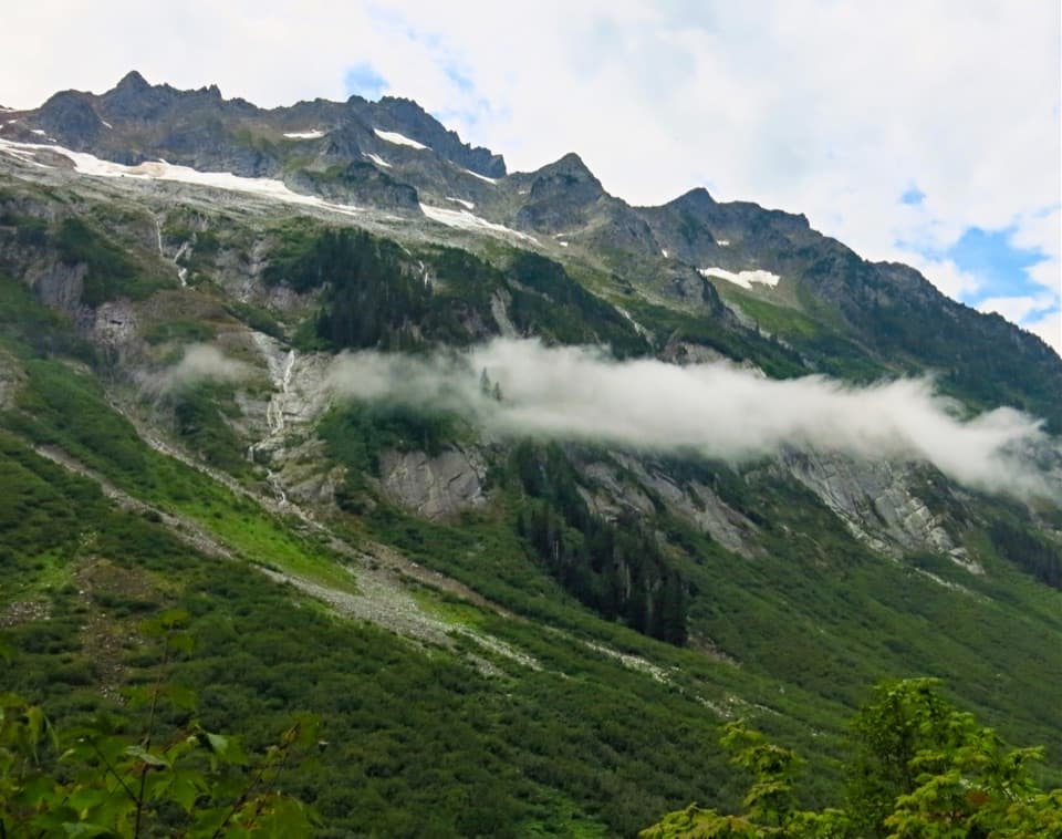
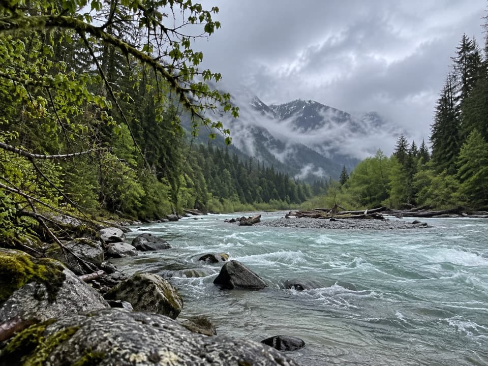
After Copper Lake the trail loses about 2,400 feet in five miles into the Chilliwack valley. The descent is steep and remote. At the bottom, the route crosses braided channels of the Chilliwack River, follows a flagged path to Indian Creek, then reaches Indian Creek Camp. This is the stretch where it is easiest to lose the tread among gravel bars, so don't wander looking for a simpler crossing. The Chilliwack ford is only for low water; high flow can make it unsafe. Steep snow may persist into July and can require an ice axe.

Rules and trailhead facilitiesOvernight stays in the national park require a backcountry permit.

Overnight stays in the national park require a backcountry permit. Fires are prohibited at Boundary and the Copper Ridge camps, and pets are prohibited at Boundary Camp and beyond. Hannegan Pass Trailhead sits at the end of Hannegan Road; parking requires a Northwest Forest Pass or America the Beautiful pass. The lot has space for about 30 vehicles plus roadside shoulders, a vault toilet, a shelter and a bearproof garbage bin. Carry food and plan water before leaving town.

Wildlife

Wildlife in North Cascades

All North Cascades wildlife maps

Sighting maps show where each species has been reported across North Cascades. Wildlife moves, so no sighting is guaranteed.

Parkwolf’s North Cascades ranking

Top-rated trails in North Cascades

All 88 trails
  1. 1Sahale Arm TrailChallenging · 11.8 mi
  2. 2Cascade Pass TrailModerate · 7.4 mi
  3. 3Heather–Maple Pass LoopChallenging · 7.2 mi
  4. 4Hidden Lake TrailChallenging · 9 mi
  5. 5Copper Ridge / Chilliwack River LoopChallenging · 33.5 mi
  6. 6Thunder Knob TrailModerate · 3.8 mi

Take Parkwolf to North Cascades.

The audio tour guide for the drive, plus offline maps, trails, and wildlife heatmaps for when the signal drops.

4.7 from 8,600+ ratings

Download Parkwolf on the App StoreGet Parkwolf on Google Play