Hannegan Pass and Peak Trail in North Cascades National Park

North Cascades National Park, WA

Hannegan Pass and Peak Trail

A steep summit spur turns a pass hike into an all-day climb.

Photo: Wikimedia Commons
Length
10.4mi
Time
7hr
Elev. change
2,986ft
Difficulty
Challenging
  • Dogs allowed
  • High point 6,142 ft
  • #30 of 88 in North Cascades
Parkwolf audio tour83 stories across North Cascades’s roads

Overview

About Hannegan Pass and Peak Trail

Why go

  • Waterfalls and open Ruth Creek views lead into a full summit panorama.
  • Hannegan Pass makes a worthwhile shorter turnaround.

Heads up

  • The final mile climbs about 1,200 feet on steep switchbacks.
  • The 10.4-mile summit outing takes most of a day.

Map & elevation

The route

Loading the North Cascades map
Full map
Elevation3,156–6,142 ft
TrailheadHannegan Trailhead48.91019, -121.59197
Keep this map with you offline in the Parkwolf app

Plan your hike

Before you go

Parking

Start at Hannegan Trailhead at the end of Forest Service Road 32. The lot has a vault toilet and picnic tables, but no potable water. Parking requires a Forest Service day-use fee or an accepted Forest/interagency pass; the Washington Discover Pass is not accepted.

Safety

The peak branch gains about 1,200 feet in roughly a mile on steep switchbacks; snow can make the high section unsafe. Black bears frequent the area, so secure food. There is no potable water at the trailhead.

7 active North Cascades alerts

  • ClosureWildfire closures and Stehekin fire advisoryWildfire-related closures remain in effect; stay out of all closed trails, camps, and areas.Official details
  • CautionCampfires banned across the park complexCampfires and other ash-producing fires are banned throughout the North Cascades National Park Service Complex.Official details
See all 7 alerts
A park ranger sits on a dash-mounted phone, talking, as Parkwolf’s Tour Guide plays “Army Cutworm Moths: A Grizzly Bear Buffet” on Grand Loop Road below Dunraven Pass in Yellowstone
Parkwolf Tour GuideThe highest, rockiest slopes around here are a summer buffet for grizzly bears.

North Cascades Tour Guide

Your drive to Hannegan Pass and Peak Trail, narrated.

Parkwolf is a GPS audio tour guide for North Cascades National Park. As you drive, it chimes in with what’s ahead: hidden gems, upcoming stops, history, geology, and wildlife, right through your car’s speakers.

See the North Cascades audio tour
  • 83 audio storiesacross North Cascades’s roads, triggered by GPS as you drive
  • Wildlife heatmapsfor Mountain Goat, Black Bear, Mule Deer, and 10 more
  • Works offlinemaps, 88 trails, 76 places, and audio download before you lose signal
  • CarPlay readysimple controls built for the drive
★★★★★
“Fantastic app with many points of information… It’s great to just turn on while you’re driving and it gives you an audio tour of the national Park. We love it!!!!”
JMJamesApp Store review
Download Parkwolf on the App StoreGet Parkwolf on Google Play

4.7 from 8,600+ ratings

Trail guide

Hiking Hannegan Pass and Peak Trail

Make it a summit dayHannegan Pass and Peak is a hard 10.

Hannegan Pass and Peak is a hard 10.4-mile out-and-back from Hannegan Trailhead: four miles to Hannegan Pass, then a steep branch up to 6,186-foot Hannegan Peak. Allow about seven hours for the whole outing. The pass is a good shorter choice at roughly eight miles round trip, but the extra climb buys a wide-open summit with views in every direction. Do the peak if you have a full day and like a real uphill finish; turn around at the pass if the weather, snow, or your legs make that last push a poor bet.

The Ruth Creek approachThe first mile is fairly gentle through patches of forest.

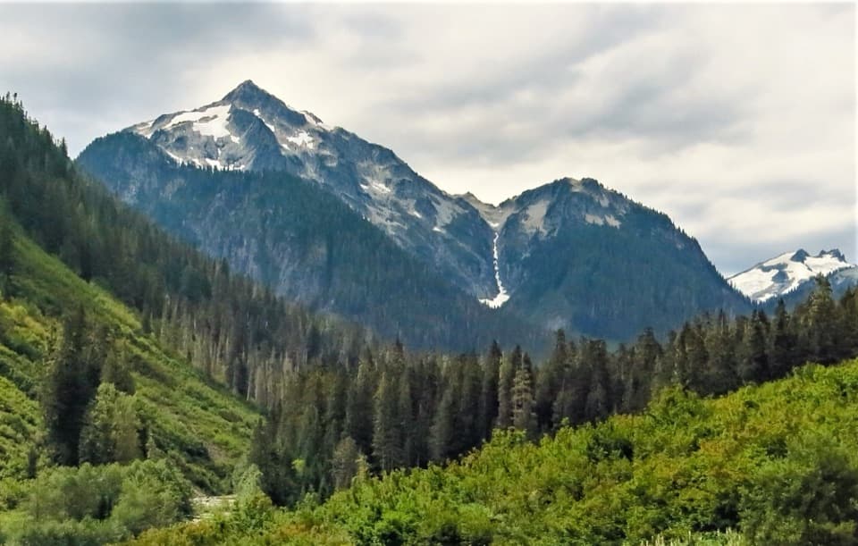
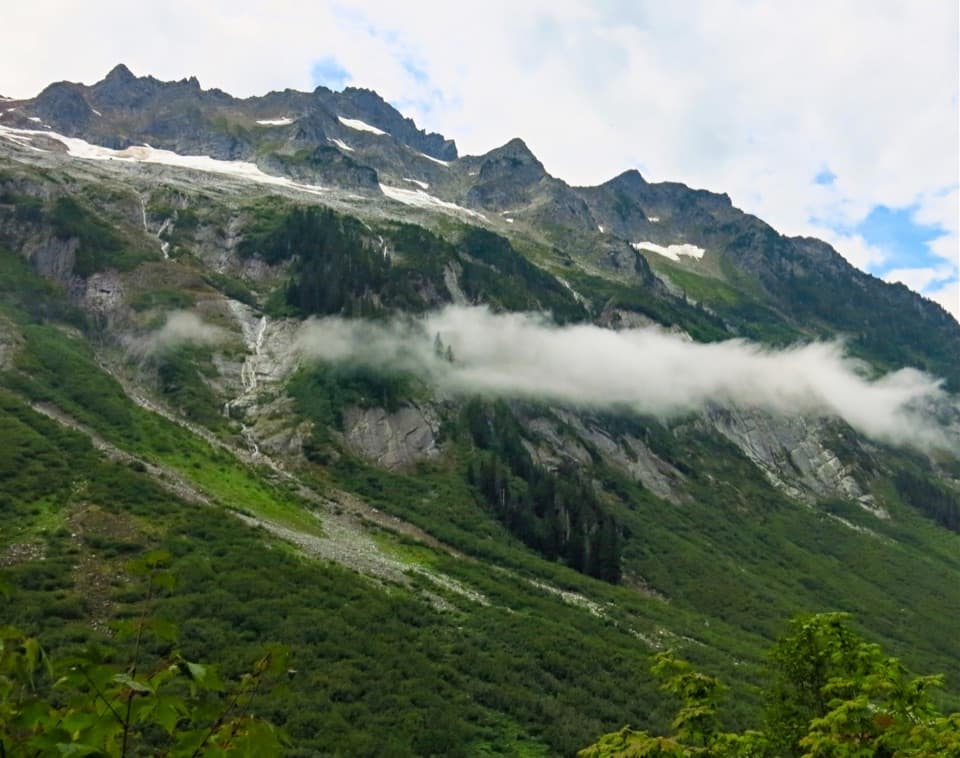
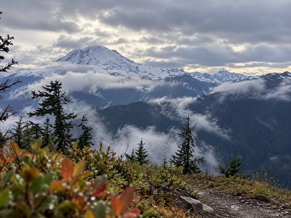
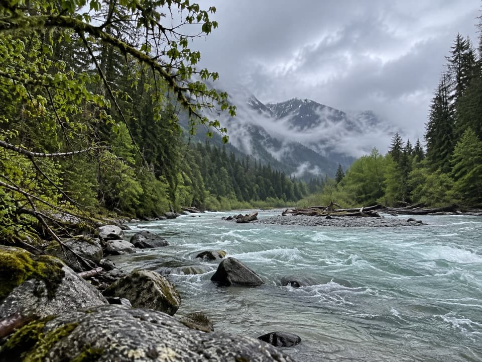
The first mile is fairly gentle through patches of forest. The path then climbs gradually across the open Ruth Creek valley, with the white dome of Ruth Mountain appearing after about a mile and views toward Mount Sefrit and Nooksack Ridge. The creek stays below the route, and small waterfalls cross the trail. Short shady glades break up the open stretch, though biting flies can be a nuisance where the lower vegetation is dense.

Around mile three the grade picks up. Switchbacks climb toward Hannegan Camp and then through subalpine forest to the pass. About half a mile below the pass, a signed right-hand branch leads to camp; stay on the main trail to reach the pass.

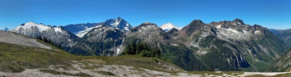
Take a breather at Hannegan PassAt about four miles from the trailhead, the pass opens the view into the Middle Creek drainage…

At about four miles from the trailhead, the pass opens the view into the Middle Creek drainage and the national park beyond. The pass sits around 5,050 to 5,100 feet, depending on the source. This is the turnaround for the pass-only hike. If you continue, look for the signed Trail 674.1 branch to Hannegan Peak; it is a different, much steeper climb from the valley approach.

The steep finishThe peak branch rises through forest and alpine meadows on tight switchbacks, gaining about…

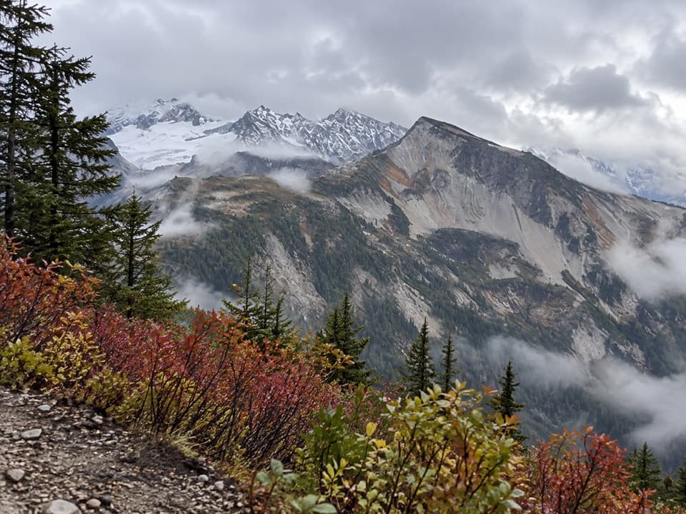
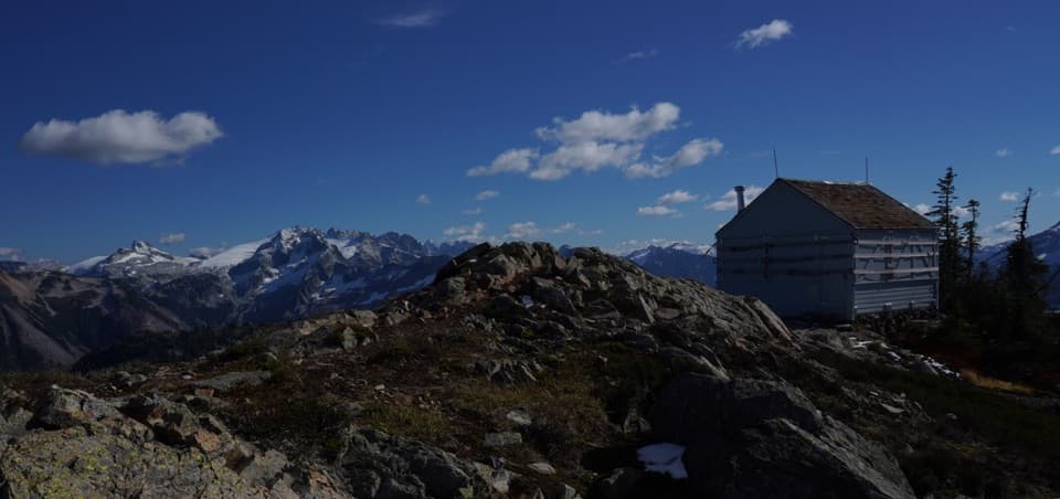
The peak branch rises through forest and alpine meadows on tight switchbacks, gaining about 1,200 feet in roughly a mile. It is the hardest part of the day and can feel like a second hike after the long approach. Snow can cover the high switchbacks in a late-snow season; check current conditions and be willing to stop at the pass if the upper slope is unsafe. The summit is 6,186 feet high and has room to walk around and take in the view.

Look in every directionFrom Hannegan Peak, Mount Baker, Mount Shuksan, Ruth Mountain, East Nooksack Glacier and…

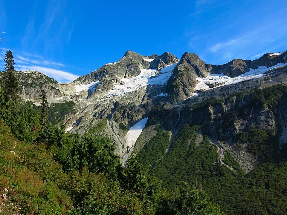
From Hannegan Peak, Mount Baker, Mount Shuksan, Ruth Mountain, East Nooksack Glacier and Nooksack Tower fill much of the southern view. Copper Ridge and Mount Redoubt are to the east, peaks in British Columbia and Silesia Creek valley lie north, and Goat Mountain, High Divide and Nooksack Ridge stretch west. For a panorama, keep a little of the rocky summit foreground in the frame; it gives the huge mountain horizon a sense of scale.

Water, wildlife and dogsThe Hannegan Trailhead has a vault toilet and picnic tables, but no potable water; food service…

The Hannegan Trailhead has a vault toilet and picnic tables, but no potable water; food service along the route was not found. Black bears frequent the area, so store food securely. Leashed dogs are allowed on this Forest Service route. Trail 674.1 is for hikers, and the northbound trail beyond the pass enters North Cascades National Park, where pets are prohibited.

Getting to the startThe trail begins at Hannegan Trailhead at the end of Forest Service Road 32.

The trail begins at Hannegan Trailhead at the end of Forest Service Road 32. Parking requires a Forest Service day-use fee or an accepted Forest or interagency pass; the Washington Discover Pass is not accepted. The access road has been reported as narrow and pothole-strewn, so take it slowly.

Wildlife

Wildlife in North Cascades

All North Cascades wildlife maps

Sighting maps show where each species has been reported across North Cascades. Wildlife moves, so no sighting is guaranteed.

Parkwolf’s North Cascades ranking

Top-rated trails in North Cascades

All 88 trails
  1. 1Sahale Arm TrailChallenging · 11.8 mi
  2. 2Cascade Pass TrailModerate · 7.4 mi
  3. 3Heather–Maple Pass LoopChallenging · 7.2 mi
  4. 4Hidden Lake TrailChallenging · 9 mi
  5. 5Copper Ridge / Chilliwack River LoopChallenging · 33.5 mi
  6. 6Thunder Knob TrailModerate · 3.8 mi

Take Parkwolf to North Cascades.

The audio tour guide for the drive, plus offline maps, trails, and wildlife heatmaps for when the signal drops.

4.7 from 8,600+ ratings

Download Parkwolf on the App StoreGet Parkwolf on Google Play