Hozomeen Lake Trail in North Cascades National Park

North Cascades National Park, WA

Hozomeen Lake Trail

A remote lake walk beneath peaks named for their sharp edges.

Length
7.2mi
Time
4hr
Elev. change
1,152ft
Difficulty
Moderate
  • Dogs allowed
  • High point 2,927 ft

Hear the audio tour

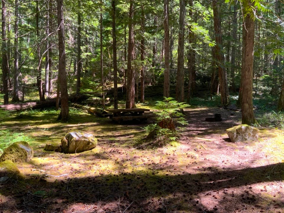
Hozomeen Campground and Hozomeen Lake

Overview

About Hozomeen Lake Trail

Why go

  • Clear water beneath Hozomeen Mountain, with common loons calling at the lake.

Heads up

  • The trailhead takes serious access planning from the south.
Hozomeen Lake Trail is a moderate 7.2-mile out-and-back from Hozomeen Campground’s Upper Loop to the shore below Hozomeen Mountain—3.6 miles each way, around four hours on the trail, and roughly 1,200 feet of climbing. It’s a good choice if you’re already visiting Hozomeen and want the lake; getting to this remote trailhead takes more planning than the hike itself. Dogs are allowed on leash.
Parkwolf’s verdictThe lake is the payoff

Map & elevation

The route

Loading the North Cascades map
Full map
Elevation1,775–2,927 ft
TrailheadHozomeen Campground Upper Loop48.98541, -121.06985
Keep this map with you offline in the Parkwolf app

Plan your hike

Before you go

Parking

Start at the Upper Loop of Hozomeen Campground. North access is via Silver-Skagit Road from Hope, British Columbia, subject to seasonal road and border conditions. From the south, there is no direct road: reach Ross Lake by boat or use the 31-mile East Bank Trail. Those approach miles are not included in the trail distance.

Safety

Hozomeen has no cell reception. The East Bank approach takes multiple days and overnight backcountry stays require a permit.

7 active North Cascades alerts

  • ClosureWildfire closures and Stehekin fire advisoryWildfire-related closures remain in effect; stay out of all closed trails, camps, and areas.Official details
  • CautionCampfires banned across the park complexCampfires and other ash-producing fires are banned throughout the North Cascades National Park Service Complex.Official details
See all 7 alerts
A park ranger sits on a dash-mounted phone, talking, as Parkwolf’s Tour Guide plays “Army Cutworm Moths: A Grizzly Bear Buffet” on Grand Loop Road below Dunraven Pass in Yellowstone
Parkwolf Tour GuideThe highest, rockiest slopes around here are a summer buffet for grizzly bears.

North Cascades Tour Guide

Your drive to Hozomeen Lake Trail, narrated.

Parkwolf is a GPS audio tour guide for North Cascades National Park. As you drive, it chimes in with what’s ahead: hidden gems, upcoming stops, history, geology, and wildlife, right through your car’s speakers.

See the North Cascades audio tour

Recorded for this trailhead

Hozomeen Campground and Hozomeen Lake
0:00 / 0:32
“You're nearing Hozomeen Campground, a remote forest base near the northern end of Ross Lake.”

Plays as you drive up to this trailhead in the Parkwolf North Cascades Tour Guide.

  • 83 audio storiesacross North Cascades’s roads, triggered by GPS as you drive
  • Wildlife heatmapsfor Mountain Goat, Black Bear, Mule Deer, and 10 more
  • Works offlinemaps, 88 trails, 76 places, and audio download before you lose signal
  • CarPlay readysimple controls built for the drive
★★★★★
“Fantastic app with many points of information… It’s great to just turn on while you’re driving and it gives you an audio tour of the national Park. We love it!!!!”
JMJamesApp Store review
Download Parkwolf on the App StoreGet Parkwolf on Google Play

4.7 from 8,600+ ratings

Trail guide

Hiking Hozomeen Lake Trail

A steady climb, one steeper pushThe trail starts with a gentle climb near Hozomeen Creek, crosses boggy patches on boardwalks,…

The trail starts with a gentle climb near Hozomeen Creek, crosses boggy patches on boardwalks, then winds through partly shaded forest on switchbacks. Around 2.5 miles, the grade eases at a signed fork. Take the left branch for Hozomeen Lake. About 0.6 mile remains, including a steeper push just before the first view of the water. You’ll climb that pitch again on the way back from the lake.

At the shoreThe trail follows the edge past campsites to a day-use area.

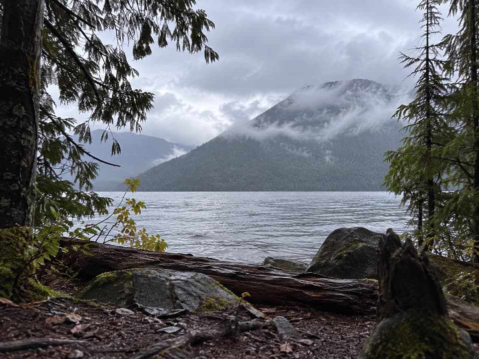
The trail follows the edge past campsites to a day-use area. Clear water sits beneath Hozomeen Mountain, and common loons are a good reason to pause and listen. For a photo, keep some of the lake in front of the mountain; the water gives the peaks their scale. Hozomeen’s name comes from a Salish word for sharpness, referring to the peaks and to chert Indigenous and First Nations people worked into sharp-edged tools.

The approach mattersThe 7.2-mile figure begins at the campground Upper Loop, not at the docks.

The 7.2-mile figure begins at the campground Upper Loop, not at the docks. From the north, access follows Silver-Skagit Road from Hope, British Columbia; the road and border crossing vary. From the south, there is no direct road: reach Ross Lake by boat, with a portage around Ross Dam on the Colonial Creek route, or hike the 31-mile East Bank Trail. That is a multi-day approach, and overnight backcountry stays require a permit. Hozomeen has no cell reception.

Wildlife

Wildlife in North Cascades

All North Cascades wildlife maps

Sighting maps show where each species has been reported across North Cascades. Wildlife moves, so no sighting is guaranteed.

Parkwolf’s North Cascades ranking

Top-rated trails in North Cascades

All 88 trails
  1. 1Sahale Arm TrailChallenging · 11.8 mi
  2. 2Cascade Pass TrailModerate · 7.4 mi
  3. 3Heather–Maple Pass LoopChallenging · 7.2 mi
  4. 4Hidden Lake TrailChallenging · 9 mi
  5. 5Copper Ridge / Chilliwack River LoopChallenging · 33.5 mi
  6. 6Thunder Knob TrailModerate · 3.8 mi

Take Parkwolf to North Cascades.

The audio tour guide for the drive, plus offline maps, trails, and wildlife heatmaps for when the signal drops.

4.7 from 8,600+ ratings

Download Parkwolf on the App StoreGet Parkwolf on Google Play