Cawthorn Roman Camps in North York Moors National Park

Sight · North York Moors National Park

Cawthorn Roman Camps

Mile-long walk around four Roman earthworks with wide moorland views.

Photo: Wikimedia Commons
Type
Sight
Nearest trail
0.3 km
Audio stories
8 nearby
  • Parking
  • Exhibit
  • Scenic viewpoint

Hear the audio tour

Cawthorn Roman Camps

Overview

About Cawthorn Roman Camps

Why stop

  • Four readable Roman earthworks in a compact walk
  • Broad moorland views from the viewing platform

Heads up

  • Exposed with no shelter when weather turns
  • Some banks and ditches are easy to miss without the interpretation
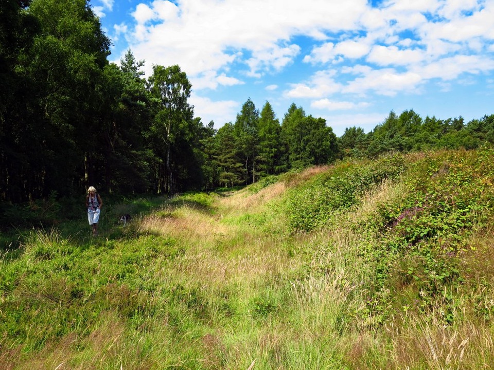
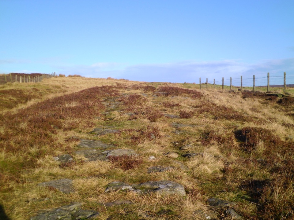
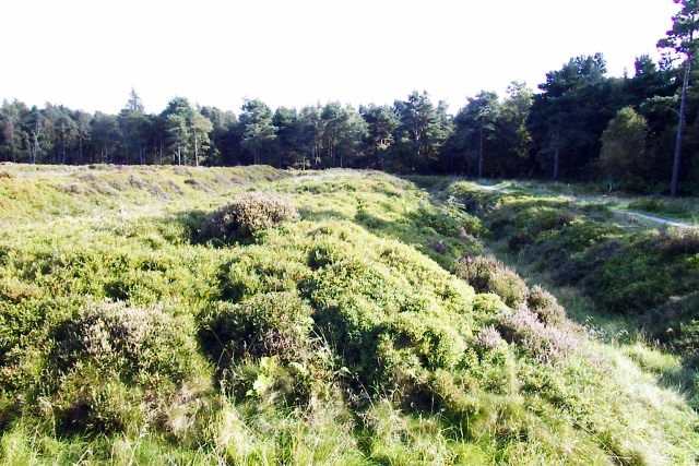
Most Roman military sites in the north survive only as buried lines on a map. Here the banks and ditches are still readable on the ground: a group of four earthworks made up of two forts, one with a later annexe, and a temporary camp, set on open heathland above the moorland edge. The complex is nationally important and counts as one of the region's most significant Roman sites, yet it stays a quiet, low-key place to walk rather than a ticketed attraction.
Parkwolf’s verdictWhy stop here

Map

Where it is

Loading the North York Moors map
Full map
SightCawthorn Roman Camps54.29890, -0.80032
Keep this map with you offline in the Parkwolf app

Plan your stop

Before you go

Best time to go

Dry, clear weather is the difference between a good visit and a muddy one, both for the grass section and for the long views that make the platform worthwhile. Low light early or late in the day rakes across the ramparts and makes the banks and ditches far easier to pick out than flat midday light. Weekdays and the first or last hours of daylight tend to be the quietest. Spring through autumn is the most comfortable window; in winter the exposure and wind chill are the main limits, though bare vegetation can make the earthworks stand out.


8 active North York Moors alerts

  • ClosureHawnby Bridleway 110 closurePublic Bridleway 25.122/110/1 in Hawnby is closed to pedestrians, cyclists and equestrians because its bridge is unsafe. - The closure is between grid references SE 5309 9073 and SE 5335 9097.Official details
  • ClosureWest Ayton Footpath 1 closurePublic Footpath 1 in West Ayton (Forge Valley) is temporarily closed because its boardwalk is unsafe. - The closure is between SE 9860 8494 and SE 9839 8712.Official details
See all 8 alerts
A park ranger sits on a dash-mounted phone, talking, as Parkwolf’s Tour Guide plays “Army Cutworm Moths: A Grizzly Bear Buffet” on Grand Loop Road below Dunraven Pass in Yellowstone
Parkwolf Tour GuideThe highest, rockiest slopes around here are a summer buffet for grizzly bears.

North York Moors Tour Guide

Your drive to Cawthorn Roman Camps, narrated.

Parkwolf is a GPS audio tour guide for North York Moors National Park. As you drive, it chimes in with what’s ahead: hidden gems, upcoming stops, history, geology, and wildlife, right through your car’s speakers.

Recorded for this place

Cawthorn Roman Camps
0:00 / 0:27
“You're approaching the access for Cawthorn Roman Camps; the earthworks are farther along the signed track.”

Plays as you drive up to Cawthorn Roman Camps in the Parkwolf North York Moors Tour Guide.

More stories near here in the app

  • The Gate That Made You Turn
  • The Beavers That Slowed a Beck
  • Cropton Village and River Seven Walk
  • The Cross the Forest Hid
  • 298 audio storiesacross North York Moors’s roads, triggered by GPS as you drive
  • Wildlife heatmapsfor Eurasian Otter, Red Deer, Grey Seal, and 13 more
  • Works offlinemaps, 126 trails, 65 places, and audio download before you lose signal
  • CarPlay readysimple controls built for the drive
★★★★★
“Fantastic app with many points of information… It’s great to just turn on while you’re driving and it gives you an audio tour of the national Park. We love it!!!!”
JMJamesApp Store review
Download Parkwolf on the App StoreGet Parkwolf on Google Play

4.7 from 8,600+ ratings

Guide

More about Cawthorn Roman Camps

What you see and doA self-guided illustrated trail loops the earthworks, starting from the information sign in the…
  • A self-guided illustrated trail loops the earthworks, starting from the information sign in the far corner of the car park, near the parking machine.
  • Interpretation panels along the way explain how the forts and camp were laid out and reimagine what stood here. Archaeologists link the site to two periods of Roman use, broadly around the late first and mid second centuries AD.
  • A viewing platform with a bench gives the clearest overview of the earthwork ramparts and a broad, big-sky outlook across the surrounding country.
  • The designated area also includes a stretch of medieval trackway known as the Portergate.
  • Grazing goats are sometimes used on site to hold back bramble, bracken, and scrub that damage the remains.
Access and what to bringThe circuit is about 1 mile with roughly 140 feet of gentle climbing, usually 30 minutes to an…

The circuit is about 1 mile with roughly 140 feet of gentle climbing, usually 30 minutes to an hour at an easy pace, longer if you read everything. The main path has a hard, compacted surface and is fairly level, with a short undulating grass section that is the weak link after rain. Parking is within about 50 metres of the trail entrance, with designated accessible bays, and charges apply. The approach drive is slightly uneven in places. Bring sturdy footwear, water, and a windproof or waterproof layer, since the site is fully exposed. OS Explorer OL27 covers the area, and the grid reference is SE 783 894.

Honest drawbacksNo toilets, cafe, or visitor services on site.
  • No toilets, cafe, or visitor services on site. The nearest refreshments are at Cropton and Newton-upon-Rawcliffe.
  • Parking is paid, which surprises some visitors at a site with no facilities.
  • The grass section can become difficult when wet, and the access drive is bumpy.
  • These are earthworks, not standing walls. Without the panels and the platform, some visitors find the shapes hard to read, so allow time to use both.
  • There is no shelter anywhere on the loop, so poor weather is felt immediately.

Wildlife

Wildlife in North York Moors

All North York Moors wildlife maps

Sighting maps show where each species has been reported across North York Moors. Wildlife moves, so no sighting is guaranteed.

Keep exploring

Near Cawthorn Roman Camps

See it all on the map

Trails nearby

More stops nearby

Parkwolf’s North York Moors ranking

Top sights in North York Moors

All 65 places
  1. 1North Yorkshire Moors RailwaySight
  2. 2Roseberry ToppingSight
  3. 3Rievaulx AbbeySight
  4. 4Robin Hood's Bay and BeachSight
  5. 5Hole of HorcumSight
  6. 6Goathland StationSight

Take Parkwolf to North York Moors.

The audio tour guide for the drive, plus offline maps, trails, and wildlife heatmaps for when the signal drops.

4.7 from 8,600+ ratings

Download Parkwolf on the App StoreGet Parkwolf on Google Play