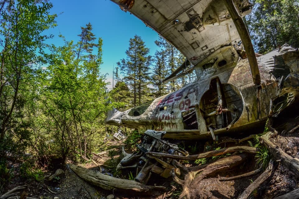
Canso Plane Crash Site in Pacific Rim National Park Reserve

#9 of 21 sights in Pacific Rim

Sight · Pacific Rim National Park Reserve

Canso Plane Crash Site

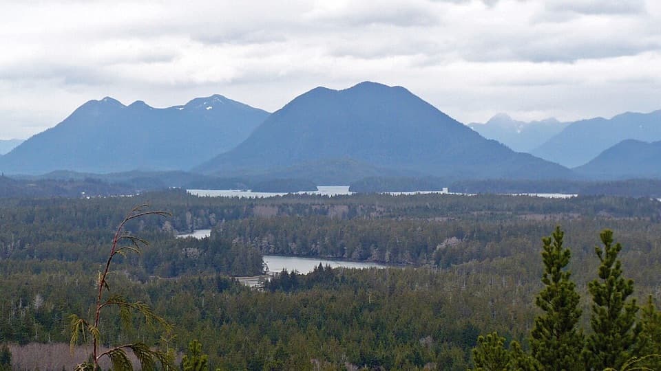
A WWII flying boat wreck in the rainforest south of Radar Hill.

Photo: Wikimedia Commons
Type
Sight
Nearest trail
1.5 km
Audio stories
6 nearby
  • Parking

Hear the audio tour

The Flying Boat in the Forest

Overview

About Canso Plane Crash Site

Why stop

  • A rare wartime aircraft site with a remarkable survival story.

Heads up

  • Informal, muddy route with roots, uneven ground and a steep final climb.

Map

Where it is

Loading the Pacific Rim map
Full map
SightCanso Plane Crash Site49.07862, -125.82190
Keep this map with you offline in the Parkwolf app

Plan your stop

Before you go

7 active Pacific Rim alerts

  • CautionWolf warning in Long Beach UnitA wolf warning remains active in the Long Beach Unit; leave pets at home because dogs attract wolves. Check current trail conditions before travelling.Official details
  • ClosureWest Coast Trail winter access restrictionFrom October 7 through April 30, only day use between Pachena Bay trailhead and km 8 is permitted; overnight use and the remainder of the West Coast Trail are closed.Official details

See all 7 alerts
A park ranger sits on a dash-mounted phone, talking, as Parkwolf’s Tour Guide plays “Army Cutworm Moths: A Grizzly Bear Buffet” on Grand Loop Road below Dunraven Pass in Yellowstone
Parkwolf Tour GuideThe highest, rockiest slopes around here are a summer buffet for grizzly bears.

Pacific Rim Tour Guide

Your drive to Canso Plane Crash Site, narrated.

Parkwolf is a GPS audio tour guide for Pacific Rim National Park Reserve. As you drive, it chimes in with what’s ahead: hidden gems, upcoming stops, history, geology, and wildlife, right through your car’s speakers.

See the Pacific Rim audio tour

Recorded for this area

The Flying Boat in the Forest
0:00 / 0:27
“The forest near Radar Hill still holds the wreck of a wartime flying boat. In nineteen forty-five, a Canso took off from the Tofino air base. One engine lost power, and the aircraft came down among the trees.”

Plays on the road 1.1 km from Canso Plane Crash Site in the Parkwolf Pacific Rim Tour Guide.

More stories near here in the app

  • Radar Hill
  • A Slug’s Four Feelers
  • Four Sides from One Board
  • Schooner Cove
  • 34 audio storiesacross Pacific Rim’s roads, triggered by GPS as you drive
  • Wildlife heatmapsfor Orca, Humpback Whale, Black Bear, and 13 more
  • Works offlinemaps, 19 trails, 52 places, and audio download before you lose signal
  • CarPlay readysimple controls built for the drive
★★★★★
“Fantastic app with many points of information… It’s great to just turn on while you’re driving and it gives you an audio tour of the national Park. We love it!!!!”
JMJamesApp Store review
Download Parkwolf on the App StoreGet Parkwolf on Google Play

4.7 from 8,600+ ratings

Guide

More about Canso Plane Crash Site

A wartime aircraft wreck in the woodsCanso 11007 is a Canadian Vickers PBV-1A flying boat that came down on a wooded hillside just…

Canso 11007 is a Canadian Vickers PBV-1A flying boat that came down on a wooded hillside just south of Radar Hill. Much of its fuselage and wing remains among the trees. Go for the unusual aircraft wreck and its history; the visit is a rough forest walk, not a viewpoint.

Find the routeStart at the lower Radar Hill parking area and follow the paved multi-use path south before…

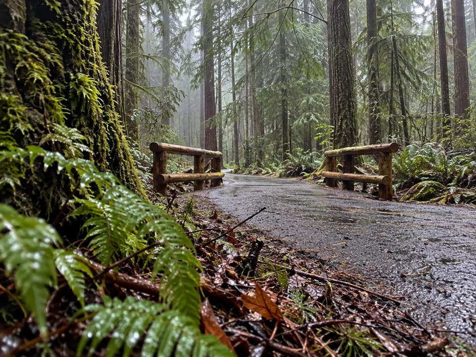
Start at the lower Radar Hill parking area and follow the paved multi-use path south before entering the woods. The crash-site route is informal and lightly marked, so save directions and avoid the highway shoulder. A route estimate is about 2 km round trip and 1 to 1½ hours; route-finding and wet ground can stretch that.

Expect a muddy approachBog, roots, logs and uneven ground are common, with a short, steep climb to the wreck.

Bog, roots, logs and uneven ground are common, with a short, steep climb to the wreck. Wear sturdy shoes; this is not a wheelchair or stroller route. Bring water and a snack because there is no food service at the site. Stay on the ground around the old aircraft; do not climb on or into a wreck that may be unstable.

How Canso 11007 came downDuring the Second World War, 11007 took off from RCAF Tofino on a flight toward Alliford Bay.

During the Second World War, 11007 took off from RCAF Tofino on a flight toward Alliford Bay. Its port engine failed shortly after departure; it struck trees while turning back, but all 12 people aboard survived.

The pond beside the planeThe small, nearly round pond beside the wreck is the crater left when rescuers removed depth…

The small, nearly round pond beside the wreck is the crater left when rescuers removed depth charges from the aircraft and detonated them nearby. It is a second trace of the crash, separate from the airframe still lying in the forest.

Wildlife

Wildlife in Pacific Rim

All Pacific Rim wildlife maps

Sighting maps show where each species has been reported across Pacific Rim. Wildlife moves, so no sighting is guaranteed.

Keep exploring

Near Canso Plane Crash Site

See it all on the map

Trails nearby

More stops nearby

Parkwolf’s Pacific Rim ranking

Top sights in Pacific Rim

All 52 places
  1. 1Long BeachBeach
  2. 2Wickaninnish BeachBeach
  3. 3Tsusiat FallsSight
  4. 4Incinerator RockSight
  5. 5Owen Point Sea CavesSight
  6. 6Radar HillSight

Take Parkwolf to Pacific Rim.

The audio tour guide for the drive, plus offline maps, trails, and wildlife heatmaps for when the signal drops.

4.7 from 8,600+ ratings

Download Parkwolf on the App StoreGet Parkwolf on Google Play