Chee Dale Stepping Stones in Peak District National Park

Sight · Peak District National Park

Chee Dale Stepping Stones

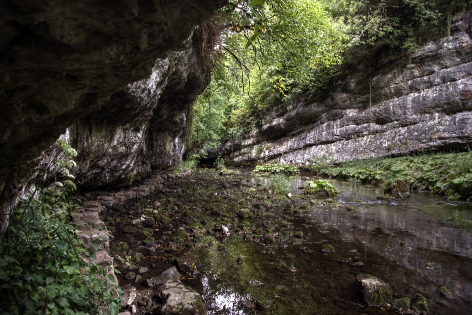
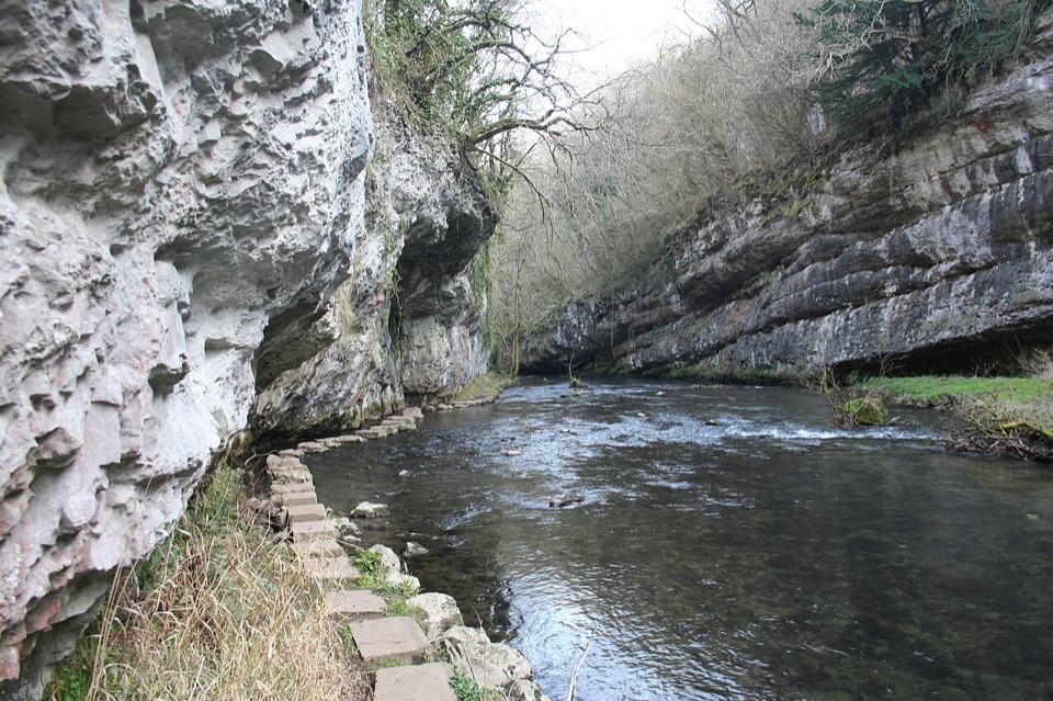
Hop limestone slabs along the River Wye beneath an overhanging cliff

Photo: Wikimedia Commons
Type
Sight
Nearest trail
1.3 km
Audio stories
7 nearby

Hear the audio tour

Chee Dale Stepping Stones from Topley Pike

Overview

About Chee Dale Stepping Stones

Why stop

  • Sheltered limestone gorge and an engaging riverside crossing

Heads up

  • Stones can be submerged after heavy rain
  • Rocky, muddy and uneven riverside path

Map

Where it is

Loading the Peak District map
Full map
SightChee Dale Stepping Stones53.25519, -1.81459
Keep this map with you offline in the Parkwolf app

Plan your stop

Before you go

Best time to go

  • Drier spells make for a better walk. Heavy rain can raise the river enough to submerge the stones completely, and paths here are very likely to be wet, muddy or flooded from September through March.
  • Summer is the strongest season for flowers and insects: early-purple orchids and cowslips appear in May, with rock rose, Jacob's Ladder, grass of Parnassus and scabious later on.
  • On sunny weekends and school holidays, arriving early or late in the day is the sensible move.

Getting there

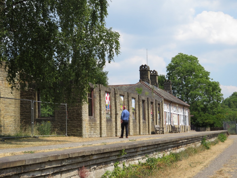
Most people start from the Miller's Dale area, where the Millers Dale Station access point on the Monsal Trail has pay-and-display parking, a cafe, accessible toilets and a Changing Places facility. From there you drop off the old railway line to the river. A popular circuit is around 5 km (about 3.1 miles) with roughly 183 m of ascent, taking in both stepping-stone sections and returning along the flat Monsal Trail and its tunnels, though other approaches along the river work too. The reserve itself is open at all times.

5 active Peak District alerts

  • ClosureA54 Cat and Fiddle road closureThe A54 Macclesfield Main Road (Cat and Fiddle) is fully closed to all traffic from 27 July through 30 October 2026 during phase 1 improvement works.Official details
  • ClosureHooks Carr (Stanage Popular) car park closureHooks Carr (Stanage Popular) car park will be partially or fully closed from 6 October for four weeks.Official details
See all 5 alerts
A park ranger sits on a dash-mounted phone, talking, as Parkwolf’s Tour Guide plays “Army Cutworm Moths: A Grizzly Bear Buffet” on Grand Loop Road below Dunraven Pass in Yellowstone
Parkwolf Tour GuideThe highest, rockiest slopes around here are a summer buffet for grizzly bears.

Peak District Tour Guide

Your drive to Chee Dale Stepping Stones, narrated.

Parkwolf is a GPS audio tour guide for Peak District National Park. As you drive, it chimes in with what’s ahead: hidden gems, upcoming stops, history, geology, and wildlife, right through your car’s speakers.

Recorded for this place

Chee Dale Stepping Stones from Topley Pike
0:00 / 0:29
“You're nearing the Topley Pike start for Chee Dale, where stepping stones run along the River Wye beneath an overhanging limestone cliff.”

Plays as you drive up to Chee Dale Stepping Stones in the Parkwolf Peak District Tour Guide.

More stories near here in the app

  • Millers Dale Goods Shed
  • Monsal Trail from Blackwell Mill
  • The Apprentice Who Spoke Out
  • Why Millers Dale Has Two Bridges
  • 298 audio storiesacross Peak District’s roads, triggered by GPS as you drive
  • Wildlife heatmapsfor Red Deer, Red Fox, Eurasian Otter, and 13 more
  • Works offlinemaps, 88 trails, 76 places, and audio download before you lose signal
  • CarPlay readysimple controls built for the drive
★★★★★
“Fantastic app with many points of information… It’s great to just turn on while you’re driving and it gives you an audio tour of the national Park. We love it!!!!”
JMJamesApp Store review
Download Parkwolf on the App StoreGet Parkwolf on Google Play

4.7 from 8,600+ ratings

Guide

More about Chee Dale Stepping Stones

What you actually doA public footpath along the River Wye includes two sets of stepping stones where the valley…

A public footpath along the River Wye includes two sets of stepping stones where the valley floor runs out of room. The first set hugs the water directly beneath an overhanging limestone cliff, so you step from slab to slab with rock leaning out above you and the river sliding past at boot level. Farther along the riverside path there is a second stepping-stone section. The rest of the route links up ordinary riverside paths and footbridges, and the ground between the stones is rocky, narrow and uneven, threading through a steep-sided gorge roughly 200 feet deep.

Why it stands outThe stones are part of a working public footpath rather than a set-piece attraction, so they…
  • The stones are part of a working public footpath rather than a set-piece attraction, so they come as a natural part of the walk.
  • The overhung cliff section gives a sheltered, enclosed feel that is unlike the open plateau walking elsewhere in the area.
  • It sits inside a 54-hectare nature reserve of Carboniferous limestone slopes, crags, ash woodland, limestone grassland and old quarry features.
Wildlife and geologyThe gorge cuts through Carboniferous limestone, and the mix of crags, ash woodland and…

The gorge cuts through Carboniferous limestone, and the mix of crags, ash woodland and grassland supports birds including dippers, spotted flycatchers, blackcaps, chiffchaffs and willow warblers. Nothing is guaranteed on any given visit, so treat sightings as a bonus rather than the reason to come.

Honest drawbacks and accessSlippery, uneven ground is the norm, with rocky, wet and muddy stretches.
  • Slippery, uneven ground is the norm, with rocky, wet and muddy stretches. Appropriate sturdy footwear with good grip is the single most useful thing you can bring.
  • High water can change the day. Heavy rain can put the stepping stones under the river, and paths can flood.
  • The stepping stones, boardwalks and steps make this route unsuitable for people with limited mobility, and it is not wheelchair accessible. The Monsal Trail above is flat and accessible as far as the abseiling bridge, which is the better option if the low-level route is beyond you.
  • Natural rock faces and old quarry ground nearby can be hazardous, so keep to the path.
  • Dogs must be on a lead in the reserve and on the trail. Barbecues and fires are not permitted on the trail.
  • Sort out parking, food and toilets in the Miller's Dale area before you set off.

Wildlife

Wildlife in Peak District

All Peak District wildlife maps

Sighting maps show where each species has been reported across Peak District. Wildlife moves, so no sighting is guaranteed.

Parkwolf’s Peak District ranking

Top sights in Peak District

All 76 places
  1. 1Chatsworth HouseSight
  2. 2Mam TorSight
  3. 3Dovedale Stepping StonesSight
  4. 4Ladybower ReservoirSight
  5. 5Stanage EdgeSight
  6. 6Kinder ScoutSight

Take Parkwolf to Peak District.

The audio tour guide for the drive, plus offline maps, trails, and wildlife heatmaps for when the signal drops.

4.7 from 8,600+ ratings

Download Parkwolf on the App StoreGet Parkwolf on Google Play