Solomon's Temple in Peak District National Park

Sight · Peak District National Park

Solomon's Temple

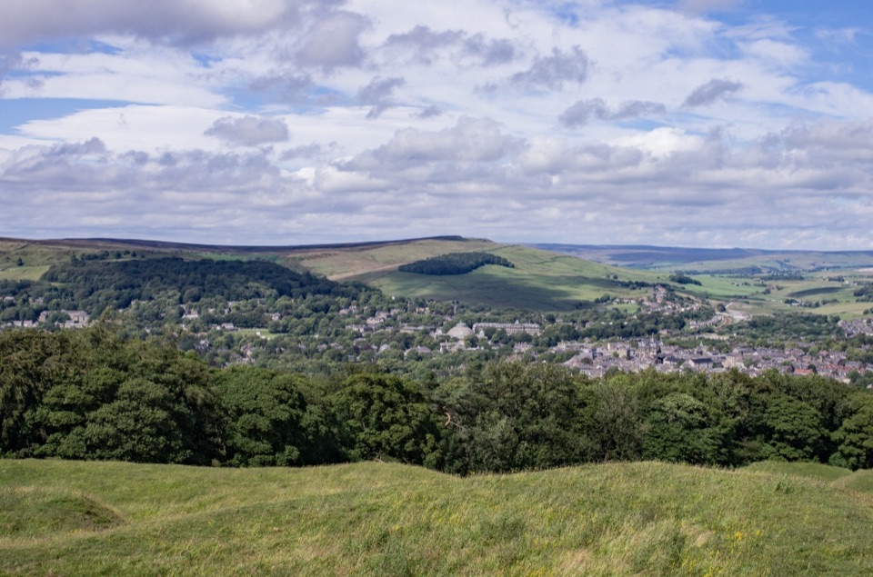
Hilltop Victorian folly with wide views over Buxton and the hills

Photo: Wikimedia Commons
Type
Sight
Nearest trail
4.6 km
Audio stories
3 nearby
  • Parking

Hear the audio tour

The Older Secret of Solomon's Temple

Overview

About Solomon's Temple

Why stop

  • Panoramic views over Buxton and the Peak District

Heads up

  • Narrow spiral stairs are not suitable for everyone
  • Exposed hilltop can be cold and windy

Map

Where it is

Loading the Peak District map
Full map
SightSolomon's Temple53.24270, -1.92056
Keep this map with you offline in the Parkwolf app

Plan your stop

Before you go

Best time to go

Go on a clear, settled day for the widest outlook; early morning or the hour before sunset gives the softest light over the town. The hilltop is exposed, and it is often colder and windier at the top than in Buxton, so bring a layer more than you think you need.


Getting there

  • On foot only. Common starts are the car park at the Poole's Cavern visitor centre, Temple Fields off Green Lane, or Buxton Caravan Park, each usually 20 to 40 minutes to the tower.
  • From Buxton railway station allow a little under 40 minutes on foot.
  • There is parking on Grin Low around 0.6 km from the tower, so even the shortest option involves an uphill walk.

5 active Peak District alerts

  • ClosureA54 Cat and Fiddle road closureThe A54 Macclesfield Main Road (Cat and Fiddle) is fully closed to all traffic from 27 July through 30 October 2026 during phase 1 improvement works.Official details
  • ClosureHooks Carr (Stanage Popular) car park closureHooks Carr (Stanage Popular) car park will be partially or fully closed from 6 October for four weeks.Official details
See all 5 alerts
A park ranger sits on a dash-mounted phone, talking, as Parkwolf’s Tour Guide plays “Army Cutworm Moths: A Grizzly Bear Buffet” on Grand Loop Road below Dunraven Pass in Yellowstone
Parkwolf Tour GuideThe highest, rockiest slopes around here are a summer buffet for grizzly bears.

Peak District Tour Guide

Your drive to Solomon's Temple, narrated.

Parkwolf is a GPS audio tour guide for Peak District National Park. As you drive, it chimes in with what’s ahead: hidden gems, upcoming stops, history, geology, and wildlife, right through your car’s speakers.

Recorded for this area

The Older Secret of Solomon's Temple
0:00 / 0:30
“Solomon's Temple looks ancient from a distance, but the little tower above Buxton dates to 1896. The older feature is underneath it: a prehistoric burial mound.”

Plays on the road 1.5 km from Solomon's Temple in the Parkwolf Peak District Tour Guide.

More stories near here in the app

  • Why Buxton's Spring Runs Warm
  • The Zigzag in the Heather
  • The Railway Ruskin Hated
  • An Old Reef on the Skyline
  • 298 audio storiesacross Peak District’s roads, triggered by GPS as you drive
  • Wildlife heatmapsfor Red Deer, Red Fox, Eurasian Otter, and 13 more
  • Works offlinemaps, 88 trails, 76 places, and audio download before you lose signal
  • CarPlay readysimple controls built for the drive
★★★★★
“Fantastic app with many points of information… It’s great to just turn on while you’re driving and it gives you an audio tour of the national Park. We love it!!!!”
JMJamesApp Store review
Download Parkwolf on the App StoreGet Parkwolf on Google Play

4.7 from 8,600+ ratings

Guide

More about Solomon's Temple

Why make the climbA squat stone tower about 6 m high, standing on the crown of Grin Low at roughly 437 m above…

A squat stone tower about 6 m high, standing on the crown of Grin Low at roughly 437 m above sea level. It is the landmark you see on the skyline from much of Buxton, and the short climb up to it turns that silhouette into a broad viewpoint over the town and the surrounding Peak District hills.

What you seeFrom the grassy summit and the tower's small viewing platform the outlook opens out in almost…

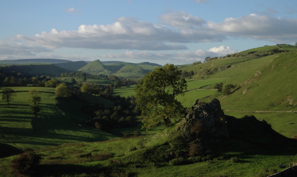
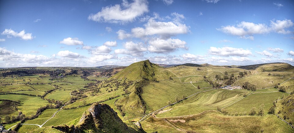
From the grassy summit and the tower's small viewing platform the outlook opens out in almost every direction: Buxton spread out below, green hills and moorland edges beyond. On a clear day the view can reach distant heights including Mam Tor and Shivering Mountain, though low cloud and haze often close things down. The tower itself sits among paths, rough grass and scattered trees, with open sky above.

How this differs from a generic Buxton walkMost approaches climb through Grin Low plantation, where the woodland floor still carries the…

Most approaches climb through Grin Low plantation, where the woodland floor still carries the humps and hollows of old quarrying and lime burning. The destination is a specific, named and Grade II listed structure with a summit platform, rather than a viewpoint you happen to reach along a footpath.

Terrain, stairs and limitsThe walk up is short but genuinely uphill, and some approaches are steep and tiring,…

The walk up is short but genuinely uphill, and some approaches are steep and tiring, particularly in wet weather. Inside, the spiral stairs are narrow, steep and thin, which will not suit everyone, and the tower is not wheelchair accessible. Anyone unsure on steps or confined stairways may prefer to enjoy the view from the grassy summit around the base.

Durable historyThe present tower was built in 1896 and restored in 1988, replacing an earlier structure linked…

The present tower was built in 1896 and restored in 1988, replacing an earlier structure linked to Solomon Mycock, a local farmer and landowner, which is how the name stuck. It stands on a Bronze Age barrow; work during construction is recorded as uncovering Beaker-period burials and later Roman finds. That is background to read about rather than anything on show, so treat the mound itself with care.

Honest notesIt is a modest folly, not a grand monument, and a few visitors find the build-up larger than…

It is a modest folly, not a grand monument, and a few visitors find the build-up larger than the tower. The reward is the panorama and the walk through the plantation, so pick a day with visibility and reasonable footwear, and keep expectations sized to a short hilltop excursion.

Wildlife

Wildlife in Peak District

All Peak District wildlife maps

Sighting maps show where each species has been reported across Peak District. Wildlife moves, so no sighting is guaranteed.

Keep exploring

Near Solomon's Temple

See it all on the map

Trails nearby

More stops nearby

Parkwolf’s Peak District ranking

Top sights in Peak District

All 76 places
  1. 1Chatsworth HouseSight
  2. 2Mam TorSight
  3. 3Dovedale Stepping StonesSight
  4. 4Ladybower ReservoirSight
  5. 5Stanage EdgeSight
  6. 6Kinder ScoutSight

Take Parkwolf to Peak District.

The audio tour guide for the drive, plus offline maps, trails, and wildlife heatmaps for when the signal drops.

4.7 from 8,600+ ratings

Download Parkwolf on the App StoreGet Parkwolf on Google Play