Magpie Mine in Peak District National Park

Sight · Peak District National Park

Magpie Mine

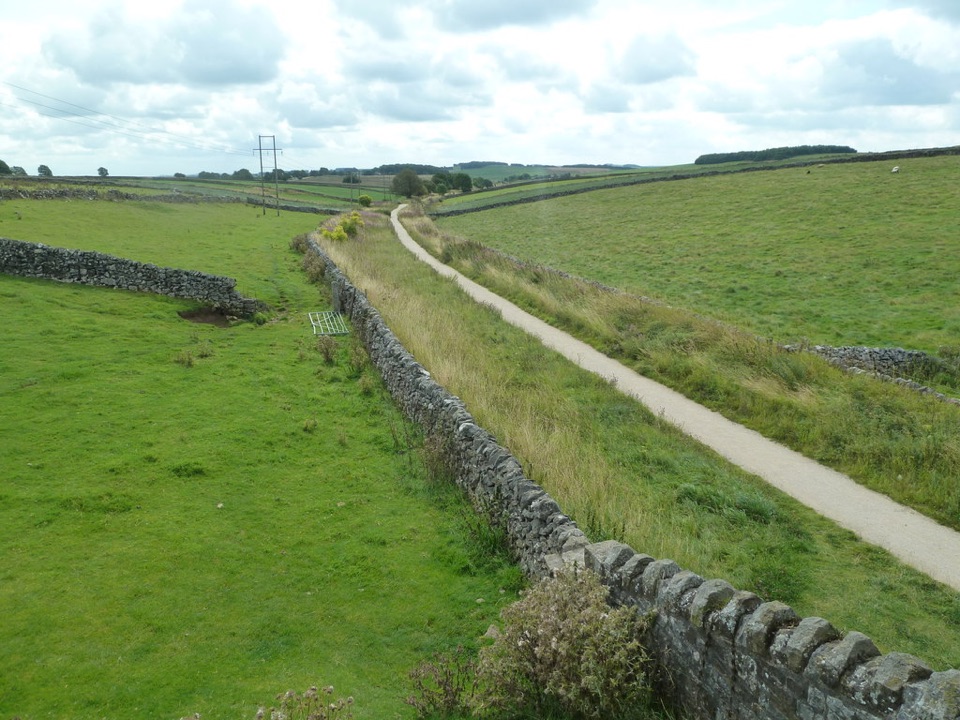
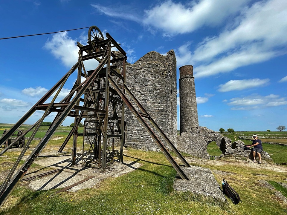
Cornish engine house and steel headgear on a windswept limestone plateau

Photo: Wikimedia Commons
Type
Sight
Nearest trail
4.2 km
Audio stories
9 nearby

Hear the audio tour

Magpie Mine

Overview

About Magpie Mine

Why stop

  • Rare surviving lead-mine complex with striking engine-house ruins
  • Open plateau setting that rewards industrial-heritage photography

Heads up

  • Rough, exposed ground with little shelter
A whole Derbyshire lead mine, left standing in a field. Most old workings in the White Peak survive as bumps in the grass, but here the Cornish engine house, tall chimney and steel headgear still break the skyline, backed by open plateau views in every direction. Visitors consistently find it atmospheric and unusually photogenic for an industrial ruin, and there are information boards on site to make sense of what you are looking at.
Parkwolf’s verdictWhy stop

Map

Where it is

Loading the Peak District map
Full map
SightMagpie Mine53.21005, -1.74322
Keep this map with you offline in the Parkwolf app

Plan your stop

Before you go

Best time to visit

Low morning or late afternoon light does the most for the engine house and headgear, throwing long shadows across the plateau and giving the stonework texture. The plateau is fully exposed, so windproof and waterproof layers are sensible in any season and a clear, breezy day gives the best long views. The roadside parking is limited and the small layby can fill, so arriving early is the practical way to avoid a walk back along the road.


Getting there

The site sits on the limestone plateau roughly 700 metres south of Sheldon, at about 310 metres above sea level. Park at the roadside on the Bakewell to Flagg road south of the site rather than in Sheldon, then walk about a quarter of a mile along a rough track. Sturdy footwear matters, since much of the ground is uneven, with stone rubble, hollows and grass.

5 active Peak District alerts

  • ClosureA54 Cat and Fiddle road closureThe A54 Macclesfield Main Road (Cat and Fiddle) is fully closed to all traffic from 27 July through 30 October 2026 during phase 1 improvement works.Official details
  • ClosureHooks Carr (Stanage Popular) car park closureHooks Carr (Stanage Popular) car park will be partially or fully closed from 6 October for four weeks.Official details
See all 5 alerts
A park ranger sits on a dash-mounted phone, talking, as Parkwolf’s Tour Guide plays “Army Cutworm Moths: A Grizzly Bear Buffet” on Grand Loop Road below Dunraven Pass in Yellowstone
Parkwolf Tour GuideThe highest, rockiest slopes around here are a summer buffet for grizzly bears.

Peak District Tour Guide

Your drive to Magpie Mine, narrated.

Parkwolf is a GPS audio tour guide for Peak District National Park. As you drive, it chimes in with what’s ahead: hidden gems, upcoming stops, history, geology, and wildlife, right through your car’s speakers.

Recorded for this place

Magpie Mine
0:00 / 0:34
“You're approaching the access for Magpie Mine, where a rough quarter-mile track leads to a remarkably complete lead-mining site.”

Plays as you drive up to Magpie Mine in the Parkwolf Peak District Tour Guide.

More stories near here in the app

  • The Horse-Powered Lift at Magpie
  • A River to Drain a Mine
  • The Fatal Feud at Magpie Mine
  • The Unfinished Fort at Fin Cop
  • 298 audio storiesacross Peak District’s roads, triggered by GPS as you drive
  • Wildlife heatmapsfor Red Deer, Red Fox, Eurasian Otter, and 13 more
  • Works offlinemaps, 88 trails, 76 places, and audio download before you lose signal
  • CarPlay readysimple controls built for the drive
★★★★★
“Fantastic app with many points of information… It’s great to just turn on while you’re driving and it gives you an audio tour of the national Park. We love it!!!!”
JMJamesApp Store review
Download Parkwolf on the App StoreGet Parkwolf on Google Play

4.7 from 8,600+ ratings

Guide

More about Magpie Mine

What you will seeThis is a preserved surface site only.

This is a preserved surface site only. There is no access to the underground workings, and the shafts are capped.

  • The Cornish engine house and chimney, the most complete structures on the site
  • Steel headgear from the mine's final working phase in the 1950s
  • Capped shafts, a horse gin circle, powder store, ruined coes and other stone footings
  • Flues, drains, tramway lines, ore-processing remains, the Agent's House and Smithy
  • Part of Magpie Sough, the drainage level that still discharges water
History in shortWorkings here were recorded from 1740, and by 1824 a Newcomen-type pumping engine stood on the…

Workings here were recorded from 1740, and by 1824 a Newcomen-type pumping engine stood on the Main Shaft, with output reaching 800 tons of lead in 1827. In 1839 John Taylor reopened the mine and brought in Cornish methods, deepening the Main Shaft to about 208 metres and installing a 40-inch Cornish pumping engine. Water and long-running disputes with neighbouring mines dogged the venture, and a local story about a curse on the mine still gets repeated, though it is legend rather than record. Magpie Consolidated Mines worked the ground again from 1950 before final closure in 1958. The wider complex, taking in Magpie and its neighbouring mines, is a Scheduled Monument and one of the most complete Derbyshire lead mines left.

Honest drawbacksNo dependable toilet, food or seating facilities are reported at the site, so bring your own…
  • No dependable toilet, food or seating facilities are reported at the site, so bring your own essentials and rely on the information boards
  • Uneven, rough terrain throughout, and access to individual structures is not unrestricted
  • Very little shelter from wind or rain
  • Roadside parking only, and it is tight

Wildlife

Wildlife in Peak District

All Peak District wildlife maps

Sighting maps show where each species has been reported across Peak District. Wildlife moves, so no sighting is guaranteed.

Keep exploring

Near Magpie Mine

See it all on the map

Trails nearby

More stops nearby

Parkwolf’s Peak District ranking

Top sights in Peak District

All 76 places
  1. 1Chatsworth HouseSight
  2. 2Mam TorSight
  3. 3Dovedale Stepping StonesSight
  4. 4Ladybower ReservoirSight
  5. 5Stanage EdgeSight
  6. 6Kinder ScoutSight

Take Parkwolf to Peak District.

The audio tour guide for the drive, plus offline maps, trails, and wildlife heatmaps for when the signal drops.

4.7 from 8,600+ ratings

Download Parkwolf on the App StoreGet Parkwolf on Google Play