Arethusa Cirque Trail in Peter Lougheed Provincial Park

#7 of 66 trails in Peter Lougheed

Peter Lougheed Provincial Park, AB

Arethusa Cirque Trail

A braided alpine loop with larches, creek crossings, and cirque views.

Length
3.9km
Time
2.5hr
Elev. change
281m
Difficulty
Moderate
  • Loop
  • Dogs allowed
  • High point 2,446 m

Hear the audio tour

Arethusa Cirque: Meadow and Sea Fossils

Overview

About Arethusa Cirque Trail

Why go

  • A creek, larch meadow and steep cirque walls in a short loop.
  • Coral fossils sit in the talus; look, but leave them in the park.

Heads up

  • Unsigned braids and a steep, loose slope demand routefinding and careful footing.
  • No verified toilets or drinking water at the trailhead.

Map & elevation

The route

Loading the Peter Lougheed map
Full map
Elevation2,165–2,446 m
TrailheadArethusa Cirque Trail Parking (informal gravel pullout)50.58779, -114.97309
Keep this map with you offline in the Parkwolf app

Plan your hike

Before you go

Parking

Use the unmarked gravel clearing on the east side of Highway 40, about 1.4 km south of the Ptarmigan Cirque parking area. Start at the north end of the clearing. It can fill during larch season, so arrive early. Facilities at the pullout are uncertain; use Ptarmigan Cirque before driving south.

Safety

The route is unsigned and braided, with several rock-hop creek crossings, loose scree and a short steep slope that can be slippery when wet. Highway 40 closes annually from December 1 through June 14; a Kananaskis Conservation Pass is required for vehicle access. Keep dogs on a leash no longer than 2 metres.

4 active Peter Lougheed alerts

  • ClosureTrail closures and Three Isle detourThree trail sections remain closed; stay out of closed areas and follow the signed Three Isle detour to reach the open backcountry campgrounds.Official details
  • CautionBear activity near Elpoca and ValleyviewFrequent bear activity has been noted along Valleyview Road from Elpoca Day Use Area south to Highway 40, near Little Highwood Pass and Valleyview Day Use Areas; use bear precautions.Official details
See all 4 alerts
A park ranger sits on a dash-mounted phone, talking, as Parkwolf’s Tour Guide plays “Army Cutworm Moths: A Grizzly Bear Buffet” on Grand Loop Road below Dunraven Pass in Yellowstone
Parkwolf Tour GuideThe highest, rockiest slopes around here are a summer buffet for grizzly bears.

Peter Lougheed Tour Guide

Your drive to Arethusa Cirque Trail, narrated.

Parkwolf is a GPS audio tour guide for Peter Lougheed Provincial Park. As you drive, it chimes in with what’s ahead: hidden gems, upcoming stops, history, geology, and wildlife, right through your car’s speakers.

See the Peter Lougheed audio tour

Recorded for this trailhead

Arethusa Cirque: Meadow and Sea Fossils
0:00 / 0:30
“You're coming up on the informal trail access for Arethusa Cirque. I'd choose the roughly four-kilometre loop for its creek meadow beneath steep limestone walls; allow two to three hours.”

Plays as you drive up to this trailhead in the Parkwolf Peter Lougheed Tour Guide.

More stories near here in the app

  • Highwood Pass and the Meadow Walk
  • A Grouse Inside the Snow
  • How Frost Breaks a Mountain
  • Rock Glacier: A Short Walk and Pikas
  • 41 audio storiesacross Peter Lougheed’s roads, triggered by GPS as you drive
  • Wildlife heatmapsfor Grizzly Bear, Canada Lynx, Black Bear, and 13 more
  • Works offlinemaps, 66 trails, 41 places, and audio download before you lose signal
  • CarPlay readysimple controls built for the drive
★★★★★
“Fantastic app with many points of information… It’s great to just turn on while you’re driving and it gives you an audio tour of the national Park. We love it!!!!”
JMJamesApp Store review
Download Parkwolf on the App StoreGet Parkwolf on Google Play

4.7 from 8,600+ ratings

Trail guide

Hiking Arethusa Cirque Trail

A short loop into the cirqueArethusa Cirque is an unofficial 2.

Arethusa Cirque is an unofficial 2.45-mile loop from a gravel pullout on Highway 40 into a creek-cut alpine meadow, around the rocky basin and back through the trees. The climb is about 920 feet, and the high point is an open slope below the surrounding peaks, not a summit or built lookout. Allow two to three hours. The mileage is short, but this is a real mountain walk: the tracks are unsigned, several creek crossings mean rock-hopping, and one short slope is steep and loose. Published accounts range from about 2.5 to 3 miles as people follow different braids and loop choices; this length follows the shorter full cirque circuit and leaves out the separate Little Arethusa and Mount Arethusa scrambles.

From the pullout to the creekThe trail starts at the north end of a broad, unmarked gravel clearing on the east side of…

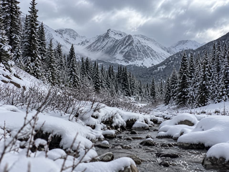
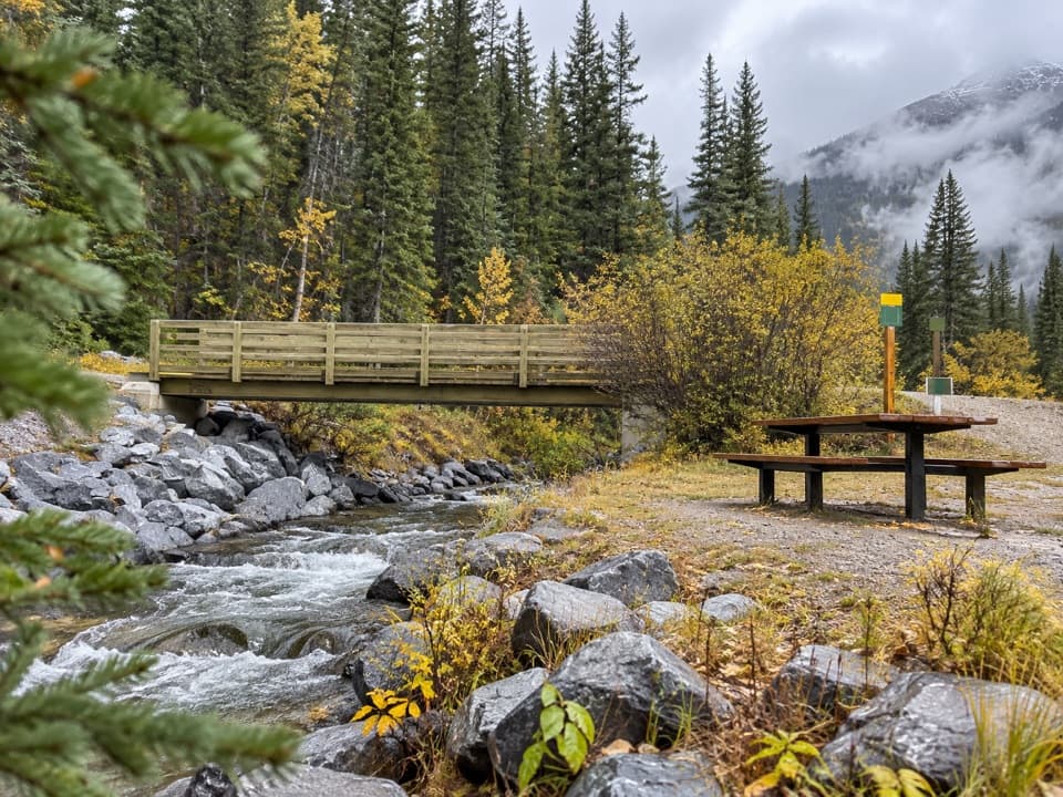
The trail starts at the north end of a broad, unmarked gravel clearing on the east side of Highway 40, about 1.4 km south of the Ptarmigan Cirque parking area. A gentle path winds through forest for roughly 0.7 km. Roots and mud can make this lower stretch slick, and a small waterfall appears shortly before the trees open onto the meadow. The creek is the first big change: you leave the shade, reach the water above the falls, and get your first full view of the cirque.

Find the right way aroundAt the creek, several faint tracks branch.

At the creek, several faint tracks branch. A middle path is a shortcut; the outer circuit keeps going around the basin. Other tracks climb toward Little Arethusa or Mount Arethusa, which are separate, much more demanding scrambles. There are no signs to sort them out, and the tracks braid over open ground, so save an offline map and check it at each fork. The two directions have different tradeoffs: a short, steep dirt slope is awkward when wet, and hikers disagree about which way feels easier. If you would rather climb that slope than descend it, choose your direction accordingly.

The upper loop leaves the creekside meadow for loose rock and scree below Storm Mountain, then crosses more open, rocky ground. Watch where you step; the tread can fade among gravel and low shrubs. The descent drops back toward forest and the creek, where a final crossing brings you to the approach trail. The circuit is not a technical summit route, but the unstable footing and short steep section make it more demanding than the distance suggests.

Larches, fossils and the cirque wallsThe basin is the attraction: a stream through an open meadow, golden larches in fall, and steep…

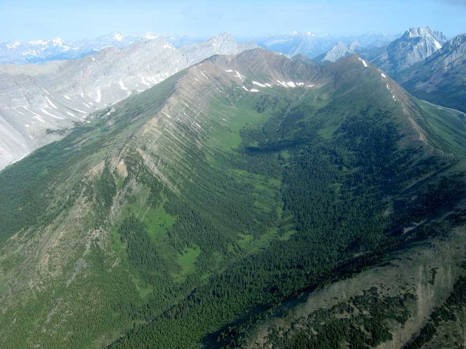
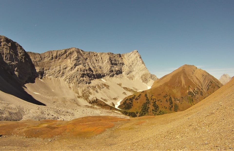
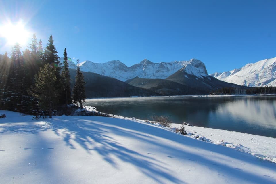
The basin is the attraction: a stream through an open meadow, golden larches in fall, and steep limestone walls with Mount Arethusa, Little Arethusa and Storm Mountain above them. Wildflowers are reported in summer; larch color usually arrives in mid to late September, though the exact week changes each year. For a photo, keep the creek in the foreground and frame the peaks through the meadow rather than shooting only the rock wall.

The talus also holds fossils. The limestone belongs to the Rundle Group, rock laid down in a warm, shallow sea about 340 million years ago and later shifted along the Rundle Thrust. Coral forms and shell fossils have been reported in the rockfall. Look closely, but leave every fossil where it is; collecting is prohibited in provincial parks.

Before you drive inThere are no confirmed washrooms, bins or drinking water at the pullout; a portable toilet has…

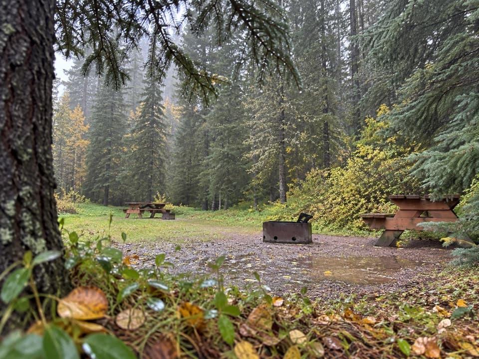
There are no confirmed washrooms, bins or drinking water at the pullout; a portable toilet has been mentioned by visitors, but it is not something to count on. Use facilities at Ptarmigan Cirque before driving south and bring your own water. The small gravel area can fill during larch season, so an early start helps. Highway 40 closes each winter from December 1 through June 14, and a Kananaskis Conservation Pass is required for vehicles using the area. Dogs are allowed on a leash no longer than 2 metres.

Wildlife

Wildlife in Peter Lougheed

All Peter Lougheed wildlife maps

Sighting maps show where each species has been reported across Peter Lougheed. Wildlife moves, so no sighting is guaranteed.

Keep exploring

Near Arethusa Cirque Trail

See it all on the map

Trails that start nearby

Places near the trailhead

Parkwolf’s Peter Lougheed ranking

Top-rated trails in Peter Lougheed

All 66 trails
  1. 1Rawson Lake TrailModerate · 7.8 km
  2. 2Ptarmigan Cirque Interpretive TrailModerate · 4.5 km
  3. 3Burstall Pass TrailChallenging · 14.8 km
  4. 4Chester Lake TrailModerate · 9.2 km
  5. 5Upper Kananaskis Lake LoopModerate · 15.7 km
  6. 6Sarrail Ridge via Rawson LakeChallenging · 11.7 km

Take Parkwolf to Peter Lougheed.

The audio tour guide for the drive, plus offline maps, trails, and wildlife heatmaps for when the signal drops.

4.7 from 8,600+ ratings

Download Parkwolf on the App StoreGet Parkwolf on Google Play