Grizzly Ridge Trail in Peter Lougheed Provincial Park

Peter Lougheed Provincial Park, AB

Grizzly Ridge Trail

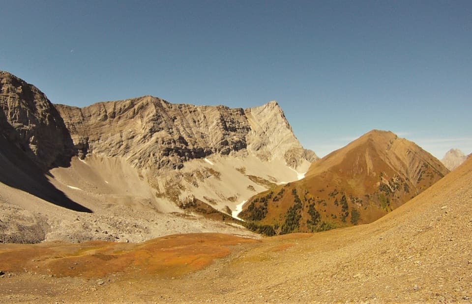
Larches, a mountain tarn and a short scramble open onto wide views.

Photo: Wikimedia Commons
Length
9.7km
Time
5.3hr
Elev. change
529m
Difficulty
Moderate
  • Dogs allowed
  • High point 2,713 m
  • #20 of 66 in Peter Lougheed

Hear the audio tour

Highwood Pass and the Meadow Walk

Overview

About Grizzly Ridge Trail

Why go

  • Larch-lined approach and a summit panorama
  • A natural col turnaround skips the final scramble

Heads up

  • Unsigned turns are easy to miss
  • The last summit section is rocky and exposed

Map & elevation

The route

Loading the Peter Lougheed map
Full map
Elevation2,184–2,713 m
TrailheadHighwood Meadows Day Use Area50.59582, -114.98514
Keep this map with you offline in the Parkwolf app

Plan your hike

Before you go

Parking

Park at Highwood Meadows Day Use on Highway 40; the signed Ptarmigan Cirque approach starts from the lot. A Kananaskis Conservation Pass is required for vehicle parking. Highway 40 between Peter Lougheed Provincial Park and Highwood House Junction closes December 1 through June 14.

Safety

The informal route has unsigned turns, a creek crossing and muddy ground. The final roughly 100 metres are a rocky scramble with minor exposure; turn around at Grizzly Col if that finish does not suit you. No drinking-water point was confirmed. A vehicle Conservation Pass is required, and Highway 40 closes December 1 through June 14. Dogs must be leashed to no longer than 2 metres.

4 active Peter Lougheed alerts

  • ClosureTrail closures and Three Isle detourThree trail sections remain closed; stay out of closed areas and follow the signed Three Isle detour to reach the open backcountry campgrounds.Official details
  • CautionBear activity near Elpoca and ValleyviewFrequent bear activity has been noted along Valleyview Road from Elpoca Day Use Area south to Highway 40, near Little Highwood Pass and Valleyview Day Use Areas; use bear precautions.Official details
See all 4 alerts
A park ranger sits on a dash-mounted phone, talking, as Parkwolf’s Tour Guide plays “Army Cutworm Moths: A Grizzly Bear Buffet” on Grand Loop Road below Dunraven Pass in Yellowstone
Parkwolf Tour GuideThe highest, rockiest slopes around here are a summer buffet for grizzly bears.

Peter Lougheed Tour Guide

Your drive to Grizzly Ridge Trail, narrated.

Parkwolf is a GPS audio tour guide for Peter Lougheed Provincial Park. As you drive, it chimes in with what’s ahead: hidden gems, upcoming stops, history, geology, and wildlife, right through your car’s speakers.

See the Peter Lougheed audio tour

Recorded for this trailhead

Highwood Pass and the Meadow Walk
0:00 / 0:32
“Up ahead is Highwood Pass, on Canada's highest paved road. The mountain view starts at the parking area, so this is a stop I'd keep even if you're skipping the big hikes.”

Plays as you drive up to this trailhead in the Parkwolf Peter Lougheed Tour Guide.

More stories near here in the app

  • Arethusa Cirque: Meadow and Sea Fossils
  • Rock Glacier: A Short Walk and Pikas
  • A Grouse Inside the Snow
  • How Frost Breaks a Mountain
  • 41 audio storiesacross Peter Lougheed’s roads, triggered by GPS as you drive
  • Wildlife heatmapsfor Grizzly Bear, Canada Lynx, Black Bear, and 13 more
  • Works offlinemaps, 66 trails, 41 places, and audio download before you lose signal
  • CarPlay readysimple controls built for the drive
★★★★★
“Fantastic app with many points of information… It’s great to just turn on while you’re driving and it gives you an audio tour of the national Park. We love it!!!!”
JMJamesApp Store review
Download Parkwolf on the App StoreGet Parkwolf on Google Play

4.7 from 8,600+ ratings

Trail guide

Hiking Grizzly Ridge Trail

The ridge hikeGrizzly Ridge is an informal, unsigned out-and-back from Highwood Meadows Day Use, passing…

Grizzly Ridge is an informal, unsigned out-and-back from Highwood Meadows Day Use, passing Pocaterra Tarn and Grizzly Col before reaching a high rocky ridge in Peter Lougheed Provincial Park. Plan on 6 miles round trip, about 2,240 feet of climbing and roughly 4.5 to 6 hours. Most of the route is a moderate mountain hike; the final 100 metres or so are a rocky scramble with handholds and minor exposure. Come for the broad ridge views if you’re comfortable finding an unmarked turn and scrambling above the col. If that last section is beyond your comfort level, Grizzly Col is a natural turnaround; the col-only outing is still about 5.6 miles round trip.

Find the right turnFrom the Highwood Meadows lot, start on the signed Ptarmigan Cirque approach.

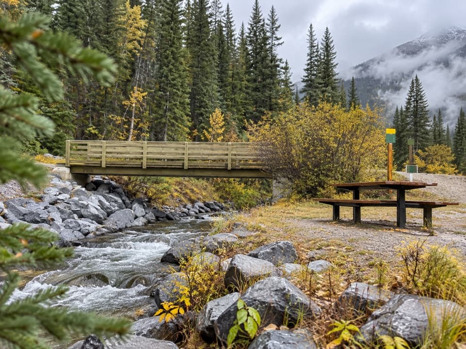
From the Highwood Meadows lot, start on the signed Ptarmigan Cirque approach. After a few hundred metres, look for an unsigned left turn into the trees; the entrance is muddy and easy to walk past. The first stretch rolls across a creek and muddy patches, then climbs moderately over open avalanche slopes. Don’t follow the tempting left branches before Pocaterra Tarn. Stay on the main track until you pass the tarn, then turn left at a small rock marker. The track continuing to the right heads toward Pocaterra Ridge.

Up to Grizzly ColAbove the tarn, the path climbs through larch trees, then across a grassy slope toward rockier…

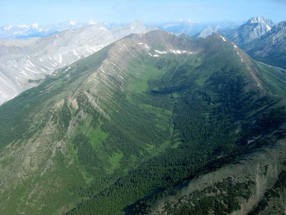
Above the tarn, the path climbs through larch trees, then across a grassy slope toward rockier ground. The tread becomes scree-like as it rises, with dark rock that can feel hot in direct sun. Grizzly Col is the notch between Grizzly Ridge and Mount Tyrwhitt, and a useful place to pause before the steeper finish. Mount Tyrwhitt rises to the right; its own scramble is very steep and is not part of this route.

The summit finishThe climb from the col to the ridge takes about 15 minutes.

The climb from the col to the ridge takes about 15 minutes. At the ridge, bear left toward Grizzly Ridge. The final roughly 100 metres are a hands-on scramble over rocky ground with some exposure; this short finish can feel more serious than the long approach. Turn back at the col if you don’t want that section. From the ridge, the view opens over Paradise Valley and Pocaterra Ridge, with surrounding peaks in every direction. The route’s published high point is about 2,770 metres.

Access and practical detailsThe trail starts at Highwood Meadows Day Use on Highway 40.

The trail starts at Highwood Meadows Day Use on Highway 40. A Kananaskis Conservation Pass is required for vehicle parking, and this stretch of Highway 40 closes each year from December 1 through June 14. There is a washroom at the parking area, but no food or confirmed drinking-water source along the hike. Dogs are allowed in Alberta Parks on a leash no longer than 2 metres; consider the exposed scramble when deciding whether to bring one.

Wildlife

Wildlife in Peter Lougheed

All Peter Lougheed wildlife maps

Sighting maps show where each species has been reported across Peter Lougheed. Wildlife moves, so no sighting is guaranteed.

Keep exploring

Near Grizzly Ridge Trail

See it all on the map

Trails that start nearby

Places near the trailhead

Parkwolf’s Peter Lougheed ranking

Top-rated trails in Peter Lougheed

All 66 trails
  1. 1Rawson Lake TrailModerate · 7.8 km
  2. 2Ptarmigan Cirque Interpretive TrailModerate · 4.5 km
  3. 3Burstall Pass TrailChallenging · 14.8 km
  4. 4Chester Lake TrailModerate · 9.2 km
  5. 5Upper Kananaskis Lake LoopModerate · 15.7 km
  6. 6Sarrail Ridge via Rawson LakeChallenging · 11.7 km

Take Parkwolf to Peter Lougheed.

The audio tour guide for the drive, plus offline maps, trails, and wildlife heatmaps for when the signal drops.

4.7 from 8,600+ ratings

Download Parkwolf on the App StoreGet Parkwolf on Google Play