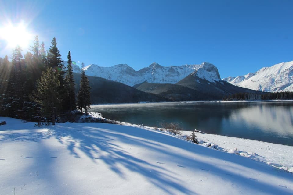
Ptarmigan Cirque Interpretive Trail in Peter Lougheed Provincial Park

#2 of 66 trails in Peter Lougheed

Peter Lougheed Provincial Park, AB

Ptarmigan Cirque Interpretive Trail

A steep climb to a flowered alpine bowl below Mount Rae.

Photo: Wikimedia Commons
Length
4.5km
Time
1.5hr
Elev. change
217m
Difficulty
Moderate
  • Loop
  • Dogs allowed
  • High point 2,412 m

Hear the audio tour

Highwood Pass and the Meadow Walk

Overview

About Ptarmigan Cirque Interpretive Trail

Why go

  • A quick climb from the pass into a real alpine cirque.
  • Forest, flowers, larch, a stream and mountain views in one loop.

Heads up

  • The opening climb is steep, with loose gravel and roots.
  • High-elevation weather and a busy fall parking lot complicate timing.

Map & elevation

The route

Loading the Peter Lougheed map
Full map
Elevation2,195–2,412 m
TrailheadHighwood Meadows Day Use Area50.59582, -114.98514
Keep this map with you offline in the Parkwolf app

Plan your hike

Before you go

Parking

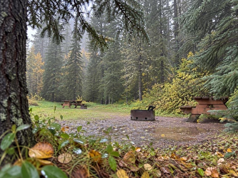
Use Highwood Meadows Day Use Area at Highwood Pass on Highway 40. Follow the marked Highwood Meadows path over the bridge to the signed Highway 40 crossing for Ptarmigan Cirque. Parking can fill early in fall; roadside overflow is not reliable. A Kananaskis Conservation Pass is required. Pit toilets are reported at the lot.

Safety

The opening climb is steep on loose gravel and roots. The high-elevation meadow is exposed to fast weather changes, and the rocky stream crossing near the moraine can be slippery. Cross Highway 40 only at the marked crossing and stay on the path to protect fragile alpine plants. Groups are limited to 15. Highwood Pass access is seasonally closed December 1 through June 14.

4 active Peter Lougheed alerts

  • ClosureTrail closures and Three Isle detourThree trail sections remain closed; stay out of closed areas and follow the signed Three Isle detour to reach the open backcountry campgrounds.Official details
  • CautionBear activity near Elpoca and ValleyviewFrequent bear activity has been noted along Valleyview Road from Elpoca Day Use Area south to Highway 40, near Little Highwood Pass and Valleyview Day Use Areas; use bear precautions.Official details
See all 4 alerts
A park ranger sits on a dash-mounted phone, talking, as Parkwolf’s Tour Guide plays “Army Cutworm Moths: A Grizzly Bear Buffet” on Grand Loop Road below Dunraven Pass in Yellowstone
Parkwolf Tour GuideThe highest, rockiest slopes around here are a summer buffet for grizzly bears.

Peter Lougheed Tour Guide

Your drive to Ptarmigan Cirque Interpretive Trail, narrated.

Parkwolf is a GPS audio tour guide for Peter Lougheed Provincial Park. As you drive, it chimes in with what’s ahead: hidden gems, upcoming stops, history, geology, and wildlife, right through your car’s speakers.

See the Peter Lougheed audio tour

Recorded for this trailhead

Highwood Pass and the Meadow Walk
0:00 / 0:32
“Up ahead is Highwood Pass, on Canada's highest paved road. The mountain view starts at the parking area, so this is a stop I'd keep even if you're skipping the big hikes.”

Plays as you drive up to this trailhead in the Parkwolf Peter Lougheed Tour Guide.

More stories near here in the app

  • Arethusa Cirque: Meadow and Sea Fossils
  • Rock Glacier: A Short Walk and Pikas
  • A Grouse Inside the Snow
  • How Frost Breaks a Mountain
  • 41 audio storiesacross Peter Lougheed’s roads, triggered by GPS as you drive
  • Wildlife heatmapsfor Grizzly Bear, Canada Lynx, Black Bear, and 13 more
  • Works offlinemaps, 66 trails, 41 places, and audio download before you lose signal
  • CarPlay readysimple controls built for the drive
★★★★★
“Fantastic app with many points of information… It’s great to just turn on while you’re driving and it gives you an audio tour of the national Park. We love it!!!!”
JMJamesApp Store review
Download Parkwolf on the App StoreGet Parkwolf on Google Play

4.7 from 8,600+ ratings

Trail guide

Hiking Ptarmigan Cirque Interpretive Trail

What this loop gives youPtarmigan Cirque Interpretive Trail is a 4.5 km (2.

Ptarmigan Cirque Interpretive Trail is a 4.5 km (2.8 mi) loop from Highwood Meadows Day Use Area into an alpine bowl below Mount Arethusa and Mount Rae. The current trail report gives 210 m of climbing and one to two hours; leave closer to two if you want time at the numbered stops and in the basin. It’s a compact way to reach open alpine country, but the first climb is steep.

Distance figures vary: the current listing says 4.5 km, some route descriptions and the mapped line are closer to 3.7 km, and an older interpretive map says 6 km. Plan for 4.5 km from the current lot; some GPS traces will come out shorter.

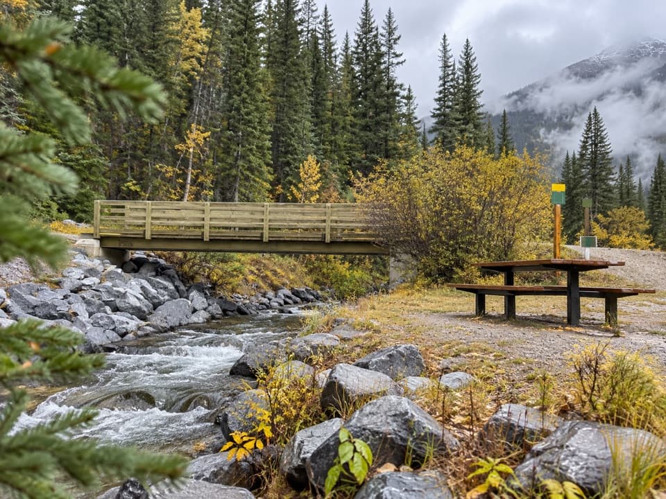
Start at Highwood MeadowsFrom the day-use lot, follow the meadow path over the wooden bridge.

From the day-use lot, follow the meadow path over the wooden bridge. At the junction before the boardwalk, about 400 m along, turn right and use the marked crossing over Highway 40. The lot can fill early in larch season; don’t count on roadside overflow. A Kananaskis Conservation Pass is required to park here. Highway 40 over Highwood Pass closes from December 1 through June 14, and this trail is listed for summer use.

The steep forest climbAfter the crossing, switchbacks climb through Engelmann spruce and subalpine fir.

After the crossing, switchbacks climb through Engelmann spruce and subalpine fir. Roots and loose gravel keep your eyes down, and the slope stays honest for the first stretch. Openings give you glimpses back toward Highwood Ridge and Little Arethusa; the view broadens as the forest thins. You start around 2,200 m, so the climb can feel harder than the short distance suggests.

Into the alpine bowlAbove treeline, the forest gives way to low meadow plants, scattered alpine larch, pale rock…

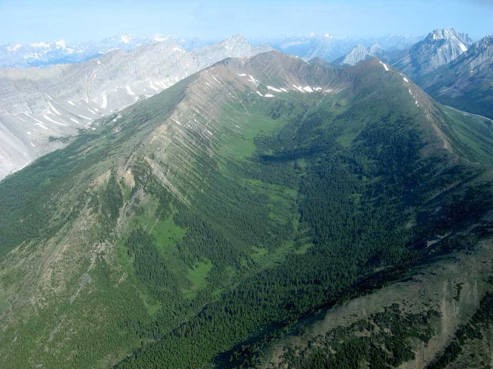
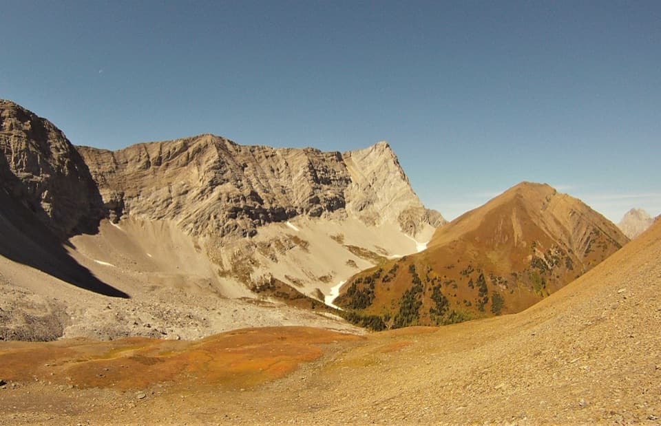
Above treeline, the forest gives way to low meadow plants, scattered alpine larch, pale rock and steep mountain walls. In mid-summer, look for flowers tucked close to the ground; later in September, larch needles turn gold before they drop. The best wide view opens near the forest edge, where the meadow frames Highwood Ridge and Little Arethusa. Stay on the path: these exposed plants grow slowly and are easily damaged.

Follow the signed loopThe marked route circles the upper basin one way.

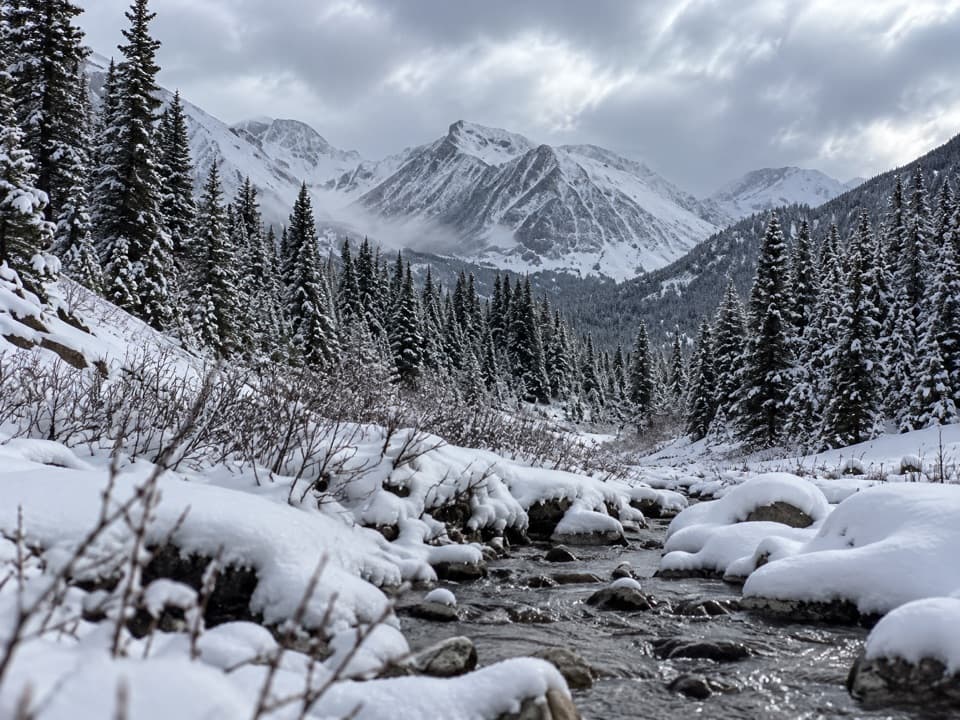
The marked route circles the upper basin one way. Near its high point, it crosses a rocky terminal moraine and a small stream beside a modest cascade; it’s more a stream-and-rock stop than a big waterfall. Follow the markers across the broken stones. The return side descends past scattered larch, drops back into the trees and rejoins the approach trail. Retrace the meadow path and marked crossing. Loose rock beyond the circuit leads toward Mount Rae and becomes a separate scramble, not part of this trail.

A bowl carved by icePtarmigan Cirque sits between Mount Arethusa and Mount Rae.

Ptarmigan Cirque sits between Mount Arethusa and Mount Rae. Ice-age glaciers and frost scooped out the bowl; debris piled against lingering ice left the rocky moraine at the top. The stream runs over steps in that rock. Across the bowl, Mount Arethusa’s exposed wall shows tilted sedimentary layers, lifted and folded long after the sea that deposited them disappeared.

The name and the alpine lifeThe namesake is the white-tailed ptarmigan, a grouse that blends into summer vegetation and…

The namesake is the white-tailed ptarmigan, a grouse that blends into summer vegetation and turns white for winter. The numbered stops explain how avalanches keep meadow strips open for bighorn sheep, elk and grizzly bears. Columbian ground squirrels spend most of the year underground, while golden eagles hunt above the slope. Those are reasons to look, not promised sightings.

Make the high elevation workThe effort is concentrated in the forest climb and rocky footing near the stream.

The effort is concentrated in the forest climb and rocky footing near the stream. Weather can change quickly above treeline. Groups are limited to 15; larger organized groups should check permit rules. Dogs are allowed but must stay on a leash no longer than 2 m. If the climb is more than you want, the shorter Highwood Meadows boardwalk is a separate, gentler walk from the same area; it does not reach the cirque.

Wildlife

Wildlife in Peter Lougheed

All Peter Lougheed wildlife maps

Sighting maps show where each species has been reported across Peter Lougheed. Wildlife moves, so no sighting is guaranteed.

Keep exploring

Near Ptarmigan Cirque Interpretive Trail

See it all on the map

Trails that start nearby

Places near the trailhead

Parkwolf’s Peter Lougheed ranking

Top-rated trails in Peter Lougheed

All 66 trails
  1. 1Rawson Lake TrailModerate · 7.8 km
  2. 3Burstall Pass TrailChallenging · 14.8 km
  3. 4Chester Lake TrailModerate · 9.2 km
  4. 5Upper Kananaskis Lake LoopModerate · 15.7 km
  5. 6Sarrail Ridge via Rawson LakeChallenging · 11.7 km
  6. 7Arethusa Cirque TrailModerate · 3.9 km

Take Parkwolf to Peter Lougheed.

The audio tour guide for the drive, plus offline maps, trails, and wildlife heatmaps for when the signal drops.

4.7 from 8,600+ ratings

Download Parkwolf on the App StoreGet Parkwolf on Google Play