Headwall Lakes Trail in Peter Lougheed Provincial Park

#9 of 66 trails in Peter Lougheed

Peter Lougheed Provincial Park, AB

Headwall Lakes Trail

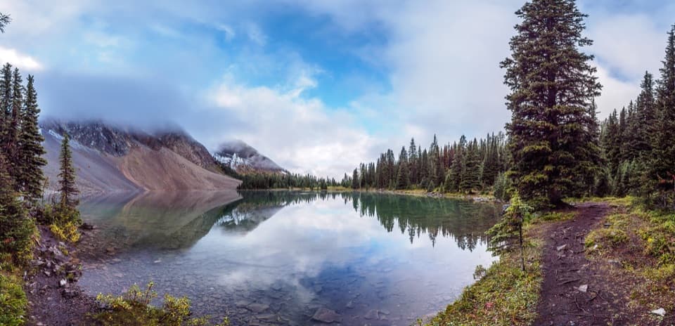
Two alpine lakes and a waterfall reward the long approach.

Photo: Wikimedia Commons
Length
13.7km
Time
5.8hr
Elev. change
389m
Difficulty
Challenging
  • Dogs allowed
  • High point 2,305 m

Hear the audio tour

Chester Lake: A Half-Day Hike

Overview

About Headwall Lakes Trail

Why go

  • Two alpine lakes, a waterfall and a steep rock-walled valley.

Heads up

  • The first few kilometres are forested with limited views.
  • A cairned turn is easy to miss, followed by steep, loose ledges.

Map & elevation

The route

Loading the Peter Lougheed map
Full map
Elevation1,916–2,305 m
TrailheadChester Lake Day Use Area50.79100, -115.30069
Keep this map with you offline in the Parkwolf app

Plan your hike

Before you go

Parking

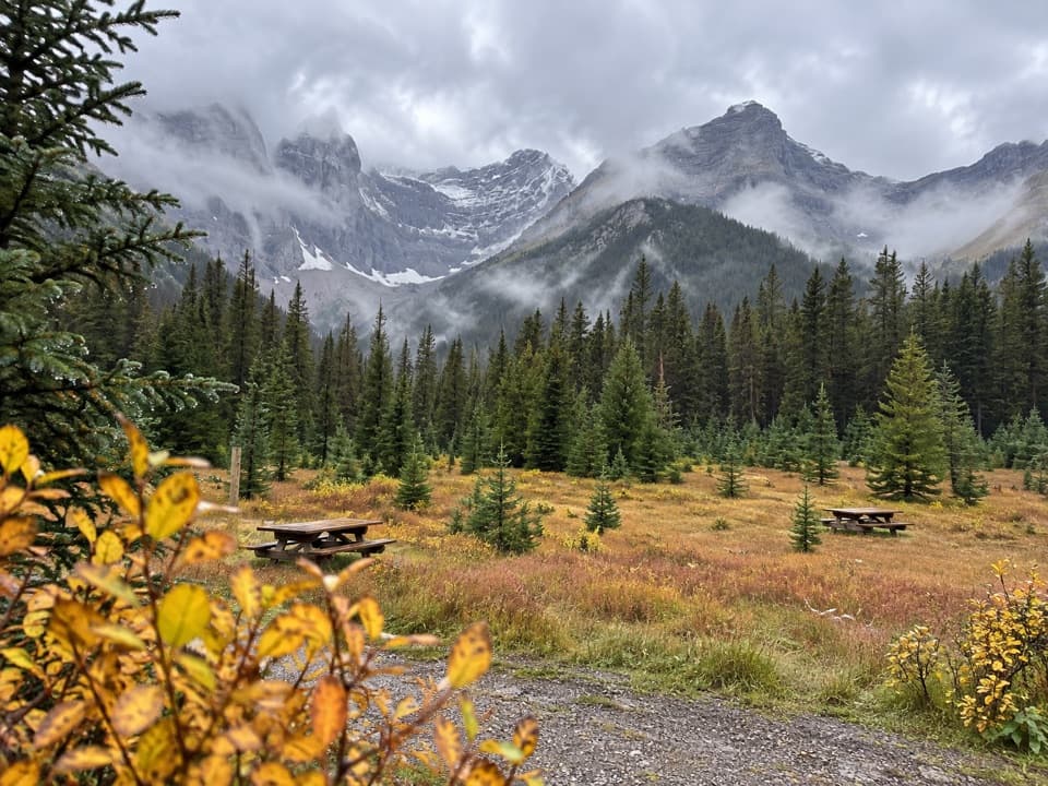
Use Chester Lake Day Use Area off the Smith-Dorrien-Spray Lakes Trail. The lot serves both Chester Lake and Headwall Lakes and can fill on beautiful weekends. A Kananaskis Conservation Pass is required to park. Toilet availability is uncertain: pit toilets have been reported, but park facility information lists no amenities.

Safety

Watch for the easy-to-miss cairn turn after the Headwall Creek bridge. The climb to Lower Headwall Lake uses steep, loose ledges that can be slick when wet. There is no food or water service on route. A Kananaskis Conservation Pass is required for parking. Keep pets leashed; most groomed ski trails are closed to dogs in winter, which may affect some Sawmill approaches.

4 active Peter Lougheed alerts

  • ClosureTrail closures and Three Isle detourThree trail sections remain closed; stay out of closed areas and follow the signed Three Isle detour to reach the open backcountry campgrounds.Official details
  • CautionBear activity near Elpoca and ValleyviewFrequent bear activity has been noted along Valleyview Road from Elpoca Day Use Area south to Highway 40, near Little Highwood Pass and Valleyview Day Use Areas; use bear precautions.Official details
See all 4 alerts
A park ranger sits on a dash-mounted phone, talking, as Parkwolf’s Tour Guide plays “Army Cutworm Moths: A Grizzly Bear Buffet” on Grand Loop Road below Dunraven Pass in Yellowstone
Parkwolf Tour GuideThe highest, rockiest slopes around here are a summer buffet for grizzly bears.

Peter Lougheed Tour Guide

Your drive to Headwall Lakes Trail, narrated.

Parkwolf is a GPS audio tour guide for Peter Lougheed Provincial Park. As you drive, it chimes in with what’s ahead: hidden gems, upcoming stops, history, geology, and wildlife, right through your car’s speakers.

See the Peter Lougheed audio tour

Recorded for this trailhead

Chester Lake: A Half-Day Hike
0:00 / 0:25
“You're approaching the Chester Lake trailhead, for a hike to an alpine lake beneath Mount Chester's steep rock wall.”

Plays as you drive up to this trailhead in the Parkwolf Peter Lougheed Tour Guide.

More stories near here in the app

  • Burstall Pass Day Use: Mud Lake Views
  • Powdered Rock in the Water
  • A Pika's Winter Pantry
  • A Jay That Glues Its Groceries
  • 41 audio storiesacross Peter Lougheed’s roads, triggered by GPS as you drive
  • Wildlife heatmapsfor Grizzly Bear, Canada Lynx, Black Bear, and 13 more
  • Works offlinemaps, 66 trails, 41 places, and audio download before you lose signal
  • CarPlay readysimple controls built for the drive
★★★★★
“Fantastic app with many points of information… It’s great to just turn on while you’re driving and it gives you an audio tour of the national Park. We love it!!!!”
JMJamesApp Store review
Download Parkwolf on the App StoreGet Parkwolf on Google Play

4.7 from 8,600+ ratings

Trail guide

Hiking Headwall Lakes Trail

What you are signing up forHeadwall Lakes Trail is about 13.7 km (8.

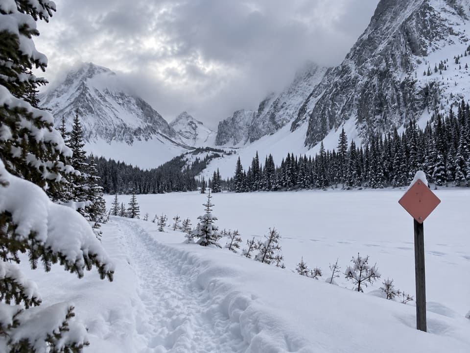
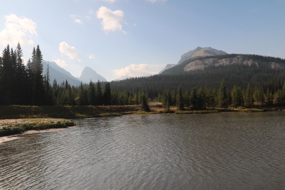
Headwall Lakes Trail is about 13.7 km (8.5 mi) out and back from Chester Lake Day Use Area to two alpine lakes below Mount Chester and The Fortress. Plan on 5 to 6 hours and around 430 m of climbing. The first few kilometres are mostly forest on the Sawmill snowshoe-trail network; the payoff is a narrow, rugged approach into a bare, rock-walled valley. This is a long day hike, not a quick lake stroll. The mapped line stops at Upper Headwall Lake and returns the same way. The Fortress scramble and the Chester-Headwall col loop are separate, much harder extensions. Most published guidance is near 14 km, though recorded tracks range up to 17.1 km.

Finding the right turnFrom the Chester lot, follow the marked Sawmill trails toward Headwall Creek.

From the Chester lot, follow the marked Sawmill trails toward Headwall Creek. One documented route uses Frost Heave into Snowdrift. The first few kilometres are mostly trees with little to see, so keep an offline map handy and watch the junctions. Cross Headwall Creek on the bridge at roughly 3.2 km, then climb a steep road for a short stretch. About half a kilometre beyond the bridge, look left for a cairn and a small arrow made of stones. That marks the narrow trail leaving the wider route, and it is easy to walk past. Branches in the Sawmill network vary by approach; stay on the line toward Headwall Creek and the lakes rather than continuing toward Chester or the col.

Creek, rockslide and Lower LakeBeyond the cairn, the tread narrows and winds through dense trees, uprooted trunks and short…

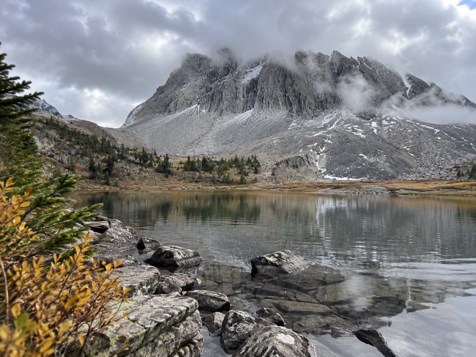
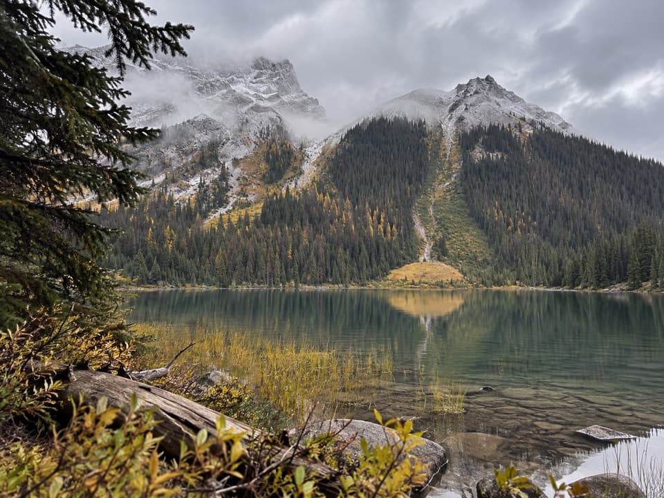
Beyond the cairn, the tread narrows and winds through dense trees, uprooted trunks and short creekside stretches. It reaches the base of a broad rockslide below a notch, where the valley finally opens. The climb to Lower Headwall Lake is steep, with loose rock and ledges that become more troublesome when wet. Allow about two hours to reach it. A small waterfall detour is possible near the lake; a larger waterfall marks the far end, and the route climbs beside and above it on the way to Upper Headwall Lake, about 15 minutes farther. Old avalanche chutes and bent trees shape the upper valley, but they are landscape features, not a current conditions report.

The upper basinUpper Headwall Lake sits below Mount Chester to the west, The Fortress to the north and a high…

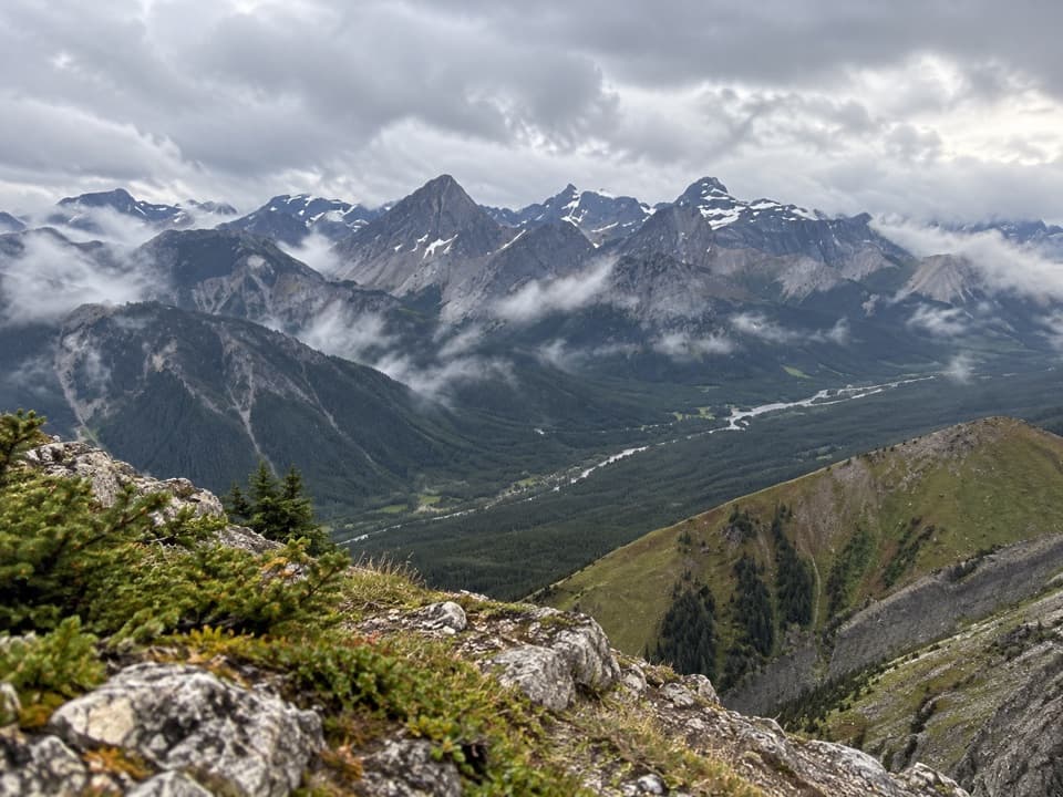
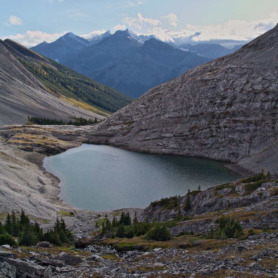
Upper Headwall Lake sits below Mount Chester to the west, The Fortress to the north and a high ridge to the east. From the valley, the view opens south across the Smith-Dorrien valley toward the Continental Divide. The pale limestone slabs near the rockslide have fossils reported in them, though no particular fossil or age is established. In fall, a few larches may color the rockslide area, not the whole route. For a photo, frame the waterfall at the end of Lower Lake with the rock slope; at Upper Lake, include the water in front of the steep surrounding peaks. The foot route ends at the upper lake. Continuing beyond it becomes off-trail travel or a much harder Fortress/col extension.

Parking and a shorter optionStart at Chester Lake Day Use Area off the Smith-Dorrien-Spray Lakes Trail.

Start at Chester Lake Day Use Area off the Smith-Dorrien-Spray Lakes Trail. The large lot also serves Chester Lake and can fill on beautiful weekends. A Kananaskis Conservation Pass is required to park. Toilet status is uncertain: pit toilets have been reported, but park facility information lists no amenities, so do not rely on one. No food or water service was found on the route. Dogs are allowed on leash. In winter, pets are barred from most groomed ski trails, so confirm whether your chosen Sawmill approach overlaps one. If 14 km and rough ledges are too much, Chester Lake Trail shares the same lot and is 4.6 km one way with about 300 m of gain.

Wildlife

Wildlife in Peter Lougheed

All Peter Lougheed wildlife maps

Sighting maps show where each species has been reported across Peter Lougheed. Wildlife moves, so no sighting is guaranteed.

Keep exploring

Near Headwall Lakes Trail

See it all on the map

Trails that start nearby

Places near the trailhead

Parkwolf’s Peter Lougheed ranking

Top-rated trails in Peter Lougheed

All 66 trails
  1. 1Rawson Lake TrailModerate · 7.8 km
  2. 2Ptarmigan Cirque Interpretive TrailModerate · 4.5 km
  3. 3Burstall Pass TrailChallenging · 14.8 km
  4. 4Chester Lake TrailModerate · 9.2 km
  5. 5Upper Kananaskis Lake LoopModerate · 15.7 km
  6. 6Sarrail Ridge via Rawson LakeChallenging · 11.7 km

Take Parkwolf to Peter Lougheed.

The audio tour guide for the drive, plus offline maps, trails, and wildlife heatmaps for when the signal drops.

4.7 from 8,600+ ratings

Download Parkwolf on the App StoreGet Parkwolf on Google Play