Bay Area Ridge Trail: Bolinas Ridge to Samuel P. Taylor State Park in Point Reyes National Seashore

Point Reyes National Seashore, CA

Bay Area Ridge Trail: Bolinas Ridge to Samuel P. Taylor State Park

A long ridge crossing ends beside Lagunitas Creek.

Length
12.5mi
Time
6.3hr
Elev. change
1,575ft
Difficulty
Challenging
  • Dogs allowed
  • High point 1,683 ft

Hear the audio tour

When the Herons Left the Redwoods

Overview

About Bay Area Ridge Trail: Bolinas Ridge to Samuel P. Taylor State Park

Why go

  • Open ridge sections give the route a wide coastal horizon.
  • The paved creekside finish is a cool change of pace.

Heads up

  • The 12.5-mile one-way route needs a vehicle handoff.
  • The start has only a few small roadside parking areas.

Map & elevation

The route

Loading the Point Reyes map
Full map
Elevation108–1,683 ft
TrailheadBolinas Ridge Trail southern access (Fairfax-Bolinas Road before West Ridgecrest Boulevard)37.93944, -122.65855
Keep this map with you offline in the Parkwolf app

Plan your hike

Before you go

Parking

At the southern start, use the few small roadside parking areas on the southwest side of Fairfax-Bolinas Road just before West Ridgecrest Boulevard; park fully off the road. At the north end, roadside parking is available on the west side of Platform Bridge Road just north of Sir Francis Drake Boulevard. Arrange a pickup or leave a second vehicle.

Safety

The long open ridge is exposed to sun, wind, heat, and fog; cattle and ticks in tall grass are recurring concerns. Fairfax-Bolinas Road can close during winter landslides or summer fire hazards.

4 active Point Reyes alerts

  • ClosureOld Tocaloma/Platform Bridge closed to vehiclesMentions Platform Bridge, referenced in this guideDo not drive across the Old Tocaloma/Platform Bridge; it is closed to all vehicular traffic until further notice.Official details
  • ClosurePalomarin Beach Trail closedPalomarin Beach Trail is closed to all visitors, employees, and residents until further notice; do not use the trail. - The trail is closed because unstable and failing sections have made it unsafe.Official details
See all 4 alerts
A park ranger sits on a dash-mounted phone, talking, as Parkwolf’s Tour Guide plays “Army Cutworm Moths: A Grizzly Bear Buffet” on Grand Loop Road below Dunraven Pass in Yellowstone
Parkwolf Tour GuideThe highest, rockiest slopes around here are a summer buffet for grizzly bears.

Point Reyes Tour Guide

Your drive to Bay Area Ridge Trail: Bolinas Ridge to Samuel P. Taylor State Park, narrated.

Parkwolf is a GPS audio tour guide for Point Reyes National Seashore. As you drive, it chimes in with what’s ahead: hidden gems, upcoming stops, history, geology, and wildlife, right through your car’s speakers.

Recorded for this area

When the Herons Left the Redwoods
0:00 / 0:29
“On Bolinas Lagoon's northeast shore, the redwoods of Picher Canyon once held a huge heron and egret colony. As many as 175 breeding pairs nested there, and researchers watched the site for decades.”

Plays on the road 1.5 mi from the trailhead in the Parkwolf Point Reyes Tour Guide.

More stories near here in the app

  • The Coast's Summer Water
  • Where Redwoods Meet Chaparral
  • Bolinas Lagoon's Unbuilt Marina
  • Why the Radio Stations Stood Apart
  • 61 audio storiesacross Point Reyes’s roads, triggered by GPS as you drive
  • Wildlife heatmapsfor Northern Elephant Seal, Grey Whale, Humpback Whale, and 13 more
  • Works offlinemaps, 65 trails, 41 places, and audio download before you lose signal
  • CarPlay readysimple controls built for the drive
★★★★★
“Fantastic app with many points of information… It’s great to just turn on while you’re driving and it gives you an audio tour of the national Park. We love it!!!!”
JMJamesApp Store review
Download Parkwolf on the App StoreGet Parkwolf on Google Play

4.7 from 8,600+ ratings

Trail guide

Hiking Bay Area Ridge Trail: Bolinas Ridge to Samuel P. Taylor State Park

A long one-way crossingThis 12.

This 12.5-mile point-to-point section of the Bay Area Ridge Trail starts on Fairfax-Bolinas Road in Bolinas and ends at the Samuel P. Taylor State Park entrance by Platform Bridge Road and Sir Francis Drake Boulevard. From the south access, it follows Bolinas Ridge to the Jewell Trail junction, drops east to Lagunitas Creek, then turns northwest on Cross Marin to the entrance. Allow about six to seven hours on foot, plus the vehicle transfer. This is a through-hike, not a loop, so arrange a second car or pickup before you set out. The route ends at the park entrance near Platform Bridge, not down at the campground.

Open ground on Bolinas RidgeMost of the long middle leg follows an unpaved ranch and fire road along the ridge.

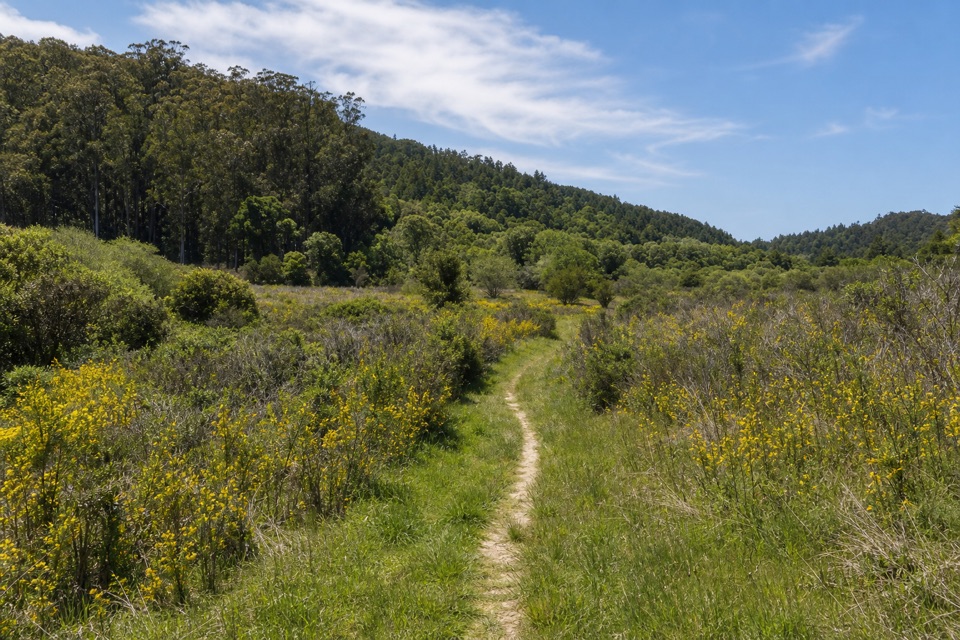
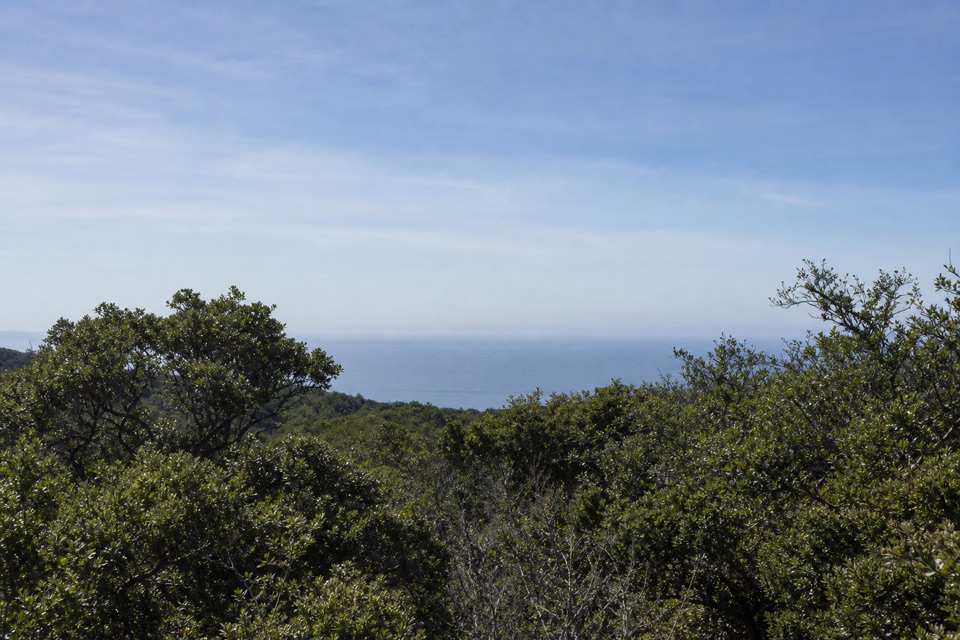
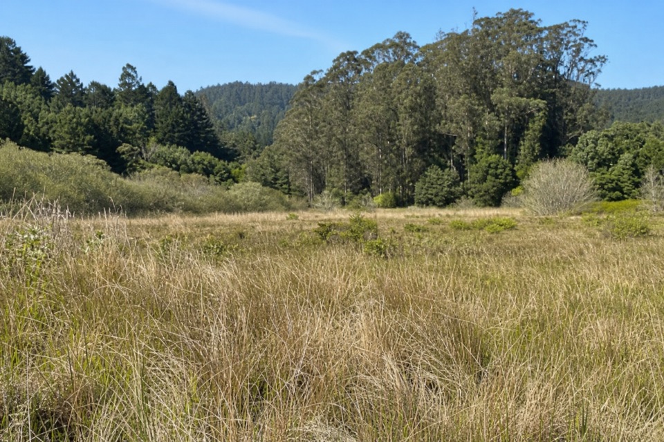
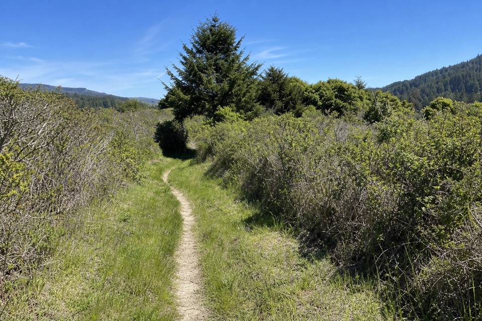
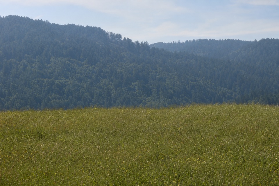
Most of the long middle leg follows an unpaved ranch and fire road along the ridge. The tread shifts between soft leaf duff in damp forest, bare rocky ground through chaparral, and open, cattle-grazed grassland. Clear openings look over Olema Valley toward Tomales Bay and Black Mountain; chaparral breaks can open south toward Bolinas Lagoon, Stinson Beach, and the Pacific. The ridge section is mostly downhill, but the distance is still a full-day commitment. There is little shelter in the open ground, so sun, wind, fog, and heat can change how the same miles feel. Cattle graze along the route; give them room, especially cows with calves. Tall grass can hide ticks. For a ridge photo, keep some grassland in the foreground and let the forested ridge carry the distance instead of cropping tightly on the far hills.

Down to the creekAt the Jewell junction, turn east and downhill; continuing north on Bolinas Ridge heads toward…

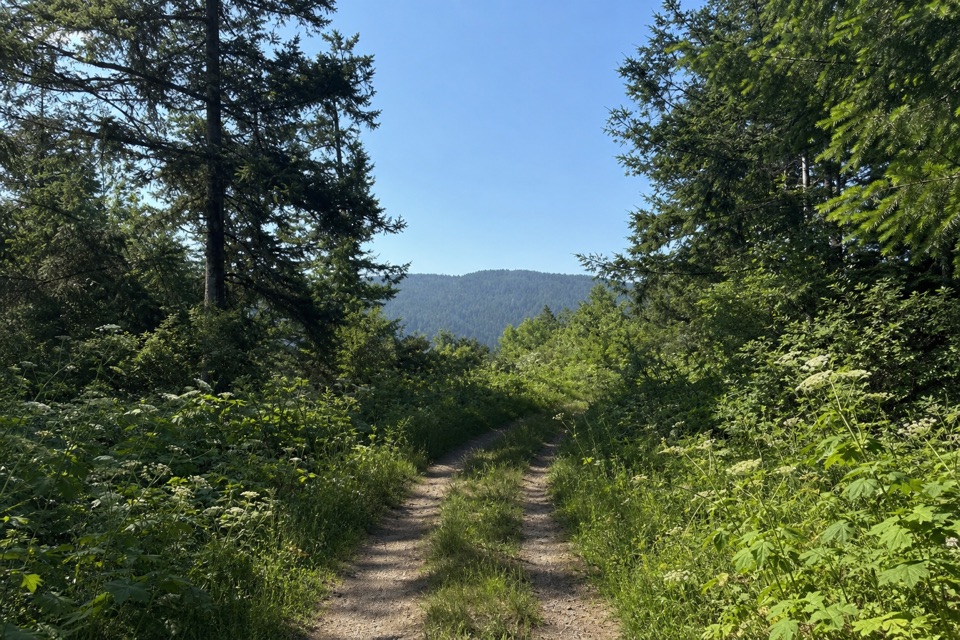
At the Jewell junction, turn east and downhill; continuing north on Bolinas Ridge heads toward a different trailhead and is not part of this route. Jewell follows an old road down to Lagunitas Creek. At Cross Marin, turn northwest toward Platform Bridge. This broad paved stretch follows the old North Pacific Coast Railroad grade beside the creek through streamside woodland, meadows, and a few small redwood groves. It is a calmer finish after the open ridge, though the path is shared with bicycles and horses. The route stops at the entrance-side access; it does not continue southeast into the state park's campground area.

Access and tradeoffsThe southern start is just before West Ridgecrest Boulevard, where a few small roadside parking…

The southern start is just before West Ridgecrest Boulevard, where a few small roadside parking areas sit on the southwest side of Fairfax-Bolinas Road. Park completely off the road. At the north end, roadside parking is available along Platform Bridge Road just north of Sir Francis Drake Boulevard. The transfer between ends is part of the trip. No food or water service is confirmed at the southern access, and the ridge has few public facilities.

Dogs are allowed on Bolinas Ridge, Jewell, and the Cross Marin section used here; keep them leashed to six feet or less and stay on this route, since nearby state-park trails have different pet rules. Fairfax-Bolinas Road is often closed for winter landslides and summer fire hazards, so check access before driving to the start. If you want a shorter, flatter outing instead, walk the paved Cross Marin from Platform Bridge and turn back where you like; its full one-way span is 5.3 miles.

Wildlife

Wildlife in Point Reyes

All Point Reyes wildlife maps

Sighting maps show where each species has been reported across Point Reyes. Wildlife moves, so no sighting is guaranteed.

Keep exploring

Near Bay Area Ridge Trail: Bolinas Ridge to Samuel P. Taylor State Park

See it all on the map

Trails that start nearby

Places near the trailhead

Parkwolf’s Point Reyes ranking

Top-rated trails in Point Reyes

All 65 trails
  1. 1Tomales Point TrailChallenging · 9.5 mi
  2. 2Alamere Falls via Palomarin and Wildcat BeachChallenging · 13.2 mi
  3. 3Chimney Rock TrailEasy · 1.8 mi
  4. 4Abbotts Lagoon TrailEasy · 2.8 mi
  5. 5Bear Valley Trail to Miller PointModerate · 9 mi
  6. 6Drakes Head via Estero TrailModerate · 8.8 mi

Take Parkwolf to Point Reyes.

The audio tour guide for the drive, plus offline maps, trails, and wildlife heatmaps for when the signal drops.

4.7 from 8,600+ ratings

Download Parkwolf on the App StoreGet Parkwolf on Google Play