Cowhead Saddle Trail in Saguaro National Park

Saguaro National Park, AZ

Cowhead Saddle Trail

Four miles of steep climbing into Saguaro's cool pine backcountry.

Length
4mi
Time
4.5hr
Elev. change
2,067ft
Difficulty
Challenging
  • No dogs
  • High point 8,189 ft
Parkwolf audio tour43 stories across Saguaro’s roads

Overview

About Cowhead Saddle Trail

Why go

  • Climbs from desert scrub into ponderosa forest and remote Manning Camp.
  • A sharp change in scenery and climate over a short named segment.

Heads up

  • Cowhead Saddle is 8.8 to 11 trail miles from road access.
  • Steep, remote terrain with no confirmed water along the segment.

Map & elevation

The route

Loading the Saguaro map
Full map
Elevation6,122–8,189 ft
TrailheadCowhead Saddle at the Douglas Spring and Tanque Verde Ridge junction32.20331, -110.59964
Keep this map with you offline in the Parkwolf app

Plan your hike

Before you go

Parking

There is no vehicle access at Cowhead Saddle. Reach the junction via Douglas Spring Trail from its trailhead at the east end of Speedway Boulevard (about 8.8 trail miles), or via Tanque Verde Ridge Trail from Javelina Picnic Area (about 11 trail miles). These approach distances are not included in the 4-mile route.

Safety

This remote high-country route climbs about 2,000 feet in 4 miles. Carry at least one gallon of water per person per day, treat surface water, and expect a cooler mountain climate than the low desert. Pets are prohibited on this trail.

3 active Saguaro alerts

  • CautionHazards in Rincon Mountain burn areasMentions Rincon Mountain, referenced in this guideStay on trails and use extra caution in high-elevation Rincon Mountain areas burned by the two 2020 fires; fire damage can leave unstable ground and other hazards.Official details
  • ClosureTucson Mountain District road closuresSeveral Tucson Mountain District roads are closed; follow posted closures and use McCain Loop to bypass the Kinney Road closure.Official details
See all 3 alerts
A park ranger sits on a dash-mounted phone, talking, as Parkwolf’s Tour Guide plays “Army Cutworm Moths: A Grizzly Bear Buffet” on Grand Loop Road below Dunraven Pass in Yellowstone
Parkwolf Tour GuideThe highest, rockiest slopes around here are a summer buffet for grizzly bears.

Saguaro Tour Guide

Your drive to Cowhead Saddle Trail, narrated.

Parkwolf is a GPS audio tour guide for Saguaro National Park. As you drive, it chimes in with what’s ahead: hidden gems, upcoming stops, history, geology, and wildlife, right through your car’s speakers.

See the Saguaro audio tour

More stories near here in the app

  • Douglas Spring and Wildhorse: The Falls Hike
  • 43 audio storiesacross Saguaro’s roads, triggered by GPS as you drive
  • Wildlife heatmapsfor Black Bear, Mountain Lion, Mule Deer, and 13 more
  • Works offlinemaps, 74 trails, 40 places, and audio download before you lose signal
  • CarPlay readysimple controls built for the drive
★★★★★
“Fantastic app with many points of information… It’s great to just turn on while you’re driving and it gives you an audio tour of the national Park. We love it!!!!”
JMJamesApp Store review
Download Parkwolf on the App StoreGet Parkwolf on Google Play

4.7 from 8,600+ ratings

Trail guide

Hiking Cowhead Saddle Trail

A steep line into the high countryCowhead Saddle Trail is a 4-mile point-to-point climb from Cowhead Saddle to Manning Camp in…

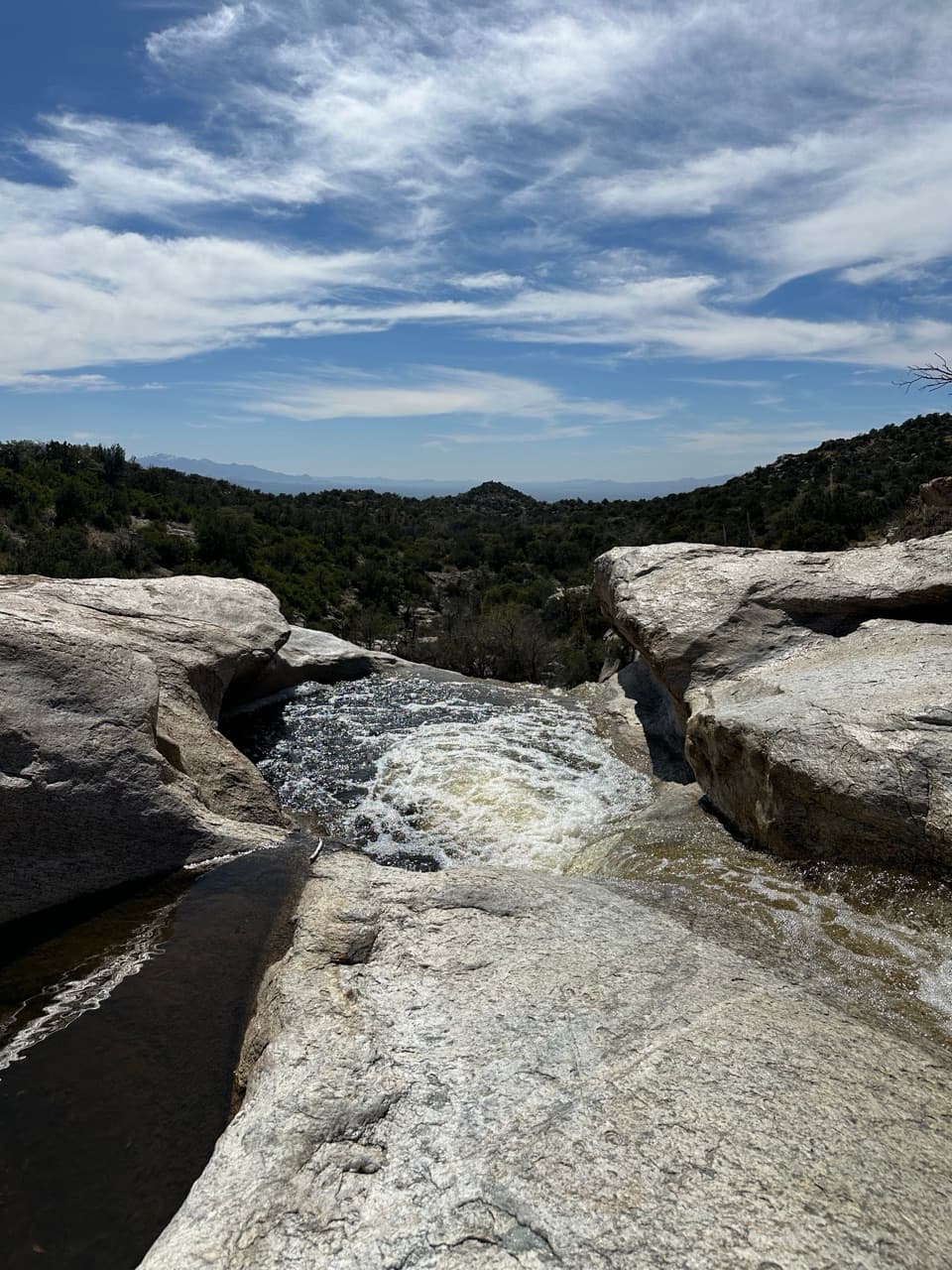
Cowhead Saddle Trail is a 4-mile point-to-point climb from Cowhead Saddle to Manning Camp in Saguaro's Rincon Mountains. It gains about 2,000 feet, from roughly 6,100 feet to the high country near 8,000 feet. Allow around four to five hours for this segment. It's a hard backcountry connection for hikers already making a longer trip; those four miles do not include the long walk to the saddle.

Get to the saddle firstThere is no road access at Cowhead Saddle.

There is no road access at Cowhead Saddle. From the Douglas Spring Trailhead at the east end of Speedway Boulevard, the approach to the saddle is about 8.8 trail miles. The other approach follows Tanque Verde Ridge Trail for about 11 miles from Javelina Picnic Area. These are separate approaches, so plan the whole itinerary and return before setting out.

From scrub into pinesThe climb leaves the saddle through open, sun-exposed slopes with manzanita, oak and juniper,…

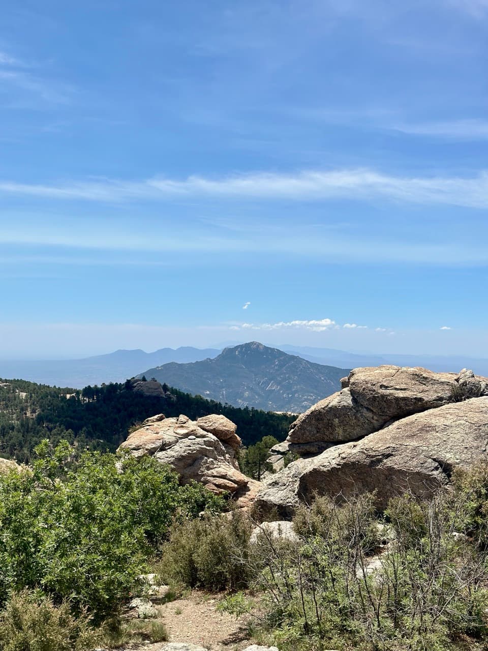
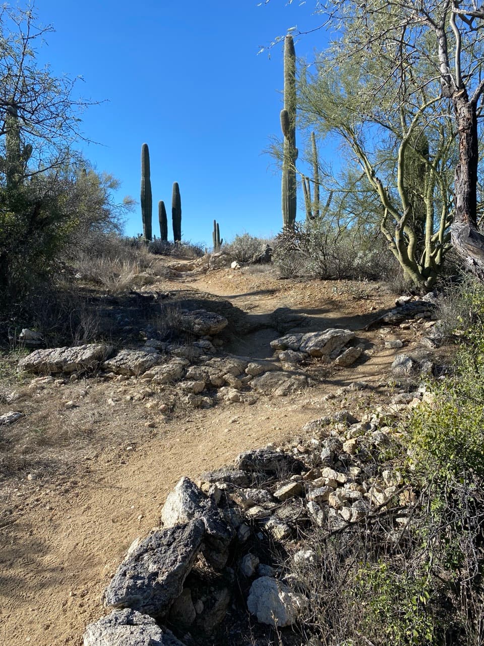
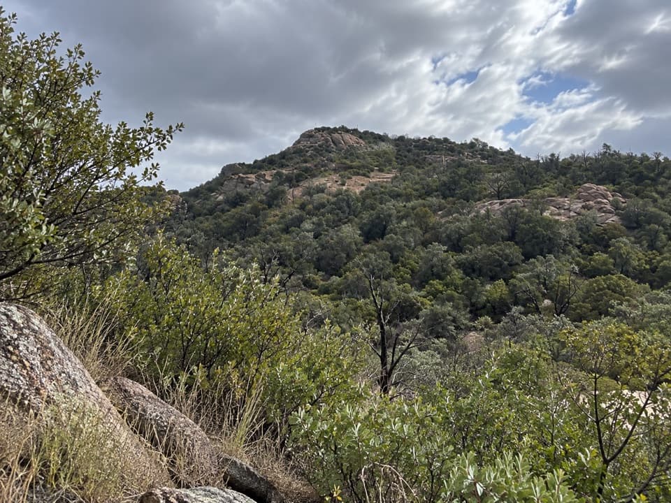
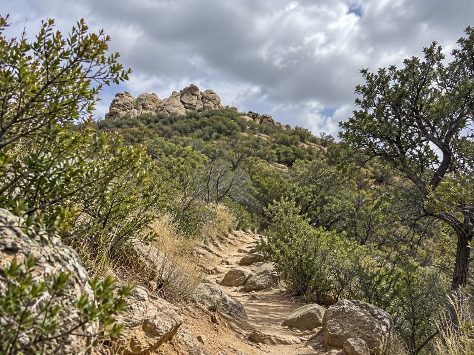
The climb leaves the saddle through open, sun-exposed slopes with manzanita, oak and juniper, then reaches thicker ponderosa pine forest higher up. The tread is steep and rocky in places, with about 2,000 feet of ascent packed into four miles. At the saddle, look up the route toward the pale rock outcrops; that framed view through the juniper is the trail's best photo stop.

Junctions below Helens DomeAbout three miles in, below Helens Dome, northbound junctions lead toward Mica Mountain and…

About three miles in, below Helens Dome, northbound junctions lead toward Mica Mountain and North Slope. Keep the route to Manning Camp in mind at these forks. The last stretch reaches Manning Cabin and the campground, where other paths branch away.

At Manning CampManning Camp sits around 7,920 feet under ponderosa pines, a very different climate from the…

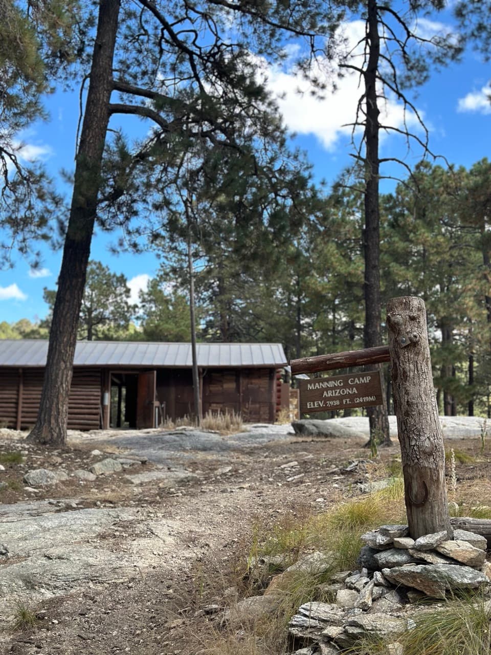
Manning Camp sits around 7,920 feet under ponderosa pines, a very different climate from the desert below. Former Tucson mayor Levi Manning built the cabin as a family summer home; the park now uses the camp as a base for fire and natural-resource work. There are six designated sites, and an overnight stay requires a reservation and permit. Water near the cabin is usually available but has dried up before, and there is no confirmed water source along this trail segment. Carry at least a gallon per person per day and treat any surface water.

Wildlife

Wildlife in Saguaro

All Saguaro wildlife maps

Sighting maps show where each species has been reported across Saguaro. Wildlife moves, so no sighting is guaranteed.

Keep exploring

Near Cowhead Saddle Trail

See it all on the map

Trails that start nearby

Places near the trailhead

Parkwolf’s Saguaro ranking

Top-rated trails in Saguaro

All 74 trails
  1. 1Wasson Peak via King Canyon and Gould Mine LoopChallenging · 7.8 mi
  2. 2Hugh Norris Trail to Wasson PeakChallenging · 10 mi
  3. 3Bridal Wreath Falls TrailModerate · 5.9 mi
  4. 4King Canyon Trail to Wasson PeakModerate · 7 mi
  5. 5Valley View Overlook Nature TrailEasy · 0.8 mi
  6. 6Freeman Homestead TrailEasy · 1 mi

Take Parkwolf to Saguaro.

The audio tour guide for the drive, plus offline maps, trails, and wildlife heatmaps for when the signal drops.

4.7 from 8,600+ ratings

Download Parkwolf on the App StoreGet Parkwolf on Google Play