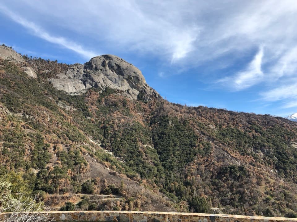
Amphitheater Point in Sequoia National Park

Sight · Sequoia National Park

Amphitheater Point

A roadside pause for Moro Rock before the climb into the groves.

Photo: National Park Service
Type
Sight
Nearest trail
1.2 mi
Audio stories
16 nearby
  • Pullout
  • Scenic viewpoint
  • Exhibit
  • #17 of 45 sights

Hear the audio tour

Amphitheater Point

Overview

About Amphitheater Point

Why stop

  • A quick roadside view of Moro Rock and the changing foothills.

Map

Where it is

Loading the Sequoia map
Full map
SightAmphitheater Point36.53659, -118.78231
Keep this map with you offline in the Parkwolf app

Plan your stop

Before you go

8 active Sequoia alerts

  • InfoGenerals Highway weekday hazard-tree removal delaysMentions Generals Highway, referenced in this guideExpect weekday delays of up to 30 minutes total on Generals Highway between Highway 180 and Giant Forest, 8 a.m.–5 p.m., while crews remove hazard trees; the highway remains open.Official details
  • CautionStage 1 fire restrictionsStage 1 fire restrictions are in effect due to high fire danger and catastrophic-wildfire risk; the restrictions reduce the possibility of accidental human-caused fires that could threaten visitors…Official details

See all 8 alerts
A park ranger sits on a dash-mounted phone, talking, as Parkwolf’s Tour Guide plays “Army Cutworm Moths: A Grizzly Bear Buffet” on Grand Loop Road below Dunraven Pass in Yellowstone
Parkwolf Tour GuideThe highest, rockiest slopes around here are a summer buffet for grizzly bears.

Sequoia Tour Guide

Your drive to Amphitheater Point, narrated.

Parkwolf is a GPS audio tour guide for Sequoia National Park. As you drive, it chimes in with what’s ahead: hidden gems, upcoming stops, history, geology, and wildlife, right through your car’s speakers.

See the Sequoia audio tour

Recorded for this place

Amphitheater Point
0:00 / 0:18
“Amphitheater Point is coming up, a roadside viewpoint where a short concrete sidewalk gives you a view of Moro Rock and Castle Rocks across the canyon.”

Plays as you drive up to Amphitheater Point in the Parkwolf Sequoia Tour Guide.

More stories near here in the app

  • A Sequoia's Fresh Start
  • The Foot-Long Cones
  • Water That Makes Caverns
  • A Bear's Seasonal Menu
  • 71 audio storiesacross Sequoia’s roads, triggered by GPS as you drive
  • Wildlife heatmapsfor Black Bear, Mountain Lion, Bobcat, and 13 more
  • Works offlinemaps, 99 trails, 68 places, and audio download before you lose signal
  • CarPlay readysimple controls built for the drive
★★★★★
“…The kids and my husband and I all agree that the narration really added to our experience driving through the parks. We learned so much about the history and the flora & fauna.”
JessestblondeApp Store review
Download Parkwolf on the App StoreGet Parkwolf on Google Play

4.7 from 8,600+ ratings

Guide

More about Amphitheater Point

A quick view from the highwayAmphitheater Point is a small roadside viewpoint on Generals Highway, between Hospital Rock…

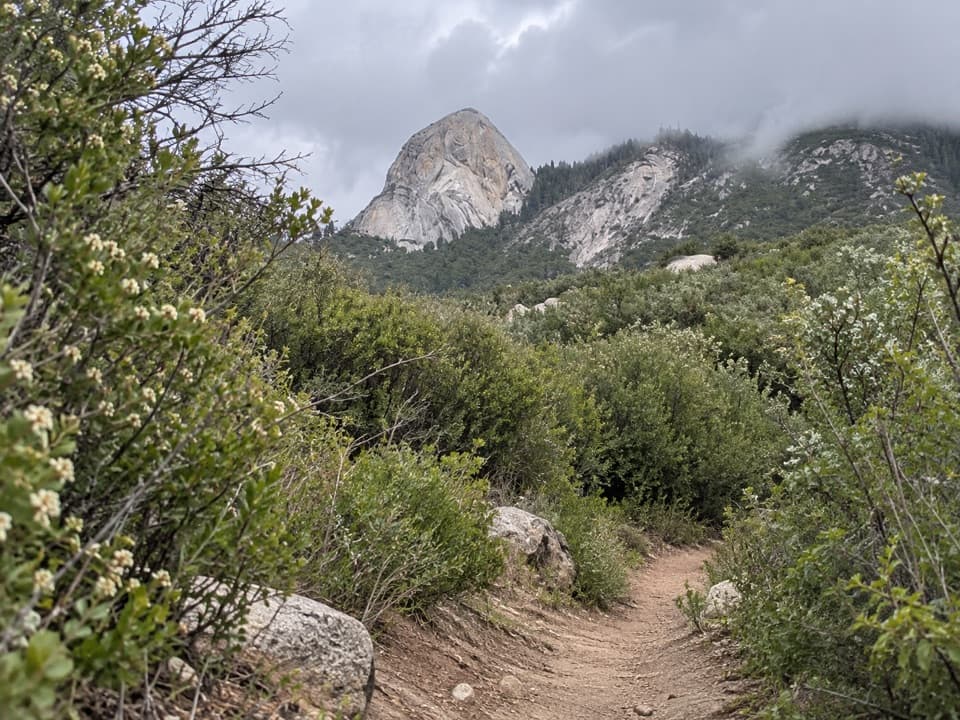
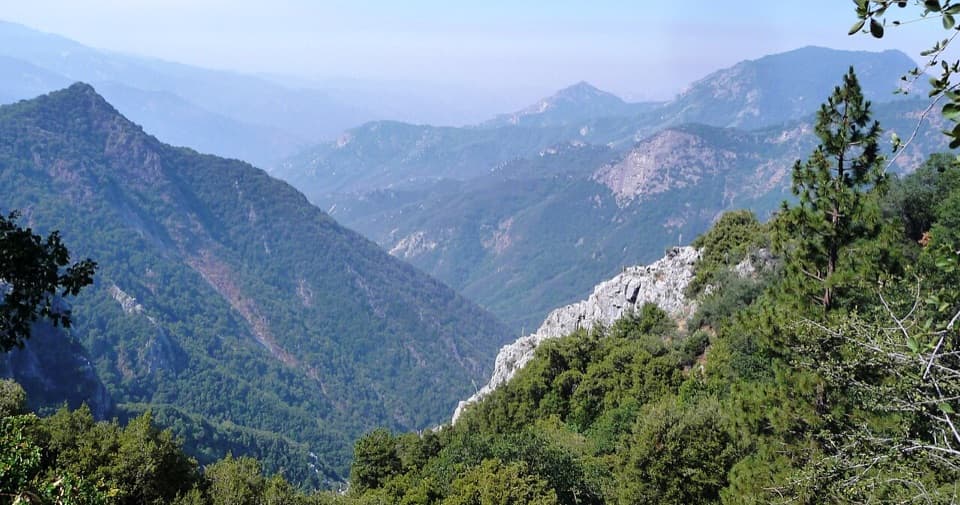
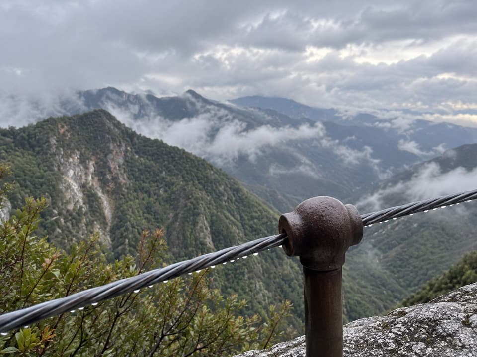
Amphitheater Point is a small roadside viewpoint on Generals Highway, between Hospital Rock Picnic Area and the Giant Forest Museum. A short concrete sidewalk opens onto Moro Rock and Castle Rocks across the canyon, with the steep foothills rising toward granite peaks. It is a worthwhile brief pause for the broad landscape; climbing Moro Rock itself is a separate, longer visit.

Take care at the pulloutThere are no designated parking spaces at the vista.

There are no designated parking spaces at the vista. The road curves here, and the National Park Service warns that traffic can be fast and sightlines limited, so wait for a clear gap before pulling in or rejoining the highway. NPS lists the viewpoint as wheelchair accessible; the approach is smooth concrete on a moderate slope, without a handrail. Vehicles longer than 22 feet are not advised between Potwisha Campground and the Giant Forest Museum.

Look from foothills to granitePick out Moro Rock’s rounded dome above the lower slopes, then look across the canyon for…

Pick out Moro Rock’s rounded dome above the lower slopes, then look across the canyon for Castle Rocks. For a photo, keep some of the nearer slope or stone wall in frame with the granite; the foreground helps show how dramatically the landscape rises. In winter, snow can dust the tops of Castle Rocks’ spires.

Wildlife belowThe foothills below the viewpoint have their own wildlife.

The foothills below the viewpoint have their own wildlife. Reptiles, birds and small mammals live there year-round; deer and bears often move downhill in cooler months, and foxes may appear around evening twilight.

Wildlife

Wildlife in Sequoia

All Sequoia wildlife maps

Sighting maps show where each species has been reported across Sequoia. Wildlife moves, so no sighting is guaranteed.

Keep exploring

Near Amphitheater Point

See it all on the map

Trails nearby

More stops nearby

Parkwolf’s Sequoia ranking

Top sights in Sequoia

All 68 places
  1. 1General Sherman TreeSight
  2. 2Moro RockSight
  3. 3Crystal CaveSight
  4. 4Crescent MeadowSight
  5. 5Tokopah FallsSight
  6. 6Tunnel LogSight

Take Parkwolf to Sequoia.

The audio tour guide for the drive, plus offline maps, trails, and wildlife heatmaps for when the signal drops.

4.7 from 8,600+ ratings

Download Parkwolf on the App StoreGet Parkwolf on Google Play