Redwood Meadow via Middle Fork Trail in Sequoia National Park

Sequoia National Park, CA

Redwood Meadow via Middle Fork Trail

A remote sequoia grove at the end of a long canyon hike.

Photo: Wikimedia Commons
Length
26mi
Time
17hr
Elev. change
2,690ft
Difficulty
Challenging
  • No dogs
  • High point 6,122 ft

Hear the audio tour

Hospital Rock and Pah-din

Overview

About Redwood Meadow via Middle Fork Trail

Why go

  • A quiet route to a remote grove of giant sequoias.
  • Views toward Moro Rock and the Great Western Divide.

Heads up

  • About 26 miles round-trip, with an overnight commitment.
  • Creek crossings can become unsafe during high water.

Map & elevation

The route

Loading the Sequoia map
Full map
Elevation3,432–6,122 ft
TrailheadMiddle Fork Trailhead36.52755, -118.75132
Keep this map with you offline in the Parkwolf app

Plan your hike

Before you go

Parking

Follow the signed Middle Fork access toward Buckeye Flat; the dirt road branches left just before the campground. Hospital Rock Picnic Area is the walk-in access when the lower road is closed to vehicles, so verify how far you can drive before starting.

Safety

The first creek is unbridged and may require wading even at low water; high flows can make crossings unsafe. Use the upper route and bridge toward Redwood Meadow when Granite Creek is high. The lower trail is hot in summer, brushy in places, and has poison oak, ticks and rattlesnakes.

8 active Sequoia alerts

  • CautionStage 1 fire restrictionsStage 1 fire restrictions are in effect due to high fire danger and catastrophic-wildfire risk; the restrictions reduce the possibility of accidental human-caused fires that could threaten visitors…Official details
  • ClosureGrant Grove trails and areas closed for prescribed burnSome trails and areas around Grant Grove and the General Grant Tree are closed for safety during a prescribed burn and until they are cleared of hazards.Official details
See all 8 alerts
A park ranger sits on a dash-mounted phone, talking, as Parkwolf’s Tour Guide plays “Army Cutworm Moths: A Grizzly Bear Buffet” on Grand Loop Road below Dunraven Pass in Yellowstone
Parkwolf Tour GuideThe highest, rockiest slopes around here are a summer buffet for grizzly bears.

Sequoia Tour Guide

Your drive to Redwood Meadow via Middle Fork Trail, narrated.

Parkwolf is a GPS audio tour guide for Sequoia National Park. As you drive, it chimes in with what’s ahead: hidden gems, upcoming stops, history, geology, and wildlife, right through your car’s speakers.

See the Sequoia audio tour

Recorded for this trailhead

Hospital Rock and Pah-din
0:00 / 0:31
“You're approaching Hospital Rock, a short stop for red pictographs and traces of the village of Pah-din. Take the steep stone stairs to the viewing platform, then give the faded paintings a moment to come into focus.”

Plays as you drive up to this trailhead in the Parkwolf Sequoia Tour Guide.

More stories near here in the app

  • Buckeye Flat and Paradise Creek
  • A Bear's Seasonal Menu
  • Moro Rock
  • A Sequoia's Fresh Start
  • 71 audio storiesacross Sequoia’s roads, triggered by GPS as you drive
  • Wildlife heatmapsfor Black Bear, Mountain Lion, Bobcat, and 13 more
  • Works offlinemaps, 99 trails, 68 places, and audio download before you lose signal
  • CarPlay readysimple controls built for the drive
★★★★★
“…The kids and my husband and I all agree that the narration really added to our experience driving through the parks. We learned so much about the history and the flora & fauna.”
JessestblondeApp Store review
Download Parkwolf on the App StoreGet Parkwolf on Google Play

4.7 from 8,600+ ratings

Trail guide

Hiking Redwood Meadow via Middle Fork Trail

Is this the trip you want?Redwood Meadow via the Middle Fork Trail is a 26-mile out-and-back from the Middle Fork access…

Redwood Meadow via the Middle Fork Trail is a 26-mile out-and-back from the Middle Fork access near Buckeye Flat to one of Sequoia’s most remote giant-sequoia groves. The grove is about 13 miles one way, so plan two days and roughly 16–18 hours of hiking for the return. This entry follows the Middle Fork approach; the Bearpaw and Paradise Ridge approaches are separate routes. You need a wilderness permit to camp overnight, and pets are not allowed on park trails. The lower route is best in spring, late fall or winter; summer heat can be punishing.

The long climbThe route starts with an unbridged creek crossing, then climbs through open foothill scrub.

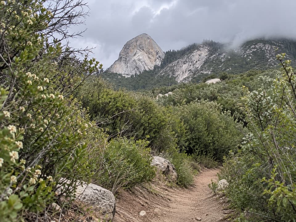
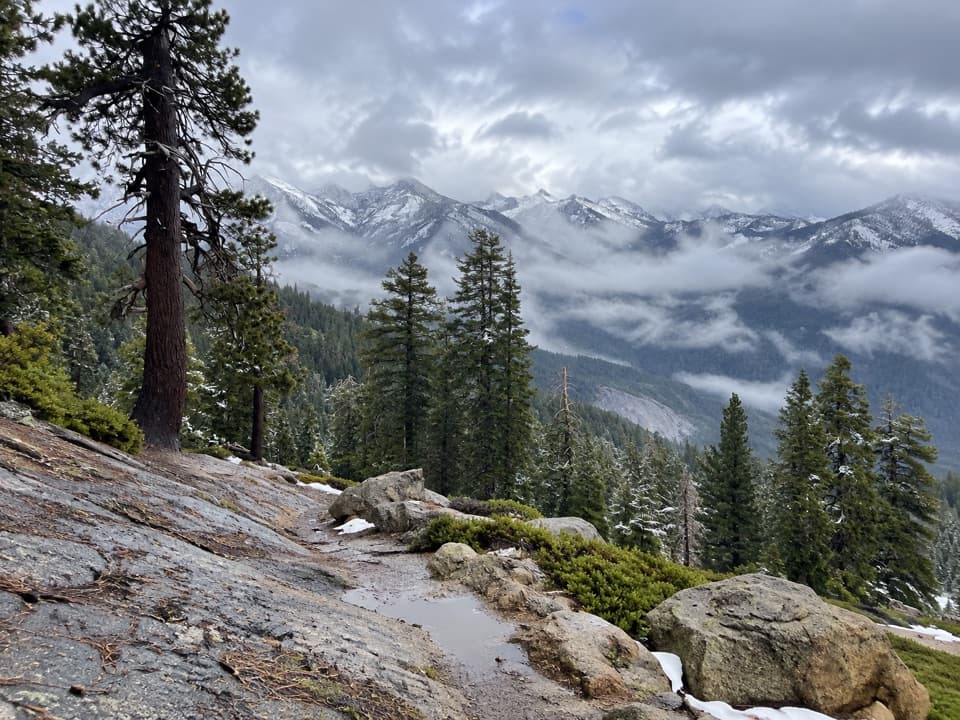
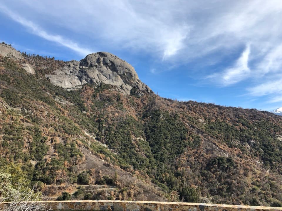
The route starts with an unbridged creek crossing, then climbs through open foothill scrub. The broad trail gives views up the Middle Fork valley toward Moro Rock, Castle Rocks and the Great Western Divide. It becomes brushier after about four miles and enters mixed forest before Panther Creek. The lower miles are the warmest and most exposed part of the trip; carry enough water and give yourself time to cross creeks carefully.

Creeks and campsPanther Creek is the first allowed campsite, about 3.

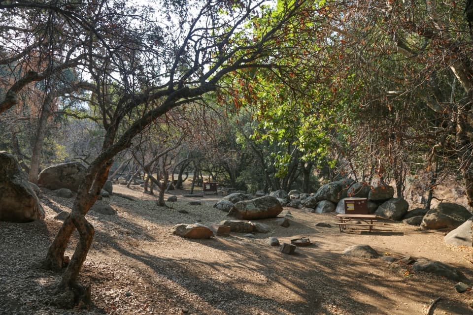
Panther Creek is the first allowed campsite, about 3.5 miles from the trailhead; Mehrten Creek and Buck Creek are farther along. The first creek crossing may require wading even at low water, and high flows can make it unsafe. Cross Eagle Scout Creek on its bridge. If Granite Creek is too high to ford, continue to the signed upper route to Redwood Meadow, which has a bridge and easier crossings. Check the park’s current access and trail conditions before setting out; brush and downed trees have been reported on this corridor.

A small, quiet groveRedwood Meadow is a sequoia grove, not a stand of coastal redwoods.

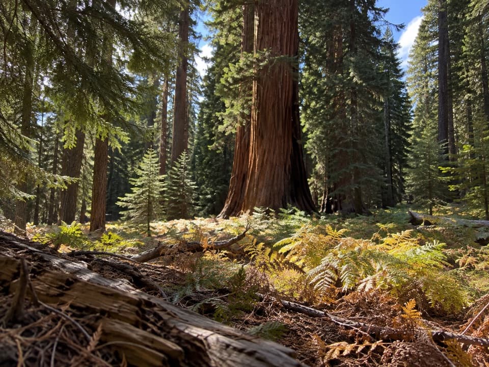
Redwood Meadow is a sequoia grove, not a stand of coastal redwoods. Only about half a dozen large giant sequoias are readily visible from the trail. The meadow is fenced and only appears briefly near the campsites; the main grove intersection has a campsite beneath two big sequoias. Look for those trunks framing the clearing when you stop, rather than expecting a dense grove like the park’s busiest sequoia walks.

The landscape changes along the wayThe first six miles pass buckthorn, manzanita, black oak, chemise and bear clover; mixed…

The first six miles pass buckthorn, manzanita, black oak, chemise and bear clover; mixed conifers take over farther up, with giant sequoias at the grove. Spring brings wildflowers. Mule deer and birds are among the wildlife visitors may see, while black bears, bobcats, mountain lions and rattlesnakes also live along this corridor. Poison oak and ticks are common concerns at the lower elevations.

A shorter turnaroundIf you are not planning an overnight, Panther Creek is a more manageable lower-canyon…

If you are not planning an overnight, Panther Creek is a more manageable lower-canyon destination, with a waterfall and a natural place to turn back. It does not reach Redwood Meadow, so treat it as a separate, shorter hike rather than a partial version of the grove route.

Wildlife

Wildlife in Sequoia

All Sequoia wildlife maps

Sighting maps show where each species has been reported across Sequoia. Wildlife moves, so no sighting is guaranteed.

Keep exploring

Near Redwood Meadow via Middle Fork Trail

See it all on the map

Trails that start nearby

Places near the trailhead

Parkwolf’s Sequoia ranking

Top-rated trails in Sequoia

All 99 trails
  1. 1Congress TrailEasy · 2.7 mi
  2. 2General Sherman Tree TrailModerate · 1 mi
  3. 3Moro Rock TrailModerate · 0.5 mi
  4. 4High Sierra TrailChallenging · 48.9 mi
  5. 5Mount Whitney TrailChallenging · 22 mi
  6. 6Lakes Trail to Pear LakeChallenging · 12.8 mi

Take Parkwolf to Sequoia.

The audio tour guide for the drive, plus offline maps, trails, and wildlife heatmaps for when the signal drops.

4.7 from 8,600+ ratings

Download Parkwolf on the App StoreGet Parkwolf on Google Play