Mosquito Lakes in Sequoia National Park

Sight · Sequoia National Park

Mosquito Lakes

A small alpine lake reached by a long Mineral King climb

Photo: National Park Service
Type
Sight
Nearest trail
2.1 mi

Hear the audio tour

Mineral King Trailheads and Honeymoon Cabin

Overview

About Mosquito Lakes

Why stop

  • Red-fir-framed lakes with granite basins farther up the trail

Heads up

  • A long, steep approach at high elevation

Map

Where it is

Loading the Sequoia map
Full map
SightMosquito Lakes36.42000, -118.61440
Keep this map with you offline in the Parkwolf app

Plan your stop

Before you go

8 active Sequoia alerts

  • ClosureMineral King Road construction closures and delaysMentions Mineral King Road, referenced in this guideConstruction work is causing scheduled closures and delays on Mineral King Road through October 28, 2026; visitors must pass through the work zone to reach Mineral King.Official details
  • CautionStage 1 fire restrictionsStage 1 fire restrictions are in effect due to high fire danger and catastrophic-wildfire risk; the restrictions reduce the possibility of accidental human-caused fires that could threaten visitors…Official details
See all 8 alerts
A park ranger sits on a dash-mounted phone, talking, as Parkwolf’s Tour Guide plays “Army Cutworm Moths: A Grizzly Bear Buffet” on Grand Loop Road below Dunraven Pass in Yellowstone
Parkwolf Tour GuideThe highest, rockiest slopes around here are a summer buffet for grizzly bears.

Sequoia Tour Guide

Your drive to Mosquito Lakes, narrated.

Parkwolf is a GPS audio tour guide for Sequoia National Park. As you drive, it chimes in with what’s ahead: hidden gems, upcoming stops, history, geology, and wildlife, right through your car’s speakers.

See the Sequoia audio tour

Recorded for this place

Mineral King Trailheads and Honeymoon Cabin
0:00 / 0:31
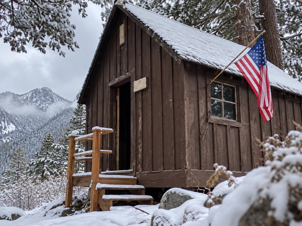
“Up ahead are the trailheads at the end of Mineral King Road, with Honeymoon Cabin beside them. For a short history stop, take a look at this last surviving Crowley Resort rental cabin.”

Plays as you drive up to Mosquito Lakes in the Parkwolf Sequoia Tour Guide.

More stories near here in the app

  • Cold Springs Campground and Nature Trail
  • Mineral King Ranger Station
  • Sawtooth Trailhead and Monarch Lakes
  • The Tree in a Pencil
  • 71 audio storiesacross Sequoia’s roads, triggered by GPS as you drive
  • Wildlife heatmapsfor Black Bear, Mountain Lion, Bobcat, and 13 more
  • Works offlinemaps, 99 trails, 68 places, and audio download before you lose signal
  • CarPlay readysimple controls built for the drive
★★★★★
“…The kids and my husband and I all agree that the narration really added to our experience driving through the parks. We learned so much about the history and the flora & fauna.”
JessestblondeApp Store review
Download Parkwolf on the App StoreGet Parkwolf on Google Play

4.7 from 8,600+ ratings

Guide

More about Mosquito Lakes

A remote lake basin, reached on footMosquito Lakes is a group of five small alpine lakes in Mineral King, reached by a steep trail…

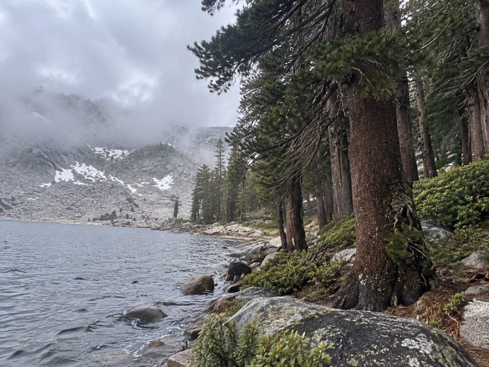
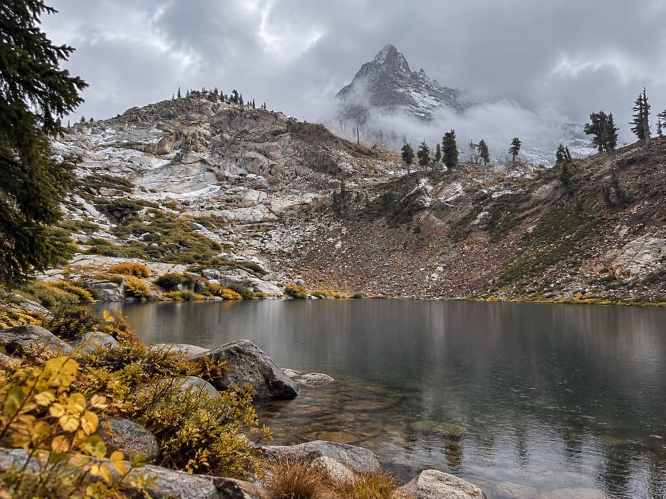
Mosquito Lakes is a group of five small alpine lakes in Mineral King, reached by a steep trail from the end of Mineral King Road. The maintained route ends at Lake #1, a shallow lake among red firs; rougher paths continue to granite-basin lakes higher up. This is a full-day choice for hikers looking for a high-country destination, not a quick stop on the drive.

Plan for the high-elevation hikeStart at the Disney parking lot at the end of Mineral King Road.

Start at the Disney parking lot at the end of Mineral King Road. The trail shares its first two miles with the Eagle Lake route, then branches right at Eagle Basin toward Mosquito Lake #1. The climb is strenuous at this elevation and the trail is not wheelchair accessible. Published mileage figures conflict, so check the park's current trail map before choosing a turnaround, and leave ample time for the return.

Make the remote approach workMineral King Road is narrow, steep and winding, with unpaved sections.

Mineral King Road is narrow, steep and winding, with unpaved sections. The area is usually accessible from late spring into October; check road status before setting out, and avoid bringing an RV or trailer. The small, rocky trailhead lot can fill in busy periods. Marmots may damage vehicle hoses and wiring, so follow the park's vehicle-protection advice.

Carry food and safe drinking water for the hike; stream and lake water isn't guaranteed safe to drink. Silver City Restaurant near the Mineral King Ranger Station is the closest food stop and is known for its pies. Early-summer mosquitoes can be a nuisance, and pets aren't allowed on the trail.

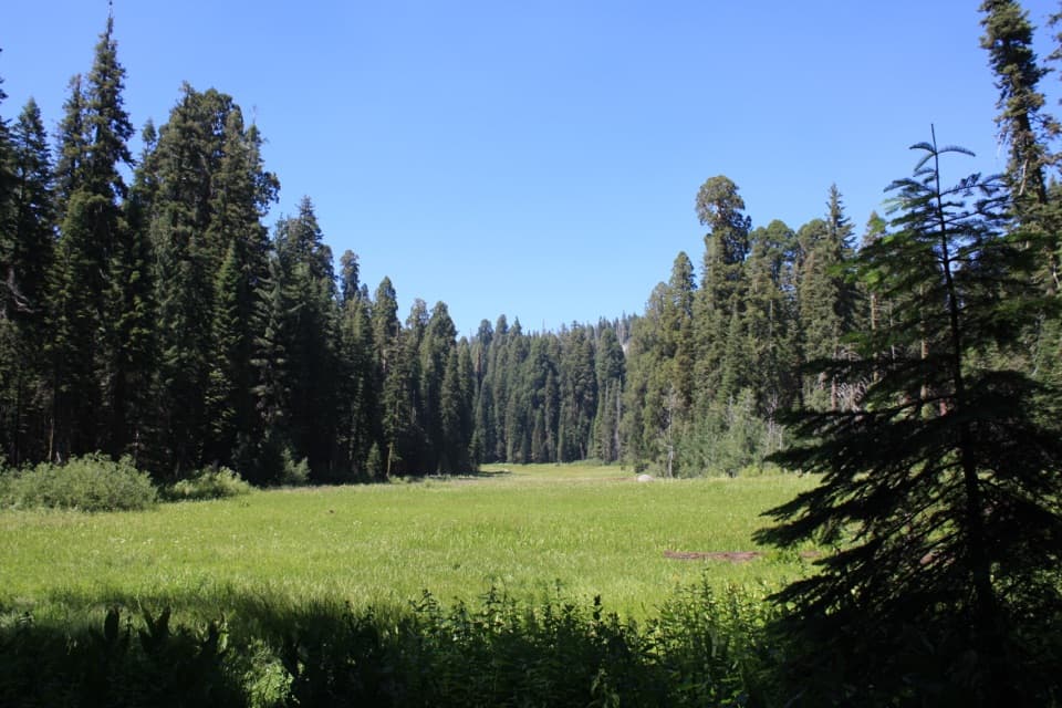
Lake #1 and the upper basinLake 1 is small and shallow, with red firs close around the shore.

Lake #1 is small and shallow, with red firs close around the shore. The maintained trail ends here. A use path climbs the rocky slope to Lake #2, set in a granite basin; this is the first permitted campsite, and overnight hikers need a wilderness permit. Cairned routes continue beyond it to three more lakes, but they leave the maintained trail and take more time and route-finding.

Details on the way inThe approach crosses Spring Creek on a small wooden bridge, with Tufa Falls tucked in foliage…

The approach crosses Spring Creek on a small wooden bridge, with Tufa Falls tucked in foliage above the trail. Farther up, Eagle Creek disappears into a large sinkhole. After climbing over Miner’s Ridge, the path drops through forest to the lake. These details make the hike more than a steady climb between trailhead and water.

Granite, water and reflectionThe high basins are part of the Sierra Nevada's granite country, shaped by rock that cooled…

The high basins are part of the Sierra Nevada's granite country, shaped by rock that cooled deep underground and by glaciers that carved alpine valleys. When the water is still, frame the lake with the pale granite and firs reflected across it; keeping shoreline boulders in the foreground gives the view a sense of scale.

Wildlife

Wildlife in Sequoia

All Sequoia wildlife maps

Sighting maps show where each species has been reported across Sequoia. Wildlife moves, so no sighting is guaranteed.

Keep exploring

Near Mosquito Lakes

See it all on the map

Trails nearby

More stops nearby

Parkwolf’s Sequoia ranking

Top sights in Sequoia

All 68 places
  1. 1General Sherman TreeSight
  2. 2Moro RockSight
  3. 3Crystal CaveSight
  4. 4Crescent MeadowSight
  5. 5Tokopah FallsSight
  6. 6Tunnel LogSight

Take Parkwolf to Sequoia.

The audio tour guide for the drive, plus offline maps, trails, and wildlife heatmaps for when the signal drops.

4.7 from 8,600+ ratings

Download Parkwolf on the App StoreGet Parkwolf on Google Play